
Dirt Bike Trails
Near Delbarton, West Virginia
Explore All Dirt Bike Trails Near Delbarton, West Virginia
Dirt Bike Trails Near Delbarton, West Virginia
Discover the best dirt bike trails near you. Browse trail maps, check difficulty ratings, and find your next adventure — whether you're looking for a quick ride or an all-day expedition.
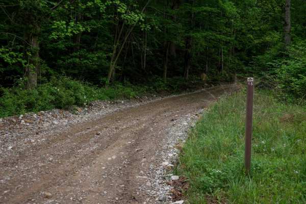
BM 15
BM 15 is a 4.8-mile access route in the Buffalo Mountain Trail System, offering a smooth, gradual ascent from the staging area into the hills. The trail begins as a wide, gravel path under consistent tree cover, narrowing slightly after the first intersection into a shelf-like track that curves alon...
Learn more about BM 15
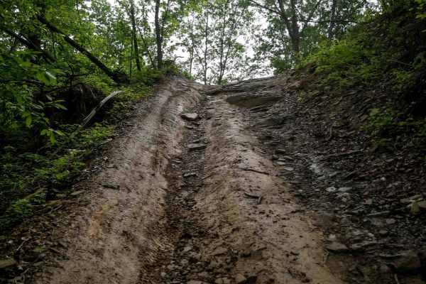
BM 48
BM 48 is a 1.6-mile narrow OHV route in the Buffalo Mountain Trail System, beginning on the east end with a rocky, shelfy ascent along the mountainside. The climb includes loose rock, ruts, and embedded rock layers forming small shelves--manageable when dry but more challenging in wet conditions. Af...
Learn more about BM 48
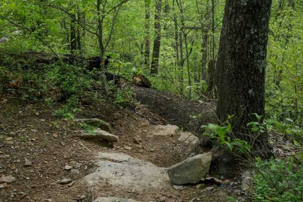
BM 182
BM 182 is a challenging, technical single track in the Buffalo Mountain Trail System, beginning with a steep, rocky climb from the east end on a wide, shelfy path. It quickly narrows into proper singletrack along a ridgeline through lush forest, with loose and embedded rock that becomes extremely sl...
Learn more about BM 182
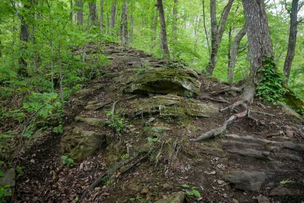
BM 197
BM 197 is a 0.5-mile more advanced singletrack in the Buffalo Mountain Trail System, starting at the intersection with BM 186 on its south end. This narrow ridgeline route offers a true singletrack experience with overgrown vegetation and low-hanging logs requiring ducking. The trail features slick,...
Learn more about BM 197
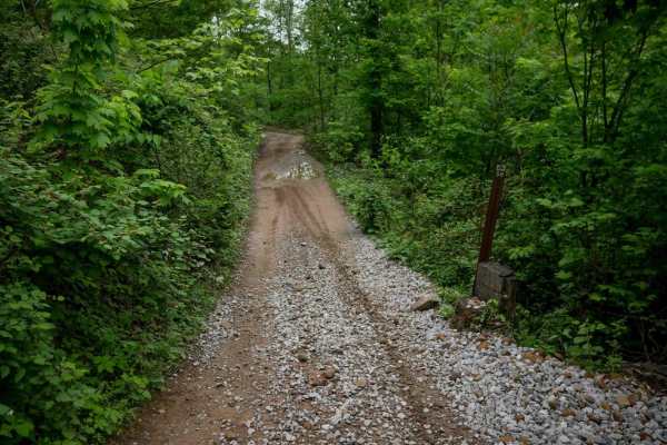
BM 58
BM 58 is a 1.3-mile, easy route near the Buffalo Mountain staging area, making it a likely spot to encounter other trail users. The trail runs through a lush, shaded forest with a consistent tree canopy and a mostly smooth surface. Minor embedded rock, debris, and shallow ruts are present but do not...
Learn more about BM 58
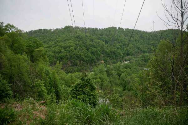
BM 55
BM 55 is a 1.5-mile easy connector in the Buffalo Mountain Trail System, beginning with a steep descent from the east end into a lush, green corridor. The trail levels out quickly into a smooth, low-gradient path with wide, gradual corners and scenic views under the power lines. With no significant ...
Learn more about BM 55
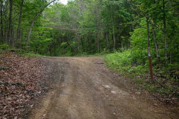
BM 19
BM 19 forms an easy 2.5-mile loop through lush forest with wide paths, scenic rocky cliffs, and dark coal-like soil in places. While mostly gradual with minimal elevation change, the trail includes narrower shelfy sections along the hillside. Riders should be prepared for occasional mud puddles and ...
Learn more about BM 19
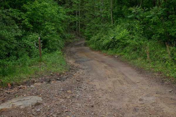
BM 22
BM 22 is a 2-mile easy connector descending down from the hilltops at trail 15, down to near Highway 52 and the intersection with trail 10. It offers a mostly wide path with occasional narrower sections, minor loose rock, and shallow ruts. The grades are gradual throughout, and the route passes alon...
Learn more about BM 22
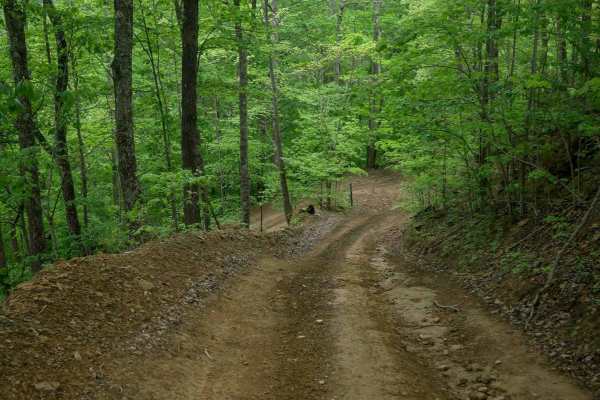
BM 42
BM 42 is a mostly easy route in the Buffalo Mountain Trail System, with a slightly more challenging start due to a steep, rutted descent from BM 19 under the power lines. After the drop, the trail turns left and continues under a tall tree canopy along a wide, smooth path similar to BM 55. Scenic ro...
Learn more about BM 42
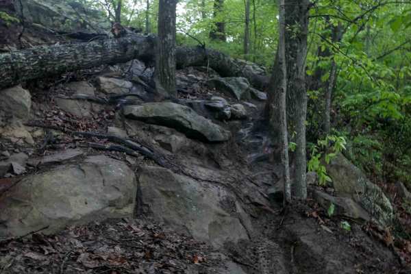
BM 199
BM 199 follows a ridgeline for 3.4 miles, offering a mix of narrow and moderately wide sections, but remains a challenging trail best suited for advanced riders. It winds underneath a leafy canopy with tight maneuvering between trees, and multiple steep sections filled with embedded rock, forming mo...
Learn more about BM 199
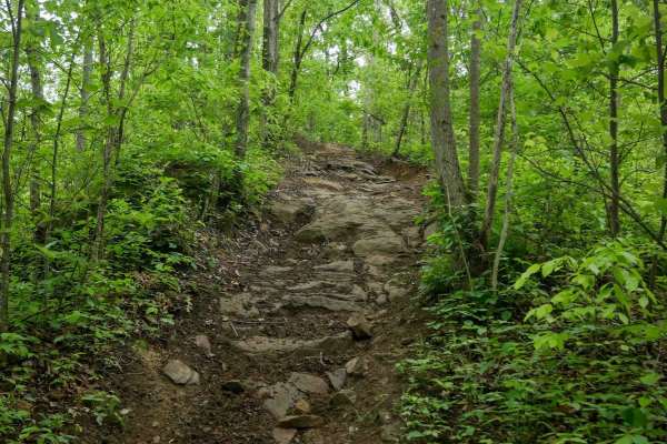
BM 186
BM 186 has a wide, rutted, and steep climb from the south, with embedded rock and clear signs of ATV use--widened to two-track width in places. It starts out easy, passing scenic boulders and rock walls, then narrows as it enters more technical terrain. Deep muddy ruts, slick embedded rock, and stee...
Learn more about BM 186
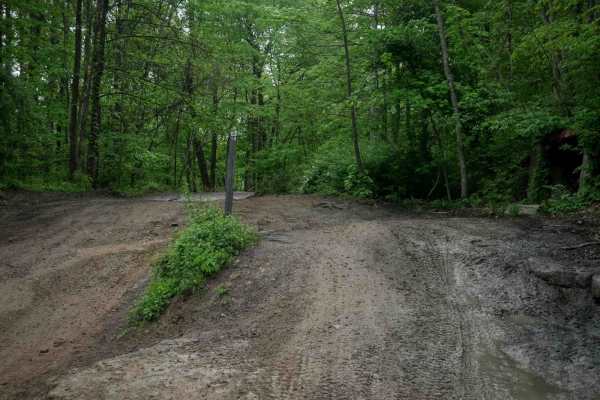
BM 13
BM 13 is a 4.3-mile easy-rated access corridor typical of the Buffalo Mountain system, offering wide, smooth, and graded terrain with room for two-way travel and excellent visibility. It features gradual grades, casual wide corners, and passes through lush forest with scenic rock walls, making it a ...
Learn more about BM 13
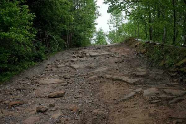
BM 26
BM 26, when approached from the north, begins as a narrow, shelf-like descent down the mountain with a mostly smooth surface and occasional rocky patches. It drops to the forest floor beside Lick Creek, where lush, jungle-like surroundings and intermittent water on the trail are the norm. The trail ...
Learn more about BM 26
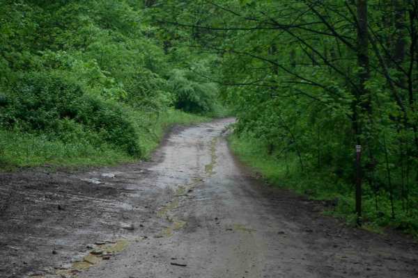
BM 20
BM 20 is a 5-mile, wide, easy access corridor that winds through lush forest with a high tree canopy and excellent visibility. The trail follows a curvy, shelfy path along the hillside beside scenic rock walls, passing a massive boulder that has fallen from the wall above. The trail maintains good w...
Learn more about BM 20
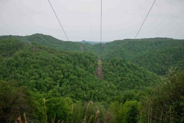
BM 34
BM 34 is a 1.6-mile loop off BM 25 featuring a shelfy, moderately narrow path that winds along the mountainside. The trail includes loose dirt, some ruts, and a series of moderate switchbacks, offering open views under the powerlines and passing by scenic rock walls. While not overly technical, the ...
Learn more about BM 34
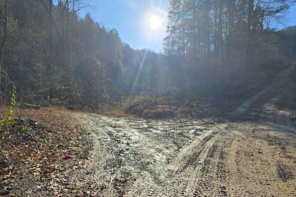
Right Fork of Hell's Creek to Hell's Knob
The elevation slowly climbs from the creek bed to the top of the mountain. The dirt is hard-packed with a couple of rocky spots. Anyone with experience can do this without worrying. This is another quick route to the hard top in a need-to situation.
Learn more about Right Fork of Hell's Creek to Hell's Knob
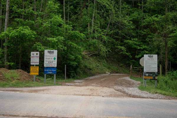
BM 11
Trail BM 11 is a 5-mile access corridor in the Buffalo Mountain Trail System, beginning from highway 52 and climbing steadily through a lush forest. It starts as a wide dirt trail with gradual, sweeping switchbacks, minor ruts, and waterbars. While there are a few narrower, rockier sections, the maj...
Learn more about BM 11
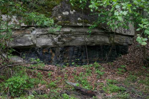
BM 12
BM 12 climbs from Highway 52 on the west end with a rutted ascent and tight switchbacks, then levels out into a wide shelfy path that serves as an easy access corridor. The 2.3-mile trail features minor ruts, multiple intersections, and scenic mossy rock walls, with good visibility and room for two-...
Learn more about BM 12
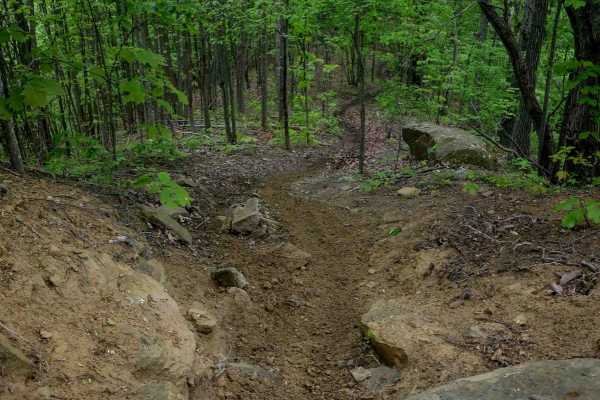
BM 137
BM 137 is a short but technical half-mile singletrack that challenges riders with a steep, rocky start featuring mossy boulder shelves about a foot tall. It winds through tight, overgrown forest with slick downed logs, embedded rock layers, and steep hills covered in leaf decay and loose rock. The t...
Learn more about BM 137
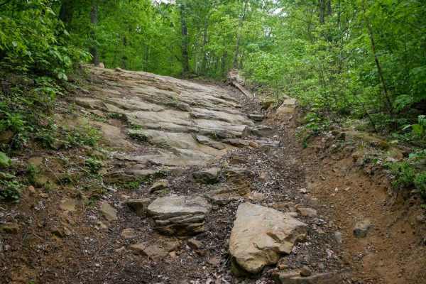
BM 57
BM 57 is a short but steep 0.3-mile spur connecting BM 11 and BM 56, featuring an intermediate technical obstacle. Dropping several hundred feet in elevation from south to north, the trail includes a prominent rock shelf made of bedrock layers spanning the entire width of the trail, along with steep...
Learn more about BM 57
ATV trails near Delbarton, West Virginia
Explore ATV-friendly trails near you. These trails are accessible for vehicles up to 50 inches wide, perfect for ATVs and smaller off-road machines.
BM 15
BM 15 is a 4.8-mile access route in the Buffalo Mountain Trail System, offering a smooth, gradual ascent from the staging area into the hills. The trail begins as a wide, gravel path under consistent tree cover, narrowing slightly after the first intersection into a shelf-like track that curves alon...
Learn more about BM 15
BM 48
BM 48 is a 1.6-mile narrow OHV route in the Buffalo Mountain Trail System, beginning on the east end with a rocky, shelfy ascent along the mountainside. The climb includes loose rock, ruts, and embedded rock layers forming small shelves--manageable when dry but more challenging in wet conditions. Af...
Learn more about BM 48
BM 58
BM 58 is a 1.3-mile, easy route near the Buffalo Mountain staging area, making it a likely spot to encounter other trail users. The trail runs through a lush, shaded forest with a consistent tree canopy and a mostly smooth surface. Minor embedded rock, debris, and shallow ruts are present but do not...
Learn more about BM 58
BM 55
BM 55 is a 1.5-mile easy connector in the Buffalo Mountain Trail System, beginning with a steep descent from the east end into a lush, green corridor. The trail levels out quickly into a smooth, low-gradient path with wide, gradual corners and scenic views under the power lines. With no significant ...
Learn more about BM 55
UTV/side-by-side trails near Delbarton, West Virginia
Find UTV and side-by-side trails near you. These trails accommodate vehicles up to 60 inches wide, ideal for UTVs, side-by-sides, and wider off-road rigs.
BM 15
BM 15 is a 4.8-mile access route in the Buffalo Mountain Trail System, offering a smooth, gradual ascent from the staging area into the hills. The trail begins as a wide, gravel path under consistent tree cover, narrowing slightly after the first intersection into a shelf-like track that curves alon...
Learn more about BM 15
BM 48
BM 48 is a 1.6-mile narrow OHV route in the Buffalo Mountain Trail System, beginning on the east end with a rocky, shelfy ascent along the mountainside. The climb includes loose rock, ruts, and embedded rock layers forming small shelves--manageable when dry but more challenging in wet conditions. Af...
Learn more about BM 48
BM 58
BM 58 is a 1.3-mile, easy route near the Buffalo Mountain staging area, making it a likely spot to encounter other trail users. The trail runs through a lush, shaded forest with a consistent tree canopy and a mostly smooth surface. Minor embedded rock, debris, and shallow ruts are present but do not...
Learn more about BM 58
BM 55
BM 55 is a 1.5-mile easy connector in the Buffalo Mountain Trail System, beginning with a steep descent from the east end into a lush, green corridor. The trail levels out quickly into a smooth, low-gradient path with wide, gradual corners and scenic views under the power lines. With no significant ...
Learn more about BM 55
The onX Offroad Difference
onX Offroad combines trail photos, descriptions, difficulty ratings, width restrictions, seasonality, and more in a user-friendly interface. Available on all devices, with offline access and full compatibility with CarPlay and Android Auto. Discover what you're missing today!
Open Trail Map