
Dirt Bike Trails
Near Daniel, Wyoming
Explore All Dirt Bike Trails Near Daniel, Wyoming
Dirt Bike Trails Near Daniel, Wyoming
Discover the best dirt bike trails near you. Browse trail maps, check difficulty ratings, and find your next adventure — whether you're looking for a quick ride or an all-day expedition.
Middle Piney Creek
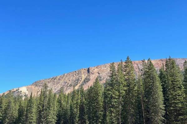
Middle Piney Creek is accessed from Big Piney. It is well maintained and it is a popular road so there are times with a fair amount of traffic. The trail leads to Middle Piney Lake at the top. At the end of the trail, there are some beautiful views of the lake. There are campsites and spurs along th...
Learn more about Middle Piney Creek
North Piney Lake
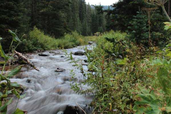
This ATV route follows the North Piney Trail through a gorgeous willow-lined valley and then uses the Lake Creek Trail to reach North Piney Lake, a mountain-enveloped lake in the Wyoming Range. Combined, these two trails offer 9 miles of riding, but the lake is reached in half that distance. The fir...
Learn more about North Piney Lake
Lower Cabin Creek
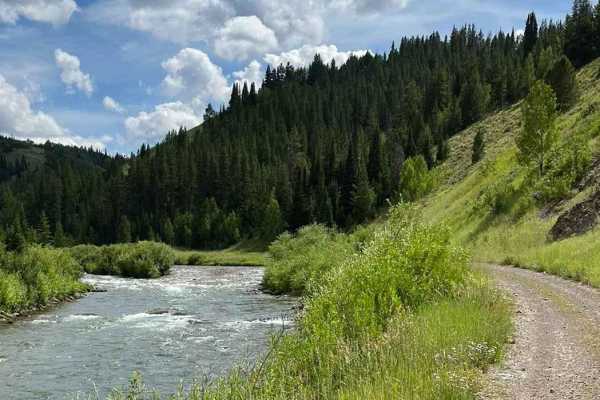
This is a beautiful trail that traces along the elevation of Meadow and Cabin Creeks. At times it ducks down into thick pine stands, then bursts out onto expanding vistas overlooking acres of majestic views. For the rider on the lookout for wildlife, there are plenty of opportunities to catch a glim...
Learn more about Lower Cabin Creek
Grind up Pinon Pass
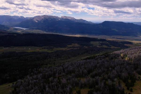
This is a fun, mid-level, technical trail that goes from the Green River all the way to the top of Gun Sight Pass, offering 360-degree views of the Wind River, Absarokas, and Grand Tetons Mountain ranges. Taking the trail from the Green River (south) you'll climb out of the river navigating deep mud...
Learn more about Grind up Pinon Pass
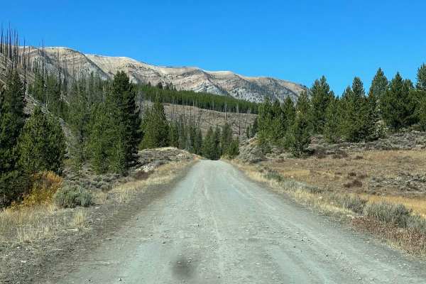
Wyoming Range 10046
This section of the Wyoming range 10046 is between South Piney Creek Road and Middle Piney Creek Road. There are plenty of spurs along the way to explore. The road is well-maintained and there are several campsites along the way. There was the Fontenelle fire that went through in 2012 and you will s...
Learn more about Wyoming Range 10046
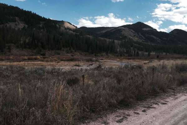
Cliff Creek - 30530
The trail has beautiful views and is an easy entrance to several hiking, mountain biking, and horse trails in the forest. The road is smooth dirt with mud possible during wet seasons. A few areas are steep or may have very minor water on the road after rain. The trail has a significant number of gre...
Learn more about Cliff Creek - 30530
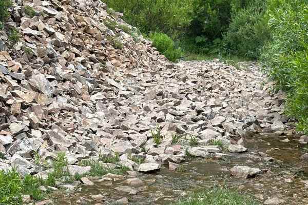
Shale Creek - Kinney Creek Loop
This is a beautiful fun ride through the pines. Some natural spring crossings. This is a loop that has sections of small rocks and others that are muddy from the springs. A couple of areas are tight for more than one vehicle so passing may be difficult. In most areas, there is enough room to get by.
Learn more about Shale Creek - Kinney Creek Loop
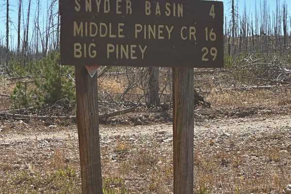
South Piney Creek
This is a nice and well-maintained forest road. You can access this from Middle Piney Road or from Labarge Creek Road. You'll go through Snyder Basin the Snyder Guard Station is along the way. There was a big fire that came through in 2012. There are plenty of spurs to explore such as Pack Saddle Ri...
Learn more about South Piney Creek
Big Fall Creek
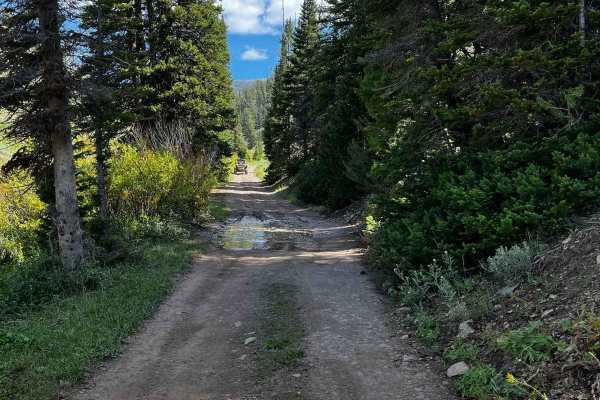
This is a relatively short trail but it makes up for its brevity with a stunning shift in scenery the entire length of the route. From where it begins in grassy, sage terrain, it pops up next to Fall Creek and transitions to willows and aspens. There are several locations to pull off and enjoy lunch...
Learn more about Big Fall Creek

Swift Creek
This is a popular point-to-point road. Accessed from East Second Avenue in Afton. There is fishing and hiking along the trail. The popular Periodic spring trail is at the top of this road. It's a short 3/4 mile hike on an easy trail. There are a couple of small reservoirs for fishing as well as Swif...
Learn more about Swift Creek
Granite Lake Trail
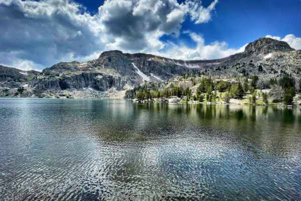
Granite Lake, In mid-summer, it's a very refreshing way to cool off. There is a hiking trail around the lake. If you plan to ride down the trail, tread lightly and leave no trace. This route is for 50 inches or less. Is fairly steep with loose sand, lots of roots, and rocks. Bring sunscreen, food, a...
Learn more about Granite Lake Trail
Willow Creek
The beginning of this section is a very easy 1 difficulty. You can access the north fork which is popular among hiking and horse riding. Shortly after that, the trail turns to a 2 and quickly to a 3. There are a few spurs along the way some are 50" or less. There is also the Pine Trail that will tak...
Learn more about Willow Creek
Grover Park
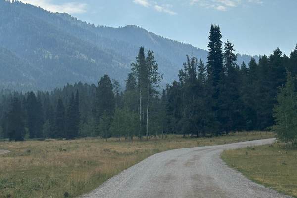
This road will take you from the small town of Grover to a smaller area known as Turnerville. This road is graded every year but still has lots of washboards and potholes. That being said it is traveled regularly by the locals to go back and forth. There is plenty of camping and spurs to do some rec...
Learn more about Grover Park
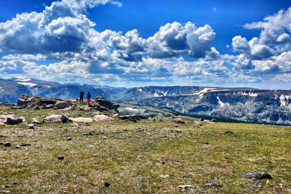
Seven Lakes Trails
This trail has the most amazing views of the Wind River Range. You will encounter a few water crossings, even in August. Be prepared to bring warmer gear, it becomes much colder and windier as you reach higher elevations, even in summer. Bring sunscreen, food, and extra H20, take your time, and enjo...
Learn more about Seven Lakes Trails
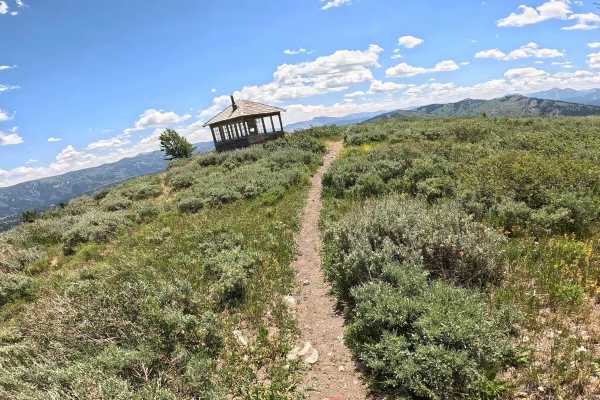
Elk Moutain Lookout
Located within the Bridger-Teton National Forest, Elk Mountain is a seasonal trail, so be sure to check current access dates. This challenging single-track is defined by a steep ascent, featuring a few super tight switchbacks throughout the first mile before transitioning into a rugged expanse of lo...
Learn more about Elk Moutain Lookout
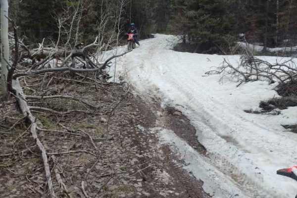
Wickiup
Wickiup is a scenic 7-mile trail located in the Bridger-Teton National Forest near Star Valley, Wyoming, offering an engaging and moderate route tailored specifically for offroad vehicles up to 50 inches wide, including ATVs, SxSs, and dirt bikes. This loop-style trail winds through mountainous terr...
Learn more about Wickiup
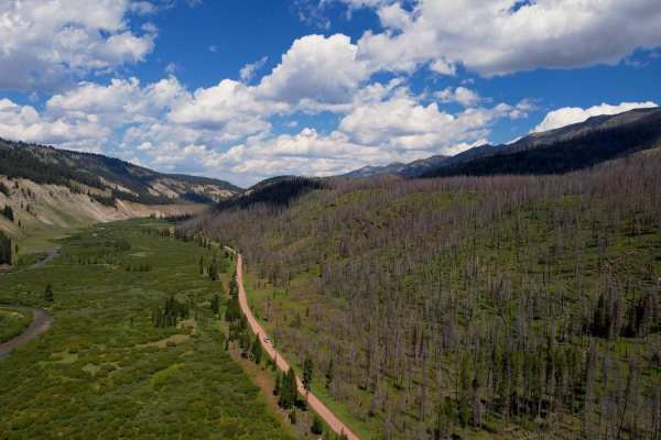
Greys River Road
This route takes you the whole length of the Wyoming Range following the Greys River. Along the way, you'll experience mountain vistas, the beautiful Greys River, wildlife, alpine lakes, and hundreds of places to camp. The trail is not aggressive at all, minus a few water crossings and the occasiona...
Learn more about Greys River Road
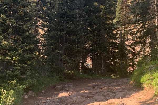
Dry Creek
The Point to Point trail is a scenic ride through the pines. The lower section of the trail is a typical forest service road, a 1 or 2 on the difficulty chart. Then you start to climb, and it gets rocky and tighter. There are nice camp sites up at the lake.
Learn more about Dry Creek
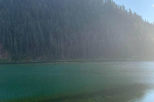
Cottonwood
You access this road from County Road 153. Cottonwood Lake is at the top of the road. There is camping and fishing there as well. The road can be busy at times which can make it dusty. There are picnic areas with fire rings and tables next to the lake.
Learn more about Cottonwood
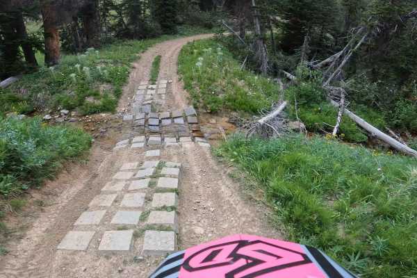
South Fork Ridge (MT13)
This is an easy-going ATV/dirt bike trail. There are a few water crossings, with man-made cinder blocks and potential large mudholes in spring. This trail has fun, small, little kickers and swooping turns, it almost feels like riding a mini dirt bike track. Small cc bikes and quad friendly. Since th...
Learn more about South Fork Ridge (MT13)
ATV trails near Daniel, Wyoming
Explore ATV-friendly trails near you. These trails are accessible for vehicles up to 50 inches wide, perfect for ATVs and smaller off-road machines.
Middle Piney Creek
Middle Piney Creek is accessed from Big Piney. It is well maintained and it is a popular road so there are times with a fair amount of traffic. The trail leads to Middle Piney Lake at the top. At the end of the trail, there are some beautiful views of the lake. There are campsites and spurs along th...
Learn more about Middle Piney Creek
North Piney Lake
This ATV route follows the North Piney Trail through a gorgeous willow-lined valley and then uses the Lake Creek Trail to reach North Piney Lake, a mountain-enveloped lake in the Wyoming Range. Combined, these two trails offer 9 miles of riding, but the lake is reached in half that distance. The fir...
Learn more about North Piney Lake
Lower Cabin Creek
This is a beautiful trail that traces along the elevation of Meadow and Cabin Creeks. At times it ducks down into thick pine stands, then bursts out onto expanding vistas overlooking acres of majestic views. For the rider on the lookout for wildlife, there are plenty of opportunities to catch a glim...
Learn more about Lower Cabin Creek
Grind up Pinon Pass
This is a fun, mid-level, technical trail that goes from the Green River all the way to the top of Gun Sight Pass, offering 360-degree views of the Wind River, Absarokas, and Grand Tetons Mountain ranges. Taking the trail from the Green River (south) you'll climb out of the river navigating deep mud...
Learn more about Grind up Pinon Pass
UTV/side-by-side trails near Daniel, Wyoming
Find UTV and side-by-side trails near you. These trails accommodate vehicles up to 60 inches wide, ideal for UTVs, side-by-sides, and wider off-road rigs.
Middle Piney Creek
Middle Piney Creek is accessed from Big Piney. It is well maintained and it is a popular road so there are times with a fair amount of traffic. The trail leads to Middle Piney Lake at the top. At the end of the trail, there are some beautiful views of the lake. There are campsites and spurs along th...
Learn more about Middle Piney Creek
Lower Cabin Creek
This is a beautiful trail that traces along the elevation of Meadow and Cabin Creeks. At times it ducks down into thick pine stands, then bursts out onto expanding vistas overlooking acres of majestic views. For the rider on the lookout for wildlife, there are plenty of opportunities to catch a glim...
Learn more about Lower Cabin Creek
Grind up Pinon Pass
This is a fun, mid-level, technical trail that goes from the Green River all the way to the top of Gun Sight Pass, offering 360-degree views of the Wind River, Absarokas, and Grand Tetons Mountain ranges. Taking the trail from the Green River (south) you'll climb out of the river navigating deep mud...
Learn more about Grind up Pinon Pass
Wyoming Range 10046
This section of the Wyoming range 10046 is between South Piney Creek Road and Middle Piney Creek Road. There are plenty of spurs along the way to explore. The road is well-maintained and there are several campsites along the way. There was the Fontenelle fire that went through in 2012 and you will s...
Learn more about Wyoming Range 10046
The onX Offroad Difference
onX Offroad combines trail photos, descriptions, difficulty ratings, width restrictions, seasonality, and more in a user-friendly interface. Available on all devices, with offline access and full compatibility with CarPlay and Android Auto. Discover what you're missing today!
Open Trail Map