
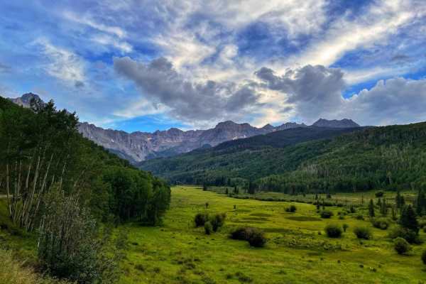
Dirt Bike Trails
Near Colona, Colorado
Explore All Dirt Bike Trails Near Colona, Colorado
Dirt Bike Trails Near Colona, Colorado
Discover the best dirt bike trails near you. Browse trail maps, check difficulty ratings, and find your next adventure — whether you're looking for a quick ride or an all-day expedition.
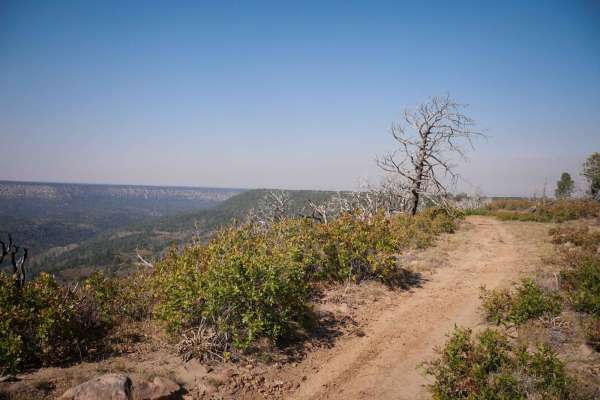
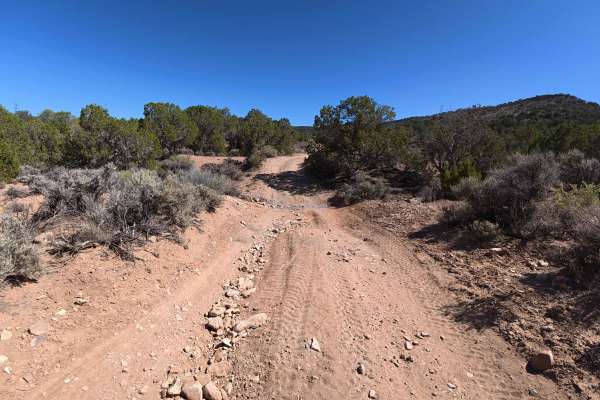
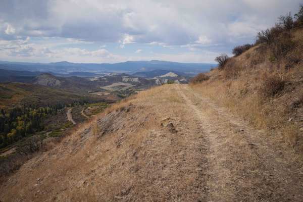
Buckhorn Lakes Park (Buckhorn Rd)
Parking in the parking area is only recommended for those trailering in. You can unload and ride from there. All others can simply continue onward and access the Park, the various trails around the lake, and the Castles trail.
This 8-mile stretch of well-maintained dirt road provides access to the...
Learn more about Buckhorn Lakes Park (Buckhorn Rd)
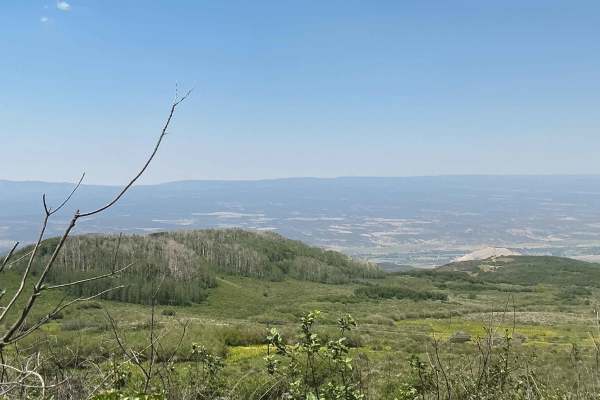
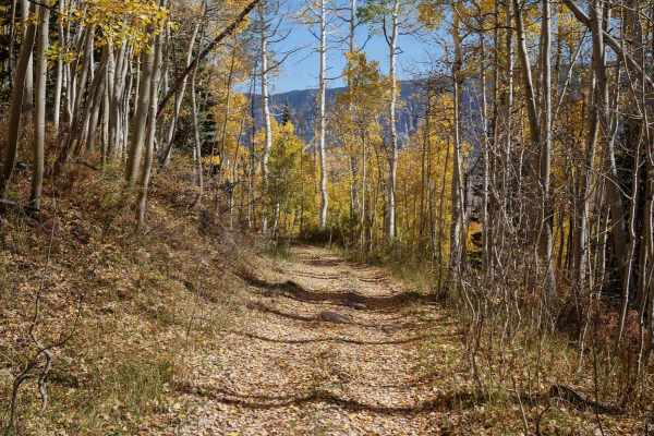
Sims Mesa/Delores Creek
The maintained gravel Sims Mesa Rd offers views of the Uncompaghre River valley. It becomes a rutted unmaintained Forest Service road as it enters the National Forest. Wildflowers and aspen groves line the trail as it turns into Caprock Road leading to Delores Creek which feeds a small, animal-attr...
Learn more about Sims Mesa/Delores Creek
Owl Creek Pass
This is an enjoyable and easy 45-mile trip over Owl Creek Pass between the Uncompahgre and Cimarron Rivers. There can be a few water-filled potholes, but nothing that would stop a passenger car with reasonable clearance. Perhaps it would be muddier early in the year. John Wayne filmed scenes from bo...
Learn more about Owl Creek Pass
Gunnison Tunnel
In 2020 a locked gate was placed near the west portal (west of the canal dipper) which prevents running the complete trail. The trail can be run from the Uncompahgre River east to the gate but you can not reach the west portal. If you want to see the west portal and the canal dipper you must enter t...
Learn more about Gunnison Tunnel
Spring Creek Spur A ATV Trail
This is a short spur trail off of the Spring Creek ATV Trail, that goes south through a forest of tall pine trees, aspens, and gambel oak on a wide easy path. There are small embedded rocks in the trail, but nothing difficult and no ledges. It's flat, with hardly any elevation change. The trail ride...
Learn more about Spring Creek Spur A ATV Trail
Lower Spring Creek Trail
Lower Spring Creek is a 7-mile-long trail west of Montrose, Colorado, that starts on the south end of the Uncompahgre National Forest and heads north through BLM land. It heads straight down towards Montrose from the forest, dropping 1,500 feet in elevation as it descends from the pine trees into mo...
Learn more about Lower Spring Creek Trail
Spring Creek ATV Trail (East)
This segment of the Spring Creek ATV Trail descends off of the Uncompahgre Plateau for 4.3 miles, dropping almost 900 feet in elevation, and riding through a variety of landscapes as it descends from forest to high desert. The trail starts in a forest of fir trees and beautiful groves of aspen trees...
Learn more about Spring Creek ATV Trail (East)
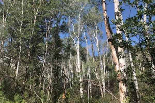
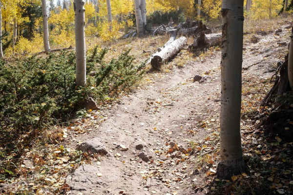
Nate Creek
The Nate Creek singletrack starts at the end of the Lou Creek ATV trail and heads south for 7 miles through the Uncompahgre National Forest to an inconspicuous entrance on Owl Creek Pass. This is a hidden gem advanced trail in a less trafficked part of Colorado. From the north end, it starts as a ro...
Learn more about Nate Creek
East Dallas Trail
Easy wide dirt trail mostly through private property with access to National Forest land and dispersed camping at the end. The first third of the trail is a smooth dirt road that can get muddy and slick when wet after a rain storm. Higher up, the trail gets bumpy with a more rocky road surface, but ...
Learn more about East Dallas Trail
Shavano Loop
The Shavano Loop acts as a highly active, crucial multi-use connector trail, originating from a generous staging area that easily accommodates 8 to 12 vehicles and provides immediate access to a vast network of hiking paths and 50-inch motorized tracks. Averaging a relatively brisk 10 mph over its 3...
Learn more about Shavano Loop
Forest Fence
The Forest Fence is a fun single track through the Uncompahgre National Forest that starts on Divide Road at a couple of dispersed campsites. The trail has many fast and flowy sections between aspens and fir trees, on hard-packed dirt, with gradual turns through the forest. It also has lots of rocki...
Learn more about Forest Fence
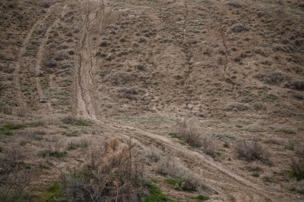
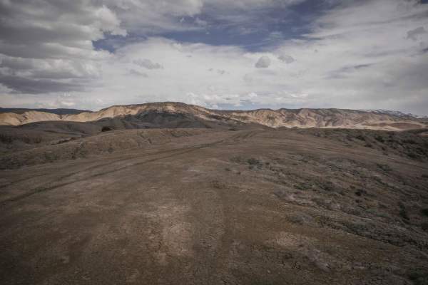
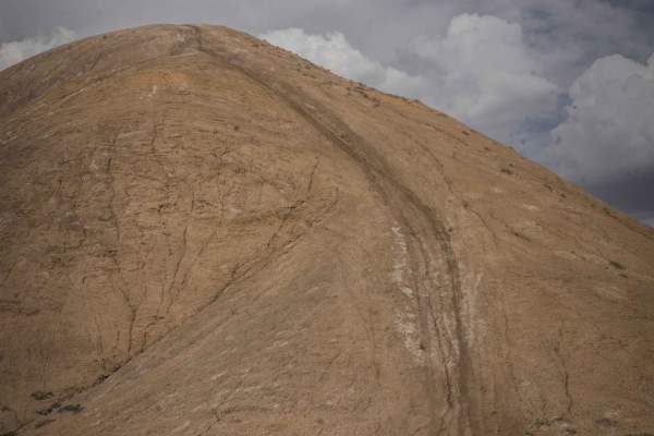
Landfill Ridge
This unmarked single track starts at a small dirt area off of the paved Landfill Road that goes to the dump. It is an unmarked trailhead and there are no trail signs in this area. It starts as a wide road with lots of tracks going up the adobe clay badland hills and starting to meander on adobe ridg...
Learn more about Landfill Ridge
South Landfill Ridge
This unmarked trail is part of the trail system in the adobe badlands outside of Montrose, Colorado. This trail is fainter and less ridden than some of the ridge line trails closer to the staging areas. The SW end of the trail dead ends at a power line, making part of the trail an out and back, but ...
Learn more about South Landfill Ridge
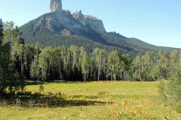
Cimarron Owl Creek Pass
This is a very scenic, pastoral drive down Cimarron Road into the Uncompaghre National Forest. There are many side roads leading to various forks of the Cimarron River, with plentiful dispersed camping sites along the way. There are access points to Cowboy Lake for fishing, boating, kayaking, etc. I...
Learn more about Cimarron Owl Creek Pass
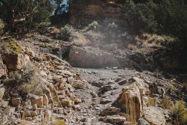
Boulder Canyon
Take your off-road experience to the extreme! This is one of seven rock crawling trails located just a few miles west of Montrose, Colorado, in the Dry Creek Rock Crawling (DCRC) area of the Uncompahgre Plateau. Vehicles using these "Full Sized Trails" are required to display an Off-Highway Vehicl...
Learn more about Boulder Canyon
Dump Ridge ATV Trail
This is one of many ATV trails in the Flat Top - Peach Valley Recreation Area, which is a 9,700-acre area mostly of adobe clay badlands. From the east end, it starts with a steep climb up a hill that is rutted and an ATV would really have to keep their momentum and consider if the steepness is possi...
Learn more about Dump Ridge ATV Trail
A Spur
The .8-mile long Spur A is an easy flat two-track that goes along the edge of a hillside, on a shelfy path between scrub oak and tall grass. You'll be overlooking the valley as you ride west, and have a view of Pinnacle Ridge as you ride back east. It has some small dips and big rollers over water b...
Learn more about A Spur
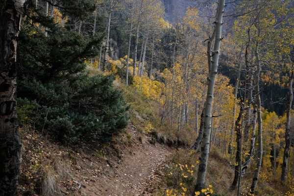
Fox Creek ATV
Fox Creek ATV trail is an easy two-track through a forest of pines, aspens, and blue spruce trees, crossing several muddy small stream crossings right away. It climbs up through the mountainside, with small loose pieces of rock in the trail, and wide curves through beautiful aspen groves. There's po...
Learn more about Fox Creek ATV
Landfill Connector
This is an unmarked single track in the Flat Top- Peach Valley adobe badlands near the town of Montrose, Colorado. It branches off of another similar single track on a ridge line to make a loop on some lower adobe hills. Compared to some of the adobe trails that are closer to the Elephant Skin stagi...
Learn more about Landfill Connector
Dented Door ATV Trail
This short ATV trail, 1.7 miles, connects the Dented Door Spring Road to the Spring Creek ATV Trail. It goes through a forest of blue spruce and aspen trees, the trail almost as wide as a road. The trail is covered in small loose rock at times, but is also smooth hard packed dirt at times, going thr...
Learn more about Dented Door ATV Trail
ATV trails near Colona, Colorado
Explore ATV-friendly trails near you. These trails are accessible for vehicles up to 50 inches wide, perfect for ATVs and smaller off-road machines.
Buckhorn Lakes Park (Buckhorn Rd)
Parking in the parking area is only recommended for those trailering in. You can unload and ride from there. All others can simply continue onward and access the Park, the various trails around the lake, and the Castles trail.
This 8-mile stretch of well-maintained dirt road provides access to the...
Learn more about Buckhorn Lakes Park (Buckhorn Rd)
Sims Mesa/Delores Creek
The maintained gravel Sims Mesa Rd offers views of the Uncompaghre River valley. It becomes a rutted unmaintained Forest Service road as it enters the National Forest. Wildflowers and aspen groves line the trail as it turns into Caprock Road leading to Delores Creek which feeds a small, animal-attr...
Learn more about Sims Mesa/Delores Creek
Owl Creek Pass
This is an enjoyable and easy 45-mile trip over Owl Creek Pass between the Uncompahgre and Cimarron Rivers. There can be a few water-filled potholes, but nothing that would stop a passenger car with reasonable clearance. Perhaps it would be muddier early in the year. John Wayne filmed scenes from bo...
Learn more about Owl Creek Pass
Gunnison Tunnel
In 2020 a locked gate was placed near the west portal (west of the canal dipper) which prevents running the complete trail. The trail can be run from the Uncompahgre River east to the gate but you can not reach the west portal. If you want to see the west portal and the canal dipper you must enter t...
Learn more about Gunnison Tunnel
UTV/side-by-side trails near Colona, Colorado
Find UTV and side-by-side trails near you. These trails accommodate vehicles up to 60 inches wide, ideal for UTVs, side-by-sides, and wider off-road rigs.
Buckhorn Lakes Park (Buckhorn Rd)
Parking in the parking area is only recommended for those trailering in. You can unload and ride from there. All others can simply continue onward and access the Park, the various trails around the lake, and the Castles trail.
This 8-mile stretch of well-maintained dirt road provides access to the...
Learn more about Buckhorn Lakes Park (Buckhorn Rd)
Sims Mesa/Delores Creek
The maintained gravel Sims Mesa Rd offers views of the Uncompaghre River valley. It becomes a rutted unmaintained Forest Service road as it enters the National Forest. Wildflowers and aspen groves line the trail as it turns into Caprock Road leading to Delores Creek which feeds a small, animal-attr...
Learn more about Sims Mesa/Delores Creek
Owl Creek Pass
This is an enjoyable and easy 45-mile trip over Owl Creek Pass between the Uncompahgre and Cimarron Rivers. There can be a few water-filled potholes, but nothing that would stop a passenger car with reasonable clearance. Perhaps it would be muddier early in the year. John Wayne filmed scenes from bo...
Learn more about Owl Creek Pass
Gunnison Tunnel
In 2020 a locked gate was placed near the west portal (west of the canal dipper) which prevents running the complete trail. The trail can be run from the Uncompahgre River east to the gate but you can not reach the west portal. If you want to see the west portal and the canal dipper you must enter t...
Learn more about Gunnison Tunnel
The onX Offroad Difference
onX Offroad combines trail photos, descriptions, difficulty ratings, width restrictions, seasonality, and more in a user-friendly interface. Available on all devices, with offline access and full compatibility with CarPlay and Android Auto. Discover what you're missing today!
Open Trail Map