
Dirt Bike Trails
Near Cherokee, Alabama
Explore All Dirt Bike Trails Near Cherokee, Alabama
Dirt Bike Trails Near Cherokee, Alabama
Discover the best dirt bike trails near you. Browse trail maps, check difficulty ratings, and find your next adventure — whether you're looking for a quick ride or an all-day expedition.
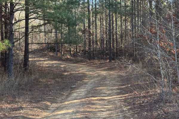
#21 Maynard's Trail
Maynard's trail is one of the longest trails in the park. This trail does a loop and dumps you out where it starts. This trail is all heavily wooded until you reach the end of the trail and then there is a big clearing. There are no major obstacles on this trail.
Learn more about #21 Maynard's Trail
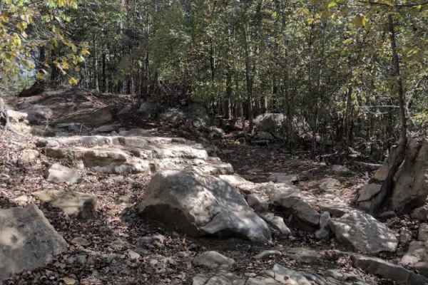
#20 Sidewinder
Trail #20 – Sidewinder lives up to its name, immediately putting drivers off-camber as they tackle a steep, twisting climb filled with continuous rock and boulder obstacles. The trail offers little relief, with technical challenges that increase in difficulty the farther you go. Careful spotting, th...
Learn more about #20 Sidewinder
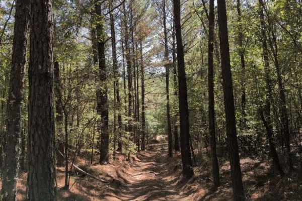
#18 Gate Road
Trail #18 – Gate Road primarily serves as a return route for Trail #20 (Sidewinder) and Trail #19 (Viper). It’s a smooth, wooded dirt road that provides an easy connection back to the main Trail #1. Although it includes a few mild grades, the surface is generally well-packed and should pose no issue...
Learn more about #18 Gate Road
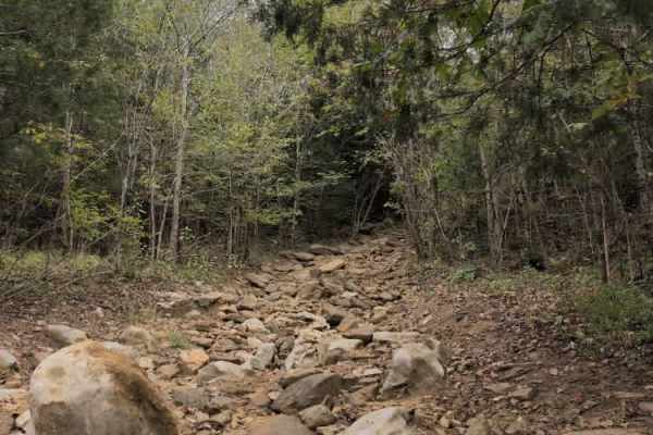
#56 Ol' No. 21
Trail #56 – Ol' No. 21 branches off Trail #57 and connects to Trail #92 (Middle Access). It’s a very short but challenging route featuring numerous large rocks and boulders. Most obstacles are under 30 inches tall, but one particularly tricky section puts vehicles at a steep off-camber angle, creati...
Learn more about #56 Ol' No. 21
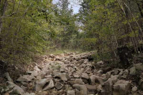
#57 Ol' No. 22
Trail #57 (Ol' No. 22) is a short, rocky technical trail that connects trails #91(Cane Creek) to #92 (Middle Access). The trail starts off with some moderate rocks and ledges that continue throughout; however, as you get towards the end, the trail gets very narrow and overgrown. Expect to get scratc...
Learn more about #57 Ol' No. 22
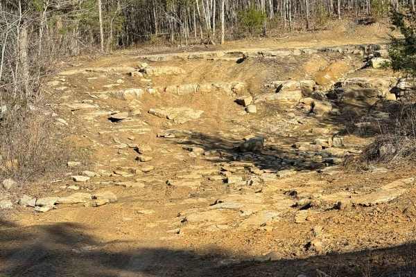
#91 Cane Creek Trail
This trail follows the park's border for most of it and is one of the longer trails. There are a lot of trails varying in difficulty that shoot off from this trail, so make sure to follow the Signs that say Cane Creek Trail. There are quite a few ways to get to this trail but the most common one is ...
Learn more about #91 Cane Creek Trail
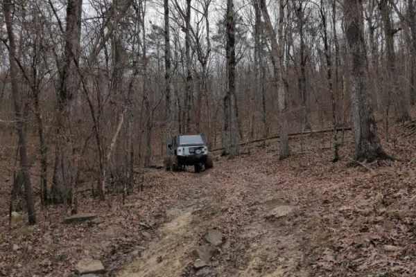
#98 Cherokee
Trail #98 Cherokee is short rocky trail that connects #90 Abbie's Trail to #23 Lucky's Trail. It starts off smooth, but quickly turns into a rocky climb as you approach Lucky's. It has a few washouts, but most obstacles are less than 2 feet tall. At the end of the trail, you turn left to continue on...
Learn more about #98 Cherokee
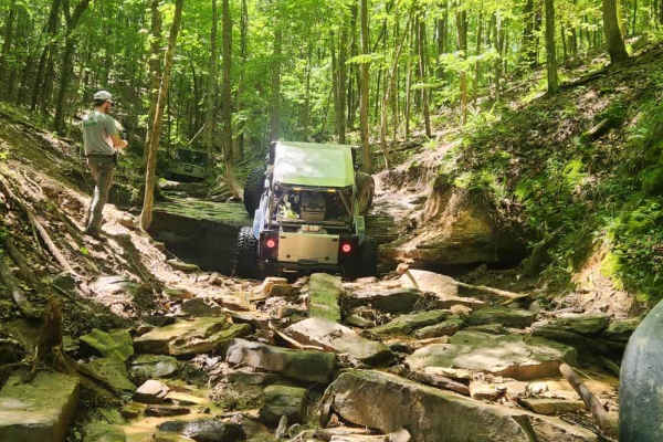
#115 Commandments
Trail #115 Commandments is a rocky climb from the north end of the park all the way back to the power lines. It has a lot of off-camber areas and tight trees to contend with. The trail also features large rock ledges 5 or 6 feet tall to contend with.
Learn more about #115 Commandments
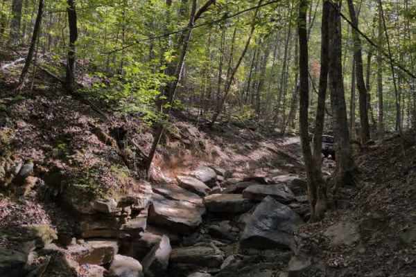
#136 - Fatty's Crack
Fatty's Crack is another popular and talked-about trail at Hawk Pride. It’s a very rough and rocky route characterized by large boulders, steep undercut ledges, and a couple of off-camber sections that challenge even experienced drivers. Fatty's Way runs parallel and offers a safe vantage point to w...
Learn more about #136 - Fatty's Crack
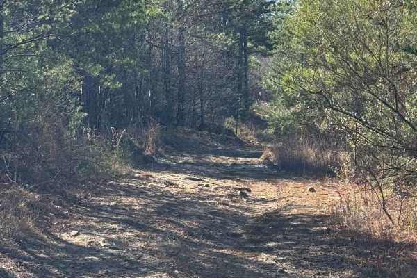
#93 Upper Access
This trail connects #90 to #94 It is a fairly easy trail with no major obstacles. There is a part that branches off and is not on the main trail of #93, which doesn't get much traffic and has become very rutted out and sketchy. It has a boulder around 3 feet and is on a very steep incline, almost be...
Learn more about #93 Upper Access
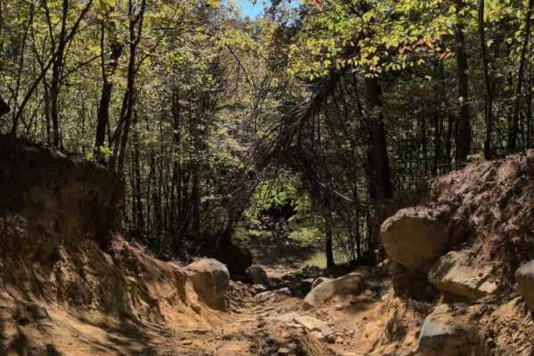
#19 Viper
Trail #19 – Viper is a steep, technical climb filled with continuous rock obstacles from start to finish. Right at the beginning, drivers will encounter a challenging ledge that can easily tip a vehicle toward the passenger side and cause body damage if approached incorrectly. Beyond that initial ob...
Learn more about #19 Viper
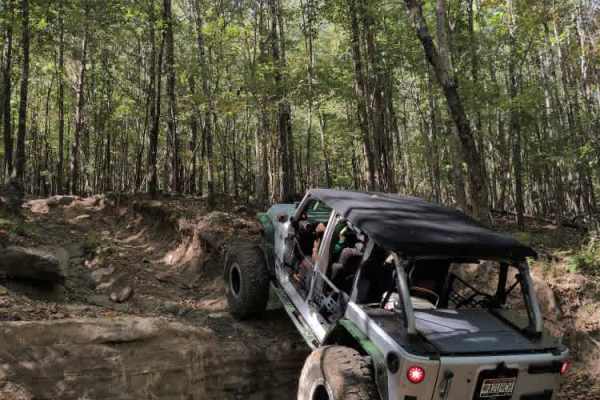
#23 Lucky's Trail
Trail #23 Lucky’s Trail is one of the longest trails at Hawk Pride, stretching roughly 1.3 miles across the park and offering a wide range of terrain and challenges along the way. The trail features numerous rock obstacles and technical sections that demand careful driving and precise vehicle contro...
Learn more about #23 Lucky's Trail
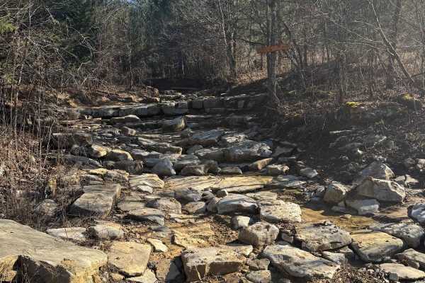
#55 Waterfall
This trail connects trails #91 and #92. There are two exits on it if you want to exit early. These exits will dump you out on trail #93, which parallels the waterfall and is much easier. It is common for riders who do not want to attempt the trail to park on trail #93 and spectate. There is no room ...
Learn more about #55 Waterfall
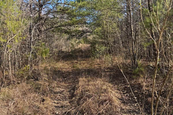
#106 The Bush
This trail is a connector trail in between trails #91 and #92. The entrance of this trail tends to be hard to find due to the entrance being overgrown. There is no room to pass on this trail. There are lots of low branches on this trail that could scratch your paint.
Learn more about #106 The Bush
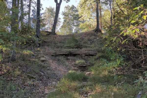
#103 Vertical Limit
Trail #103 – Vertical Limit is an extremely steep and hazardous hill climb located on the north end of the park. About halfway up, the trail splits into three separate lines, each presenting near-vertical ascents with loose rock and deep ruts. These climbs are among the most difficult in the park — ...
Learn more about #103 Vertical Limit
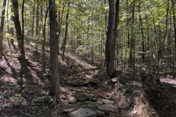
#83 Allen's Way
#83 Allen's Way is essentially a continuation of #136 Fatty's Crack. You can continue to ride the creek bed or some of the flat dirt trails running alongside it. There are some narrow spots and trees to watch out for, but this trail is milder than Fatty's Crack.
Learn more about #83 Allen's Way
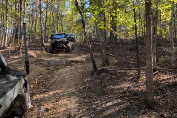
#136a Fatty's Way
Trail – Fatty’s Way descends from the Polaris Outfitter Trail and leads directly to the start of Trail #136 (Fatty’s Crack). Continuing past that junction brings you to the entrance of Trail #115 (Commandments), after which the route runs roughly parallel to Fatty’s Crack before looping back up to r...
Learn more about #136a Fatty's Way
#131 Treestand
Trail #131 Treestand is a steep, rocky, and mostly straight path up a wooded hillside. It connects #23 Lucky's Trail to #114 Hardline Trail. This trail is narrow with multiple large rock obstacles, most with bypasses. Be aware of off-camber sections near trees that can cause body damage.
Learn more about #131 Treestand
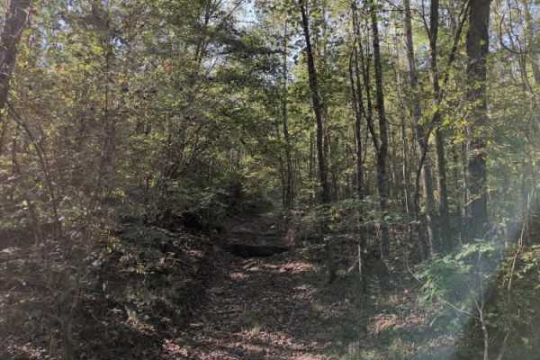
#102 Jake's Hill
Trail #102 – Jake’s Hill lives up to its reputation — and whoever Jake was, he clearly had nerves of steel. This is a very steep and demanding hill climb featuring massive rock ledges exceeding 7 feet in height, loose dirt, and deep ruts that challenge even the most capable rigs. It’s true rock-boun...
Learn more about #102 Jake's Hill
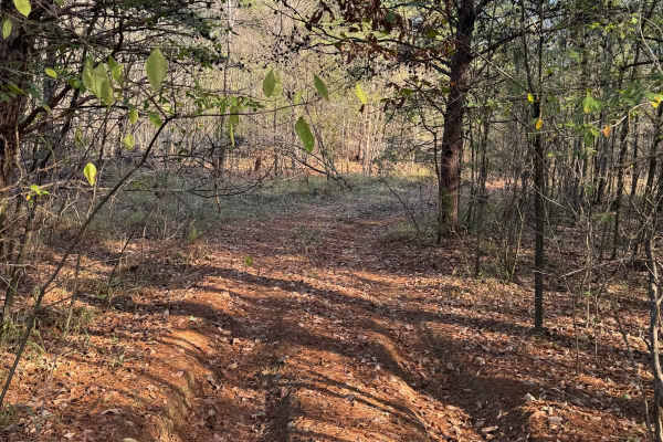
#61 Bridge Street
Bridge Street Is a short connector trail in between trails #91 and #92, it is mostly flat and wooded with dirt and pine straw covering the ground. This trail is infrequently used so it can sometimes be grown up and rutted out. The trail itself does not have any major obstacles on it.
Learn more about #61 Bridge Street
ATV trails near Cherokee, Alabama
Explore ATV-friendly trails near you. These trails are accessible for vehicles up to 50 inches wide, perfect for ATVs and smaller off-road machines.
#21 Maynard's Trail
Maynard's trail is one of the longest trails in the park. This trail does a loop and dumps you out where it starts. This trail is all heavily wooded until you reach the end of the trail and then there is a big clearing. There are no major obstacles on this trail.
Learn more about #21 Maynard's Trail
#20 Sidewinder
Trail #20 – Sidewinder lives up to its name, immediately putting drivers off-camber as they tackle a steep, twisting climb filled with continuous rock and boulder obstacles. The trail offers little relief, with technical challenges that increase in difficulty the farther you go. Careful spotting, th...
Learn more about #20 Sidewinder
#18 Gate Road
Trail #18 – Gate Road primarily serves as a return route for Trail #20 (Sidewinder) and Trail #19 (Viper). It’s a smooth, wooded dirt road that provides an easy connection back to the main Trail #1. Although it includes a few mild grades, the surface is generally well-packed and should pose no issue...
Learn more about #18 Gate Road
#56 Ol' No. 21
Trail #56 – Ol' No. 21 branches off Trail #57 and connects to Trail #92 (Middle Access). It’s a very short but challenging route featuring numerous large rocks and boulders. Most obstacles are under 30 inches tall, but one particularly tricky section puts vehicles at a steep off-camber angle, creati...
Learn more about #56 Ol' No. 21
UTV/side-by-side trails near Cherokee, Alabama
Find UTV and side-by-side trails near you. These trails accommodate vehicles up to 60 inches wide, ideal for UTVs, side-by-sides, and wider off-road rigs.
#21 Maynard's Trail
Maynard's trail is one of the longest trails in the park. This trail does a loop and dumps you out where it starts. This trail is all heavily wooded until you reach the end of the trail and then there is a big clearing. There are no major obstacles on this trail.
Learn more about #21 Maynard's Trail
#20 Sidewinder
Trail #20 – Sidewinder lives up to its name, immediately putting drivers off-camber as they tackle a steep, twisting climb filled with continuous rock and boulder obstacles. The trail offers little relief, with technical challenges that increase in difficulty the farther you go. Careful spotting, th...
Learn more about #20 Sidewinder
#18 Gate Road
Trail #18 – Gate Road primarily serves as a return route for Trail #20 (Sidewinder) and Trail #19 (Viper). It’s a smooth, wooded dirt road that provides an easy connection back to the main Trail #1. Although it includes a few mild grades, the surface is generally well-packed and should pose no issue...
Learn more about #18 Gate Road
#56 Ol' No. 21
Trail #56 – Ol' No. 21 branches off Trail #57 and connects to Trail #92 (Middle Access). It’s a very short but challenging route featuring numerous large rocks and boulders. Most obstacles are under 30 inches tall, but one particularly tricky section puts vehicles at a steep off-camber angle, creati...
Learn more about #56 Ol' No. 21
The onX Offroad Difference
onX Offroad combines trail photos, descriptions, difficulty ratings, width restrictions, seasonality, and more in a user-friendly interface. Available on all devices, with offline access and full compatibility with CarPlay and Android Auto. Discover what you're missing today!
Open Trail Map