
Dirt Bike Trails
Near Carter Springs, Nevada
Explore All Dirt Bike Trails Near Carter Springs, Nevada
Dirt Bike Trails Near Carter Springs, Nevada
Discover the best dirt bike trails near you. Browse trail maps, check difficulty ratings, and find your next adventure — whether you're looking for a quick ride or an all-day expedition.
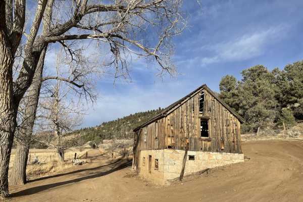
Carson River East Fork Hot Springs Trail
This trail along the East Fork of the Carson River with spectacular views of the River's canyon, the walls peaks of the High Sierra's to the west will not disappoint any mid-level experienced rider. Use caution and be courteous, this may be a high traffic area. The majority of this trail is only wid...
Learn more about Carson River East Fork Hot Springs Trail
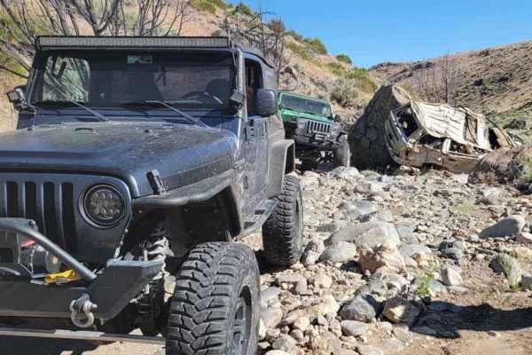
Secret Canyon
This trail offers a rugged adventure, tracing a dry riverbed through a rocky canyon. It's a demanding route, testing both driver skill and vehicle durability. The scenery may not be particularly picturesque, but the trail will thoroughly challenge every bolt, screw, and fastener on your 4x4. To tack...
Learn more about Secret Canyon
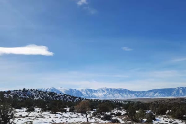
P-10 Trail
Named by the BLM, P-10 is a North/South trail passing along the East side of the Carson Valley. On the North it intersects Sunrise Pass (BLM R-09), and in the South intersecting with Pine Nut Road II (BLM P-11). P-10 is an easy trail, consisting of dirt, sand, and some rocky sections. There is a min...
Learn more about P-10 Trail
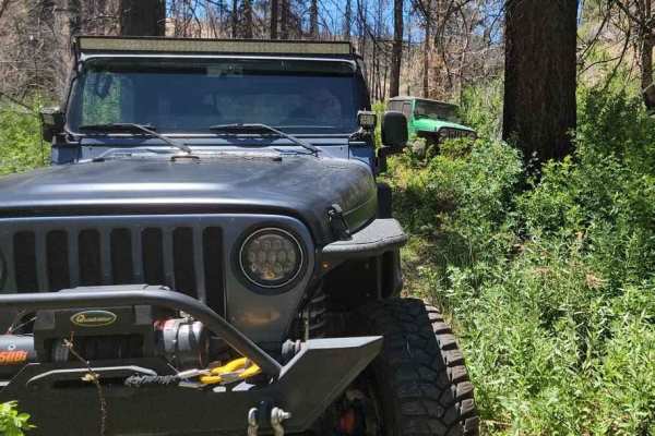
Poison Creek
The trail begins on a dirt road just off Highway 395 and quickly descends into a lush valley. In this valley, the path follows a creek, winding in and out of dense vegetation. At times, the vehicle feels like it's traveling through a tunnel formed by the overhanging trees and greenery. While the tra...
Learn more about Poison Creek
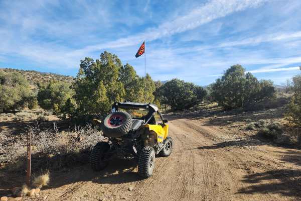
Pine Nuts P-16 Trail
Traveling East from the Carson Valley, P-16 Trail will take you into the heart of the Pine Nut Mountains. It is a one-lane winding mountain trail that gains altitude as you go East. The trail is lined with Juniper trees and Pinion Pines, with some open areas, and offers grand views of the Sierra Fro...
Learn more about Pine Nuts P-16 Trail
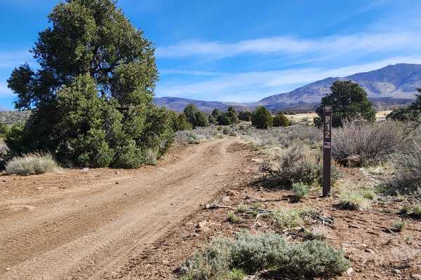
Lone Pine Canyon Road - BLM P-12
Traveling East from the Carson Valley, Lone Pine Canyon Road (BLM P-12) will take you into the Southern portion of the Pine Nut Mountains. It is a one-lane winding mountain trail with some moderate challenges. It gains altitude as you go East into the Pine Nuts. The trail once was lined with Junipe...
Learn more about Lone Pine Canyon Road - BLM P-12
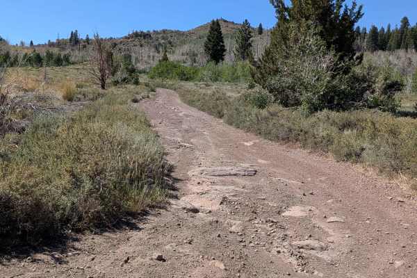
Big Spring Spur Road
Big Spring Spur Road is a scenic dirt route in the Toiyabe National Forest, accessed from Highway 89, about 7.5 miles west of the Highway 395/89 Junction. This rugged path takes you through open meadows, rolling ridgelines, and offers striking views of the surrounding mountain ranges. The road surfa...
Learn more about Big Spring Spur Road
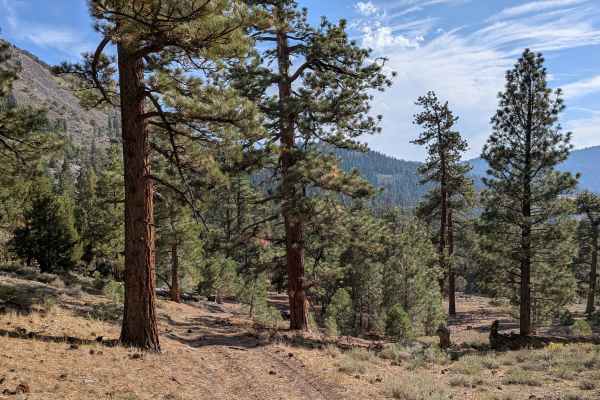
Water Tank Spur - FS 31347
This 2.5-mile out-and-back trail begins from Leviathan Road and offers a quick but rugged climb. The route gains over 450 feet in under a mile before dropping about 130 feet to its end high above Poison Creek, where wide views open across the valley below. The track is one vehicle wide, made of dirt...
Learn more about Water Tank Spur - FS 31347
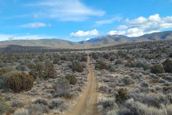
1947 Bunker Trail
This trail starts off on a wide graded dirt road. Then turning Northeast you proceed up a narrow double track trail. This portion of the trail ascends up a flat topped ridge which is lined with Juniper trees. There are several small arroyos to cross along the way. The arroyos are usually dry, but ca...
Learn more about 1947 Bunker Trail
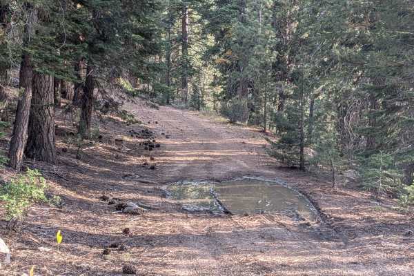
High Peak Road - FS 31050
This narrow 3-mile route starts near the end of Leviathan Road by the mine and climbs more than 700 feet. The trail is tight and overgrown in spots, with low-hanging branches and brush crowding the edges. It is made of hard-packed dirt and is barely wide enough for a single vehicle. From the start, ...
Learn more about High Peak Road - FS 31050
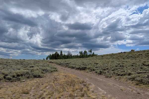
Leviathan Bypass - FS 31353
Accessed from Big Spring Road West, this lesser-known offshoot delivers a peaceful backcountry ride through sagebrush meadows and an Aspen forest that truly comes alive in the fall. The trail is one vehicle wide and winds gently through vibrant vegetation, gradually climbing over 300 feet from south...
Learn more about Leviathan Bypass - FS 31353
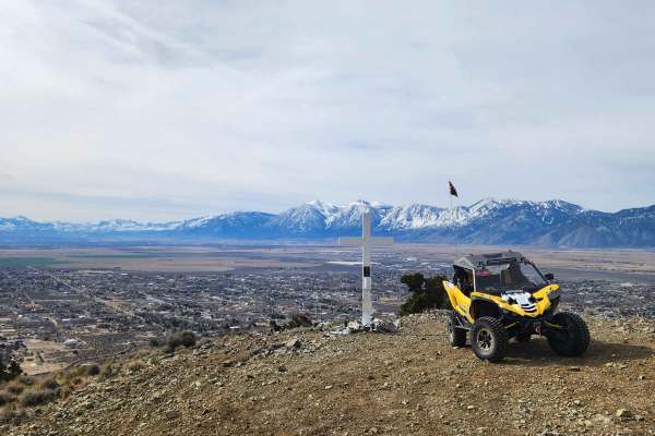
Hot Springs Mountains Senic Trail
This trail leads you to panoramic views of the Carson Valley and the Sierra Front. I prefer to start at the Johnson Lane Staging Area and travel North, but either direction is okay. The trail has a few challenges. You will encounter soft sand and loose rocks on some of the steep climbs, so have appr...
Learn more about Hot Springs Mountains Senic Trail
Sunrise Pass Road
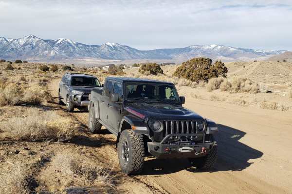
This graded dirt county road begins at the Johnson Lane OHV Park located east of Minden, NV. As the road gradually ascends, it traverses alluvial plains covered in sage and low canyons with juniper trees. Rising to 7,000 feet at Sunrise Pass, the road takes you to the heart of the Pine Nut Mountains...
Learn more about Sunrise Pass Road
Loope Canyon Road - FS 31190
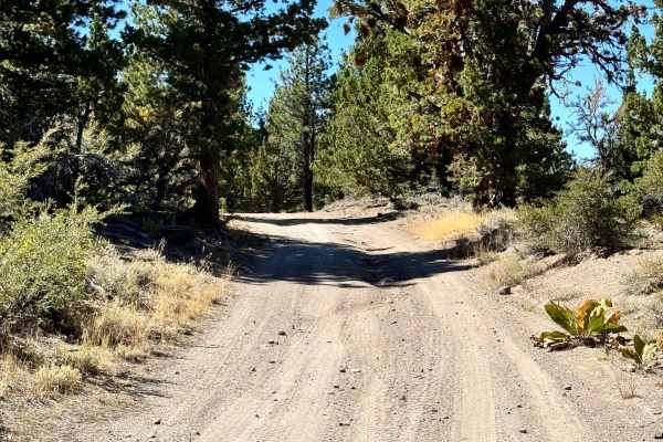
This trail does have some ruts and washes along the way. The trail is a mix of dirt and loose rock, and there are spurs going off the trail for camping. The trail view varies; one minute you're in the dense forest and the next you're out in the middle of an open area.
Learn more about Loope Canyon Road - FS 31190
Pine Nut Mountains Vista Trail
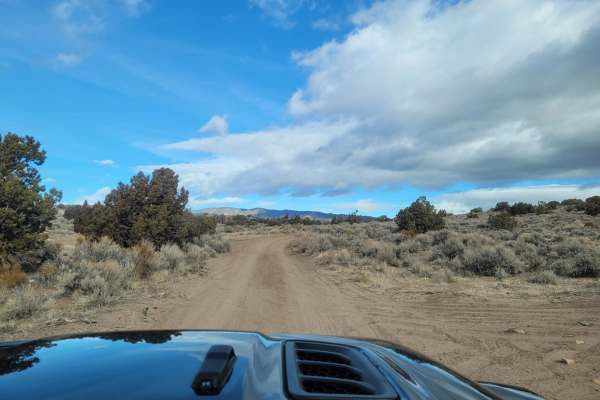
The Pine Nut Mountains Vista Trail is a scenic double-track route in the Johnson Lane OHV Area, perfect for offroaders seeking panoramic views of the Sierra Nevada Mountains, Minden, and the surrounding Carson Valley. Starting near the end of Johnson Lane, just ten miles from Minden, this 2.56-mile ...
Learn more about Pine Nut Mountains Vista Trail
Circle Peak Road - FS 31311
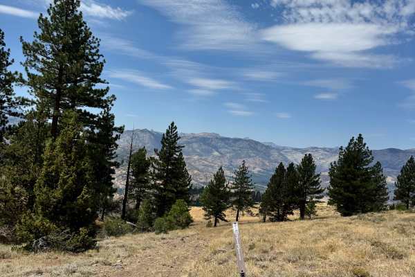
This trail once was able to bring you to Circle Peak, which has an elevation of 6,923 feet, but today it is blocked due to a washout and some overgrown vegetation beyond it. The trail starts rocky but quickly turns to dirt and tall grass the rest of the way until you reach the wash.
Learn more about Circle Peak Road - FS 31311
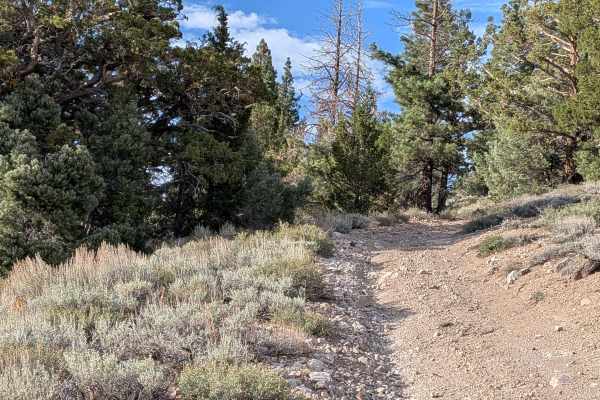
Leviathan Creek
This 4-mile out-and-back trail climbs just over 100 feet and drops more than 300 feet in under 2 miles as it winds through dense forest and open meadows. The track is a single vehicle wide, often very tight, with overgrown trees and brush. Expect Sierra pinstripes in multiple sections. The trail beg...
Learn more about Leviathan Creek
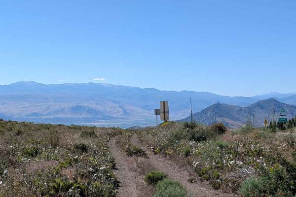
Virgil Connell Loop Road - FS 32087
Virgil Connell Loop Road, also known as Forest Service Road 32087, begins at the top of the grade off Highway 89, offering sweeping views of the Lake Topaz basin and surrounding mountain ranges. From the start, the trail parallels the highway before dropping into a wide-open valley flanked by rugged...
Learn more about Virgil Connell Loop Road - FS 32087
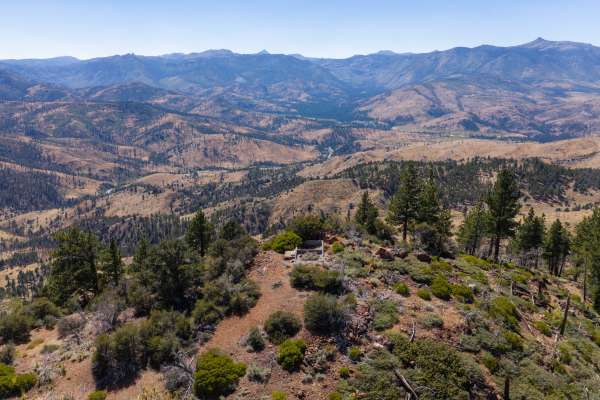
Morningstar Spur B - FS 31190B
This is a short trail that's just under a mile that takes you to an old fire lookout, the Mogul Lookout. There is only the concrete foundation left of the lookout, but it's still interesting to see. The trail doesn't go straight up to it anymore; there is overgrown vegetation, but it does get close....
Learn more about Morningstar Spur B - FS 31190B
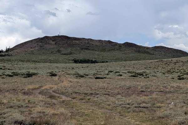
Shepherd Road - FS 31354
This short connector trail offers a scenic and efficient route between Highway 89 and Leviathan Bypass or Big Springs Road East, making it a useful shortcut for those navigating the area. Access is possible from either Highway 89 or the Leviathan Bypass trail. The track is one vehicle wide and weave...
Learn more about Shepherd Road - FS 31354
ATV trails near Carter Springs, Nevada
Explore ATV-friendly trails near you. These trails are accessible for vehicles up to 50 inches wide, perfect for ATVs and smaller off-road machines.
Carson River East Fork Hot Springs Trail
This trail along the East Fork of the Carson River with spectacular views of the River's canyon, the walls peaks of the High Sierra's to the west will not disappoint any mid-level experienced rider. Use caution and be courteous, this may be a high traffic area. The majority of this trail is only wid...
Learn more about Carson River East Fork Hot Springs Trail
Secret Canyon
This trail offers a rugged adventure, tracing a dry riverbed through a rocky canyon. It's a demanding route, testing both driver skill and vehicle durability. The scenery may not be particularly picturesque, but the trail will thoroughly challenge every bolt, screw, and fastener on your 4x4. To tack...
Learn more about Secret Canyon
P-10 Trail
Named by the BLM, P-10 is a North/South trail passing along the East side of the Carson Valley. On the North it intersects Sunrise Pass (BLM R-09), and in the South intersecting with Pine Nut Road II (BLM P-11). P-10 is an easy trail, consisting of dirt, sand, and some rocky sections. There is a min...
Learn more about P-10 Trail
Poison Creek
The trail begins on a dirt road just off Highway 395 and quickly descends into a lush valley. In this valley, the path follows a creek, winding in and out of dense vegetation. At times, the vehicle feels like it's traveling through a tunnel formed by the overhanging trees and greenery. While the tra...
Learn more about Poison Creek
UTV/side-by-side trails near Carter Springs, Nevada
Find UTV and side-by-side trails near you. These trails accommodate vehicles up to 60 inches wide, ideal for UTVs, side-by-sides, and wider off-road rigs.
Secret Canyon
This trail offers a rugged adventure, tracing a dry riverbed through a rocky canyon. It's a demanding route, testing both driver skill and vehicle durability. The scenery may not be particularly picturesque, but the trail will thoroughly challenge every bolt, screw, and fastener on your 4x4. To tack...
Learn more about Secret Canyon
P-10 Trail
Named by the BLM, P-10 is a North/South trail passing along the East side of the Carson Valley. On the North it intersects Sunrise Pass (BLM R-09), and in the South intersecting with Pine Nut Road II (BLM P-11). P-10 is an easy trail, consisting of dirt, sand, and some rocky sections. There is a min...
Learn more about P-10 Trail
Poison Creek
The trail begins on a dirt road just off Highway 395 and quickly descends into a lush valley. In this valley, the path follows a creek, winding in and out of dense vegetation. At times, the vehicle feels like it's traveling through a tunnel formed by the overhanging trees and greenery. While the tra...
Learn more about Poison Creek
Pine Nuts P-16 Trail
Traveling East from the Carson Valley, P-16 Trail will take you into the heart of the Pine Nut Mountains. It is a one-lane winding mountain trail that gains altitude as you go East. The trail is lined with Juniper trees and Pinion Pines, with some open areas, and offers grand views of the Sierra Fro...
Learn more about Pine Nuts P-16 Trail
The onX Offroad Difference
onX Offroad combines trail photos, descriptions, difficulty ratings, width restrictions, seasonality, and more in a user-friendly interface. Available on all devices, with offline access and full compatibility with CarPlay and Android Auto. Discover what you're missing today!
Open Trail Map