
Dirt Bike Trails
Near Boulder, Utah
Explore All Dirt Bike Trails Near Boulder, Utah
Dirt Bike Trails Near Boulder, Utah
Discover the best dirt bike trails near you. Browse trail maps, check difficulty ratings, and find your next adventure — whether you're looking for a quick ride or an all-day expedition.
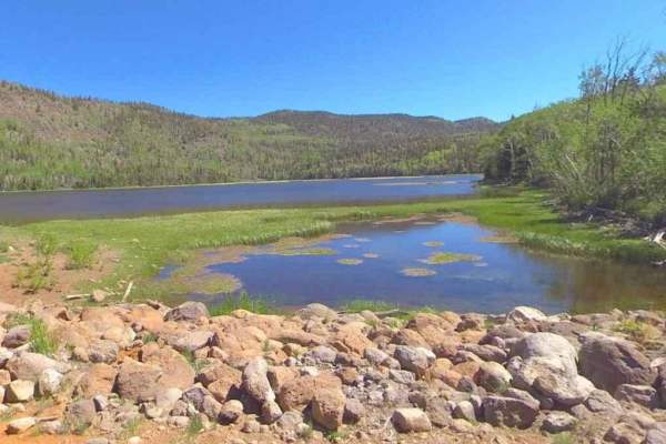
Sweetwater-NFS30494
Sweetwater-NFS30494 is a 3-mile out-and-back trail rated 3 of 10 located in Garfield County, Utah, within the Escalante Ranger District of the Dixie National Forest. Sweetwater Trail is a well-identified single-track trail that provides the only motor vehicle access to McGath Lake. The first 2 miles...
Learn more about Sweetwater-NFS30494
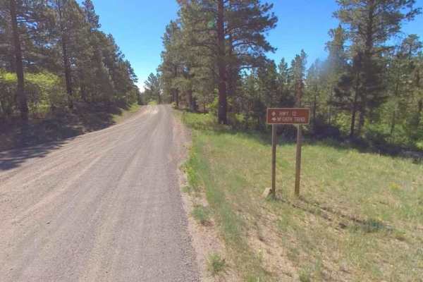
Roundup Cuddy Back-NFS30566
Roundup Cuddy Back-NFS30566 is a 4.6-mile point-to-point trail rated 2 of 10 located in Garfield County, Utah, within the Escalante Ranger District of the Dixie National Forest. Roundup Cuddy Back connects Hells Backbone (NFS30153) and the Boulder Swale ATV trail parking area. This trail also inters...
Learn more about Roundup Cuddy Back-NFS30566
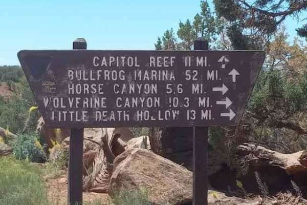
Wolverine Loop Road - 0640
Trails is a sandy gravel trail that leads you through washes and dry creek beds that is a class 2 trail. Be aware of the weather parts of the trail may be muddy and slick if wet. The trail does split into areas and leads in different directions. Wolverine Loop leads you to Little Death Hollow trailh...
Learn more about Wolverine Loop Road - 0640
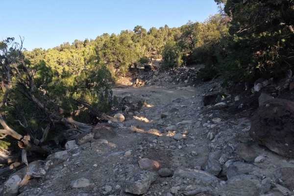
Waterline Connector - BLM10005
This short, fun trail gets you off a main road and allows you to explore the area north of Escalante. It has some challenges, but nothing a moderately skilled driver should be able to handle. There are some moderately steep climbs and rocks to contend with. The first of which you will encounter as y...
Learn more about Waterline Connector - BLM10005
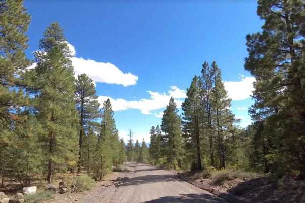
Pine Creek Road FS 30153
Pine Creek Road FS 30153 is a 10.4-mile point-to-point trail located in Garfield County within the Escalante Ranger District of the Dixie National Forest. The trailhead starts just after the cattle guard about 3.3 miles from Highway 12 in Escalante. Pine Creek Road is probably one of the most used a...
Learn more about Pine Creek Road FS 30153
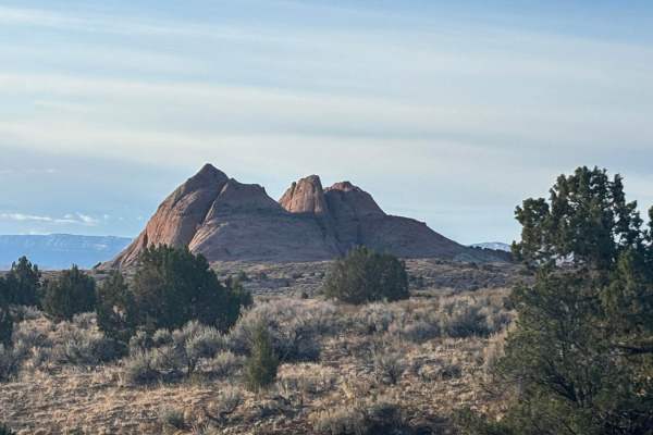
Cosmic Tour
Embark on an easy drive to a captivating geological wonder! The road culminates in a spacious turnout, where you'll find the marked trailhead for the volcanic trail. Along the way, numerous short detours lead to scenic campsites boasting breathtaking views of the surrounding landscape. The road itse...
Learn more about Cosmic Tour
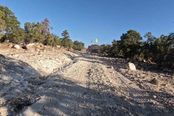
Waterline Road - BLM6850
This road starts just north of the Escalante Petrified Forest State Park and runs north, to an intersection with the Hell's Backbone Loop Road. That road is a heavily traveled road for visitors wanting to get up to the Hell's Backbone area. For that reason, this road is a nice alternative that does ...
Learn more about Waterline Road - BLM6850
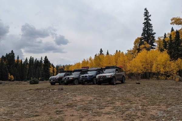
Aquarius Teasdale - NF154
Easy gravel road climbing up onto Boulder Mountain above Escalante, UT. This road accesses Posey Lake, Cyclone Lake, and a number of high alpine lakes. Climbing over 9,500 feet, this is a great place to see the aspens changing color in the fall. This area is typically snowbound between November and ...
Learn more about Aquarius Teasdale - NF154
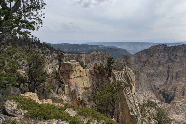
Hells Backbone - NF153
Hell's Backbone is a rugged area that bridges between towering Boulder Mountain on the north and canyons cut by the Escalante River and its tributaries on the south. The Hell's Backbone Road is a winding route that follows ridges and mountain contours through the area. The road forks from All Americ...
Learn more about Hells Backbone - NF153
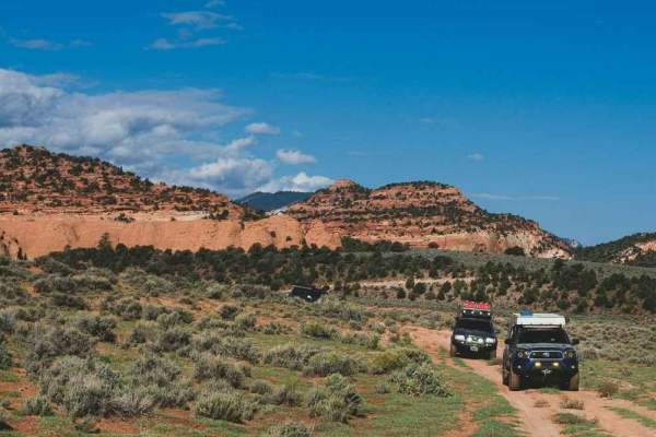
Tantalus Flat - NF30168
Fun mixed terrain route accessing Lower Browns Reservoir, Jorgensen Flat, Tantalus Flats, Laurel and Hardy Arch, and the Western back-door access point of Capitol Reef National Park. This route starts out as a graded gravel Forest Service road that begins to denigrate into a bumpy dirt two-track as ...
Learn more about Tantalus Flat - NF30168
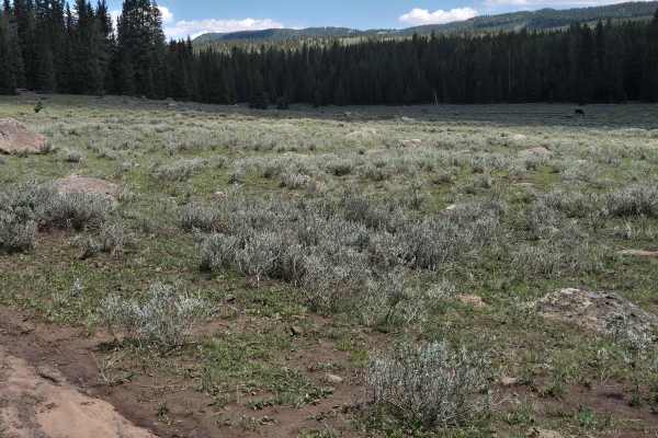
Row Lake - FS 30262
This trail goes by Row Spring and Row Lakes, and winds through the forest of spruce trees and aspen over a mostly dirt trail, but there are some rocky places. Most of this trail is above 10,000 feet in elevation, in case you are sensitive to elevation. Late summer brings cooler temperatures.
Learn more about Row Lake - FS 30262
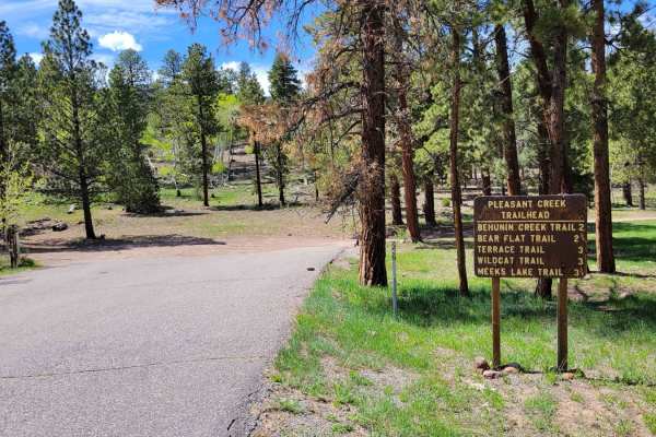
35158 - Pleasant Cr Trail
This is actually part of the Great Western Trail - a hiking route that spans North/South from Mexico to Canada. Hikers could be present on the trail, so please be respectful. The trail begins with a short, rocky hill climb and is the first of many you'll experience along the way. The next ones are s...
Learn more about 35158 - Pleasant Cr Trail

31958-B
This is a very short offshoot trail from 35158. It's on the advanced side with a couple of steep hill climbs, a couple of which have some rocky sections to navigate. It abruptly dead ends up on a hillside. If you walk across the hill a few feet, through the trees you can catch quite an expansive vie...
Learn more about 31958-B
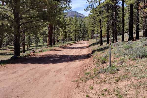
30323 - Wildcat Trail
From off of Highway 12, this nearly 2-mile out-and-back trail dead-ends at a beautiful little meadow view. It's not flat enough to camp at, unfortunately. As far as difficulty, there are a handful of small mud ruts and runoff mounds to navigate, to which having some sort of vehicle clearance helps. ...
Learn more about 30323 - Wildcat Trail
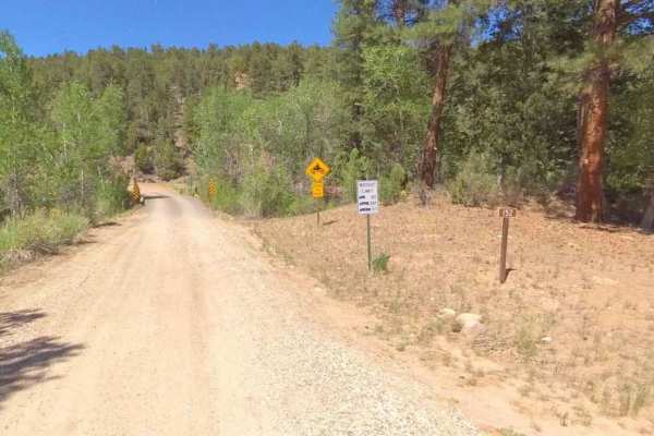
Whites Flat FS 30152
Whites Flat FS 30152 is a 10-mile point-to-point trail located in Garfield County within the Escalante Ranger District of the Dixie National Forest. The road is a full two-lane improved dirt road that is maintained by the forest service. There are no obstacles along the road and it is suitable for a...
Learn more about Whites Flat FS 30152

Chokecherry Point
Chokecherry Point has an amazing view, it is said that you can see more than 100 miles in a 180-degree radius. Ranger Walter E. Hanks was the first Ranger in this district. Chokecherry Point was his favorite place on Boulder Mountain, this was the place he would show his visitors, including his supe...
Learn more about Chokecherry Point
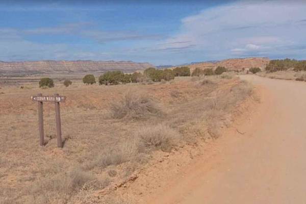
Cedar Wash Road-BLM210
Cedar Wash Road is a 9.9-mile point-to-point trail rated 2 of 10. This is a destination trail which connects Hole-in-the-Rock Road and the community of Escalante. This easy road provides access to a couple of short hikes to views of Cedar Wash Arch and Covered Wagon Natural Bridge. There is also a v...
Learn more about Cedar Wash Road-BLM210
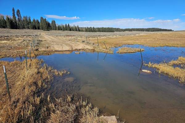
Velvet Lake Road
Velvet Lake Road offers a relatively moderate trail experience, but there are some important considerations to keep in mind. One notable feature is a water crossing that can become impassable depending on water levels, as the bottom is muddied and has concealed large rocks. You'll also encounter a g...
Learn more about Velvet Lake Road

Old Escalante Road FH 17
Old Escalante Road FH 17 is a 22-mile point-to-point trail located in Garfield County, Utah, and runs through the Dixie National Forest (Escalante Ranger District). Utah Forest Road 17 (FH 17) is a very scenic, fairly wide drive through the high mountains of Garfield County, in south-central Utah. T...
Learn more about Old Escalante Road FH 17
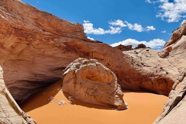
Cosmic Ashtray via Harris Wash Rd
This sandy single wide track with a few turnouts for passing is the Southern route to access the Cosmic Ashtray. 4x4 is highly recommended. The Ashtray is approx. 4.3 miles past the trailhead at Harris Wash so the length of your hike will depend on how far up Harris Wash Road you go. The last half m...
Learn more about Cosmic Ashtray via Harris Wash Rd
ATV trails near Boulder, Utah
Explore ATV-friendly trails near you. These trails are accessible for vehicles up to 50 inches wide, perfect for ATVs and smaller off-road machines.
Sweetwater-NFS30494
Sweetwater-NFS30494 is a 3-mile out-and-back trail rated 3 of 10 located in Garfield County, Utah, within the Escalante Ranger District of the Dixie National Forest. Sweetwater Trail is a well-identified single-track trail that provides the only motor vehicle access to McGath Lake. The first 2 miles...
Learn more about Sweetwater-NFS30494
Roundup Cuddy Back-NFS30566
Roundup Cuddy Back-NFS30566 is a 4.6-mile point-to-point trail rated 2 of 10 located in Garfield County, Utah, within the Escalante Ranger District of the Dixie National Forest. Roundup Cuddy Back connects Hells Backbone (NFS30153) and the Boulder Swale ATV trail parking area. This trail also inters...
Learn more about Roundup Cuddy Back-NFS30566
Wolverine Loop Road - 0640
Trails is a sandy gravel trail that leads you through washes and dry creek beds that is a class 2 trail. Be aware of the weather parts of the trail may be muddy and slick if wet. The trail does split into areas and leads in different directions. Wolverine Loop leads you to Little Death Hollow trailh...
Learn more about Wolverine Loop Road - 0640
Waterline Connector - BLM10005
This short, fun trail gets you off a main road and allows you to explore the area north of Escalante. It has some challenges, but nothing a moderately skilled driver should be able to handle. There are some moderately steep climbs and rocks to contend with. The first of which you will encounter as y...
Learn more about Waterline Connector - BLM10005
UTV/side-by-side trails near Boulder, Utah
Find UTV and side-by-side trails near you. These trails accommodate vehicles up to 60 inches wide, ideal for UTVs, side-by-sides, and wider off-road rigs.
Sweetwater-NFS30494
Sweetwater-NFS30494 is a 3-mile out-and-back trail rated 3 of 10 located in Garfield County, Utah, within the Escalante Ranger District of the Dixie National Forest. Sweetwater Trail is a well-identified single-track trail that provides the only motor vehicle access to McGath Lake. The first 2 miles...
Learn more about Sweetwater-NFS30494
Roundup Cuddy Back-NFS30566
Roundup Cuddy Back-NFS30566 is a 4.6-mile point-to-point trail rated 2 of 10 located in Garfield County, Utah, within the Escalante Ranger District of the Dixie National Forest. Roundup Cuddy Back connects Hells Backbone (NFS30153) and the Boulder Swale ATV trail parking area. This trail also inters...
Learn more about Roundup Cuddy Back-NFS30566
Wolverine Loop Road - 0640
Trails is a sandy gravel trail that leads you through washes and dry creek beds that is a class 2 trail. Be aware of the weather parts of the trail may be muddy and slick if wet. The trail does split into areas and leads in different directions. Wolverine Loop leads you to Little Death Hollow trailh...
Learn more about Wolverine Loop Road - 0640
Waterline Connector - BLM10005
This short, fun trail gets you off a main road and allows you to explore the area north of Escalante. It has some challenges, but nothing a moderately skilled driver should be able to handle. There are some moderately steep climbs and rocks to contend with. The first of which you will encounter as y...
Learn more about Waterline Connector - BLM10005
The onX Offroad Difference
onX Offroad combines trail photos, descriptions, difficulty ratings, width restrictions, seasonality, and more in a user-friendly interface. Available on all devices, with offline access and full compatibility with CarPlay and Android Auto. Discover what you're missing today!
Open Trail Map