
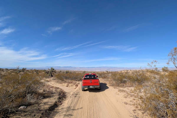
Dirt Bike Trails
Near Boron, California
Explore All Dirt Bike Trails Near Boron, California
Dirt Bike Trails Near Boron, California
Discover the best dirt bike trails near you. Browse trail maps, check difficulty ratings, and find your next adventure — whether you're looking for a quick ride or an all-day expedition.
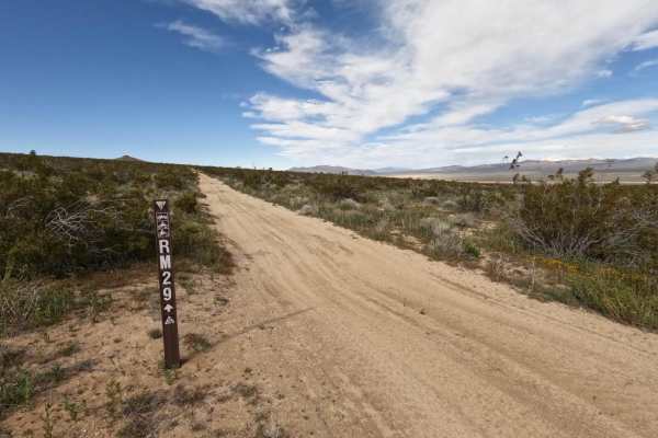
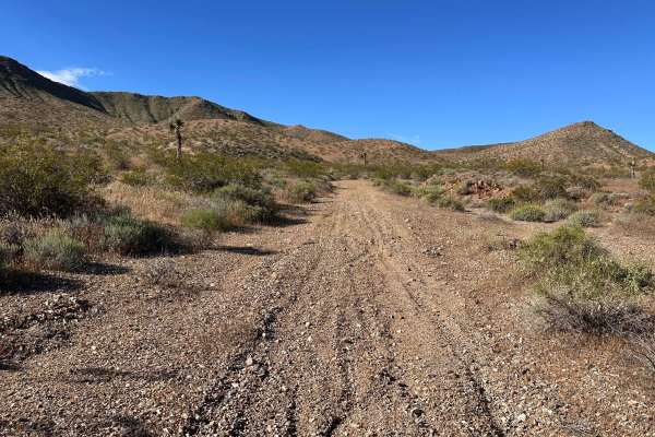
RM29
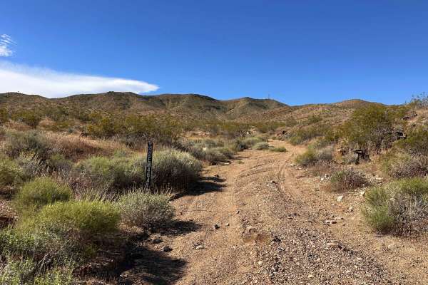
Easy desert track through dry brush and rocks. There are whoops and washes to cross, so be careful if you gather too much speed on this straight track. This follows a fence for environmental conservation, so stay on track. This will end at the Golden Valley Wilderness (or start there, based on where...
Learn more about RM29
R43 Willis Well Road
This trail connects Redrock Randsburg Road to Randsburg Mojave Road by going over the Rand mountain range. There is cell coverage throughout most of the trail, may get a drop put or 2 in the mountain. There are very deep UTV ruts and "Razor chop". Any high clearance vehicle should be able to make it...
Learn more about R43 Willis Well Road
Scorpion Cut-off
This section is all about speed and rhythm, offering a wide double-track layout that lets you really open it up. The standout feature is a series of deep, flowy sand whoops that allow for a consistent, undulating pace if you time your suspension movement right. With clear visibility across the low-l...
Learn more about Scorpion Cut-off
Cactus Ridge
This is a fun single-track option that feels like a true escape from the wider double-track roads. It’s a great stretch to check out if you’re looking for a tighter, more focused line through the terrain. The path eventually opens up into the more remote backcountry, giving you plenty of room to ext...
Learn more about Cactus Ridge
Sandstone Cut-Off
This outer dirt road acts as a key boundary route, offering a wide double-track path that leads you toward the edges of the BLM territory. It’s a great way to push further out and explore the transition into the surrounding open desert. The trail is open and predictable, providing plenty of room for...
Learn more about Sandstone Cut-Off
Whiskey Wash
This wash is an blast, offering a wide-open, flowy run that lets you really pick up the pace. The scenery is top-tier, with the natural walls of the wash creating a cool, immersive backdrop as you blast through. It’s a great stretch for finding a rhythm and enjoying the bike’s high-speed stability. ...
Learn more about Whiskey Wash

Desert Divide
This is a great little segment that packs a lot of character into a short distance. It moves away from the flat desert floor and introduces a punchy uphill climb that requires a bit of focused throttle control and body positioning. The ground is littered with small, loose rocks that add a layer of t...
Learn more about Desert Divide
Rattlesnake Loop
This wide-open trail is the ideal spot to get your bearings, offering a clear and predictable path that works perfectly as a warm-up loop. The layout is expansive, giving you plenty of room to stand up, stretch out, and find your rhythm before heading into more demanding terrain. Because the visibil...
Learn more about Rattlesnake Loop
Badlands Cut
This is a classic desert wash that’s all about finding a rhythm. It’s fun and flowy, letting you wind through the landscape's natural bends at a steady clip. There aren't any surprise obstacles here—just a wide, open path that feels great when you’re on the gas. It’s a perfect stretch to enjoy the b...
Learn more about Badlands Cut
Painted Canyon Run
This versatile link acts as a primary exit route that feeds into a spiderweb of both wide double-track and narrow single-track sections. The path drops you into several undulating washes where water-carved ruts provide a natural technical challenge, while the local flora has begun to reclaim the tra...
Learn more about Painted Canyon Run
Windmill Trail
This trail delivers a high-engagement experience, trading high-speed flats for a winding route full of tight, technical switchbacks. The elevation changes provide a great workout for your clutch work and braking precision as you snake through the terrain. Along the way, the trail opens into a scenic...
Learn more about Windmill Trail
Mule Canyon
This route offers a classic desert mix, combining wide-open vistas with a more intimate riding experience. The trail eventually ducks into a narrow section where the desert floor tightens up, forcing you to focus on your precision and bike placement. This leads directly into a natural wash, where th...
Learn more about Mule Canyon

Devil’s Saddle
This fun, outgoing trail serves as a solid connector, linking you up with several double-track and single-track options. You’ll be diving into some rutted washes that keep the ride interesting, alongside some overgrown vegetation that really tightens the feel of the path. It’s a great route if you’r...
Learn more about Devil’s Saddle
Black Butte Trail
This wash has a really great feel to it, offering a flowy ride through some pretty desert scenery. You’ll weave through sections of overgrown vegetation that hug the trail, giving it a more secluded and natural vibe. The ground is mostly loose sand, which makes for a smooth, cushioned ride as you wi...
Learn more about Black Butte Trail
Granite Wash
This fun, flowy wash is the perfect spot to find some rhythm without the constant worry of other riders. There are very few indications of heavy traffic, giving it a remote, untouched feel that’s rare for such an accessible area. The natural contour of the wash allows for a smooth, sweeping pace tha...
Learn more about Granite Wash

Sunburn Ridge
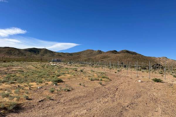
This scenic double-track route is all about the atmosphere, offering wide-open vistas of the distant desert floor as you cruise along the ridgeline. The highlight of the ride is passing by a series of mysterious concrete structures—remnants of old mining operations or forgotten desert infrastructure...
Learn more about Sunburn Ridge
Lost Prospector
This is a great, flowy stretch that focuses on rhythm and ease, making it a perfect choice for a relaxed afternoon ride. The path features mellow, sweeping turns that transition into short sections of narrow single track, giving you a taste of that tight-trail feel without the high-stakes technicali...
Learn more about Lost Prospector
Dry Wash Trail
This technical wash is a blast if you’re looking for a challenge that keeps you on your toes. It’s a tricky run packed with rock step-ups and natural obstacles that require precise wheel placement and a bit of trial-and-error. You’ll spend a lot of time picking your lines through the boulders, makin...
Learn more about Dry Wash Trail
Broken Spur
This trail sits in the western part of the BLM section and is mainly composed of a wide, manageable double-track road. It’s a key arterial route that offers several connections to other off-road sections, making it a great way to link up different riding zones. Because it’s more open, it’s a perfect...
Learn more about Broken Spur
R20
A wide trail that swerves with deep turns throughout the foothills of the Rand Mountain range, fast, fun, and nice views that connects to many other trails in the area. This trail is one of our favorites because you can ride fast in a safe trail and stop along the way to view the rock formations or ...
Learn more about R20
ATV trails near Boron, California
Explore ATV-friendly trails near you. These trails are accessible for vehicles up to 50 inches wide, perfect for ATVs and smaller off-road machines.
RM29
Easy desert track through dry brush and rocks. There are whoops and washes to cross, so be careful if you gather too much speed on this straight track. This follows a fence for environmental conservation, so stay on track. This will end at the Golden Valley Wilderness (or start there, based on where...
Learn more about RM29
R43 Willis Well Road
This trail connects Redrock Randsburg Road to Randsburg Mojave Road by going over the Rand mountain range. There is cell coverage throughout most of the trail, may get a drop put or 2 in the mountain. There are very deep UTV ruts and "Razor chop". Any high clearance vehicle should be able to make it...
Learn more about R43 Willis Well Road
Scorpion Cut-off
This section is all about speed and rhythm, offering a wide double-track layout that lets you really open it up. The standout feature is a series of deep, flowy sand whoops that allow for a consistent, undulating pace if you time your suspension movement right. With clear visibility across the low-l...
Learn more about Scorpion Cut-off
Sandstone Cut-Off
This outer dirt road acts as a key boundary route, offering a wide double-track path that leads you toward the edges of the BLM territory. It’s a great way to push further out and explore the transition into the surrounding open desert. The trail is open and predictable, providing plenty of room for...
Learn more about Sandstone Cut-Off
UTV/side-by-side trails near Boron, California
Find UTV and side-by-side trails near you. These trails accommodate vehicles up to 60 inches wide, ideal for UTVs, side-by-sides, and wider off-road rigs.
RM29
Easy desert track through dry brush and rocks. There are whoops and washes to cross, so be careful if you gather too much speed on this straight track. This follows a fence for environmental conservation, so stay on track. This will end at the Golden Valley Wilderness (or start there, based on where...
Learn more about RM29
R43 Willis Well Road
This trail connects Redrock Randsburg Road to Randsburg Mojave Road by going over the Rand mountain range. There is cell coverage throughout most of the trail, may get a drop put or 2 in the mountain. There are very deep UTV ruts and "Razor chop". Any high clearance vehicle should be able to make it...
Learn more about R43 Willis Well Road
Scorpion Cut-off
This section is all about speed and rhythm, offering a wide double-track layout that lets you really open it up. The standout feature is a series of deep, flowy sand whoops that allow for a consistent, undulating pace if you time your suspension movement right. With clear visibility across the low-l...
Learn more about Scorpion Cut-off
Sandstone Cut-Off
This outer dirt road acts as a key boundary route, offering a wide double-track path that leads you toward the edges of the BLM territory. It’s a great way to push further out and explore the transition into the surrounding open desert. The trail is open and predictable, providing plenty of room for...
Learn more about Sandstone Cut-Off
The onX Offroad Difference
onX Offroad combines trail photos, descriptions, difficulty ratings, width restrictions, seasonality, and more in a user-friendly interface. Available on all devices, with offline access and full compatibility with CarPlay and Android Auto. Discover what you're missing today!
Open Trail Map