
Dirt Bike Trails
Near Beacon Hill, Washington
Explore All Dirt Bike Trails Near Beacon Hill, Washington
Dirt Bike Trails Near Beacon Hill, Washington
Discover the best dirt bike trails near you. Browse trail maps, check difficulty ratings, and find your next adventure — whether you're looking for a quick ride or an all-day expedition.
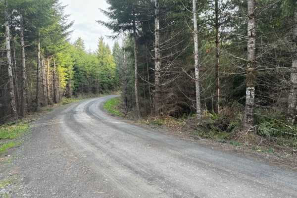
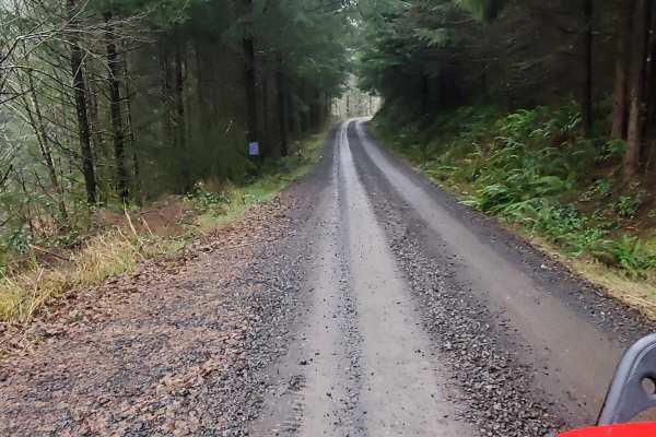
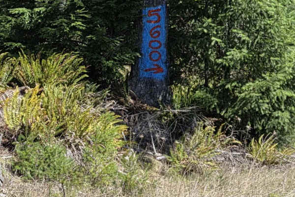
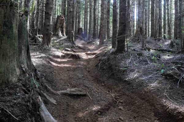
Karth Road
This forest road connects Apiary Road with Pittsburg Road and is relatively level. It is, however, a typical logging road with potholes, washboard, and the occasional windfall tree in the way. This route begins on Apiary Road adjacent to the Columbia County Park Camp Wilkerson. There's nothing extra...
Learn more about Karth Road
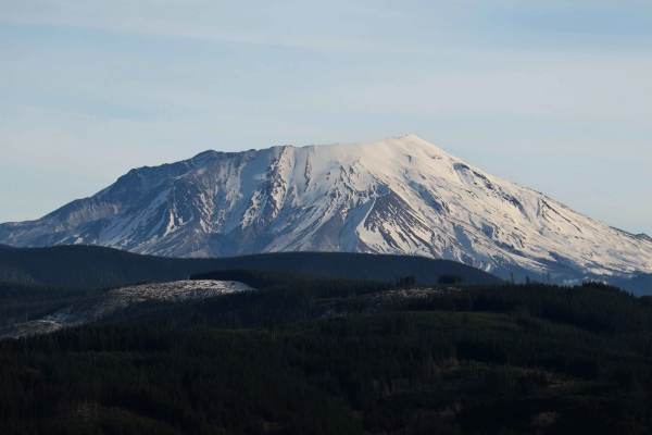
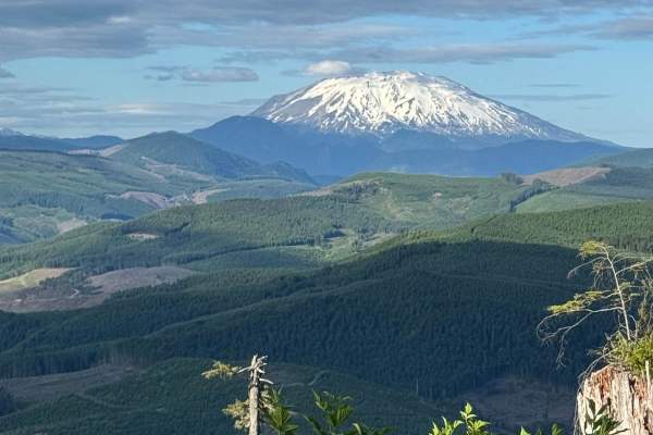
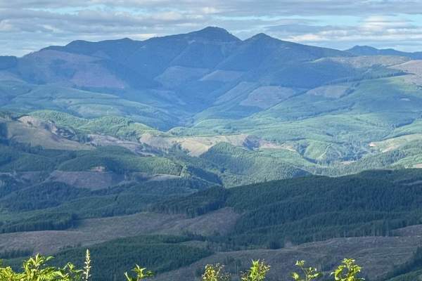
Signal Peak
A quick 20-minute scenic, well-maintained side route off the popular 4250 Mount Saint Helens route. The communication tower at the summit may be the end, but the real payoff is the views just before the final winding climb, offering massive, unobstructed views of Mount Saint Helens, Mount Adams, and...
Learn more about Signal Peak
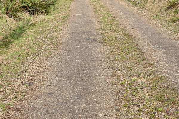
Powder Horn Spur Road
The Powder Horn Spur is an easy, out-and-back gravel road branching off the main Powder Horn route. Suitable for most vehicles, the road features minimal elevation change and generally maintains a single-lane width, with several widened pull-outs available for parking or passing.
As you drive, the ...
Learn more about Powder Horn Spur Road

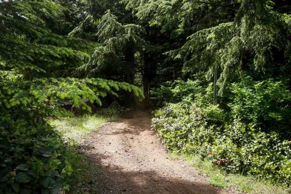
Pittsburg Road
This timberland traverse route offers a journey through lush landscapes of private timber company land and access to the pristine Tillamook State Forest. Adventurers are immediately greeted with a canopy of towering conifers and the soothing sounds of nature. The trail gradually ascends, providing g...
Learn more about Pittsburg Road
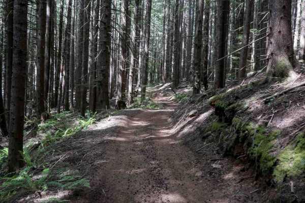
PH-4000
This is an easy trail that is mainly dirt with gravel. The trail has a few washouts and ruts but nothing that is overly challenging. There is one area of the trail where low-clearance vehicles might scrape their underbody. The trail leads to Fredrickson Road which can be used as a connecting point f...
Learn more about PH-4000
PH-3000
This is an easy trail that is mainly dirt with gravel. The trail has a few washouts and ruts. The trail is an out-and-back that offers some gorgeous views of Lake Merwin. There are a few areas that have overgrowth on the trail but nothing that will cause pin striping. You might encounter a few downe...
Learn more about PH-3000
5100
This trail is primarily gravel and single vehicle width, with many areas along the way to pass oncoming traffic (if you see any). It is easily accessible and traversable by most vehicles. You may have to dodge a fallen rock or pothole here and there, but this will not distract from the beauty of the...
Learn more about 5100
2730
This trail is a branch off of 4250 that connects to 6500 which eventually connects back to 4250, all of which are managed by the Washington State Department of Natural Resources. The trail itself is primarily a grated gravel road and has many offshoots to explore. The trail travels through dense for...
Learn more about 2730
Powder Horn
Easy scenic route through the woods that can be done in a 2WD with good clearance. There are wonderful views and plenty of side roads to check out and explore. There are also a few dispersed camping spots along the way. Be careful at blind corners, this road sees a decent amount of traffic and loggi...
Learn more about Powder Horn
5600
This is a narrow gravel road that is, at the west end, either the start or the finish of the 5600, depending on which way you run it. This route connects the 5100 (west) to the "5600 to 5605" trail (east). Most vehicles can travel this route. Along the way, there are many drainages that in springtim...
Learn more about 5600
5625
This road is an out-and-back, but worth exploring as there are great views of the S. Fork of the Toutle River Valley. Mostly a gravel road that is narrow in spots and winds in and out of the trees into large clearings that provide the views. Some sections are cut into steep hillside with no shoulde...
Learn more about 5625
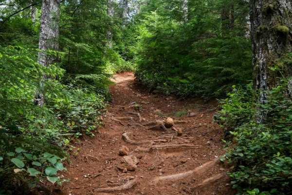
Cake Walk
Cake Walk is an easy trail, leaving from the quarry staging area and immediately presenting multiple split lines that can be a bit confusing at first. Once on the main path, the trail stays relatively easy despite frequent muddy sections, embedded and loose rock, and large root bands. The surface ha...
Learn more about Cake Walk
PC40
PC40 is a short and scenic connector trail linking Plympton Creek Trail to Plympton Ridge Road. It winds through a lush forest of Sitka spruce and Douglas fir, passing the stumps of a few massive old-growth trees. The trail features root bands, muddy spots, and scattered loose rocks, but remains man...
Learn more about PC40
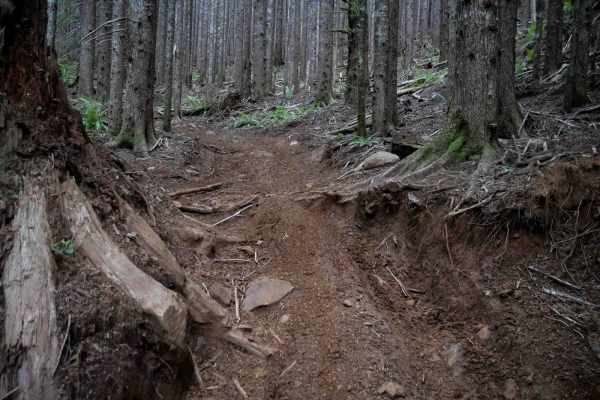
PC10
PC10 is a short spur trail connecting Plympton Creek to a nearby forest road. It features a steep climb from west to east with loose rocks, root bands, and slightly off-camber sections. Deep, muddy ruts and potential puddles add to the challenge, with most UTVs needing to straddle the ruts on the wa...
Learn more about PC10
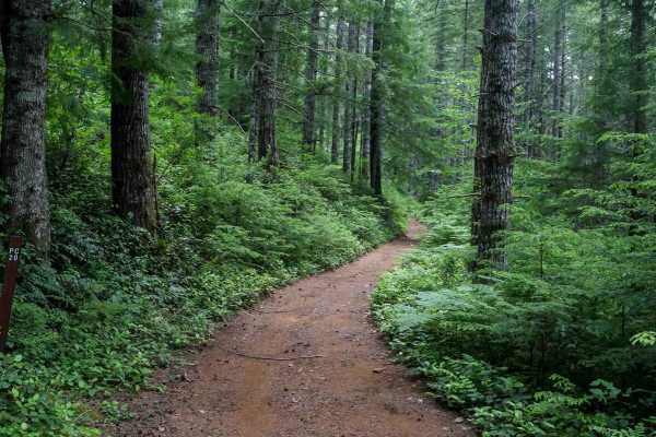
Plympton Creek
Plympton Creek is a 1.5-mile-long OHV trail that winds through a scenic forest of moss-covered spruce and fir trees. The route features tight curves, numerous big embedded and loose rocks, and several large root bands that create ledges at least a foot tall. Riders will encounter split lines weaving...
Learn more about Plympton Creek
PC20
PC20 is a short and easy connector trail that links the forest road to Plympton Creek trail. About a quarter mile long, it's mostly flat and gradual with a smooth surface and no obstacles. The trail winds through dense forest and may have a few muddy spots, but it remains very manageable and ideal f...
Learn more about PC20

Hunt Hill
Hunt Hill is a short loop off of Hunt Creek that offers a moderate ride with some technical variety. When ridden counterclockwise, it begins with a mild climb featuring embedded rock, a semi-steep grade, a few tighter turns, some overgrown brush, and rutting at the top. The descent is more challengi...
Learn more about Hunt Hill

Dirt Dorks
Dirt Dorks is a short half-mile loop off of Hunt Creek with deeper ruts along one or both sides of the trail. It descends for the first half of the trail, doubles back, and climbs back up. Both the descent and ascent are fairly steep, with branches reaching into the trail that can obscure visibility...
Learn more about Dirt Dorks
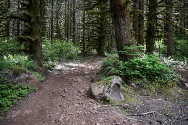
Microwave
This scenic OHV trail winds through a dense forest of mossy spruce and fir trees, with tight curves weaving between the thick trees. The trail turns fainter and more technical after crossing Cake Walk, with even tighter turns and more pronounced root bands. Though rated easy by the forest service, s...
Learn more about Microwave
Hunt Loop
This is an easy and flowy loop that adds some extra mileage off of Hunt Creek. It's a wide OHV trail through a forest of spruce and firs for 1.2 miles. Expect some large root bands, narrower spots between the trees closely lining the trail, some deep ruts in spots, and semi-steep but manageable grad...
Learn more about Hunt Loop
ATV trails near Beacon Hill, Washington
Explore ATV-friendly trails near you. These trails are accessible for vehicles up to 50 inches wide, perfect for ATVs and smaller off-road machines.
Karth Road
This forest road connects Apiary Road with Pittsburg Road and is relatively level. It is, however, a typical logging road with potholes, washboard, and the occasional windfall tree in the way. This route begins on Apiary Road adjacent to the Columbia County Park Camp Wilkerson. There's nothing extra...
Learn more about Karth Road
Signal Peak
A quick 20-minute scenic, well-maintained side route off the popular 4250 Mount Saint Helens route. The communication tower at the summit may be the end, but the real payoff is the views just before the final winding climb, offering massive, unobstructed views of Mount Saint Helens, Mount Adams, and...
Learn more about Signal Peak
Powder Horn Spur Road
The Powder Horn Spur is an easy, out-and-back gravel road branching off the main Powder Horn route. Suitable for most vehicles, the road features minimal elevation change and generally maintains a single-lane width, with several widened pull-outs available for parking or passing.
As you drive, the ...
Learn more about Powder Horn Spur Road
PH-4000
This is an easy trail that is mainly dirt with gravel. The trail has a few washouts and ruts but nothing that is overly challenging. There is one area of the trail where low-clearance vehicles might scrape their underbody. The trail leads to Fredrickson Road which can be used as a connecting point f...
Learn more about PH-4000
UTV/side-by-side trails near Beacon Hill, Washington
Find UTV and side-by-side trails near you. These trails accommodate vehicles up to 60 inches wide, ideal for UTVs, side-by-sides, and wider off-road rigs.
Karth Road
This forest road connects Apiary Road with Pittsburg Road and is relatively level. It is, however, a typical logging road with potholes, washboard, and the occasional windfall tree in the way. This route begins on Apiary Road adjacent to the Columbia County Park Camp Wilkerson. There's nothing extra...
Learn more about Karth Road
Signal Peak
A quick 20-minute scenic, well-maintained side route off the popular 4250 Mount Saint Helens route. The communication tower at the summit may be the end, but the real payoff is the views just before the final winding climb, offering massive, unobstructed views of Mount Saint Helens, Mount Adams, and...
Learn more about Signal Peak
Powder Horn Spur Road
The Powder Horn Spur is an easy, out-and-back gravel road branching off the main Powder Horn route. Suitable for most vehicles, the road features minimal elevation change and generally maintains a single-lane width, with several widened pull-outs available for parking or passing.
As you drive, the ...
Learn more about Powder Horn Spur Road
PH-4000
This is an easy trail that is mainly dirt with gravel. The trail has a few washouts and ruts but nothing that is overly challenging. There is one area of the trail where low-clearance vehicles might scrape their underbody. The trail leads to Fredrickson Road which can be used as a connecting point f...
Learn more about PH-4000
The onX Offroad Difference
onX Offroad combines trail photos, descriptions, difficulty ratings, width restrictions, seasonality, and more in a user-friendly interface. Available on all devices, with offline access and full compatibility with CarPlay and Android Auto. Discover what you're missing today!
Open Trail Map