
Dirt Bike Trails
Near Beach Haven, New Jersey
Explore All Dirt Bike Trails Near Beach Haven, New Jersey
Dirt Bike Trails Near Beach Haven, New Jersey
Discover the best dirt bike trails near you. Browse trail maps, check difficulty ratings, and find your next adventure — whether you're looking for a quick ride or an all-day expedition.
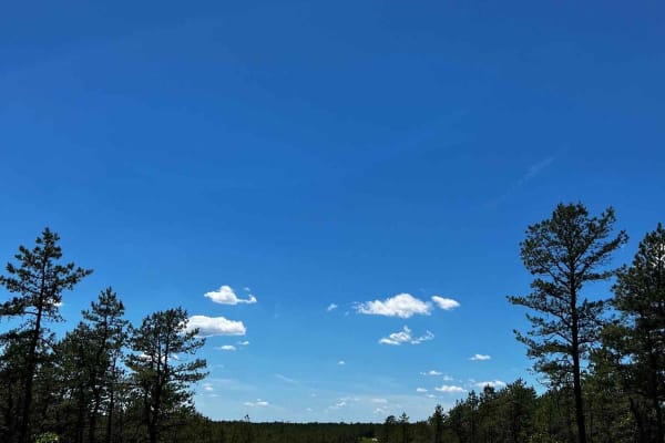
Forge Road to Wharton State Forest
This is a great trail through the New Jersey Pine Barrens that's easy to get to and easy to drive, taking you through Bass River State Forest and Wharton State Forest. You can either start off of Route 539 or 679. The trail is all dirt with some sandy sections where 4WD may be needed. The Forestry D...
Learn more about Forge Road to Wharton State Forest
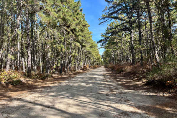
Dan's Bridge Road
This 4.4-mile trail sits just north of Bass River State Park. Along with several other sandy routes in the area, it makes for a great day trip while camping nearby. Like most off-pavement roads in the Pine Barrens, Dan’s Bridge is primarily sandy, with some muddy sections and a few larger, but gener...
Learn more about Dan's Bridge Road
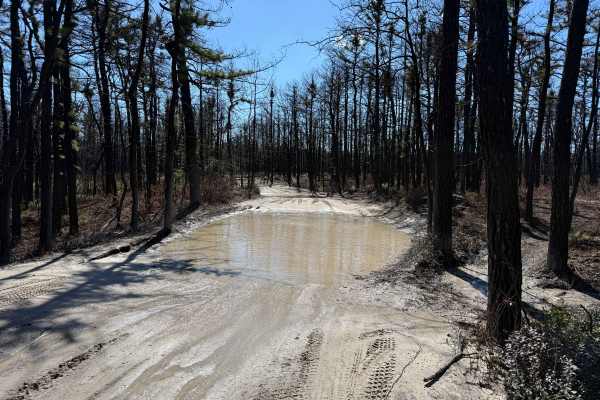
Tuckertown Railroad Extension
This is an overall very fun trail. There are the ever-famous Barrens water and mud holes, where you never really know the actual depth, and lots of whoops and off-camber travel. Most of the waterholes are soft bottom, so it is best to stick around the edges unless you have a friend, then go right ah...
Learn more about Tuckertown Railroad Extension
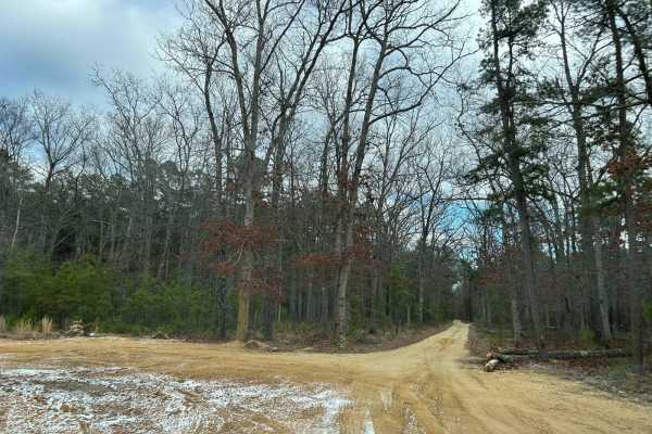
Jay's Iron Pipe Road
This trail is located off of Washington Turnpike at the 5-point intersection. The trail runs straight through the road from Washington Tpurnnpike to 563. This trail is mostly flat with some slight elevation changes and minor ruts. The trail type is a mix of compacted sand, loose sand, and gravel. Th...
Learn more about Jay's Iron Pipe Road
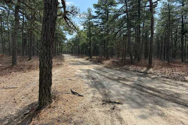
Jones Road Trail
Nice and easy drive through the Barrens Pines. If you enjoy the faster prerunner style driving, this trail is a nice and easy run to complete. There are many small water holes on both sides of the trail that can be fun to splash the water all over. Keep an eye out for ATVs and Dirt bikes, especially...
Learn more about Jones Road Trail
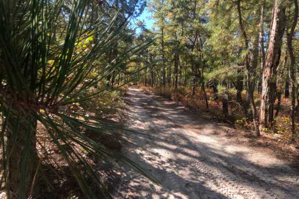
Washington Speedwell Road
Washington Speedwell Road connects Hawkins Bridge Road and Washington Turnpike, with conditions that change significantly based on rainfall. During wet periods, deep mudholes can form. Self-recovery equipment or traveling with a second vehicle is recommended during the rainy season.
Learn more about Washington Speedwell Road
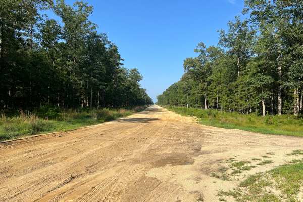
Washington Turnpike
Washington Turnpike is located in the middle of numerous other Wharton State Forest trails. The trail is a straight fire service-type road with one mud hole, approximately one foot deep, at the halfway point. The mud hole is in the center of the trail and can be bypassed by going left or right. The ...
Learn more about Washington Turnpike
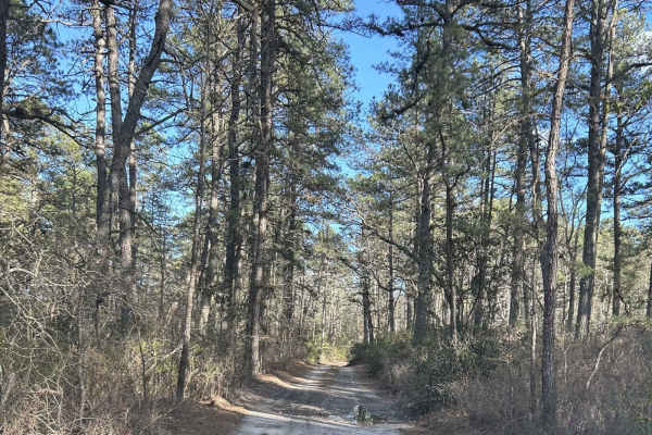
Battie Trail
The trail is a shortcut route between two larger roads. It is a flat trail just sand and gravel, with very slight grading, and can become narrow at times so be careful driving something wide through the trail. This is also one way with so be careful when driving down for oncoming traffic.
Learn more about Battie Trail
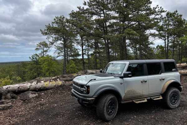
Forked River Mountain Summit
This is the Forked River Mountain Summit Trail, giving you the easiest route to the very scenic summit of the Forked River Mountains. Most of the trail has been recently maintained by the forestry service filling in most of the major mud ruts and water holes, making the trail much more easily access...
Learn more about Forked River Mountain Summit
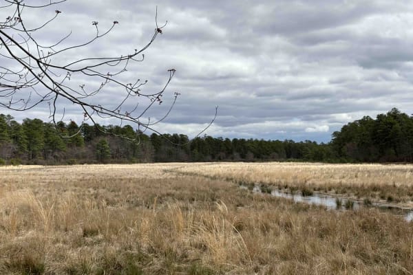
Bryant to Hays Road
Enter off 539. The trail is mostly sand and gravel and is somewhat flat. About a quarter mile in, there is a depressed campsite. After it rains, you can expect pools of water large and small. Some have go-around areas; the best practice is to stay on the outside of them. There can be ruts in the mid...
Learn more about Bryant to Hays Road
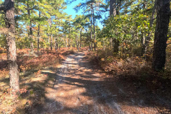
Swamp Road
Swamp Road is a lightly traveled trail with overgrown brush along the sides and a few low-hanging branches that may brush against vehicle roofs. Terrain conditions are easy, and most vehicles can navigate the route without difficulty.
Learn more about Swamp Road
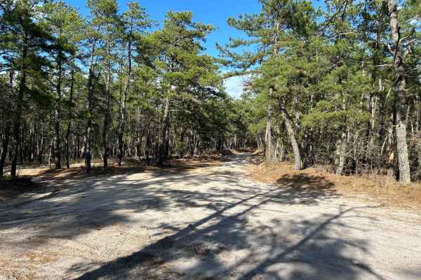
Marcus Trail
The trail is a mostly flat trail, with a mix of gravel and sand. There are a couple of whoops that are extremely mild and some dips. There is a water source close by that after a big rain that brings the possibility of flooding after heavy rains.
Learn more about Marcus Trail
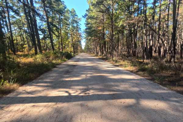
Friendship Speedwell Road
Friendship Speedwell Road is a short, well-maintained trail that takes about 10 minutes to complete. It runs between Chatsworth Road and Carranza Road and is classified as an easy green route. The trail is wide enough for two vehicles to pass comfortably, and the Carranza Road end features a pleasan...
Learn more about Friendship Speedwell Road

Lee's Trail
Enter in off of Washington Turnpike. The trail starts off with two heavy rutted dips, although there are side routes to avoid them. The rest of the trail you will encounter more of them along with some mellow whoops. The trail ends off of Penn Swamp Road. This area will also flood with rain so be ca...
Learn more about Lee's Trail
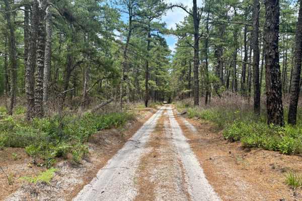
Eagle Road Bypass
This two-mile trail offers a more direct route to the Friendship Ruins, a historic ghost town that was once a 3,000-acre cranberry farm. If entering from Route 539, turn left onto Ringler Avenue to enter Wharton State Forest. This sandy trail intersects with several hiking paths along the way. Once ...
Learn more about Eagle Road Bypass
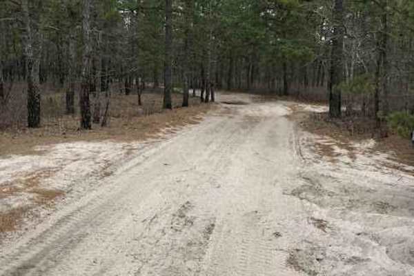
Batsto Fireline Trail
Batsto Fireline trail can connect you from Atsion Lake to Batsto Village. This trail has long spans of flooding present year-round due to the high water table in the area. The main surface of the trail is loose sand and mud. From deep water holes to sand whoops, this trail can be difficult for the a...
Learn more about Batsto Fireline Trail
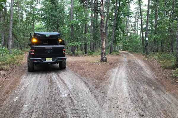
Middle Trail
This is a tight scenic trail, some whooped sections and low-hanging trees can make it easy to get some unwanted scratches. There is not a lot of room to let oncoming trail riders pass by. This Trail provides close access to both the Mullica River and the Batsto River.
Learn more about Middle Trail
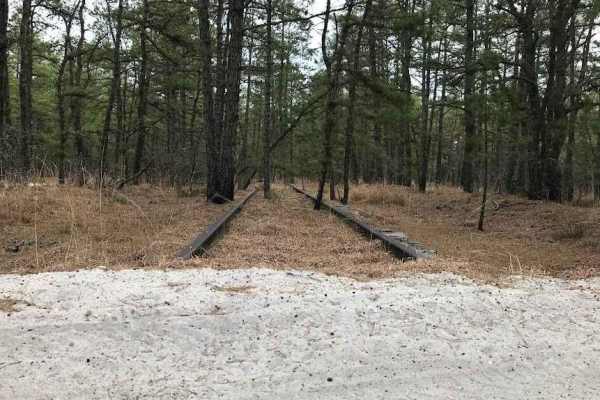
Eagle Trail
Enter this trail from either the Apple Pie Hill side off of Chatsworth Road or from the Washington Turnpike. This 6-mile track runs through Wharton State Forest. There are ponds along this trail to stop and sit at. The trail ranges from hard-packed to loose sand with varying depths of mud or water h...
Learn more about Eagle Trail
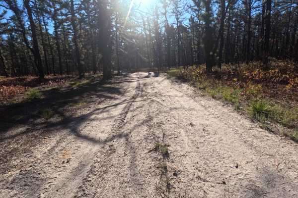
Birches Road
Birches Road is a connector trail between Whitehorse Road and Apple Pie Fire Tower Trail. This trail is an easy green trail that contains some whoops and tight sections due to the overgrowth. This trail can be easily done in any vehicle.
Learn more about Birches Road
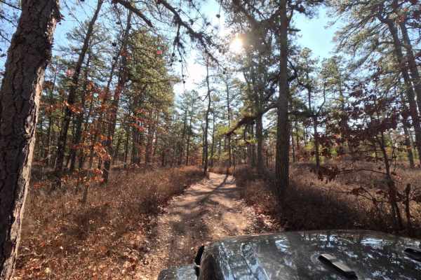
Hay Road
Very tight trail through Wharton state forest. This trail can be accessed from the intersection of Bulldozed road and Mines Spung Road, Quaker Bridge Sandy Ridge Road, or even Washington Quaker Bridge Road. Aside from the trail being tight there are a few mud pits, and low hanging trees.
Learn more about Hay Road
ATV trails near Beach Haven, New Jersey
Explore ATV-friendly trails near you. These trails are accessible for vehicles up to 50 inches wide, perfect for ATVs and smaller off-road machines.
Forge Road to Wharton State Forest
This is a great trail through the New Jersey Pine Barrens that's easy to get to and easy to drive, taking you through Bass River State Forest and Wharton State Forest. You can either start off of Route 539 or 679. The trail is all dirt with some sandy sections where 4WD may be needed. The Forestry D...
Learn more about Forge Road to Wharton State Forest
Dan's Bridge Road
This 4.4-mile trail sits just north of Bass River State Park. Along with several other sandy routes in the area, it makes for a great day trip while camping nearby. Like most off-pavement roads in the Pine Barrens, Dan’s Bridge is primarily sandy, with some muddy sections and a few larger, but gener...
Learn more about Dan's Bridge Road
Tuckertown Railroad Extension
This is an overall very fun trail. There are the ever-famous Barrens water and mud holes, where you never really know the actual depth, and lots of whoops and off-camber travel. Most of the waterholes are soft bottom, so it is best to stick around the edges unless you have a friend, then go right ah...
Learn more about Tuckertown Railroad Extension
Jay's Iron Pipe Road
This trail is located off of Washington Turnpike at the 5-point intersection. The trail runs straight through the road from Washington Tpurnnpike to 563. This trail is mostly flat with some slight elevation changes and minor ruts. The trail type is a mix of compacted sand, loose sand, and gravel. Th...
Learn more about Jay's Iron Pipe Road
UTV/side-by-side trails near Beach Haven, New Jersey
Find UTV and side-by-side trails near you. These trails accommodate vehicles up to 60 inches wide, ideal for UTVs, side-by-sides, and wider off-road rigs.
Forge Road to Wharton State Forest
This is a great trail through the New Jersey Pine Barrens that's easy to get to and easy to drive, taking you through Bass River State Forest and Wharton State Forest. You can either start off of Route 539 or 679. The trail is all dirt with some sandy sections where 4WD may be needed. The Forestry D...
Learn more about Forge Road to Wharton State Forest
Dan's Bridge Road
This 4.4-mile trail sits just north of Bass River State Park. Along with several other sandy routes in the area, it makes for a great day trip while camping nearby. Like most off-pavement roads in the Pine Barrens, Dan’s Bridge is primarily sandy, with some muddy sections and a few larger, but gener...
Learn more about Dan's Bridge Road
Tuckertown Railroad Extension
This is an overall very fun trail. There are the ever-famous Barrens water and mud holes, where you never really know the actual depth, and lots of whoops and off-camber travel. Most of the waterholes are soft bottom, so it is best to stick around the edges unless you have a friend, then go right ah...
Learn more about Tuckertown Railroad Extension
Jay's Iron Pipe Road
This trail is located off of Washington Turnpike at the 5-point intersection. The trail runs straight through the road from Washington Tpurnnpike to 563. This trail is mostly flat with some slight elevation changes and minor ruts. The trail type is a mix of compacted sand, loose sand, and gravel. Th...
Learn more about Jay's Iron Pipe Road
The onX Offroad Difference
onX Offroad combines trail photos, descriptions, difficulty ratings, width restrictions, seasonality, and more in a user-friendly interface. Available on all devices, with offline access and full compatibility with CarPlay and Android Auto. Discover what you're missing today!
Open Trail Map