
Dirt Bike Trails
Near Alum Creek, West Virginia
Explore All Dirt Bike Trails Near Alum Creek, West Virginia
Dirt Bike Trails Near Alum Creek, West Virginia
Discover the best dirt bike trails near you. Browse trail maps, check difficulty ratings, and find your next adventure — whether you're looking for a quick ride or an all-day expedition.
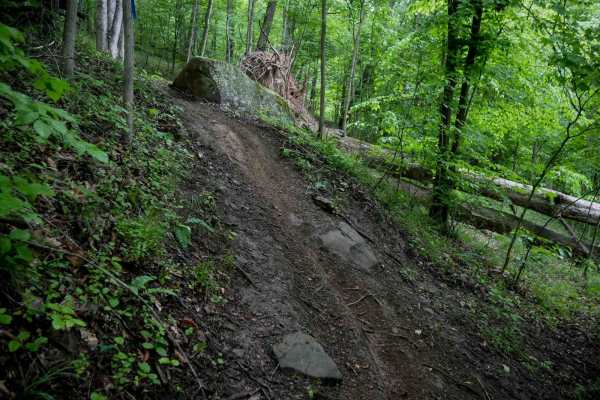
T28
Making a counterclockwise loop, T28 begins as a wide transfer section with small loose rocks and light ruts. As it enters the trees, the trail narrows and includes a few steeper sections with roots that can become slick, especially when wet. Decomposing downed trees add minor technical challenges, t...
Learn more about T28
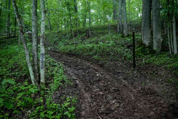
T25
Trail T25 in the Tornado trail system is a short connector under 250 yards long, beginning as a widened path from T66. It narrows slightly in spots as it winds through the trees, but remains mostly wide and easy. The trail includes a steep downhill section leading to the intersection with T26.
Learn more about T25
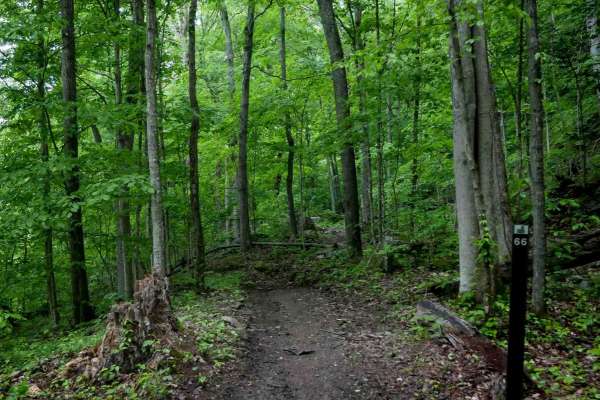
T66
Trail T66 in the Tornado system is a 0.6-mile loop that has been recently graded and widened, making it an ideal option for newer riders. The trail is relatively smooth with minimal rocks or roots, though it features some ruts, tight turns around trees, and a shelf-like section as it cuts across a h...
Learn more about T66
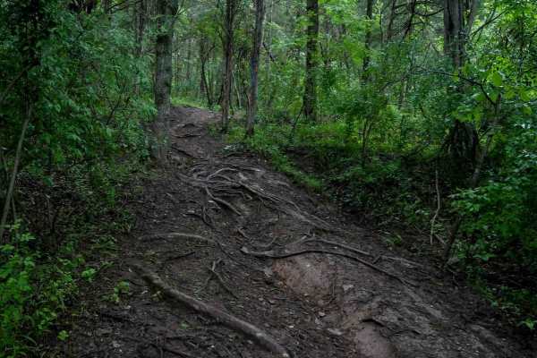
T26
Trail T26 is a one-mile route and one of the longer trails in the system. It begins as a wide path through the forest with gradual curves, small hill climbs, and a mostly smooth surface. A few sections have crisscrossing roots that become slick when wet, along with occasional ruts. As the trail loop...
Learn more about T26
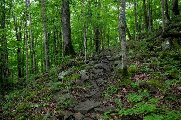
T90
Trail T90 starts with a rutted climb on the north end, then transitions into a tight, winding path through trees with embedded rocks and slick, moss-covered boulder faces. The trail continues with steep, short climbs and descents over its quarter-mile length. With its varied terrain and slick surfac...
Learn more about T90

T63
Trail T63 is a short, intermediate-level route under half a mile, starting with a flowy section through the trees before climbing steeply onto a small ridge. The descent off the ridge is technical, featuring steep drop-offs formed by embedded rock and roots. This trail is best suited for more experi...
Learn more about T63
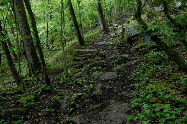
T92
Trail T92 begins on the southeast end with off-camber side-hilling and narrow, technical terrain featuring embedded rocks and 1-2 foot drop-offs. There are embedded rocks of various sizes and small rock pinches. The trail winds through a lush forest with moss-covered rocks and dense tree cover, with...
Learn more about T92
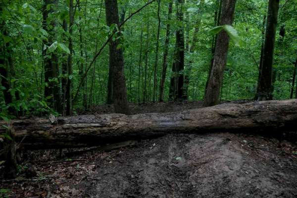
T67
Trail T67 is a short but demanding 200-yard descent that starts with a very steep, root-covered hill requiring proper braking control. The trail is loose and becomes especially slick when wet. A large, decomposing downed log crosses the trail near the top, which is tall and a moderate challenge to g...
Learn more about T67
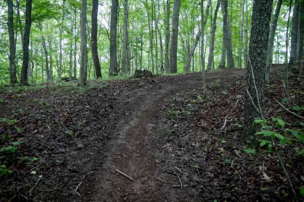
T61
Trail T61 is a narrow, quarter-mile loop branching off from T60, winding through the trees with a relatively smooth surface. It features a steep climb up a hillside that is less rutted and off-camber than nearby trails, with minimal roots and rocks. The loop finishes with a steep descent, reconnecti...
Learn more about T61
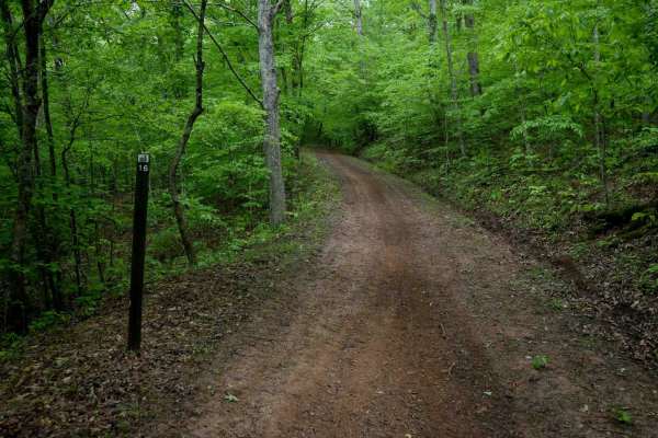
T16
Trail T16 is a wide, road-width access trail running for a quarter mile across the Tornado trail system. It features a smooth surface with minimal ruts, rocks, or roots, and is shaded by a dense canopy of typical West Virginia hardwoods, including yellow birch, beech, and maples. The heavy leaf cove...
Learn more about T16
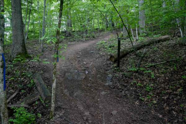
T13
Trail T13 begins with a wide, rutted, and steep ascent from the south end, with exposed roots that can become slick in wet conditions. After the climb, the trail levels out into a more mellow section, but goes through a tight tree gap. It serves as a short connector from the bottom of T68 back to th...
Learn more about T13

T14
Trail T14 is a short route under half a mile, featuring a descent through deep muddy ruts with roots, embedded rocks, and sharp turns weaving through trees. The trail includes a few steeper sections as it climbs over small hills, with occasional one-foot shelves formed by larger embedded boulders. W...
Learn more about T14
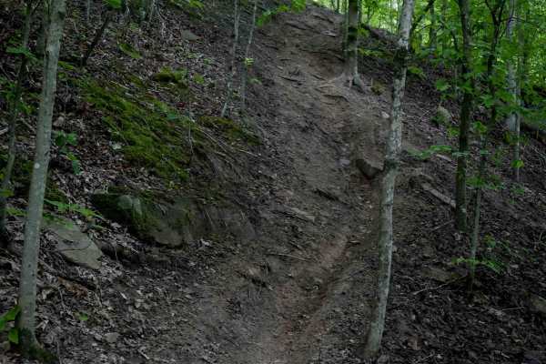
T60
Trail T60 is a short but challenging route, less than half a mile in length, featuring steep, rutted hill climbs that become especially difficult in wet conditions. The trail includes off-camber, root-covered hillsides, and steep switchbacks ascending the slope. It has lots of tight technical turns ...
Learn more about T60
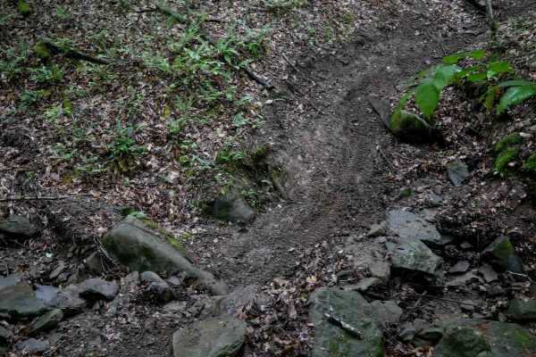
T59
Trail T59 is a tight, technical route under half a mile long, featuring narrow maneuvers through trees, embedded rocks, and several off-camber sections. It follows small ridges and dips across steep-sided ravines with small embedded boulders. Slick roots cross the trail in multiple spots, requiring ...
Learn more about T59
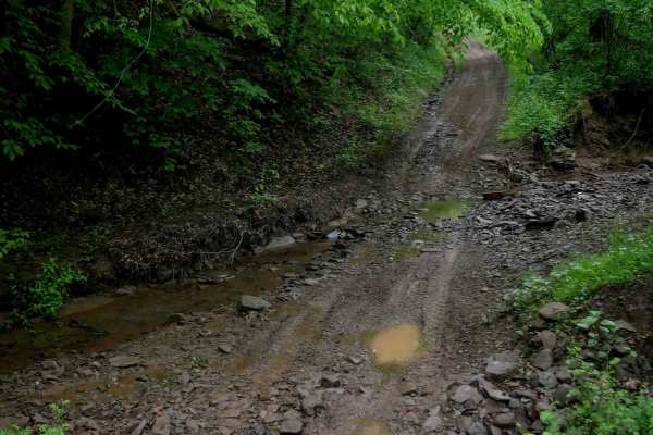
T27
T27 is a half-mile, wide connector trail that offers an easy, relaxed ride through a dense Appalachian forest. The path is mostly flat and super gradual, with a smooth surface aside from a few sections of loose rock. Two small stream crossings add minor variety without increasing difficulty. The tra...
Learn more about T27
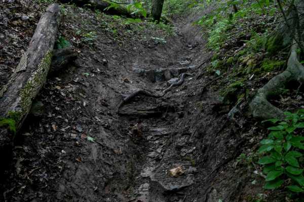
T68
T68 is a 0.8-mile route that begins with a descent from T11, featuring a narrow path with ruts, sharp turns, and multiple ravine crossings. The trail briefly runs through a steep, troughed ravine with rutted terrain and small roots, followed by sharp switchbacks climbing a hill. Sections are more pr...
Learn more about T68
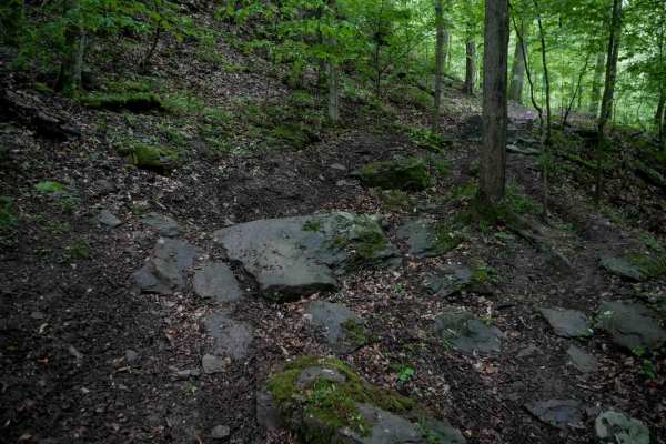
T58
Trail T58 is one of the more technically demanding routes in the Tornado trail system. This narrow single-track winds through a lush, mossy forest filled with slick roots, decomposing downed logs, and tightly spaced trees. The trail traverses off-camber sections along a hillside, with embedded rocks...
Learn more about T58
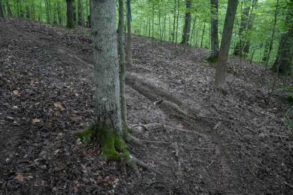
T22
T22 forms a half-mile loop at the end of T17, offering mostly smooth, gradual, and easy singletrack that weaves through a lush forest. The trail features small roots, occasional downed sticks, tight turns, and minor drop-offs, with a few short hill climbs that may become more challenging in wet cond...
Learn more about T22
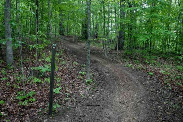
T21
T21 in the Tornado trail system is a short, quarter-mile loop off T17 featuring a wider path through the trees with a mostly smooth surface and minimal elevation change. The trail is not rutted or rocky, making it an easy option for adding mileage with minimal effort, great for newer riders. However...
Learn more about T21
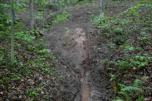
T69
T69 is a moderately easy trail that dips into a slick, rutted ravine filled with leaf litter and slippery roots. The route includes off-camber sections along the hillside above the ravine, with quick transitions in and out. After exiting the ravine, the trail weaves around the hillside with tighter ...
Learn more about T69
ATV trails near Alum Creek, West Virginia
Explore ATV-friendly trails near you. These trails are accessible for vehicles up to 50 inches wide, perfect for ATVs and smaller off-road machines.
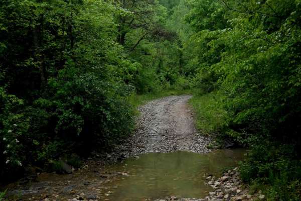
IB 13
IB 13 is a 2.2-mile easy access route through the Ivy Branch system, connecting the start of IB 10 on the west end to IB 18 on the north end, with access to Ivy Branch Road. The trail is wide and mostly smooth, with numerous puddles and a shallow stream crossing through Ivy Creek that features loose...
Learn more about IB 13
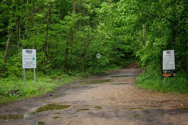
IB 18
IB 18 is a 3.1-mile trail running along the north side of the Ivy Branch system. It begins with a shallow, loose rocky stream crossing at the east entrance and follows a mostly smooth path with large puddles and a parallel ravine. The trail narrows slightly heading west, with occasional ruts and loo...
Learn more about IB 18
IB 83
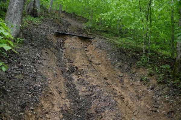
IB 83 is a challenging, steep ascent running from north to south off of IB 18. The trail begins with a steep, rutted hill, followed by a switchback into another steep slope. A metal rod is placed across the trail for erosion control, creating a foot-high slick ledge that will challenge most off-road...
Learn more about IB 83
IB 62
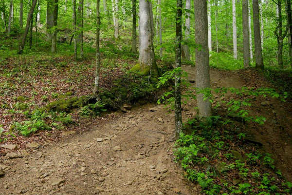
IB 62 is a quarter-mile trail off IB 18 featuring a steep ascent from north to south. The trail has a steep slope with loose rocks, deeper ruts, and embedded flat rock layers, along with roots that can make it slick when wet. As the trail continues, the ruts deepen, and wide switchbacks help navigat...
Learn more about IB 62
UTV/side-by-side trails near Alum Creek, West Virginia
Find UTV and side-by-side trails near you. These trails accommodate vehicles up to 60 inches wide, ideal for UTVs, side-by-sides, and wider off-road rigs.
IB 13
IB 13 is a 2.2-mile easy access route through the Ivy Branch system, connecting the start of IB 10 on the west end to IB 18 on the north end, with access to Ivy Branch Road. The trail is wide and mostly smooth, with numerous puddles and a shallow stream crossing through Ivy Creek that features loose...
Learn more about IB 13
IB 18
IB 18 is a 3.1-mile trail running along the north side of the Ivy Branch system. It begins with a shallow, loose rocky stream crossing at the east entrance and follows a mostly smooth path with large puddles and a parallel ravine. The trail narrows slightly heading west, with occasional ruts and loo...
Learn more about IB 18
IB 83
IB 83 is a challenging, steep ascent running from north to south off of IB 18. The trail begins with a steep, rutted hill, followed by a switchback into another steep slope. A metal rod is placed across the trail for erosion control, creating a foot-high slick ledge that will challenge most off-road...
Learn more about IB 83
IB 62
IB 62 is a quarter-mile trail off IB 18 featuring a steep ascent from north to south. The trail has a steep slope with loose rocks, deeper ruts, and embedded flat rock layers, along with roots that can make it slick when wet. As the trail continues, the ruts deepen, and wide switchbacks help navigat...
Learn more about IB 62
The onX Offroad Difference
onX Offroad combines trail photos, descriptions, difficulty ratings, width restrictions, seasonality, and more in a user-friendly interface. Available on all devices, with offline access and full compatibility with CarPlay and Android Auto. Discover what you're missing today!
Open Trail Map