
Dirt Bike Trails
Near Ali Molina, Arizona
Explore All Dirt Bike Trails Near Ali Molina, Arizona
Dirt Bike Trails Near Ali Molina, Arizona
Discover the best dirt bike trails near you. Browse trail maps, check difficulty ratings, and find your next adventure — whether you're looking for a quick ride or an all-day expedition.
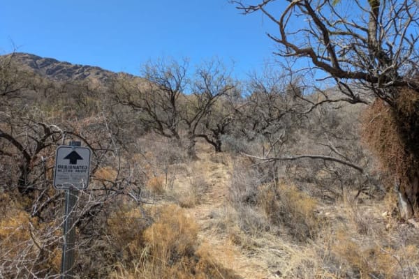
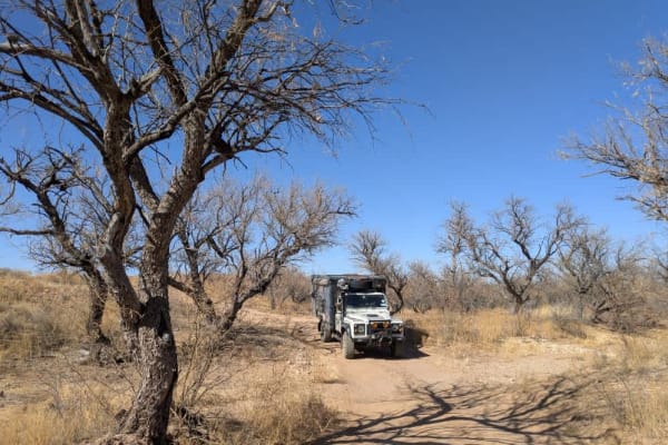
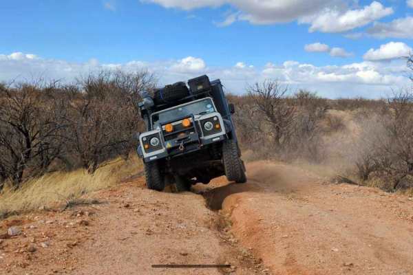
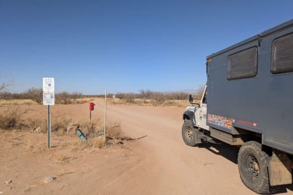
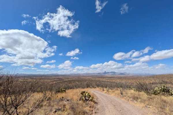
Brown Canyon Trail
The trail begins as a relatively well-maintained route but gradually deteriorates as it approaches Brown Canyon Ranch, where access becomes more restricted. To continue onto the private access road, visitors must sign the guest book near the entrance gate and carry a valid Arizona State Trust Pass, ...
Learn more about Brown Canyon Trail
Pozo Tank Loop
The trail features a high-centered middle hump with signs of water damage and several off-camber sections that require careful navigation. The approach from Highway 89 is relatively smooth, with soft sand and minimal obstacles, making for a relaxing drive. However, the terrain becomes more challengi...
Learn more about Pozo Tank Loop
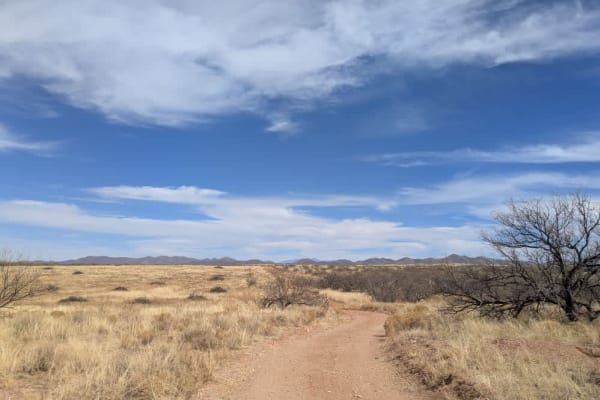
Secundino Trail Loop
The trail winds through sandy, sloping grasslands, offering a scenic drive with curving roads that weave through the open landscape. Several well-established campsites with fire rings provide excellent spots to set up camp while enjoying panoramic views reminiscent of the African savanna. The area i...
Learn more about Secundino Trail Loop
Middle Tank Loop
The trail features a few gentle ups and downs, making for an easy and enjoyable drive. There are several washes to cross along the way, but none present significant challenges under normal conditions. Continuing south on Trail 223 instead of taking Trail 233 provides additional exploration opportuni...
Learn more about Middle Tank Loop
Round Hill Road - FR224
The trail features low-hanging branches, making it likely that taller vehicles will experience significant pinstriping. While the route is generally straightforward, it does include a deep-cut wash with an off-camber section that can be challenging for longer vehicles with low departure and approach...
Learn more about Round Hill Road - FR224
FR228 Water Tank Road North
The trail features several washes that could pose a challenge during the rainy season, but under normal conditions, the road is well-maintained and generally easy to navigate. Alternative routes are available to bypass the washes if necessary. Along the way, there are multiple well-kept side trails ...
Learn more about FR228 Water Tank Road North
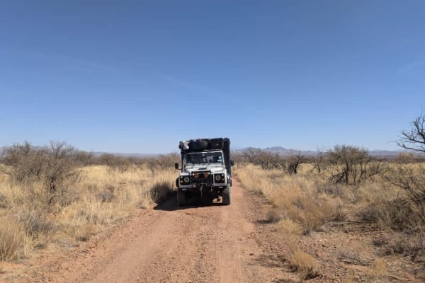
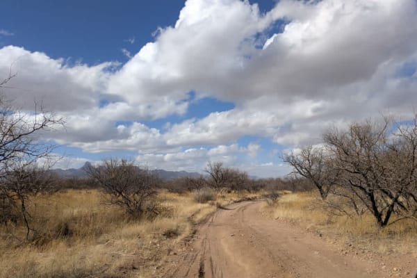
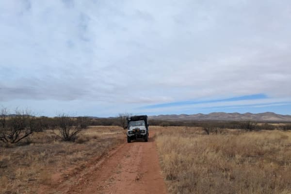
Big Bertha Road
Big Bertha Road offers a scenic and accessible route through expansive grasslands with breathtaking views of the Baboquivari Mountains. This well-traveled dirt road is relatively easy to navigate, making it suitable for most vehicles under dry conditions. The wide-open terrain provides a sense of so...
Learn more about Big Bertha Road
FR229 Bueno Tank Road
The first half of the trail is relatively straightforward, though drivers should expect some pinstriping and off-camber sections when passing through the washes. As the route continues, it transitions into open grasslands, where the terrain becomes noticeably sandy and dusty. The area is home to abu...
Learn more about FR229 Bueno Tank Road
Guijas Loop Road
This off-road trail in the Buenos Aires National Wildlife Refuge offers a mix of terrain, transitioning from open grasslands into a more mountainous landscape. Along the route, drivers may experience some pinstriping due to the dense vegetation. The southern road to the tower is relatively well-main...
Learn more about Guijas Loop Road
Round Hill Road Secondary
Round Hill Road secondary is a well-maintained trail that travels through sweeping desert grasslands. The road is typically dry and navigable, though conditions can change quickly during the rainy season, since there are some shallow washes that cross the trail. There is an elevated watering hole fo...
Learn more about Round Hill Road Secondary
McKay a Tank Road
The trail winds through high grasslands, creating an atmosphere reminiscent of the African savanna. Throughout the route, deep ruts and washouts mark the landscape, remnants of past flooding that have carved noticeable cuts into the road. Drivers should be prepared for some light pinstriping due to ...
Learn more about McKay a Tank Road
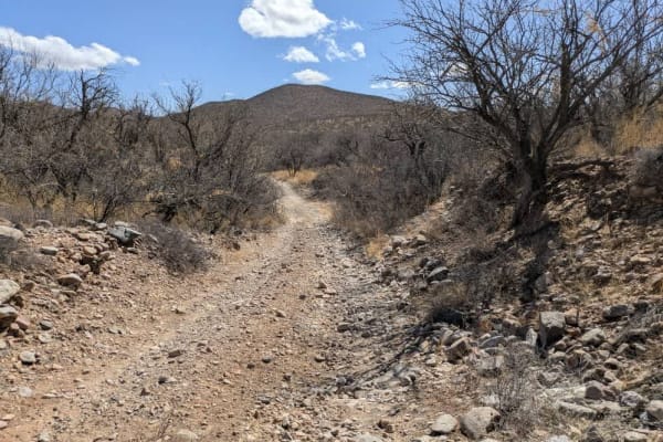
San Luis Mine Trail
Starting on High Gates South Road the trail is very well manicured. After turning northeast the trail gets gradually rougher. The final ascent to the mine area is a steep grade required 4WD. The area is typical with rolling hills mixed with creeks and small mountains. This is cattle country with ple...
Learn more about San Luis Mine Trail
High Gates North Road
This is quite a relaxing trail with ample designated camping spots. Put on some Johnny Cash and take a slow drive. The trail starts from the main road and leads to other exciting trails. This is a great trail to end the day to find a suitable campspot for the night after adventuring throughout the d...
Learn more about High Gates North Road
State Tank Road
State Tank Road #213 is a relatively well-maintained dirt trail that winds through the scenic desert grasslands of the Buenos Aires National Wildlife Refuge. Along the route, you'll cross two shallow washes, generally passable under dry conditions. A highlight of the trail is a large manmade waterin...
Learn more about State Tank Road
FR245 Honey Trap Loop
The Honey Trap Loop Road offers a rugged off-road experience with challenging terrain and smoother sections. The trail consists of rocky inclines with loose rock and off-camber driving, requiring careful navigation. Due to the rough conditions, drivers should expect the possibility of pinstriping an...
Learn more about FR245 Honey Trap Loop
Figeroa North Road
This off-road trail offers a pleasant and sandy track with stunning views of the Pajarito Mountains. The landscape features vast open spaces, creating a sense of solitude and immersion in nature. Along the route, there are several camping spots equipped with fire rings, providing opportunities for a...
Learn more about Figeroa North Road
FR 244 Guijas Loop South Road
The off-road trail in the Buenos Aires National Wildlife Refuge follows a loop route through a wash, offering a scenic and varied driving experience. Along the way, visitors may spot wildlife, including falcons soaring overhead. The trail features numerous campsites, providing plenty of options for ...
Learn more about FR 244 Guijas Loop South Road
Compartidero Flats Road
This scenic trail connects to the Pronghorn Tour Loop, winding through small mesquite forests before opening up to expansive views. While unmaintained and slightly rocky in places, it remains an easy drive. Compartidero Road branches off from this route, providing a connection to Burnt Corral Road f...
Learn more about Compartidero Flats Road
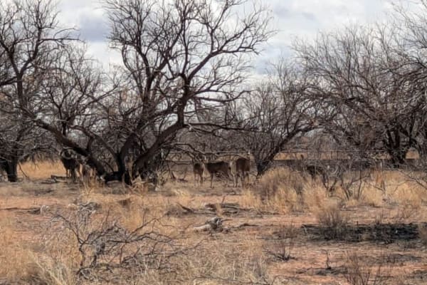
Pronghorn Tour Loop Road
The Pronghorn Trail Loop is a maintained but heavily corrugated and dusty route, best navigated at a slow and steady pace for a more comfortable ride. The winding trail passes through a hunting exclusion zone, making it an excellent area for wildlife sightings, including white-tailed deer. While the...
Learn more about Pronghorn Tour Loop Road
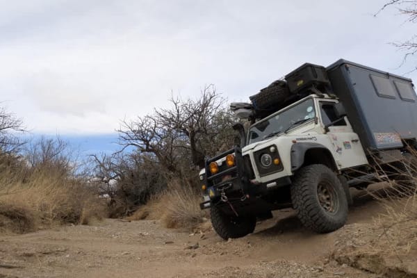
Castle Rock Tank Loop
Castle Rock 4115 begins near Buenos Aires and leads into the Coronado National Forest, offering a rugged off-road experience. The trail starts off well-traveled with a heavily corrugated surface before passing a cattle guard, where the road becomes unmaintained. The surrounding landscape is dominate...
Learn more about Castle Rock Tank Loop
ATV trails near Ali Molina, Arizona
Explore ATV-friendly trails near you. These trails are accessible for vehicles up to 50 inches wide, perfect for ATVs and smaller off-road machines.
Brown Canyon Trail
The trail begins as a relatively well-maintained route but gradually deteriorates as it approaches Brown Canyon Ranch, where access becomes more restricted. To continue onto the private access road, visitors must sign the guest book near the entrance gate and carry a valid Arizona State Trust Pass, ...
Learn more about Brown Canyon Trail
Pozo Tank Loop
The trail features a high-centered middle hump with signs of water damage and several off-camber sections that require careful navigation. The approach from Highway 89 is relatively smooth, with soft sand and minimal obstacles, making for a relaxing drive. However, the terrain becomes more challengi...
Learn more about Pozo Tank Loop
Secundino Trail Loop
The trail winds through sandy, sloping grasslands, offering a scenic drive with curving roads that weave through the open landscape. Several well-established campsites with fire rings provide excellent spots to set up camp while enjoying panoramic views reminiscent of the African savanna. The area i...
Learn more about Secundino Trail Loop
Middle Tank Loop
The trail features a few gentle ups and downs, making for an easy and enjoyable drive. There are several washes to cross along the way, but none present significant challenges under normal conditions. Continuing south on Trail 223 instead of taking Trail 233 provides additional exploration opportuni...
Learn more about Middle Tank Loop
UTV/side-by-side trails near Ali Molina, Arizona
Find UTV and side-by-side trails near you. These trails accommodate vehicles up to 60 inches wide, ideal for UTVs, side-by-sides, and wider off-road rigs.
Brown Canyon Trail
The trail begins as a relatively well-maintained route but gradually deteriorates as it approaches Brown Canyon Ranch, where access becomes more restricted. To continue onto the private access road, visitors must sign the guest book near the entrance gate and carry a valid Arizona State Trust Pass, ...
Learn more about Brown Canyon Trail
Pozo Tank Loop
The trail features a high-centered middle hump with signs of water damage and several off-camber sections that require careful navigation. The approach from Highway 89 is relatively smooth, with soft sand and minimal obstacles, making for a relaxing drive. However, the terrain becomes more challengi...
Learn more about Pozo Tank Loop
Secundino Trail Loop
The trail winds through sandy, sloping grasslands, offering a scenic drive with curving roads that weave through the open landscape. Several well-established campsites with fire rings provide excellent spots to set up camp while enjoying panoramic views reminiscent of the African savanna. The area i...
Learn more about Secundino Trail Loop
Middle Tank Loop
The trail features a few gentle ups and downs, making for an easy and enjoyable drive. There are several washes to cross along the way, but none present significant challenges under normal conditions. Continuing south on Trail 223 instead of taking Trail 233 provides additional exploration opportuni...
Learn more about Middle Tank Loop
The onX Offroad Difference
onX Offroad combines trail photos, descriptions, difficulty ratings, width restrictions, seasonality, and more in a user-friendly interface. Available on all devices, with offline access and full compatibility with CarPlay and Android Auto. Discover what you're missing today!
Open Trail Map