
Dirt Bike Trails
Near Alderson, West Virginia
Explore All Dirt Bike Trails Near Alderson, West Virginia
Dirt Bike Trails Near Alderson, West Virginia
Discover the best dirt bike trails near you. Browse trail maps, check difficulty ratings, and find your next adventure — whether you're looking for a quick ride or an all-day expedition.
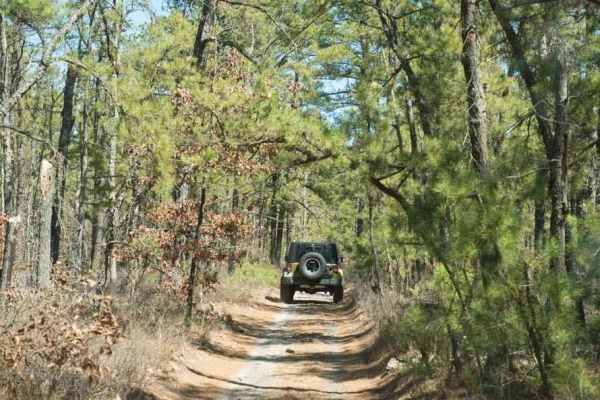
44/1 Bellwood Corporation Mine (Ford Knob Road)
This trail loops the road to Springdale bypass. That sounds like a good name for a road long forgotten. County road 44/1 is a road the locals use for recreation and your constant use will keep the DOH from closing. If you are on the Springdale side the DOH sign is marked at 44/1 Ford Knob Road. This...
Learn more about 44/1 Bellwood Corporation Mine (Ford Knob Road)
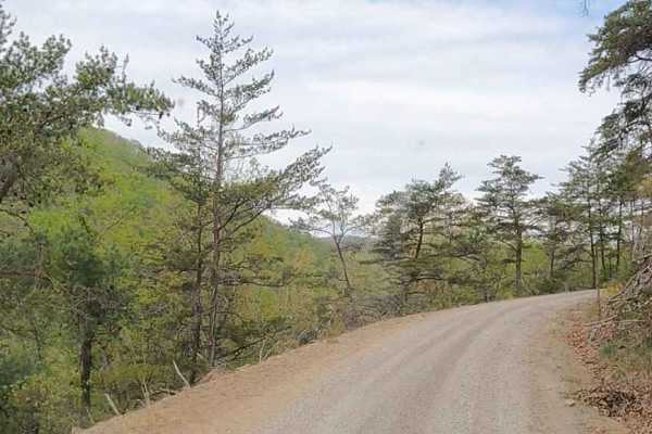
Cove Creek Road
A beautiful drive, and one stretch of Cove Creek Road even takes on the character of a western shelf road, skimming along the hillside with year‑round, stunning views. A few sections tighten up, but there’s still enough space for oncoming vehicles, making it a scenic and comfortable route for anyone...
Learn more about Cove Creek Road
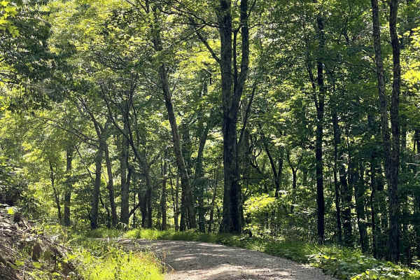
Mountain Lake Turnpike
This trail offers users either an access or an exit route to the historic Mountain Lake Lodge. The trail is a well-maintained, curvy, two-lane road consisting primarily of hard-packed gravel. The surface is generally smooth and free of major obstacles, making it suitable for most vehicles. The windi...
Learn more about Mountain Lake Turnpike
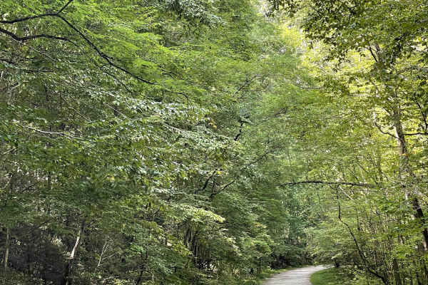
White Rocks Campground
This hard-packed gravel trail is located just off the Mountain Lake Turnpike and provides users with access to an unstaffed U.S. Forest Service campground. There is no camp host on site, but the campground is open and offers several individual campsites for visitors looking to spend time in the area...
Learn more about White Rocks Campground
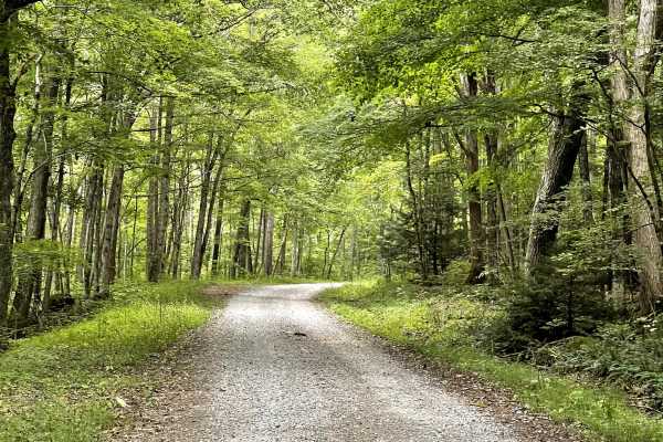
FS 10575
This trail is accessed either just after or just before the historic Mountain Lake Lodge, well known as one of the filming locations for the movie Dirty Dancing. The trail itself consists primarily of hard-packed gravel and is mostly a two-track route. There are plenty of wider areas along the trail...
Learn more about FS 10575
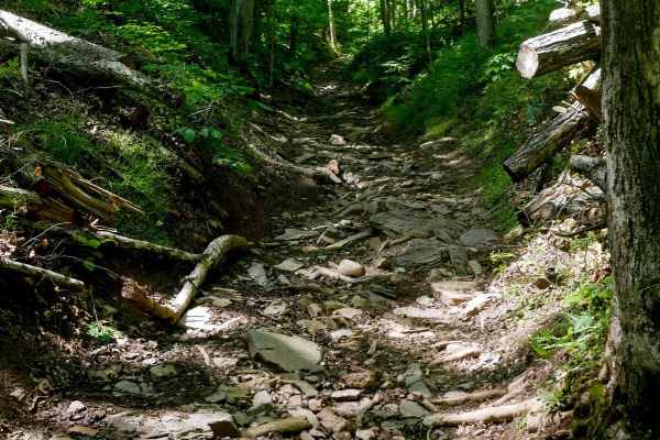
Trail 28 Razor Ridge
Trail 28 begins at the intersection with Trail 27 and climbs up to the "Razor Ridge," offering a scenic ride along the mountain's ridge. The trail is occasionally troughed and rutted, winding through trees with some roots, sticks, and mud puddles, but remains generally easy for the first mile. The ...
Learn more about Trail 28 Razor Ridge
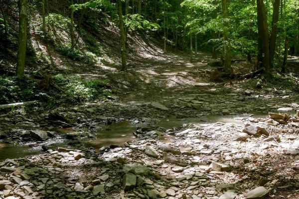
Trail 23 Sawmill Run
Trail 23 follows a rocky route that parallels Cooper Branch and crosses the rocky stream bed several times. While water flow is typically low, the trail surface is composed of loose rock, roots, and slick spots throughout. There are occasional split lines through the trees where the trail merges wit...
Learn more about Trail 23 Sawmill Run
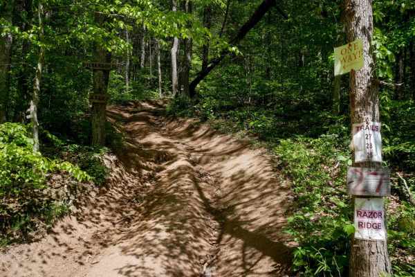
Trail 27
Trail 27 is a quarter-mile more difficult trail, designated directional west to east. It begins with a very steep and rutted climb, where foot-deep ruts are filled with loose debris like sticks and rocks, making the ascent especially difficult in slick conditions. After the initial climb, the trail ...
Learn more about Trail 27
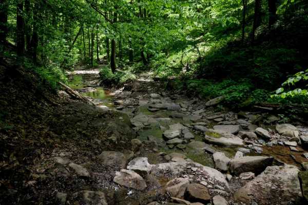
Trail 18
Trail 18 starts at the mud pits with an easy segment before transitioning into an intermediate descent marked by loose rock, ruts, and loamy soil. As it descends, it parallels a ravine, includes a couple of small rocky stream crossings, and winds tightly through the trees. The trail surface becomes ...
Learn more about Trail 18
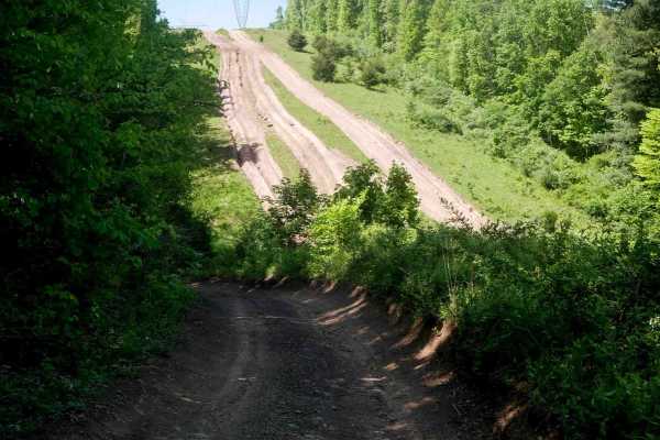
Trail 20 Powerlines
Trail 20 is a 0.6-mile directional trail running west to east. It features a wider path with ruts and minor loose rock, adding some texture to an otherwise easy ride. The trail passes under the powerlines, opening up from the forest canopy to offer broader views of the surrounding area, and connects...
Learn more about Trail 20 Powerlines
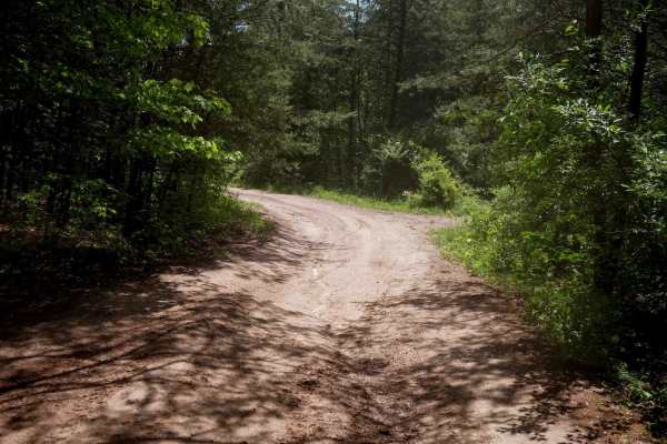
Trail 20 Mud Pit
Trail 20 forms a 0.7-mile loop around the mud pits, designated for counterclockwise travel. It's a super-easy, wide trail that winds through trees and open grassy fields beside the mud area. The surface is mostly smooth with occasional ruts and mud puddles, making it a casual loop suitable for all s...
Learn more about Trail 20 Mud Pit
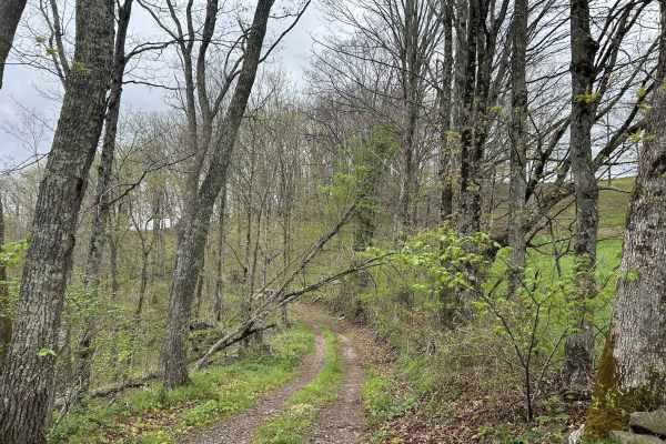
Chestnut Ridge Road
Chestnut Ridge Road offers a scenic journey along a high ridge top, providing breathtaking view on clear days. The majority of the track is an easy drive. The trail features a mandatory technical section that cannot be bypassed, adding just enough challenge to keep things interesting. Please practic...
Learn more about Chestnut Ridge Road
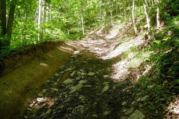
Trail 26 Razor Bypass
Trail 26 is a 0.7-mile connector between Trail 28 and Trail 21. The first quarter mile, descending from the start of Razor Ridge, is smooth and relatively easy despite the moderate grade. After it intersects with the end of Trail 28, the difficulty increases. The trail becomes more off-camber and en...
Learn more about Trail 26 Razor Bypass
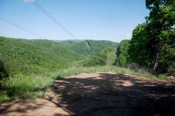
Trail 21
Trail 21 is a 1.7-mile easy trail that allows two-way travel. The south end begins with a small rocky stream crossing and some loose rock, gradually climbing up from the Trail 26 bypass. The route parallels a ravine on a wide path with a couple of additional shallow stream crossings along the way. M...
Learn more about Trail 21
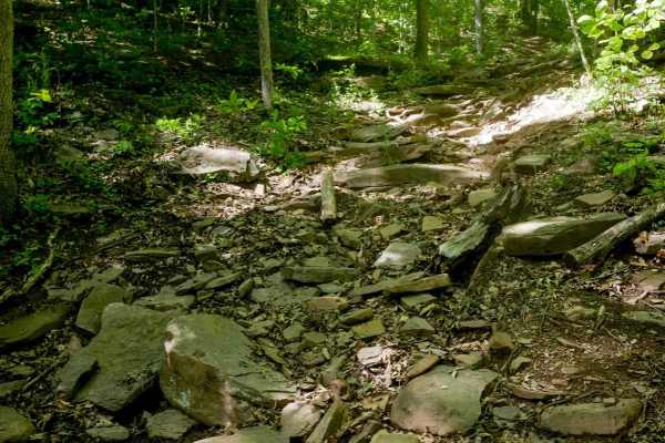
Trail 25
Trail 25 is a short but challenging spur, only 160 yards long, descending steeply from Trail 22 to the intersection with Trails 23 and 29. This directional trail (north to south) begins with a steep, rutted dirt section before transitioning into a rocky ravine with shelves and loose rock. The lower ...
Learn more about Trail 25
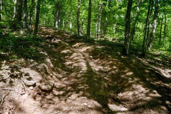
Trail 22
Trail 22 is a short, moderately easy loop less than half a mile long that branches off Trail 21 on the way to the overlook. It should be ridden in a counterclockwise direction. The trail winds through the forest with minor loose rock, leaf decay, and sticks, and features mostly steep sections. Some ...
Learn more about Trail 22
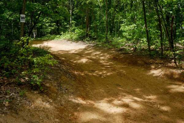
Trail 19
The entire 1.1-mile Trail 19 is overall very easy, featuring a wide path with light rutting and mostly smooth terrain. This trail has three different directional segments: from the intersection with Trail 21 to the Powerlines Trail, it allows two-way travel; from the Powerlines to Trail 17, it is di...
Learn more about Trail 19
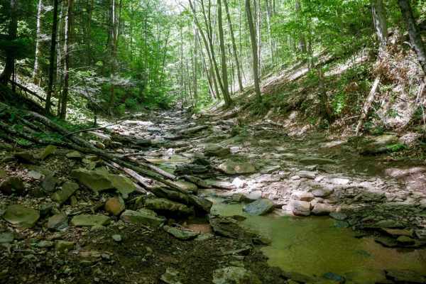
Trail 29
Trail 29 is designated as Most Difficult by the park, climbing up the Cooper Branch in a rocky creek bed. Riders travel directly in the stream much of the time, occasionally shifting to narrow dirt paths along the bank before crossing back through the water. The surface is full of smooth, flat river...
Learn more about Trail 29
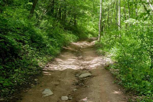
Trail 17
Trail 17 is a directional south-to-north connector between Trails 18 and 19. It features shallow ruts and scattered small loose rocks, but remains easy and fast-moving throughout. The trail flows smoothly through forested terrain and runs shelfy above a ravine, offering a scenic yet mellow ride idea...
Learn more about Trail 17
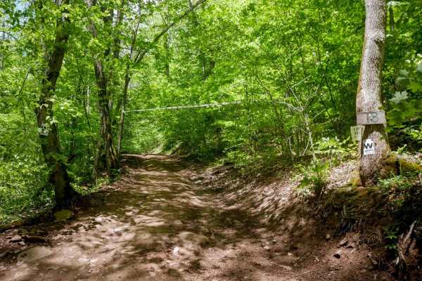
Trail 18 Crossover Section
This short quarter-mile connector is one-way from south to north and serves as an easy link between Trail 16 and the main segment of Trail 18 and Trail 17. The trail is smooth with only a few light ruts and no significant obstacles. It provides a convenient route to the mud pits or to access additio...
Learn more about Trail 18 Crossover Section
ATV trails near Alderson, West Virginia
Explore ATV-friendly trails near you. These trails are accessible for vehicles up to 50 inches wide, perfect for ATVs and smaller off-road machines.
44/1 Bellwood Corporation Mine (Ford Knob Road)
This trail loops the road to Springdale bypass. That sounds like a good name for a road long forgotten. County road 44/1 is a road the locals use for recreation and your constant use will keep the DOH from closing. If you are on the Springdale side the DOH sign is marked at 44/1 Ford Knob Road. This...
Learn more about 44/1 Bellwood Corporation Mine (Ford Knob Road)
Cove Creek Road
A beautiful drive, and one stretch of Cove Creek Road even takes on the character of a western shelf road, skimming along the hillside with year‑round, stunning views. A few sections tighten up, but there’s still enough space for oncoming vehicles, making it a scenic and comfortable route for anyone...
Learn more about Cove Creek Road
Trail 28 Razor Ridge
Trail 28 begins at the intersection with Trail 27 and climbs up to the "Razor Ridge," offering a scenic ride along the mountain's ridge. The trail is occasionally troughed and rutted, winding through trees with some roots, sticks, and mud puddles, but remains generally easy for the first mile. The ...
Learn more about Trail 28 Razor Ridge
Trail 23 Sawmill Run
Trail 23 follows a rocky route that parallels Cooper Branch and crosses the rocky stream bed several times. While water flow is typically low, the trail surface is composed of loose rock, roots, and slick spots throughout. There are occasional split lines through the trees where the trail merges wit...
Learn more about Trail 23 Sawmill Run
UTV/side-by-side trails near Alderson, West Virginia
Find UTV and side-by-side trails near you. These trails accommodate vehicles up to 60 inches wide, ideal for UTVs, side-by-sides, and wider off-road rigs.
44/1 Bellwood Corporation Mine (Ford Knob Road)
This trail loops the road to Springdale bypass. That sounds like a good name for a road long forgotten. County road 44/1 is a road the locals use for recreation and your constant use will keep the DOH from closing. If you are on the Springdale side the DOH sign is marked at 44/1 Ford Knob Road. This...
Learn more about 44/1 Bellwood Corporation Mine (Ford Knob Road)
Cove Creek Road
A beautiful drive, and one stretch of Cove Creek Road even takes on the character of a western shelf road, skimming along the hillside with year‑round, stunning views. A few sections tighten up, but there’s still enough space for oncoming vehicles, making it a scenic and comfortable route for anyone...
Learn more about Cove Creek Road
Trail 28 Razor Ridge
Trail 28 begins at the intersection with Trail 27 and climbs up to the "Razor Ridge," offering a scenic ride along the mountain's ridge. The trail is occasionally troughed and rutted, winding through trees with some roots, sticks, and mud puddles, but remains generally easy for the first mile. The ...
Learn more about Trail 28 Razor Ridge
Trail 23 Sawmill Run
Trail 23 follows a rocky route that parallels Cooper Branch and crosses the rocky stream bed several times. While water flow is typically low, the trail surface is composed of loose rock, roots, and slick spots throughout. There are occasional split lines through the trees where the trail merges wit...
Learn more about Trail 23 Sawmill Run
The onX Offroad Difference
onX Offroad combines trail photos, descriptions, difficulty ratings, width restrictions, seasonality, and more in a user-friendly interface. Available on all devices, with offline access and full compatibility with CarPlay and Android Auto. Discover what you're missing today!
Open Trail Map