
Beginner Off-Road Trails
Near Wildwood, Florida
Explore All Beginner Trails Near Wildwood, Florida
Beginner Off-Road Trails Near Wildwood, Florida
Discover the best beginner-friendly off-road trails near you. These easier, lower-rated trails are a great place to start — browse trail maps, check difficulty ratings, and find your next adventure.
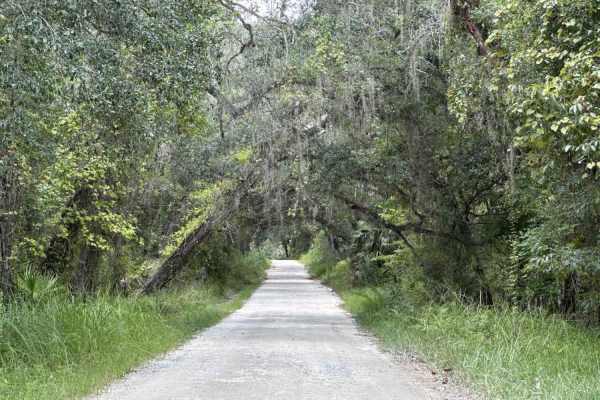
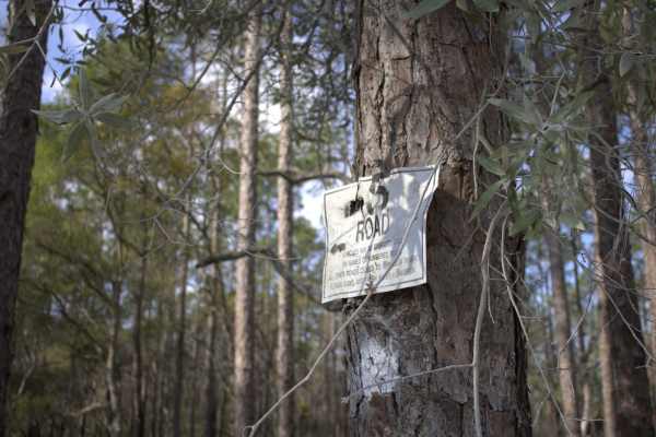
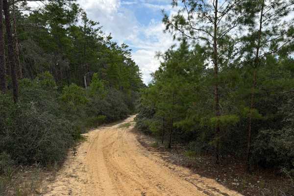
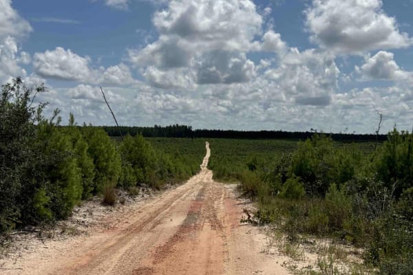
Ocala National Forest SE 13th Avenue
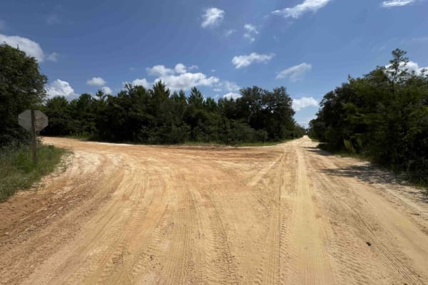
The Ocala National Forest SE 13th Avenue connects Ocklawaha Trail at the north end and State Route 314A at the south end of the trail at the west boundary of the Ocala National Forest. The trail gives you access to some dirt roads around the Tomahawk Lake and the Ocklawaha Prairie. The road conditio...
Learn more about Ocala National Forest SE 13th Avenue
Lake Eaton - ONF-5
This is the Lake Eaton Trail starting from ONF Trail 13 in the south and traveling north to the intersection with ONF 14.6.The trail has intersections with the Tread Lightly Trail as well. The road conditions are a mixture of packed sand and gravel, loose sand, and some spots that can turn into mud ...
Learn more about Lake Eaton - ONF-5
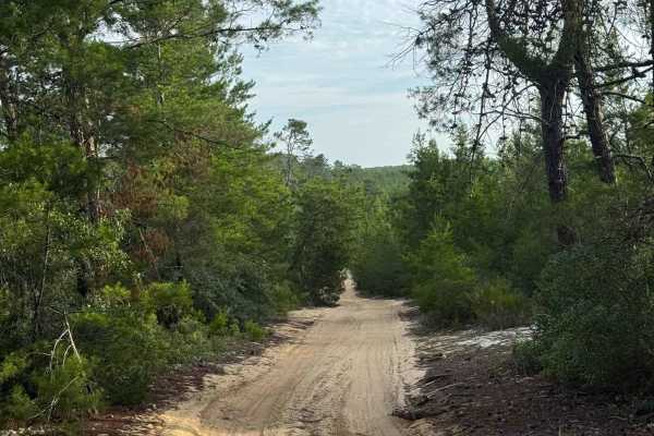
Doe Lake Trail - ONF 14
The Doe Lake Trail, also known as Ocala National Forest Road 14, connects SE 182nd Avenue at the west end and the South Cross Powerline Run at the east end in the south part of the ONF. The trail gives you access to the Doe Lake Boat Ramp and the Doe Lake Group Campground. The road conditions are a ...
Learn more about Doe Lake Trail - ONF 14
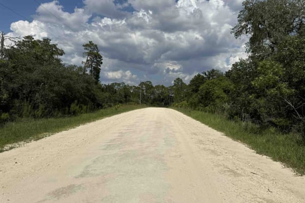
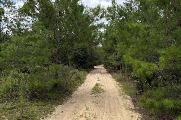
Powerline Plains
A short but memorable off-road trail running beneath power lines in the Ocala National Forest. The trail starts with its biggest challenge, a sandy uphill climb through sugar sand that needs some momentum. After any rain, this section gets harder, so come prepared with 4WD. Once you push through tha...
Learn more about Powerline Plains
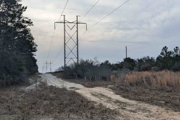
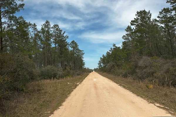
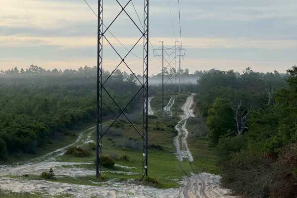
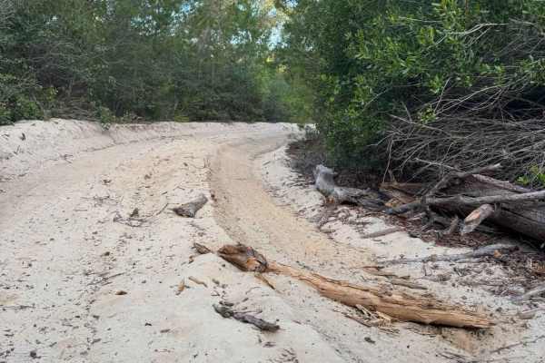
South Cross/Powerline Run
South Cross offers 5 miles of soft sand to cruise on underneath powerlines running east-west. Conditions are typically good and the trail is accessible to any vehicle with 4WD and a set of decent all-terrain tires. This trail runs alongside a much harder-packed surface sand/clay road that allows for...
Learn more about South Cross/Powerline Run
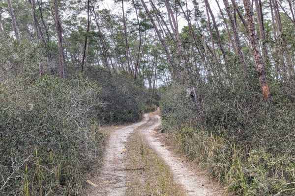
Island Lake Trail
This narrow two-track trail cuts through the heart of Ocala National Forest, allowing you to traverse deep into the wilderness. Once you're off the main road, you will be met with tight, mildly technical sections of sandy trails that put you under the canopy of towering pines and small palms. There'...
Learn more about Island Lake Trail
Trail 12 - Citrus WMA
Trail 12 takes you from County Road 581 at the east end to Trail 15 at the west end of the trail in the central part of the Citrus Wildlife Management Area. The road conditions are a mixture of packed sand, loose sand, and some deep holes that can turn into 2-foot deep mud holes after rainy days. Th...
Learn more about Trail 12 - Citrus WMA
South Boundary Trail - ONF 2
The South Boundary Trail, also known as Ocala National Forest Road 2, connects SE 150th St and Centennial Trail at the east end and Halfmoon South Trail at the west end in the south part of the ONF. The trail is the south boundary of Ocala National Forest. The road conditions are a mixture of packed...
Learn more about South Boundary Trail - ONF 2
Citrus Wildlife Management | Trail 5
Trail 5 has a variety of trail riding fun. It has sugar sand as well as built-up walls and steep grades. There is a plethora of pine trees as well as winding oak trees. We saw quite a few Fox Squirrels on this trail and Turkeys as well, so wildlife is plentiful on this trail. This is an awesome trai...
Learn more about Citrus Wildlife Management | Trail 5
Canopy Run
A wide sugar-sand trail winding through dense Florida scrub and pine forest. The bright white sand stays loose throughout, with deep ruts in areas that can slow your momentum, making 4WD a preferred choice. Tall sand pines, live oaks, and thick palmettos create a shaded tunnel for most of the drive,...
Learn more about Canopy Run
FS 2-1.4
Ocala National Forest Road 2-1.4 connects Tread Lightly! Four Wheel Drive Way at the north end and South Boundary at the south end in the south part of the forest. The trail gives you access to a few OHV and Off-Road trails in the area. The road conditions are a mixture of packed sand, loose sand, a...
Learn more about FS 2-1.4
Trail 6 - Citrus WMA
Trail 6 takes you from East Haven Street at the east end to Trail 19 at the west end of the trail in the north part of the Citrus Wildlife Management Area. The road conditions are a mixture of packed sand, loose sand, and some deep holes that can turn into 2-foot deep mud holes after rainy days. The...
Learn more about Trail 6 - Citrus WMA
FS 13.3-6A
Ocala National Forest Road 13.3-6A connects South Cross/Powerline Run at the north end and Tread Lightly! Four Wheel Drive Way at the south end in the south part of the forest. The trail gives you access to a few OHV and Off-Road trails in the area. The road conditions are a mixture of packed sand, ...
Learn more about FS 13.3-6A
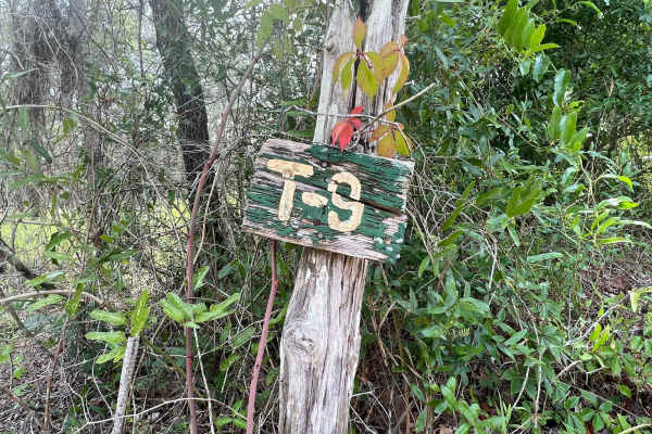
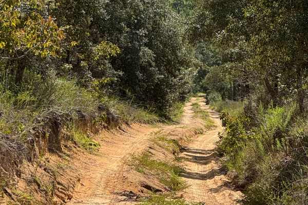
Crooms Wildlife Management | Trail 9
Trail 9 is a beautiful trail that includes slight off-camber obstacles, and has the potential to be wet during the rainy season. This trail winds through oak hammocks and pine forests giving you a nice scenic ride to see wildlife along the way. Along the trail, there are multiple horse, biking & hik...
Learn more about Crooms Wildlife Management | Trail 9
Trail 10A - Citrus WMA
Trail 10a takes you from Trail 9 at the east end to Trail 19 at the west end of the trail in the central part of the Citrus Wildlife Management Area. The road conditions are a mixture of packed sand, loose sand, and some deep holes that can turn into 2-foot deep mud holes after rainy days. The road ...
Learn more about Trail 10A - Citrus WMA
ONF Trail 17-2.6
ONF Trail 17-2.6 runs West to East from ONF Trail 17 to ONF 13. The trail is loose, primarily sand; you can expect deep sand. The trail is generally only one vehicle wide, with areas to pull off to allow passing. The trail is tight in place, and pinstriping can be expected along this trail. Some obs...
Learn more about ONF Trail 17-2.6
Lam Horse Trail - ONF 22-0.3A
The Lam Horse Trail, also known as Ocala National Forest Road 22-0.3A, connects High Tension Road at the west end and Green Bear Hole / Lam Horse Trail at the east end in the south part of the ONF. The trail gives you access to several trails including 'Tread Lightly! Four Wheel Drive Way' (Florida'...
Learn more about Lam Horse Trail - ONF 22-0.3A
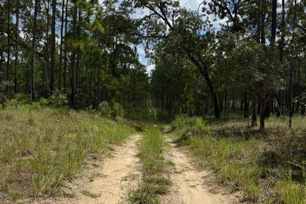
Longview Trail
A wide, sandy forest trail winding through dense Florida pine and palmetto scrub. Long straightaways provide excellent visibility and make it easy to spot obstacles or other vehicles well in advance without risk. The trail is mostly flat and smooth, with a single section of deeper rutted sand near t...
Learn more about Longview Trail
Centennial South - FS 520
Centennial South, also known as Ocala National Forest Road 520, connects Halfmoon South at the west end and Centennial Trail (FS 14-9.8) at the east end in the south part of the forest. This trail is part of the Centennial OHV area. The road conditions are a mixture of packed sand, loose sand, and s...
Learn more about Centennial South - FS 520
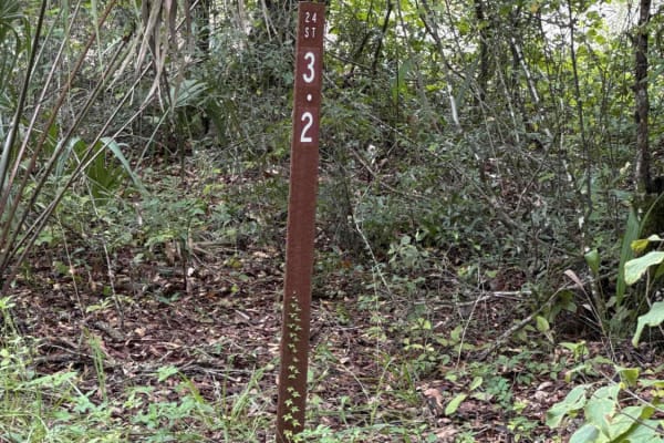
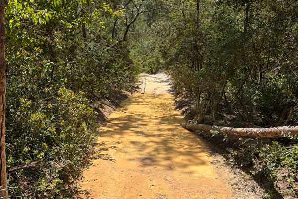
Ocklawaha Trail - ONF SE24ST
The Ocklawaha Trail, also known as Ocala National Forest Road SE24ST, connects SE 1st Road at the west end and Highway 314A at the east end in the southwest of the Ocala National Forest. The trail gives you access to some dirt roads that will take you to the Ocklawaha River. The road conditions are ...
Learn more about Ocklawaha Trail - ONF SE24ST
Beginner ATV trails near Wildwood, Florida
Explore ATV-friendly trails near you. These trails are accessible for vehicles up to 50 inches wide, perfect for ATVs and smaller off-road machines.
Ocala National Forest SE 13th Avenue
The Ocala National Forest SE 13th Avenue connects Ocklawaha Trail at the north end and State Route 314A at the south end of the trail at the west boundary of the Ocala National Forest. The trail gives you access to some dirt roads around the Tomahawk Lake and the Ocklawaha Prairie. The road conditio...
Learn more about Ocala National Forest SE 13th Avenue
Doe Lake Trail - ONF 14
The Doe Lake Trail, also known as Ocala National Forest Road 14, connects SE 182nd Avenue at the west end and the South Cross Powerline Run at the east end in the south part of the ONF. The trail gives you access to the Doe Lake Boat Ramp and the Doe Lake Group Campground. The road conditions are a ...
Learn more about Doe Lake Trail - ONF 14
Powerline Plains
A short but memorable off-road trail running beneath power lines in the Ocala National Forest. The trail starts with its biggest challenge, a sandy uphill climb through sugar sand that needs some momentum. After any rain, this section gets harder, so come prepared with 4WD. Once you push through tha...
Learn more about Powerline Plains
South Boundary Trail - ONF 2
The South Boundary Trail, also known as Ocala National Forest Road 2, connects SE 150th St and Centennial Trail at the east end and Halfmoon South Trail at the west end in the south part of the ONF. The trail is the south boundary of Ocala National Forest. The road conditions are a mixture of packed...
Learn more about South Boundary Trail - ONF 2
Beginner UTV/side-by-side trails near Wildwood, Florida
Find UTV and side-by-side trails near you. These trails accommodate vehicles up to 60 inches wide, ideal for UTVs, side-by-sides, and wider off-road rigs.
Ocala National Forest SE 13th Avenue
The Ocala National Forest SE 13th Avenue connects Ocklawaha Trail at the north end and State Route 314A at the south end of the trail at the west boundary of the Ocala National Forest. The trail gives you access to some dirt roads around the Tomahawk Lake and the Ocklawaha Prairie. The road conditio...
Learn more about Ocala National Forest SE 13th Avenue
Doe Lake Trail - ONF 14
The Doe Lake Trail, also known as Ocala National Forest Road 14, connects SE 182nd Avenue at the west end and the South Cross Powerline Run at the east end in the south part of the ONF. The trail gives you access to the Doe Lake Boat Ramp and the Doe Lake Group Campground. The road conditions are a ...
Learn more about Doe Lake Trail - ONF 14
Powerline Plains
A short but memorable off-road trail running beneath power lines in the Ocala National Forest. The trail starts with its biggest challenge, a sandy uphill climb through sugar sand that needs some momentum. After any rain, this section gets harder, so come prepared with 4WD. Once you push through tha...
Learn more about Powerline Plains
Trail 12 - Citrus WMA
Trail 12 takes you from County Road 581 at the east end to Trail 15 at the west end of the trail in the central part of the Citrus Wildlife Management Area. The road conditions are a mixture of packed sand, loose sand, and some deep holes that can turn into 2-foot deep mud holes after rainy days. Th...
Learn more about Trail 12 - Citrus WMA
The onX Offroad Difference
onX Offroad combines trail photos, descriptions, difficulty ratings, width restrictions, seasonality, and more in a user-friendly interface. Available on all devices, with offline access and full compatibility with CarPlay and Android Auto. Discover what you're missing today!
Open Trail Map