Beginner Off-Road Trails
Near Wendell, Minnesota
Explore All Beginner Trails Near Wendell, Minnesota
Beginner Off-Road Trails Near Wendell, Minnesota
Discover the best beginner-friendly off-road trails near you. These easier, lower-rated trails are a great place to start — browse trail maps, check difficulty ratings, and find your next adventure.
Jorgen’s Hallow
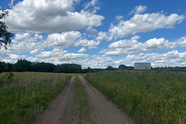
Jorgen’s hollow is a very simple, easy dirt trail with some hills running through trees. It has some very nice scenery with a historical point of interest. You may see some livestock and horses. There are a few gates you must go through; just open and close them behind yourself.
Learn more about Jorgen’s Hallow
Trail 1212B
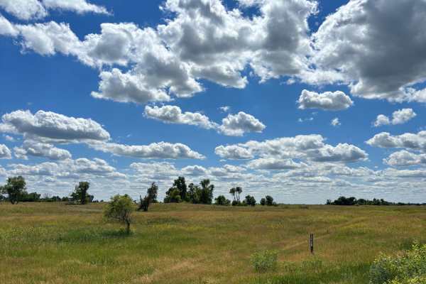
This is a very short, unmaintained trail. Grass is very high. If it rains, you may get stuck. Its landscape is very beautiful despite it being a short trail. There is a cool well on the trail for a photo op. It’s a very grassy trail, which makes it hard to see.
Learn more about Trail 1212B
Trail 1212
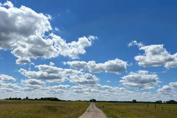
The trail is mainly made of dirt, and sand was very muddy in some parts. Has very nice points of interest and beautiful scenery. A few rutted-out spots from mud and dirt bike tracks. Ranchers all around the trail, so I did see a group of cows on the trail blocking my exit.
Learn more about Trail 1212
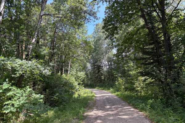
Mary Yellowhead Trail
Mary Yellowhead Trail is a scenic, easy-to-follow path through the woods near Tamarac National Wildlife Refuge, offering stunning fall views. The trail is mostly gravel with a few sandy spots and a few shallow mud holes. The Trail ends near other nearby trails, making a great fall color loop access ...
Learn more about Mary Yellowhead Trail
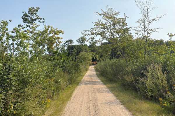
Smokey Hills Trail
Smokey Hills Trail winds through the scenic Smokey Hills State Forest. The Trail is an easy-going, mostly wide Forestry Road with some overgrowth making some narrow sections. This Trail serves as the main route through this North Section of the Smokey Hills State Forest. The Trail winds through some...
Learn more about Smokey Hills Trail
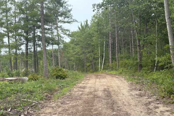
Navillus Forest Road
Navillus Forest Road is an easy-to-navigate forestry road that goes through the Smokey Hills State Forest. The trail has some sandy sections and tight corners along with rolling hills through the forest. Mostly a wide, relatively flat forest road, it does have some overgrowth in certain spots that m...
Learn more about Navillus Forest Road
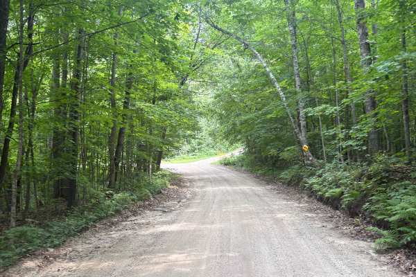
Hannah Ore Forest Road
Hannah Ore Trail winds through the Smokey Hills State Forest, offering a pleasant mix of rolling terrain, wooded views, and sandy corners. The trail is easy to follow, making it a good choice for a relaxing ride. After wet weather, some areas can become soft, muddy, or uneven. The Trail is wide enou...
Learn more about Hannah Ore Forest Road
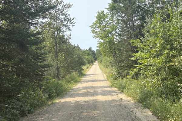
Smokey Hills Road
Smokey Hills Road offers a scenic ride through the rolling wooded terrain in the Smokey Hills State Forest. The trail winds through the South section of the Smokey Hills State Forest, serving as one of the main trails. The trail is wide enough for two vehicles to pass each other the majority of the ...
Learn more about Smokey Hills Road
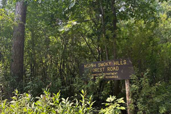
North Smokey Hills Forest Road
North Smokey Hills Forest Road is an easy going trial that takes you through a great scenic area of the Smokey Hills State Forest. The trail is mostly a wide, easy-to-travel forest road with winding corners and small hill climbs. This Trail serves as one of the main routes through this area, with mu...
Learn more about North Smokey Hills Forest Road
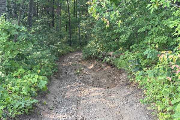
Forest Road 0425
Forest Road 0425 is a quick connector Trail between Smokey Hills Trail and North Smokey Hills Forest Road. Even though it is short, it brings some challenges. It has some steep washout climbs and off-camber turns. This trail is more difficult than the trails in the area. The trail is very narrow, si...
Learn more about Forest Road 0425
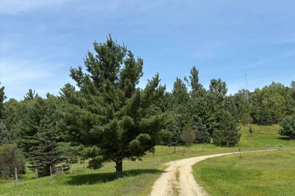
Rat Lake Trail
Rat Lake Trail is an easy route of gravel, sand, and two-track that follows the western edge of Tamarac National Wildlife Refuge. It features gentle rolling hills with scenic views of wildlife and vibrant fall colors from the surrounding habitats. The trail is open seasonally and closes from Decembe...
Learn more about Rat Lake Trail
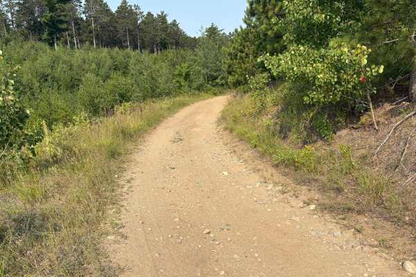
Firetower Overlook
This is a very short down-and-back trail that ends at a scenic Firetower and overlook. The Trail is very narrow and has some sandy hill climbs along with rocky washouts. The trail to the overlook is a sandy climb through the thick vegetation. Once you are approaching the end, the view opens up, and ...
Learn more about Firetower Overlook
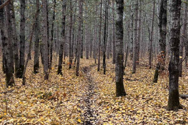
Huntersville Western Single Track Loop
This trail is a really pretty route through multiple wooded region types. There are a few large logging sections and a brief section of wider forest road, in addition to some occasional rocks, but otherwise there's little debris beyond some roots or sticks. Some sections are quite narrow but overall...
Learn more about Huntersville Western Single Track Loop
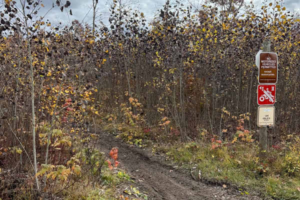
Huntersville Western Loop Parking Lot Jaunt
This trail is a nice connection route between the western parking area and the western dirt bike only loop. There is also a small gravel pit space near the junction in the middle. The trail is overall smooth with very little debris and a few whoop sections. Compared to nearby singletrack Paul Bunyan...
Learn more about Huntersville Western Loop Parking Lot Jaunt
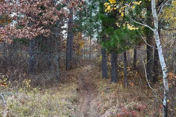
Finn Lake Loop
This trail parallels a pretty lake toward the western section of the Huntersville trail system. The trail has some small hills and whoops, as well as some sharper, windy sections that appear to be rutted/wet on occasion. Those sections might have just been cleaned up from downed trees. Overall, it's...
Learn more about Finn Lake Loop
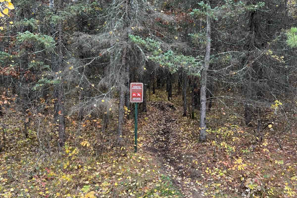
Central Huntersville Cut Through
This single-track route is a borderline direct cut-through from many western/central forest roads to the primary Huntersville forest road. The trail winds through some pretty dense evergreen sections with lots of roots. There is also a wooden bridge that assists in passing a wet marsh section given ...
Learn more about Central Huntersville Cut Through
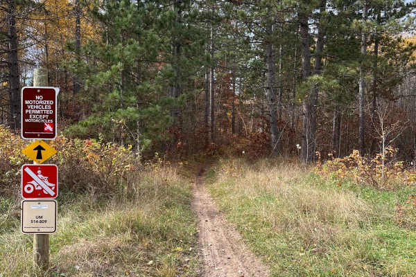
Huntersville Southwestern Trail
This trail is a Huntersville sampler. There are super dense forest sections where you have to slow down to thread trees, sections of many whoops, somewhat washed-out trails that are sandy, and some trail sections hit by the forestry service with roots, sticks, and stumps. Compared to nearby singletr...
Learn more about Huntersville Southwestern Trail
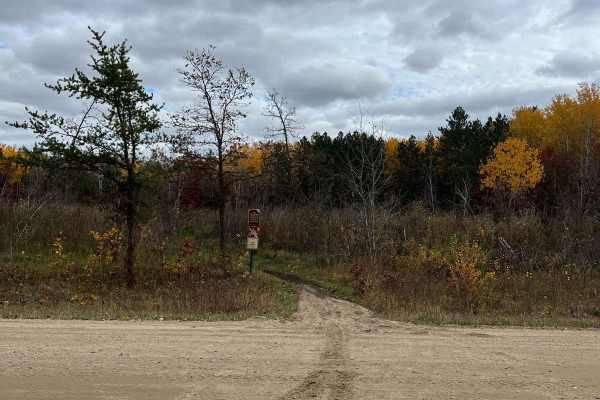
Huntersville Western Trailhead - East Leg
This is a nice, flowy, wooded section of trail with sections of heavy whoops but wide enough trees to keep some speed. It's a good option if you want to hit many central trails from the trailhead parking area. Compared to nearby singletrack Paul Bunyan and Spider Lake Trails, this trail system is ge...
Learn more about Huntersville Western Trailhead - East Leg
Beginner ATV trails near Wendell, Minnesota
Explore ATV-friendly trails near you. These trails are accessible for vehicles up to 50 inches wide, perfect for ATVs and smaller off-road machines.
Jorgen’s Hallow
Jorgen’s hollow is a very simple, easy dirt trail with some hills running through trees. It has some very nice scenery with a historical point of interest. You may see some livestock and horses. There are a few gates you must go through; just open and close them behind yourself.
Learn more about Jorgen’s Hallow
Trail 1212B
This is a very short, unmaintained trail. Grass is very high. If it rains, you may get stuck. Its landscape is very beautiful despite it being a short trail. There is a cool well on the trail for a photo op. It’s a very grassy trail, which makes it hard to see.
Learn more about Trail 1212B
Trail 1212
The trail is mainly made of dirt, and sand was very muddy in some parts. Has very nice points of interest and beautiful scenery. A few rutted-out spots from mud and dirt bike tracks. Ranchers all around the trail, so I did see a group of cows on the trail blocking my exit.
Learn more about Trail 1212
Mary Yellowhead Trail
Mary Yellowhead Trail is a scenic, easy-to-follow path through the woods near Tamarac National Wildlife Refuge, offering stunning fall views. The trail is mostly gravel with a few sandy spots and a few shallow mud holes. The Trail ends near other nearby trails, making a great fall color loop access ...
Learn more about Mary Yellowhead Trail
Beginner UTV/side-by-side trails near Wendell, Minnesota
Find UTV and side-by-side trails near you. These trails accommodate vehicles up to 60 inches wide, ideal for UTVs, side-by-sides, and wider off-road rigs.
Jorgen’s Hallow
Jorgen’s hollow is a very simple, easy dirt trail with some hills running through trees. It has some very nice scenery with a historical point of interest. You may see some livestock and horses. There are a few gates you must go through; just open and close them behind yourself.
Learn more about Jorgen’s Hallow
Trail 1212B
This is a very short, unmaintained trail. Grass is very high. If it rains, you may get stuck. Its landscape is very beautiful despite it being a short trail. There is a cool well on the trail for a photo op. It’s a very grassy trail, which makes it hard to see.
Learn more about Trail 1212B
Trail 1212
The trail is mainly made of dirt, and sand was very muddy in some parts. Has very nice points of interest and beautiful scenery. A few rutted-out spots from mud and dirt bike tracks. Ranchers all around the trail, so I did see a group of cows on the trail blocking my exit.
Learn more about Trail 1212
Mary Yellowhead Trail
Mary Yellowhead Trail is a scenic, easy-to-follow path through the woods near Tamarac National Wildlife Refuge, offering stunning fall views. The trail is mostly gravel with a few sandy spots and a few shallow mud holes. The Trail ends near other nearby trails, making a great fall color loop access ...
Learn more about Mary Yellowhead Trail
The onX Offroad Difference
onX Offroad combines trail photos, descriptions, difficulty ratings, width restrictions, seasonality, and more in a user-friendly interface. Available on all devices, with offline access and full compatibility with CarPlay and Android Auto. Discover what you're missing today!
Open Trail Map