
Beginner Off-Road Trails
Near Waskom, Texas
Explore All Beginner Trails Near Waskom, Texas
Beginner Off-Road Trails Near Waskom, Texas
Discover the best beginner-friendly off-road trails near you. These easier, lower-rated trails are a great place to start — browse trail maps, check difficulty ratings, and find your next adventure.
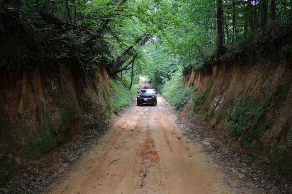
Old Stagecoach Road
Old Stagecoach road is made up of a mix of rock, sand, and dirt. When wet you get a red clay that can be slick as ice. There are some rocks in the road about 8 inches in diameter. Some narrow washouts across the road are 8-plus inches deep. Logging trucks have been traveling sections of the road an...
Learn more about Old Stagecoach Road
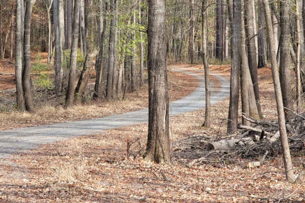
Enter Bodcau Wildlife Management Area
This easy-going, 7.8-mile scenic dirt and gravel route is perfect for beginners, scenic drivers, and outdoor enthusiasts looking to access the heart of the Bodcau Wildlife Management Area. Starting on the southeast side of the Bayou Bodcau Reservoir, the trail winds through dense bottomland hardwood...
Learn more about Enter Bodcau Wildlife Management Area
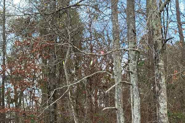
Ivan Lake Trail
This gravel road passes through the Ivan Lake area. There are a few primitive camping spots (permit required), a beautiful fishing lake, and restrooms. This trail exits the park area and heads Northwest towards Arkansas. This is in the Bayou Bodcau WMA, and all WMA rules apply. There is plenty of wi...
Learn more about Ivan Lake Trail
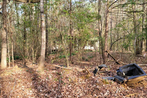
The Dead End Barrel
This trail has a bit of asphalt, dirt, and gravel. It goes to a cemetery and dead-ends at an oil structure. This trail is north of Ivan Lake and northwest of Williams Lake. You will also see an old deserted house on the right-hand side of the road.
Learn more about The Dead End Barrel
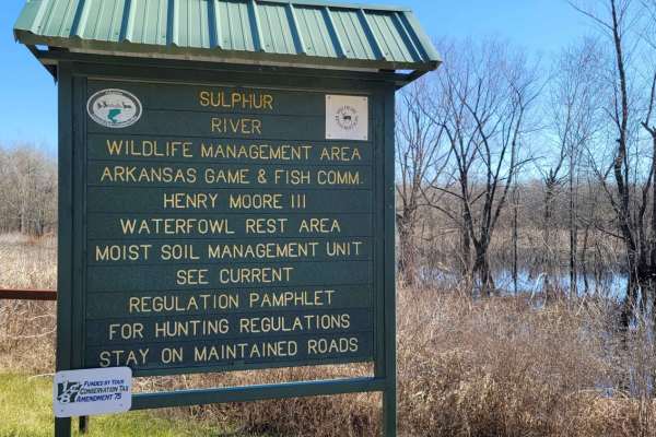
Boggy Creek Monster Trail
This is a maintained gravel road in Mercer Bayou Wildlife Area. Mercer Bayou is a gut located just 18.4 miles from Texarkana, in Miller County, in the state of Arkansas, United States, near Jonesville, AR. Sightings of the Boggy Creek Monster have been reported in this area. The road is normally in ...
Learn more about Boggy Creek Monster Trail
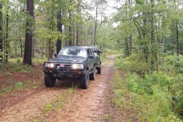
Kisatchie NF Spur Trail
Kisatchie NF Spur Trail is a short, secluded dirt offshoot ideal for campers and offroaders seeking a quiet, off-the-beaten-path lunch spot or a primitive campsite within the Caney Ranger District. Spanning just under 0.4 miles, this flat spur branches north off Road 815 (White Road) and leads direc...
Learn more about Kisatchie NF Spur Trail
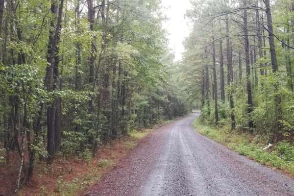
815 Road, Kisatchie NF
815 Road, Kisatchie NF is an easy, scenic dirt route through the Kisatchie National Forest, making it perfect for beginners, stock vehicles, and those looking for a relaxed cruise through Louisiana's pine woods. This basic fire road runs through rolling hills and beautiful pine forests, offering a s...
Learn more about 815 Road, Kisatchie NF
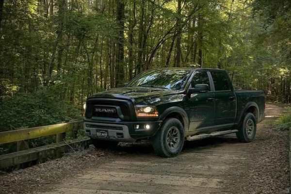
Butler Circle
This is a basic fire road within Kisatchie National Forest. It involves rolling hills through the Louisiana landscape. Hidden around the area are lookout towers for fire detection, a relic from past land management in the area. This area of the Kisatchie has a number of private in-holdings as well a...
Learn more about Butler Circle
829 Road, Kisatchie NF
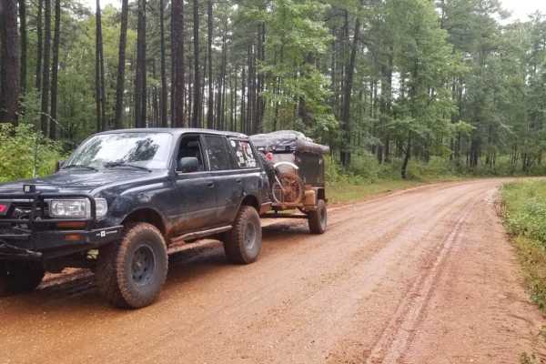
829 Road in the Caney Ranger District of the Kisatchie National Forest offers a relaxed, scenic dirt route perfect for beginners, overland travelers, and families looking to explore Louisiana’s rolling pine hills. This easily navigable forest road serves as an excellent entry point to the region's d...
Learn more about 829 Road, Kisatchie NF
The Pope
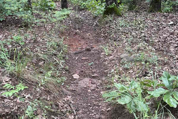
This East Texas singletrack cuts through a dense forest of pines and hardwoods on a primarily dirt surface. Riders will encounter frequent exposed roots and occasional patches of rock that add technical character without raising the difficulty too high. The trail features rolling elevation with a fe...
Learn more about The Pope
Old Camp Road
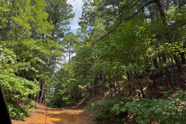
Old Camp Road ** Park Rating: 2/5 ** Technical Rating: 2/10 **Detailed Notes** Loose rocks, bumpy with some tight areas, connects to Old Camp campsite. Not recommended for full-size trailers past certain points, but fine for off-road trailers. Great for a relaxed access route and staging area.**Vehi...
Learn more about Old Camp Road
Too Easy
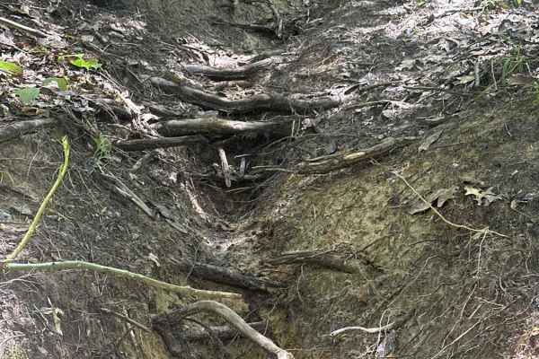
This is a short connector from "Creek Trail" to "Something Else".
Learn more about Too Easy

Southeast Main Road
Southeast Main Road ** Park Rating: 1/5 ** Technical Rating: 2/10 **Detailed Notes** Loose dirt and rocks, wide enough for large rigs and trailers, mild bumps. Connects to multiple trails and pavilions. Not technical, serves as a main access and positioning route. Can get muddy in spots after rain b...
Learn more about Southeast Main Road
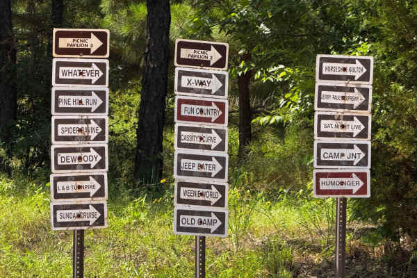
Southwest Main Road
Southwest Main Road ** Park Rating: 1/5 ** Technical Rating: 2/10 **Detailed Notes** Loose dirt and rocks, wide enough for large rigs and trailers. Connects to Old Camp and other trails. Gets rougher after bathrooms, with some washed-out sections. Scenic overlooks, including views by Dewoody. Bumpy ...
Learn more about Southwest Main Road
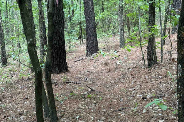
Mad Max
This East Texas singletrack cuts through a dense forest of pines and hardwoods on a primarily dirt surface. Riders will encounter frequent exposed roots and occasional patches of rock that add technical character without raising the difficulty too high. The trail features rolling elevation with a fe...
Learn more about Mad Max
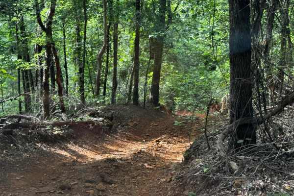
Sunday Cruise Bypass
Sunday Cruise Bypass ** Park Rating: 2/5 ** Technical Rating: 3/10 ** Detailed Notes ** Loose rocks, dirt, and clay; tight canyon-style walls and a water crossing. Steep inclines and declines, but no major ledges. Becomes more slick and tricky after rain. One-directional design makes it straightforw...
Learn more about Sunday Cruise Bypass

Jimmy's Revenge
This East Texas singletrack cuts through a dense forest of pines and hardwoods on a primarily dirt surface. Riders will encounter frequent exposed roots and occasional patches of rock that add technical character without raising the difficulty too high. The trail features rolling elevation with a fe...
Learn more about Jimmy's Revenge
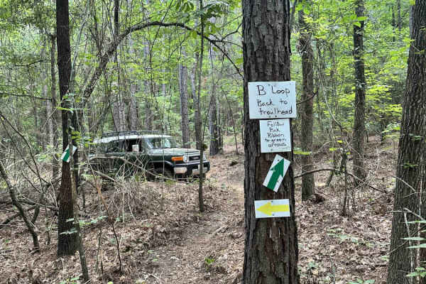
10 Mile
This flowy trail marked by green arrows is a good way to traverse the park if you need to connect the southeast side to the northeast side quickly. The trail is mostly smooth with a few exposed roots, but an occasional tree obstacle to keep the technical skills fresh.
Learn more about 10 Mile
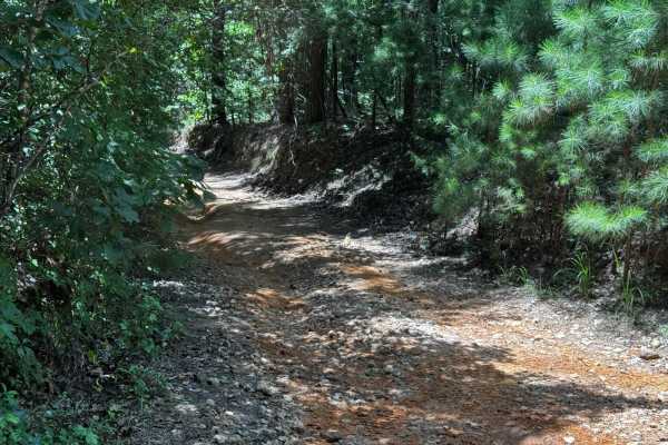
Linda Gail
Linda Gail ** Park Rating: 2/5 ** Technical Rating: 3/10 ** Detailed Notes ** Scenic and beginner-friendly trail with multiple rocky creek crossings. Off-camber sections and small rocky obstacles present learning opportunities without big risks. Bypasses exist for all challenging areas. Watch for di...
Learn more about Linda Gail
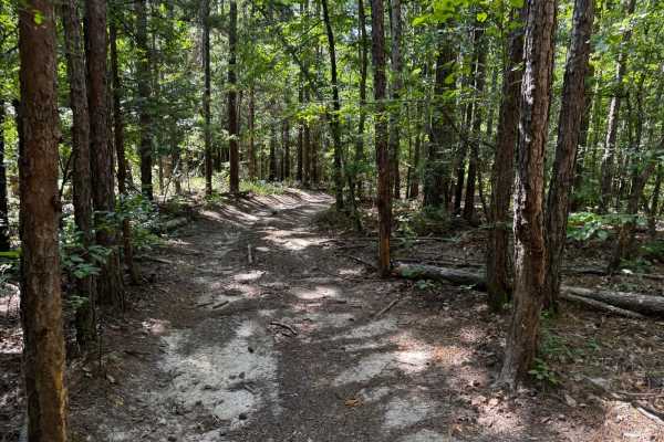
We Show
We Show ** Park Rating: 2/5 ** Technical Rating: 2/10 ** Detailed Notes ** Very tight, short trail designed for short wheelbase rigs. Not recommended for full-size rigs due to sharp turns and narrow lines. Multiple dirt bike crossings. A fun small obstacle at the end that requires a lift but has a b...
Learn more about We Show
Beginner ATV trails near Waskom, Texas
Explore ATV-friendly trails near you. These trails are accessible for vehicles up to 50 inches wide, perfect for ATVs and smaller off-road machines.
Enter Bodcau Wildlife Management Area
This easy-going, 7.8-mile scenic dirt and gravel route is perfect for beginners, scenic drivers, and outdoor enthusiasts looking to access the heart of the Bodcau Wildlife Management Area. Starting on the southeast side of the Bayou Bodcau Reservoir, the trail winds through dense bottomland hardwood...
Learn more about Enter Bodcau Wildlife Management Area
Butler Circle
This is a basic fire road within Kisatchie National Forest. It involves rolling hills through the Louisiana landscape. Hidden around the area are lookout towers for fire detection, a relic from past land management in the area. This area of the Kisatchie has a number of private in-holdings as well a...
Learn more about Butler Circle
Old Camp Road
Old Camp Road ** Park Rating: 2/5 ** Technical Rating: 2/10 **Detailed Notes** Loose rocks, bumpy with some tight areas, connects to Old Camp campsite. Not recommended for full-size trailers past certain points, but fine for off-road trailers. Great for a relaxed access route and staging area.**Vehi...
Learn more about Old Camp Road
Southeast Main Road
Southeast Main Road ** Park Rating: 1/5 ** Technical Rating: 2/10 **Detailed Notes** Loose dirt and rocks, wide enough for large rigs and trailers, mild bumps. Connects to multiple trails and pavilions. Not technical, serves as a main access and positioning route. Can get muddy in spots after rain b...
Learn more about Southeast Main Road
Beginner UTV/side-by-side trails near Waskom, Texas
Find UTV and side-by-side trails near you. These trails accommodate vehicles up to 60 inches wide, ideal for UTVs, side-by-sides, and wider off-road rigs.
Enter Bodcau Wildlife Management Area
This easy-going, 7.8-mile scenic dirt and gravel route is perfect for beginners, scenic drivers, and outdoor enthusiasts looking to access the heart of the Bodcau Wildlife Management Area. Starting on the southeast side of the Bayou Bodcau Reservoir, the trail winds through dense bottomland hardwood...
Learn more about Enter Bodcau Wildlife Management Area
Butler Circle
This is a basic fire road within Kisatchie National Forest. It involves rolling hills through the Louisiana landscape. Hidden around the area are lookout towers for fire detection, a relic from past land management in the area. This area of the Kisatchie has a number of private in-holdings as well a...
Learn more about Butler Circle
Old Camp Road
Old Camp Road ** Park Rating: 2/5 ** Technical Rating: 2/10 **Detailed Notes** Loose rocks, bumpy with some tight areas, connects to Old Camp campsite. Not recommended for full-size trailers past certain points, but fine for off-road trailers. Great for a relaxed access route and staging area.**Vehi...
Learn more about Old Camp Road
Southeast Main Road
Southeast Main Road ** Park Rating: 1/5 ** Technical Rating: 2/10 **Detailed Notes** Loose dirt and rocks, wide enough for large rigs and trailers, mild bumps. Connects to multiple trails and pavilions. Not technical, serves as a main access and positioning route. Can get muddy in spots after rain b...
Learn more about Southeast Main Road
The onX Offroad Difference
onX Offroad combines trail photos, descriptions, difficulty ratings, width restrictions, seasonality, and more in a user-friendly interface. Available on all devices, with offline access and full compatibility with CarPlay and Android Auto. Discover what you're missing today!
Open Trail Map