
Beginner Off-Road Trails
Near Warm Springs, Montana
Explore All Beginner Trails Near Warm Springs, Montana
Beginner Off-Road Trails Near Warm Springs, Montana
Discover the best beginner-friendly off-road trails near you. These easier, lower-rated trails are a great place to start — browse trail maps, check difficulty ratings, and find your next adventure.
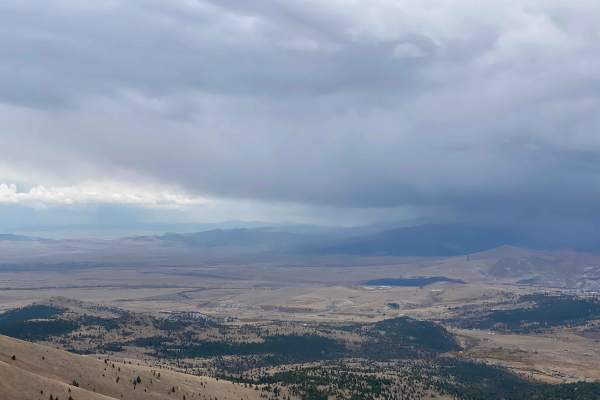
Anaconda Microwave Overlook
On the trail, you will go past a few residential homes and generally stay left to avoid their driveways and stay on the route. After passing through an H1 wide wallow, you will go through a brief narrower canyon that opens up into a wide park. There are two trails exiting the park to the north. Take...
Learn more about Anaconda Microwave Overlook
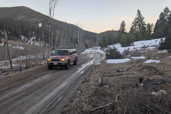
Flume Gultch
FS 85, beginning north of Rocker at just over 5,500 feet, is a single-lane trail that goes through several private land parcels before ascending to 6,900 feet. There are very minimal opportunities for camping south of the intersection with FS 608. Going west, staying on FS 85, opens up with a two-la...
Learn more about Flume Gultch
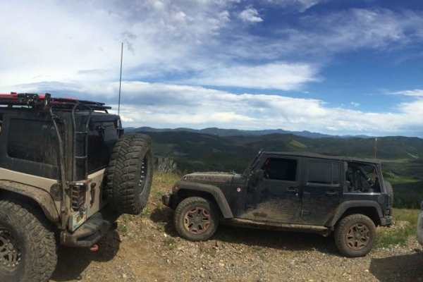
Blizard Hill
This trail connects to the Rock Creek/Leadville Trail. It is a short drive to the top of Blizzard Hill, where you can enjoy views of the surrounding mountains. As one of the highest points in the area, it's a perfect spot for stargazing and viewing comets, with no light pollution to obstruct the nig...
Learn more about Blizard Hill
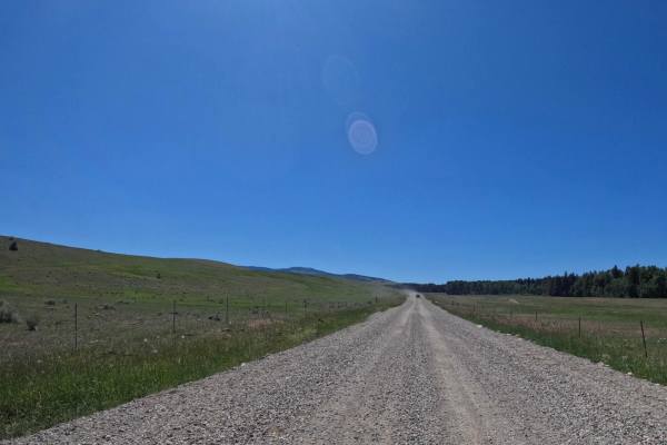
Emery Road-Champion Pass
Route starts just outside Deer Lodge on FS8344 at an altitude of 4978'. Route is mostly two-lane gravel with wide sweeping curves that will climb to 6965'. Several very shallow water holes were encountered along the route. The route can be very dusty during times of dry weather. The route travels th...
Learn more about Emery Road-Champion Pass
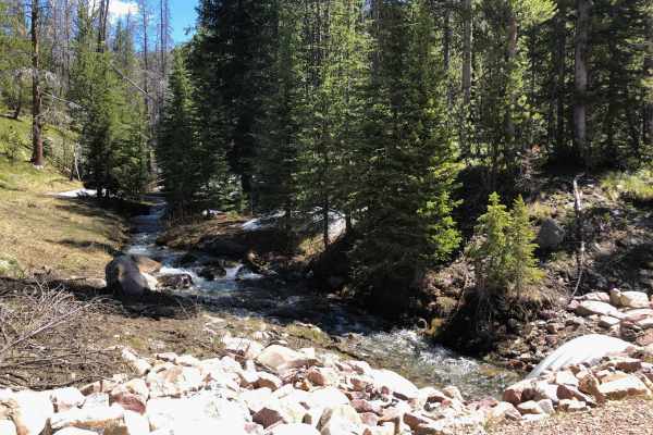
Warm Springs Creek Road 170
Follow Warm Springs Creek to find some beautiful remote campsites with the sounds of the rushing creek or nighttime critters. This road starts as a well-maintained gravel road for the first 3.5 miles before crossing over the creek and becoming rougher the further you drive. Some larger rocks and rut...
Learn more about Warm Springs Creek Road 170
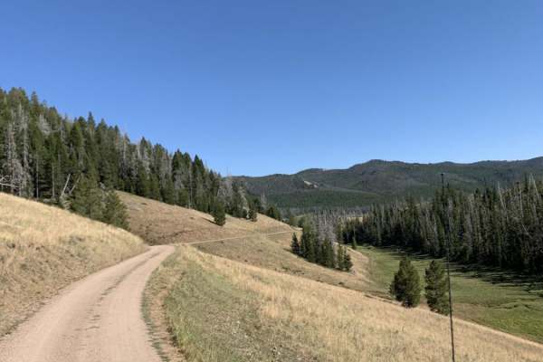
Champion Pass
Champion Pass is a scenic 25.4-mile point-to-point route that offers four-wheel-drive vehicles and SxSs an engaging trek over the Continental Divide between Interstate 90 and Interstate 15. The trail stands out for its transition from wide, sweeping valley views to tight, technical forest canopy nav...
Learn more about Champion Pass
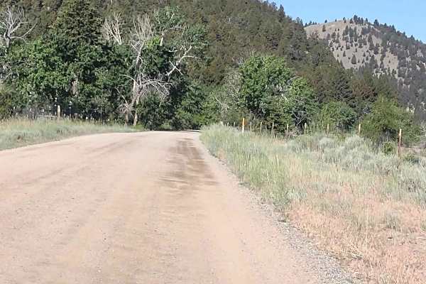
Cattle Drive to Bear Gulch
Cattle Drive to Bear Gulch is a scenic 12-mile offroad trail near Boulder, Montana, that offers a moderate, family-friendly climb from the Boulder River valley into the high elevations of the Deerlodge National Forest. Ideal for four-wheel-drive vehicles, SxSs, and dirt bikes, this route provides st...
Learn more about Cattle Drive to Bear Gulch
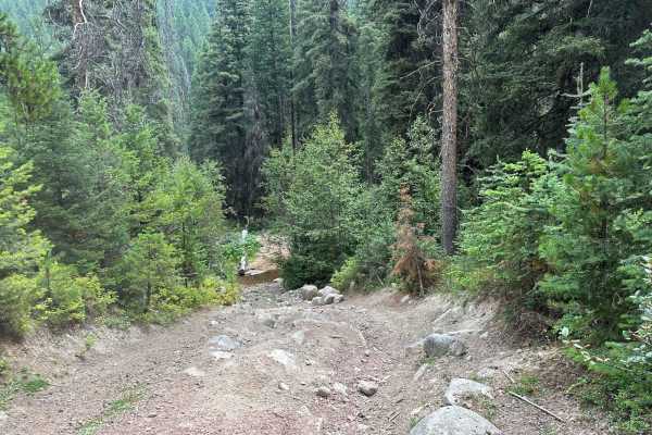
South Boulder Creek Loop
This is a fun and scenic loop with a lot of elevation change. It crosses South Boulder Creek nine times and goes by a few old mining remnants while on this loop. The trail is fairly easy although it has had a couple of recent washouts that can be tricky and there are a couple of rocky areas.
Learn more about South Boulder Creek Loop
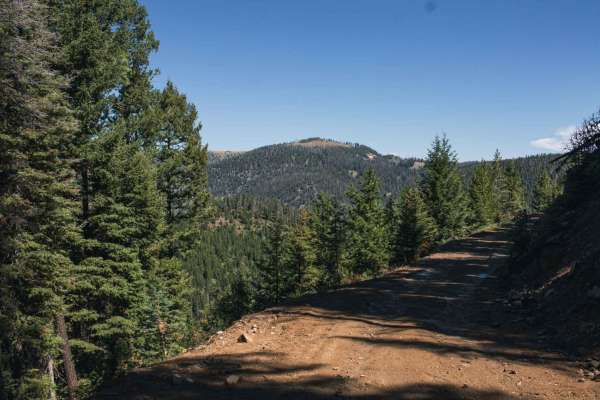
Bison Mountain
This road can be muddy when wet, with water puddles, it has beautiful views, there seems to be no camping. There is a hiking trail but it is very overgrown and hard to find. Not very many spots to turn around, a short-wheelbase vehicle will be able to, but a long vehicle will have a hard time.Dirt o...
Learn more about Bison Mountain
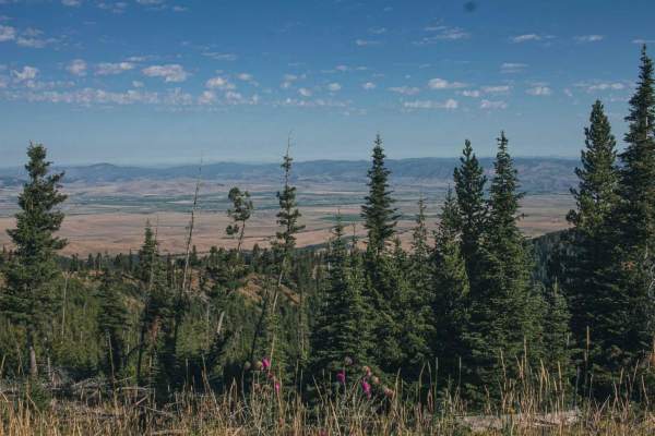
Gold Creek
Beautiful road with views to enjoy, some points you can see the town below. There isn't much for camping, maybe a spot or two. Dirt or rocky road, typically unmaintained after rain or snow. You may encounter shallow water crossings and obstacles under 12" on the trail, including small ledges. Roads ...
Learn more about Gold Creek
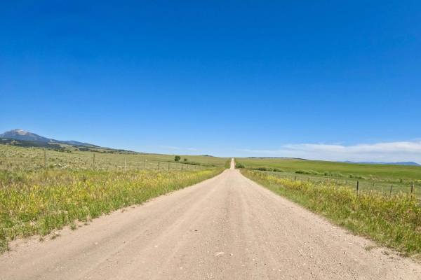
Deer Lodge MT-Gold Creek Ranch
Route begins at the South Old Stage Road leaving Deer Lodge. The route is mainly a 2 vehicle wide gravel roadway. Long straight aways with very wide gentle curves make up the route. You will encounter some rocky areas of road with a few mud holes here and there. The countryside is mostly open and us...
Learn more about Deer Lodge MT-Gold Creek Ranch
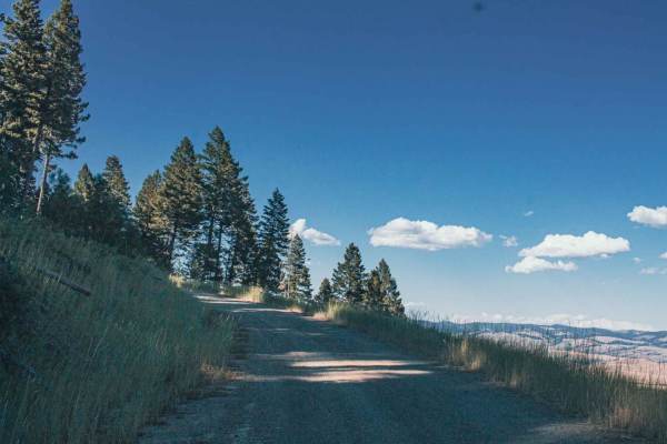
Jackson Park
Beautiful road with amazing views to enjoy, there aren't many spots for camping, maybe a spot or two and not very big. This road does offer access to other roads which will have more camping spots.Dirt or rocky road with gentle grades. Safe for most 4WD and high-clearance 2WD vehicles. Roads are typ...
Learn more about Jackson Park
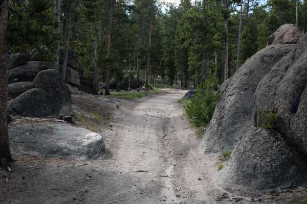
WP862
WP862 is a 1.6-mile long loop off of Delmoe Lake Road. This is a popular ATV riding area, and many dispersed campsites can be found on Delmoe Lake Road near this trail. The trail is made of dirt and decomposed granite with embedded flat surfaces of granite rock but is overall pretty smooth. It goes ...
Learn more about WP862
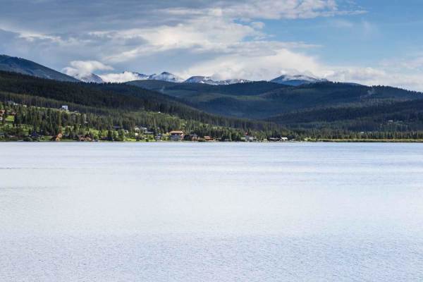
East Fork Reservoir
This is a scenic route from Georgetown Lake to the East Fork Reservoir. The route starts on Old Lake Road along the west side of Georgetown Lake. After turning on Georgetown Lake Road you will travel through thick sections of lodgepole pines and also wide meadows. The road surface is gravel and very...
Learn more about East Fork Reservoir
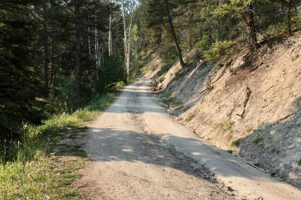
Sunnyside Road
This short Forest Service logging road is easily accessible from the Interstate access road in Basin, Montana. It’s an easy, pleasant drive up into the hills and provides opportunities for side trips and exploration of some difficult routes. The road climbs up over a ridgeline and ends in a valley. ...
Learn more about Sunnyside Road

Irish Mine
Beautiful road with amazing views to enjoy, there isn't much for camping, maybe a spot or two.Dirt or rocky road, typically unmaintained after rain or snow. You may encounter shallow water crossings and obstacles under 12" on the trail, including small ledges. Roads are typically one to two vehicles...
Learn more about Irish Mine
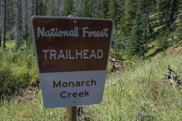
Monarch
Beautiful road with views to enjoy. When wet there will be water puddles that can be deep. There isn't much for camping, maybe a spot or two, the road ends at a hiking trail with a fire pit and a small to medium size area to turn around.Dirt or rocky road, typically unmaintained after rain or snow. ...
Learn more about Monarch
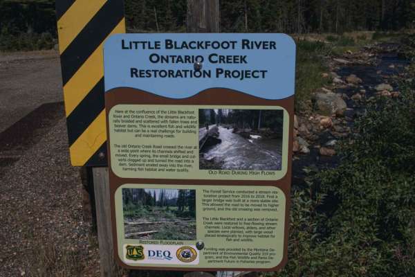
Ontario
Ontario is an inviting, scenic trail perfect for beginner offroaders and those looking for a relaxed mountain drive with ample group camping opportunities. Spanning approximately 2.1 miles through the rugged terrain near the Little Blackfoot River, this route features a primarily dirt and rock surfa...
Learn more about Ontario
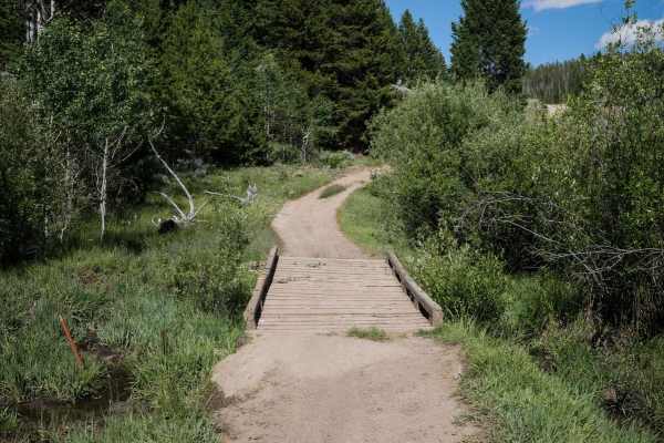
7268
This is a 1 mile ATV trail through the Deerlodge National Forest in the Pipestone OHV area. Two boulders lining the trail at the west entrance prevent full-width vehicles from entering, but it continues as a road-width dirt trail through the forest and connects to another road. It goes over a wooden...
Learn more about 7268
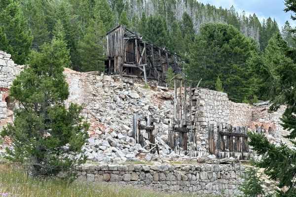
Granite Mine Ghost Town
This unimproved and fairly steep dirt road leads from Phillipsburg, MT, east into the mountains to the Granite ghost town and mine, and the Bimetalllic mine complex, now a state park property. Roads require high clearance in some areas due to boulders in the road, and 4WD is mandatory for wet or sno...
Learn more about Granite Mine Ghost Town
Beginner ATV trails near Warm Springs, Montana
Explore ATV-friendly trails near you. These trails are accessible for vehicles up to 50 inches wide, perfect for ATVs and smaller off-road machines.
Anaconda Microwave Overlook
On the trail, you will go past a few residential homes and generally stay left to avoid their driveways and stay on the route. After passing through an H1 wide wallow, you will go through a brief narrower canyon that opens up into a wide park. There are two trails exiting the park to the north. Take...
Learn more about Anaconda Microwave Overlook
Flume Gultch
FS 85, beginning north of Rocker at just over 5,500 feet, is a single-lane trail that goes through several private land parcels before ascending to 6,900 feet. There are very minimal opportunities for camping south of the intersection with FS 608. Going west, staying on FS 85, opens up with a two-la...
Learn more about Flume Gultch
Blizard Hill
This trail connects to the Rock Creek/Leadville Trail. It is a short drive to the top of Blizzard Hill, where you can enjoy views of the surrounding mountains. As one of the highest points in the area, it's a perfect spot for stargazing and viewing comets, with no light pollution to obstruct the nig...
Learn more about Blizard Hill
Emery Road-Champion Pass
Route starts just outside Deer Lodge on FS8344 at an altitude of 4978'. Route is mostly two-lane gravel with wide sweeping curves that will climb to 6965'. Several very shallow water holes were encountered along the route. The route can be very dusty during times of dry weather. The route travels th...
Learn more about Emery Road-Champion Pass
Beginner UTV/side-by-side trails near Warm Springs, Montana
Find UTV and side-by-side trails near you. These trails accommodate vehicles up to 60 inches wide, ideal for UTVs, side-by-sides, and wider off-road rigs.
Anaconda Microwave Overlook
On the trail, you will go past a few residential homes and generally stay left to avoid their driveways and stay on the route. After passing through an H1 wide wallow, you will go through a brief narrower canyon that opens up into a wide park. There are two trails exiting the park to the north. Take...
Learn more about Anaconda Microwave Overlook
Flume Gultch
FS 85, beginning north of Rocker at just over 5,500 feet, is a single-lane trail that goes through several private land parcels before ascending to 6,900 feet. There are very minimal opportunities for camping south of the intersection with FS 608. Going west, staying on FS 85, opens up with a two-la...
Learn more about Flume Gultch
Blizard Hill
This trail connects to the Rock Creek/Leadville Trail. It is a short drive to the top of Blizzard Hill, where you can enjoy views of the surrounding mountains. As one of the highest points in the area, it's a perfect spot for stargazing and viewing comets, with no light pollution to obstruct the nig...
Learn more about Blizard Hill
Emery Road-Champion Pass
Route starts just outside Deer Lodge on FS8344 at an altitude of 4978'. Route is mostly two-lane gravel with wide sweeping curves that will climb to 6965'. Several very shallow water holes were encountered along the route. The route can be very dusty during times of dry weather. The route travels th...
Learn more about Emery Road-Champion Pass
The onX Offroad Difference
onX Offroad combines trail photos, descriptions, difficulty ratings, width restrictions, seasonality, and more in a user-friendly interface. Available on all devices, with offline access and full compatibility with CarPlay and Android Auto. Discover what you're missing today!
Open Trail Map