
Beginner Off-Road Trails
Near Trout Creek, Montana
Explore All Beginner Trails Near Trout Creek, Montana
Beginner Off-Road Trails Near Trout Creek, Montana
Discover the best beginner-friendly off-road trails near you. These easier, lower-rated trails are a great place to start — browse trail maps, check difficulty ratings, and find your next adventure.
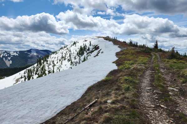
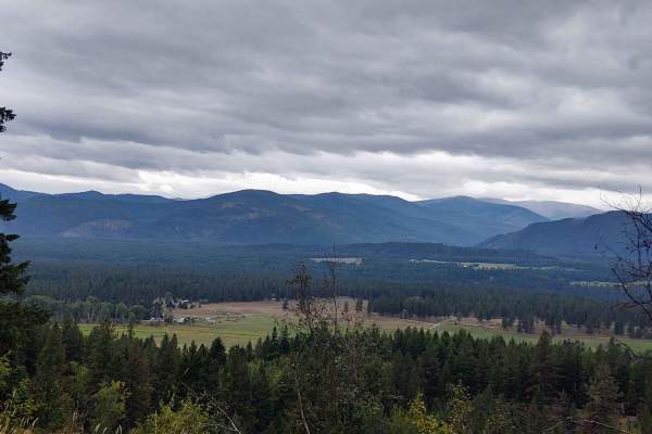
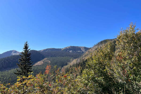
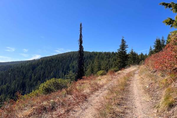
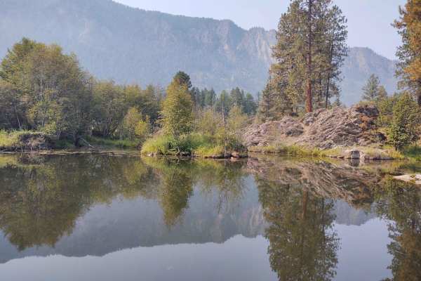
Bloom Peak Trail
Bloom Peak trail starts on the west side of Noxon Reservoir, Montana, crosses the Idaho border, and completes near Pritchard, Idaho. This is primarily a gravel route with fantastic views and culminates with panoramic views at Bloom Peak. The route utilizes USFS roads #322 (Minton Peak Rd), Clark For...
Learn more about Bloom Peak Trail
Sex Ridge Road
Sex Ridge Road (FS 2222) is an infrequently used narrow road from the top of Sex Peak reaching down to White Pine, Montana. The lookout can be reserved on Recreation.gov and offers stellar views of the Cabinet Mountains to the east. The road is rough, and some sections are susceptible to washouts. T...
Learn more about Sex Ridge Road
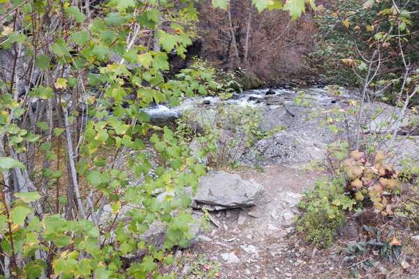
Lower Marten Creek
This nicely graded trail begins at the inlet of Martin Creek Bay and runs alongside the creek as it works its way into the forest. There is plenty of dispersed camping sites along the way. If you prefer a more established place to camp, the Martin Creek campground is an excellent choice near the beg...
Learn more about Lower Marten Creek
Stevens Creek Road
This well-groomed trail generally follows the powerlines from the dam all the way to the Marten Creek campground. As it twists its way around, you will get amazing views of the lake and hillsides. Some offshoots may lead to dispersed camping spots, but the campground, complete with pit toilets, is t...
Learn more about Stevens Creek Road
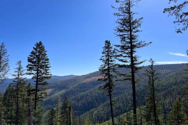
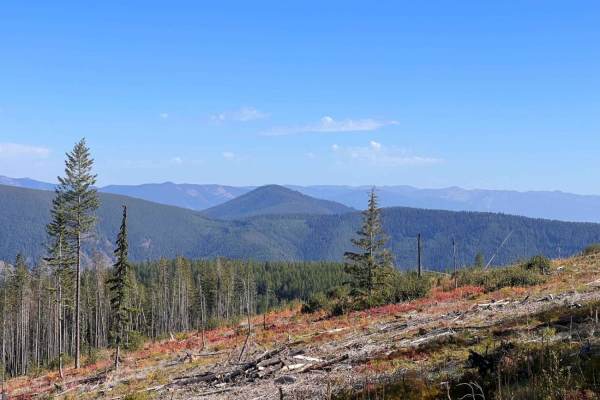
Cougar Peak
This trail zigzags from the valley floor at 2607 feet to over 6100 feet in the Lolo National Forest towards Cougar Peak. A fire in the area the day we rode stopped us from getting all the way up, but if you can go beyond our trail, it will take you right to Cougar Peak. All private property crossing...
Learn more about Cougar Peak
Graves Creek Falls/Vermilion
This 12-mile RT trail goes into the Lolo National Forest, rising from the valley floor at 2400 feet to over 4300 feet. A fire in the high country cut our trip short, so if there's no fire, you can explore for several more miles in this area, going even higher into the backcountry. Just three miles u...
Learn more about Graves Creek Falls/Vermilion
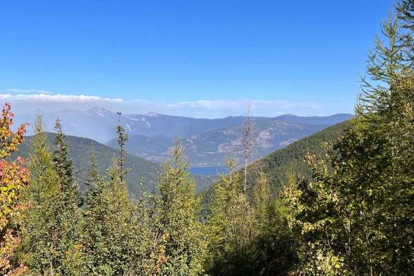
Stevens Ridge
This well-graded ridge run is a perfect ride up or down from the mountain above to the primary graded trails below. There are ample pull-offs, a few tight switchbacks, and hardly any potholes to impede one's progress. The views of the Clark Fork river are spectacular, especially on the way down. No ...
Learn more about Stevens Ridge

Big Beaver Creek
Big Beaver Creek Road (FS 152) from the top of the summit travels down the ravine and back up Sex Ridge to the top of Sex Peak. The lookout can be reserved on Recreation.gov and offers stellar views of the Cabinet Mountains to the east. The road is easy to drive with a mild grade, though some sectio...
Learn more about Big Beaver Creek
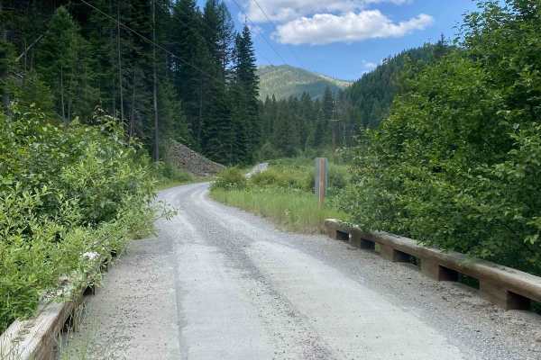
West Fork Eagle Creek (805)
West Fork Eagle Creek Road (805) is a scenic route that follows Eagle Creek into the woods for about 6 miles. The road is single-lane width but has occasional turnouts and several spots that are wide enough to pass oncoming traffic. There are a few small bridges that are single car width. The road i...
Learn more about West Fork Eagle Creek (805)
North Branch of Martin Creek
This easy climb gradually heads into the hills. It's pretty wooded, and the forest is dense in some spots. There's a slight break in the trees here and there to get a glimpse of a view. The trail is mostly easy, with some ruts, loose sections, and more significant dips at the erosion stoppers. It's ...
Learn more about North Branch of Martin Creek
West Fork Pilgrim Creek
This generally easy trail heads back up to the ridges and deeper into the forest. It's mostly easy with a few larger potholes, and tight switchback turns. The only camping noticed was alongside the road in pullouts, but some of the spots had amazing views. It's a nice easy trail to get to elevation ...
Learn more about West Fork Pilgrim Creek
Denver Ridge
This 10-mile RT track goes from Clear Creek Trail up to just over 4000 feet in the Lolo National Forest. There is room to let another vehicle pass on some of the corners. All private property crossings are allowed if you stay on the trail. The trails up the mountains are steep and twisting turns. Be...
Learn more about Denver Ridge
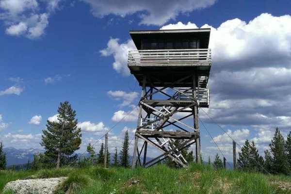
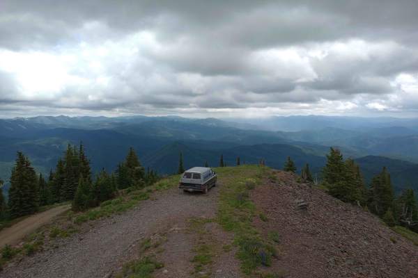
Gem Peak
This narrow, steep run to the top is rutted and rocky with a few loose climbs. There are excellent views, and if you're lucky, the lookout rental cabin road will be open for you to get the whole way to the top. If not, you should respect the privacy of those who rented the lookout cabin. There is on...
Learn more about Gem Peak
Huckleberry Mountain
This fun trail ducks and dives, bobs, and weaves its way around the hillsides. There are a few rutted areas. Some narrow sections with tall grass and a few loose hill climbs. Overall it's pretty narrow without many good spots to allow oncoming to pass. Other than some of the fantastic vistas, the hi...
Learn more about Huckleberry Mountain
Lone Cliff Cutover
This easy ridge trail cuts across the top of the hills with amazing views of the Clark Fork valley and the Cabinet mountains. There is also access to the Skeleton Creek hiking trail from both ends. There are some decent-sized pullouts to dispersed camps and one outstanding one right in a forestry cl...
Learn more about Lone Cliff Cutover
Flatiron Ridge
This 12-mile RT trail zigzags up Flatiron Ridge in the Lolo National Forest to an elevation of 4362 feet. There is room to let another vehicle pass on some of the corners. All private property crossings are allowed if you stay on the trail. The trails up the mountains are steep and twisting turns. B...
Learn more about Flatiron Ridge
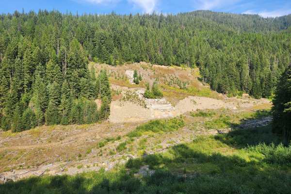
Oregon Toboggan Road
Oregon Toboggan (FS 2349) and Jack Waite Forks (FS 1551) are moderately used, mild forest roads with great views of the Coeur d’Alene mountains. At 11.3 miles, there is a spur road on the left which dead ends close to the remediation site of the Jack Waite Mine, which was founded back in 1884. The r...
Learn more about Oregon Toboggan Road
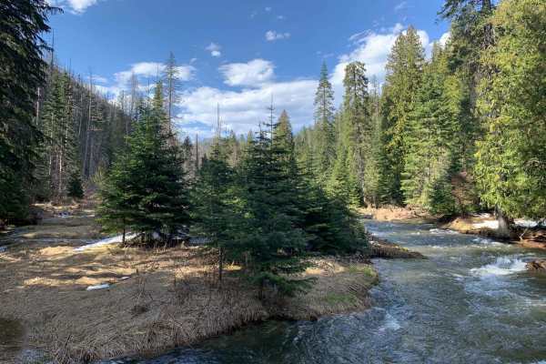
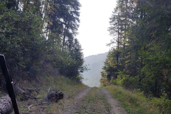
Clear Creek
This 5-mile portion of Clear Creek Trail takes you from Prospect Creek Road near Thompson Falls, MT, into the high country of the Lolo National Forest. If you follow Clear Creek beyond where our track ends, you can access Beaver Peak, Clear Peak, Emma Peak and Helwick Peak, all of which are between ...
Learn more about Clear Creek
Cooper Pass Road to Burke Ghost Town
This is a fun and scenic route off of Thompson Pass Road in Montana that ends at Burke, Idaho, which is a very cool abandoned mining town with a lot of history. The road is narrow with quite a few switchbacks and great views. At the very top of the pass and at 5,811 feet, there is also a dirt bike l...
Learn more about Cooper Pass Road to Burke Ghost Town
Shoshone Ridge (602)
Shoshone Ridge is a scenic trail off of Coeur d'Alene River Road (208). There's a great view at the end of 602, plenty of room to turn around, as well as parking for 3-4 cars. There's a hiking trailhead here as well (Shoshone Ridge Trail #81). You can take a hairpin turn and continue another 1.5 mil...
Learn more about Shoshone Ridge (602)
Beginner ATV trails near Trout Creek, Montana
Explore ATV-friendly trails near you. These trails are accessible for vehicles up to 50 inches wide, perfect for ATVs and smaller off-road machines.
Bloom Peak Trail
Bloom Peak trail starts on the west side of Noxon Reservoir, Montana, crosses the Idaho border, and completes near Pritchard, Idaho. This is primarily a gravel route with fantastic views and culminates with panoramic views at Bloom Peak. The route utilizes USFS roads #322 (Minton Peak Rd), Clark For...
Learn more about Bloom Peak Trail
Sex Ridge Road
Sex Ridge Road (FS 2222) is an infrequently used narrow road from the top of Sex Peak reaching down to White Pine, Montana. The lookout can be reserved on Recreation.gov and offers stellar views of the Cabinet Mountains to the east. The road is rough, and some sections are susceptible to washouts. T...
Learn more about Sex Ridge Road
Lower Marten Creek
This nicely graded trail begins at the inlet of Martin Creek Bay and runs alongside the creek as it works its way into the forest. There is plenty of dispersed camping sites along the way. If you prefer a more established place to camp, the Martin Creek campground is an excellent choice near the beg...
Learn more about Lower Marten Creek
Stevens Creek Road
This well-groomed trail generally follows the powerlines from the dam all the way to the Marten Creek campground. As it twists its way around, you will get amazing views of the lake and hillsides. Some offshoots may lead to dispersed camping spots, but the campground, complete with pit toilets, is t...
Learn more about Stevens Creek Road
Beginner UTV/side-by-side trails near Trout Creek, Montana
Find UTV and side-by-side trails near you. These trails accommodate vehicles up to 60 inches wide, ideal for UTVs, side-by-sides, and wider off-road rigs.
Bloom Peak Trail
Bloom Peak trail starts on the west side of Noxon Reservoir, Montana, crosses the Idaho border, and completes near Pritchard, Idaho. This is primarily a gravel route with fantastic views and culminates with panoramic views at Bloom Peak. The route utilizes USFS roads #322 (Minton Peak Rd), Clark For...
Learn more about Bloom Peak Trail
Sex Ridge Road
Sex Ridge Road (FS 2222) is an infrequently used narrow road from the top of Sex Peak reaching down to White Pine, Montana. The lookout can be reserved on Recreation.gov and offers stellar views of the Cabinet Mountains to the east. The road is rough, and some sections are susceptible to washouts. T...
Learn more about Sex Ridge Road
Lower Marten Creek
This nicely graded trail begins at the inlet of Martin Creek Bay and runs alongside the creek as it works its way into the forest. There is plenty of dispersed camping sites along the way. If you prefer a more established place to camp, the Martin Creek campground is an excellent choice near the beg...
Learn more about Lower Marten Creek
Stevens Creek Road
This well-groomed trail generally follows the powerlines from the dam all the way to the Marten Creek campground. As it twists its way around, you will get amazing views of the lake and hillsides. Some offshoots may lead to dispersed camping spots, but the campground, complete with pit toilets, is t...
Learn more about Stevens Creek Road
The onX Offroad Difference
onX Offroad combines trail photos, descriptions, difficulty ratings, width restrictions, seasonality, and more in a user-friendly interface. Available on all devices, with offline access and full compatibility with CarPlay and Android Auto. Discover what you're missing today!
Open Trail Map