
Beginner Off-Road Trails
Near South Hills, Montana
Explore All Beginner Trails Near South Hills, Montana
Beginner Off-Road Trails Near South Hills, Montana
Discover the best beginner-friendly off-road trails near you. These easier, lower-rated trails are a great place to start — browse trail maps, check difficulty ratings, and find your next adventure.

Birdseye-Mullan Road
This exciting trail generally follows the railroad route over the Continental Divide. Fans of train watching have six railroad crossings, a trestle bridge and multiple miles of track in view from the trail. Keep an eye out for one of the many freight or coal trains that pass along this route daily. ...
Learn more about Birdseye-Mullan Road
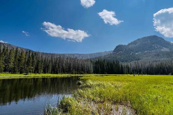
Prickly Pear to Tizer Lakes
Starting from Montana Highway 282, you will take the bend onto Tizer Lake Road, which leads to Prickly Pear Road. Prickly Pear Road goes through private land, but there is a designated route to access Tizer Lake. A compressor or other method to air tires up or down is recommended since the majority ...
Learn more about Prickly Pear to Tizer Lakes
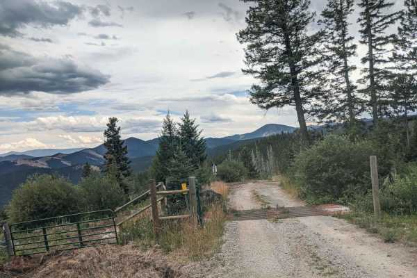
Microwave
Beautiful road with amazing views to enjoy, there isn't much for camping, there is camp at top of the road, big cell or power towers at top? Spotty cell phone service. Offers skiing trail in winter. Dirt or rocky road, typically unmaintained after rain or snow. You may encounter shallow water crossi...
Learn more about Microwave
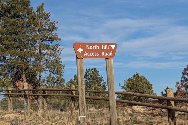
North Hills Recreation Area
The North Hills Recreation Area trail is a scenic, beginner-friendly route near Helena, Montana, offering gorgeous panoramic views of the surrounding valley and the distant Garnet Range. Stretching approximately 2.6 miles, this unpaved dirt road climbs gently to a maximum elevation of 4,658 feet fro...
Learn more about North Hills Recreation Area
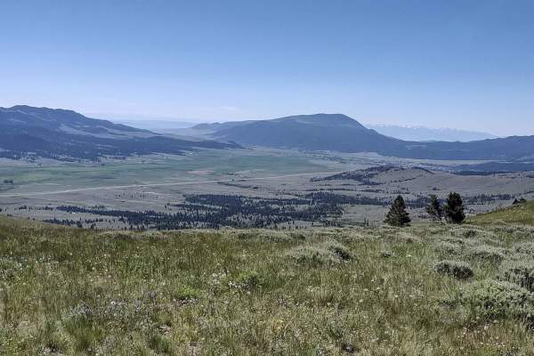
Wood Chute to Blue Bird Mine
Wood Chute to Blue Bird Mine is a scenic and moderately challenging seven-mile trail near Wickes, Montana, perfect for four-wheel-drive vehicles, OHVs, and SxSs looking to explore historic mining country while tackling fun elevation changes. Starting near the historic Wickes Tunnel, this route climb...
Learn more about Wood Chute to Blue Bird Mine
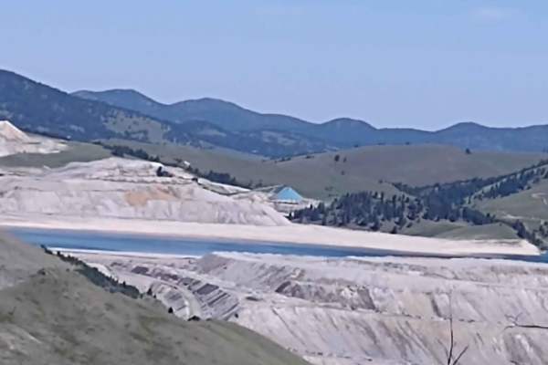
Mina Gulch Spur
This Mina Gulch Spur takes you from the Bluebird Mine Loop past the Mina Mine and to an overlook of the lake on Montana Tunnels Mining. It's just under a mile, and your elevation is about 6600 feet. All private property crossings are allowed if you stay on the trail. The scenery is beautiful. The vi...
Learn more about Mina Gulch Spur
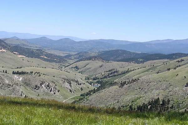
Clancy Creek Road
Clancy Creek Road takes you from Mina Gulch/Between Gulch west a little further into the Helena National Forest. If you follow it further than our track, you pass the Crawley Camp Mine and get an overlook of the lake at Montana Tunnels Mining. All private property crossings are allowed if you stay o...
Learn more about Clancy Creek Road
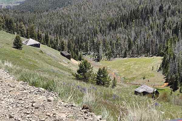
Bluebird Mine Trail Loop
This 2-mile loop connects the Bluebird Mine Trail to Between Gulch Trail and Flynn Gulch Road. It travels through the Helena National Forest at an average elevation of 6500 feet. All private property crossings are allowed if you stay on the trail. The scenery is beautiful. The views are amazing. Th...
Learn more about Bluebird Mine Trail Loop
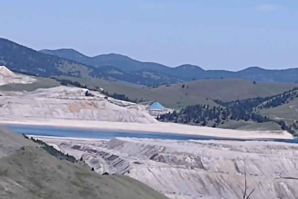
Bluebird Mine Road
This 1.68-mile trail takes you from Bluebird Mine Loop to Wood Chute Cr to Bluebird Mine Trail. All private property crossings are allowed if you stay on the trail. The scenery is beautiful. The views are amazing. This forest is home to deer, elk, and bears. If you are here in the early springtime, ...
Learn more about Bluebird Mine Road
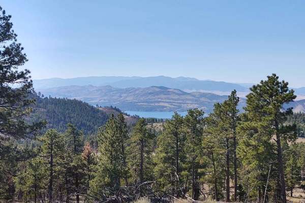
Nelson Road
Nelson Road offers a scenic and highly accessible offroad driving experience near Helena, Montana, making it perfect for beginners, families, and anyone hoping to spot local wildlife in a healthy, well-maintained forest. Spanning approximately 5.7 miles, this route climbs from an elevation of 3,983 ...
Learn more about Nelson Road
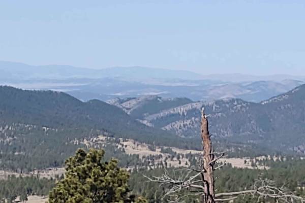
Oregon Gulch
This 5-mile trail connects Kingsbury Spur Trail to York Gulch Trail. You gain almost 2,000 feet in elevation, rising to 6,329 feet at the highest point. The scenery is spectacular, the forest is healthy and well-maintained, and the wildlife includes deer, elk, moose, and bears. All private property ...
Learn more about Oregon Gulch
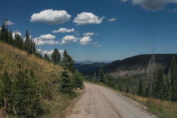
Minnehaha
You will enjoy this road with its amazing views. There are a few spots that look like they would be good for camping. Road can be muddy when wet, with some water puddles. One section of this road is steep, and can be slippery when wet.Dirt or rocky road, typically unmaintained after rain or snow. Yo...
Learn more about Minnehaha
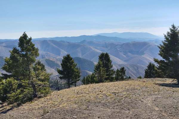
Owl Gulch Loop
This 3-mile loop connects the Favorite Gulch Trail via Owl Gulch to the Pipeline Trail and Pipeline Loop. Private property crossings are allowed if you stay on the trail. The scenery is spectacular, the forest is healthy and well-maintained, and the wildlife includes deer, elk, moose, and bears. You...
Learn more about Owl Gulch Loop
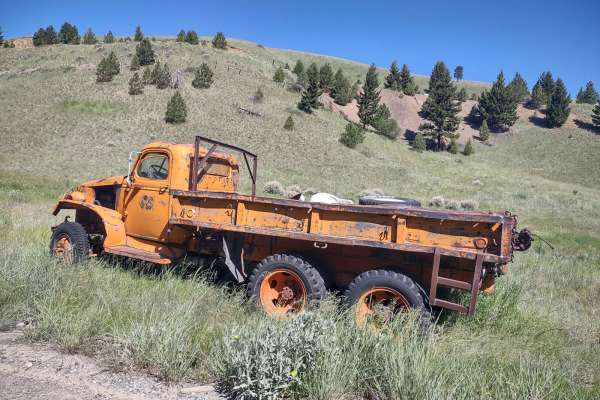
Wickes Road
Wickes Road is an excellent scenic mountain bypass for four-wheel-drive vehicles, SxSs, and dirt bikes looking to traverse between the historic mining towns of Basin and Corbin, Montana, while enjoying sweeping high-altitude views. Spanning approximately 3 miles, this trail climbs up and over the mo...
Learn more about Wickes Road
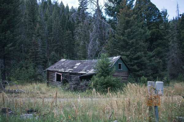
Telegraph
Telegraph is a scenic out-and-back trail in the Boulder Mountains of Montana, perfect for beginners and drivers looking for beautiful mountain views and quiet dispersed camping. Spanning 9.9 miles, the route climbs from an elevation of 5,287 feet to a peak of 7,029 feet, offering an elevation gain o...
Learn more about Telegraph
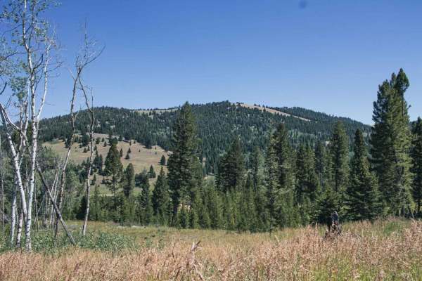
Treasure Mountain
This road has beautiful views, there seems to be no camping, it does ends at a gate, but open is to motorized under 50inchs wide, as well as bike, and hiking.Dirt or rocky road with gentle grades. Safe for most 4WD and high-clearance 2WD vehicles. Roads are typically two vehicles wide.
Learn more about Treasure Mountain
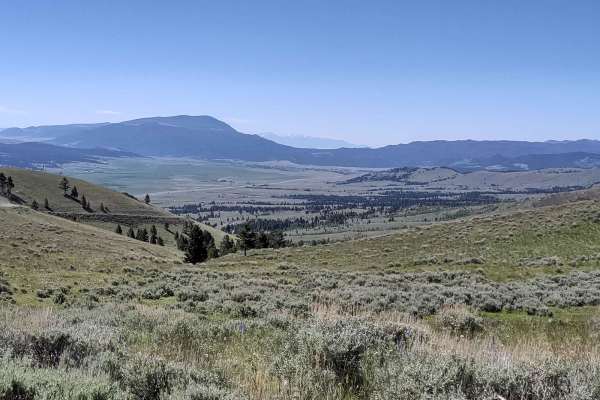
Comet/Mount Thompson Loop
This 3-mile track loops off of the Wickes Tunnel: Basin to Corbin Trail on the Comet/Mount Thompson Trail, and then comes back to Wickes Tunnel: Basin to Corbin Trail on Mount Thompson Spur. You're in the Deerlodge National Forest at an elevation of approximately 7150 feet. There is some downed tim...
Learn more about Comet/Mount Thompson Loop
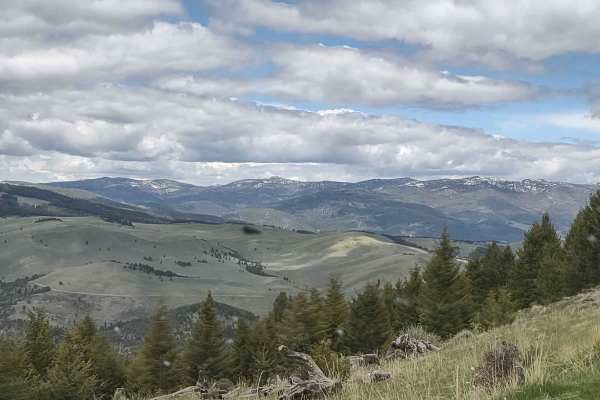
Badger Creek
Badger Creek is an easy, scenic point-to-point trail in the Elkhorn Mountains of the Helena National Forest, perfect for beginners and those seeking stunning mountain vistas, historical remnants, and abundant wildlife. Extending just under 3 miles, this route connects Indian Creek Road Trail on its ...
Learn more about Badger Creek
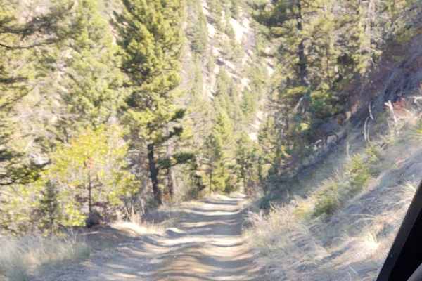
York Gulch
The York Gulch Trail connects York Road to Hedges Mountain, Oregon Gulch, Kingsberry Spur, and the Magpie Creek to Avalanche Creek Trails. You go from 3900 feet to just over 6200 feet in the Helena National Forest. The scenery is spectacular, the forest is healthy and well-maintained, and the wildli...
Learn more about York Gulch

Little Blackfoot
Little Blackfoot is an easy, scenic dirt and gravel route perfect for beginner offroaders, families, and those seeking access to pristine Montana backcountry camping and trailheads. Stretching approximately 12.8 miles near Elliston, Montana, the route begins off Highway 12 as a paved road for the fi...
Learn more about Little Blackfoot
Beginner ATV trails near South Hills, Montana
Explore ATV-friendly trails near you. These trails are accessible for vehicles up to 50 inches wide, perfect for ATVs and smaller off-road machines.
Birdseye-Mullan Road
This exciting trail generally follows the railroad route over the Continental Divide. Fans of train watching have six railroad crossings, a trestle bridge and multiple miles of track in view from the trail. Keep an eye out for one of the many freight or coal trains that pass along this route daily. ...
Learn more about Birdseye-Mullan Road
Prickly Pear to Tizer Lakes
Starting from Montana Highway 282, you will take the bend onto Tizer Lake Road, which leads to Prickly Pear Road. Prickly Pear Road goes through private land, but there is a designated route to access Tizer Lake. A compressor or other method to air tires up or down is recommended since the majority ...
Learn more about Prickly Pear to Tizer Lakes
Microwave
Beautiful road with amazing views to enjoy, there isn't much for camping, there is camp at top of the road, big cell or power towers at top? Spotty cell phone service. Offers skiing trail in winter. Dirt or rocky road, typically unmaintained after rain or snow. You may encounter shallow water crossi...
Learn more about Microwave
North Hills Recreation Area
The North Hills Recreation Area trail is a scenic, beginner-friendly route near Helena, Montana, offering gorgeous panoramic views of the surrounding valley and the distant Garnet Range. Stretching approximately 2.6 miles, this unpaved dirt road climbs gently to a maximum elevation of 4,658 feet fro...
Learn more about North Hills Recreation Area
Beginner UTV/side-by-side trails near South Hills, Montana
Find UTV and side-by-side trails near you. These trails accommodate vehicles up to 60 inches wide, ideal for UTVs, side-by-sides, and wider off-road rigs.
Birdseye-Mullan Road
This exciting trail generally follows the railroad route over the Continental Divide. Fans of train watching have six railroad crossings, a trestle bridge and multiple miles of track in view from the trail. Keep an eye out for one of the many freight or coal trains that pass along this route daily. ...
Learn more about Birdseye-Mullan Road
Prickly Pear to Tizer Lakes
Starting from Montana Highway 282, you will take the bend onto Tizer Lake Road, which leads to Prickly Pear Road. Prickly Pear Road goes through private land, but there is a designated route to access Tizer Lake. A compressor or other method to air tires up or down is recommended since the majority ...
Learn more about Prickly Pear to Tizer Lakes
Microwave
Beautiful road with amazing views to enjoy, there isn't much for camping, there is camp at top of the road, big cell or power towers at top? Spotty cell phone service. Offers skiing trail in winter. Dirt or rocky road, typically unmaintained after rain or snow. You may encounter shallow water crossi...
Learn more about Microwave
North Hills Recreation Area
The North Hills Recreation Area trail is a scenic, beginner-friendly route near Helena, Montana, offering gorgeous panoramic views of the surrounding valley and the distant Garnet Range. Stretching approximately 2.6 miles, this unpaved dirt road climbs gently to a maximum elevation of 4,658 feet fro...
Learn more about North Hills Recreation Area
The onX Offroad Difference
onX Offroad combines trail photos, descriptions, difficulty ratings, width restrictions, seasonality, and more in a user-friendly interface. Available on all devices, with offline access and full compatibility with CarPlay and Android Auto. Discover what you're missing today!
Open Trail Map