
Beginner Off-Road Trails
Near Sierra Vista Southeast, Arizona
Explore All Beginner Trails Near Sierra Vista Southeast, Arizona
Beginner Off-Road Trails Near Sierra Vista Southeast, Arizona
Discover the best beginner-friendly off-road trails near you. These easier, lower-rated trails are a great place to start — browse trail maps, check difficulty ratings, and find your next adventure.
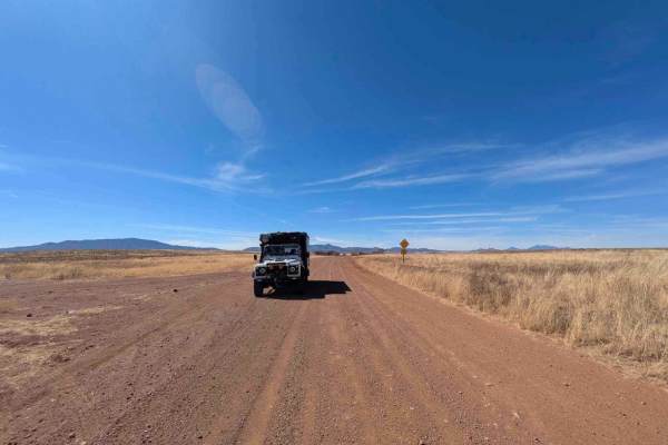
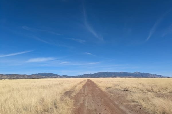
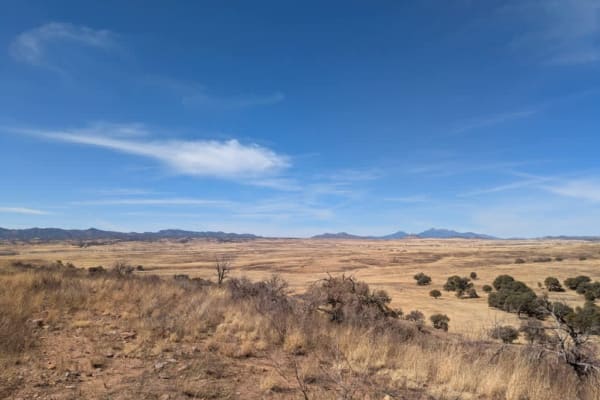
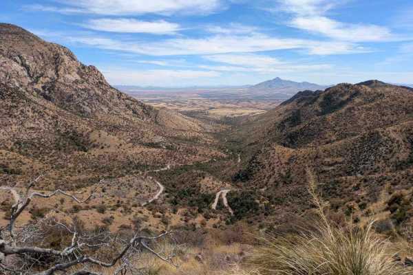
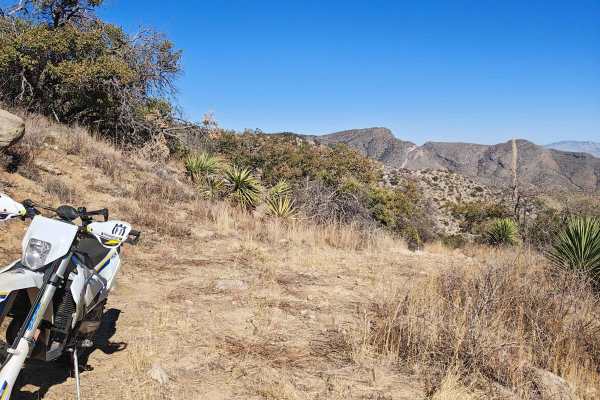
Montezuma Pass
Montezuma Pass is a heavily corrugated service road that provides access to Parker Canyon Lake. The route is a double-lane mountain pass with winding curves and rolling elevation changes, making for a scenic but bumpy drive. On Sundays, the road is a popular destination for motorcyclists looking to ...
Learn more about Montezuma Pass
Sunnyside Canyon
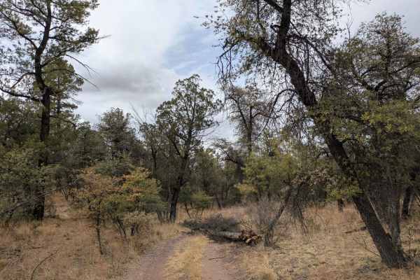
Sunnyside Canyon is a narrow, single-track dirt road with numerous spurs and offshoots that invite exploration. The trail is unmaintained and rocky, stretching long and flat with certain sections that require slow, careful navigation due to rough terrain. Following the boundary of a fenced area, the...
Learn more about Sunnyside Canyon
Sunnyside
The trail winds its way to the Sunnyside Canyon Trailhead along the iconic Arizona Trail, beginning with a rugged, rocky path that gradually softens into a smoother journey. As the trail descends into the valley, a pine forest unfolds, however, after heavy rain, the road may become impassable, as de...
Learn more about Sunnyside
Parker Canyon
Parker Canyon is a rugged off-road trail characterized by rocky and bumpy terrain, though it remains mostly level throughout. The route follows a ridge line, offering dispersed camping opportunities along the way. The trail initially runs alongside a fence line before opening up to stunning panorami...
Learn more about Parker Canyon
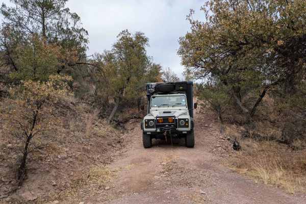
4633A
Trail 4633A is accessed through two gates at the corner of a ranch fence along Trail 4892. Initially, the route is simply rocky and bumpy, but it soon descends into a narrow wash where overgrown trees crowd the path, leading to inevitable pinstriping. The trail shows minimal signs of recent use, and...
Learn more about 4633A
Short Turkey - FR4748
Short Turkey begins at the water tank at the end of Trail 4892 and descends into the canyon along a rocky and heavily eroded single-track route. The trail features multiple off-camber sections and requires careful navigation. Along the way, fresh bear scat and cattle droppings were visible, indicati...
Learn more about Short Turkey - FR4748
Parker Montezuma
Parker Montezuma is a narrow single-track trail that serves as a shortcut from Parker Canyon Trail to Montezuma Pass, winding through open grasslands along the way. The route eventually connects with Parker Canyon Road, which leads to the lake and its nearby campground. The trail has a rugged and re...
Learn more about Parker Montezuma
Parker Road
Parker Road is a scenic single-track trail that connects to Montezuma Pass, which then links up with the Patagonia Loop. As it winds through the landscape, the trail passes by several ranches and navigates a series of washes, featuring gentle ascents and descents along the way. In some areas, the te...
Learn more about Parker Road
Max Tank Road
Max Tank Road branches off to the right from the Patagonia Loop, welcoming travelers with sightings of deer herds near its entrance. The trail winds through open grasslands, where signs of cattle are evident, though few are typically seen along the route. As the journey unfolds, the road splits, req...
Learn more about Max Tank Road
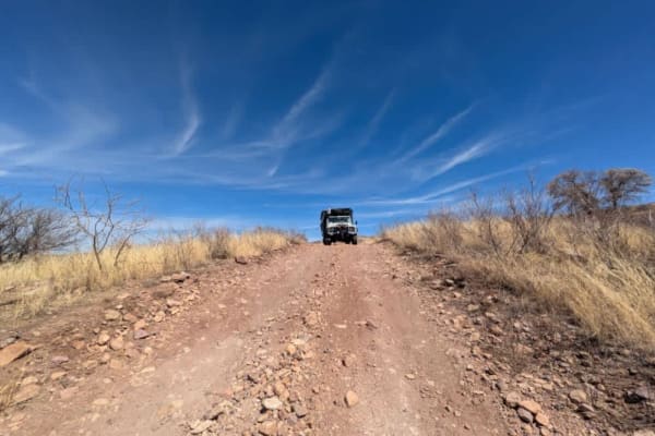
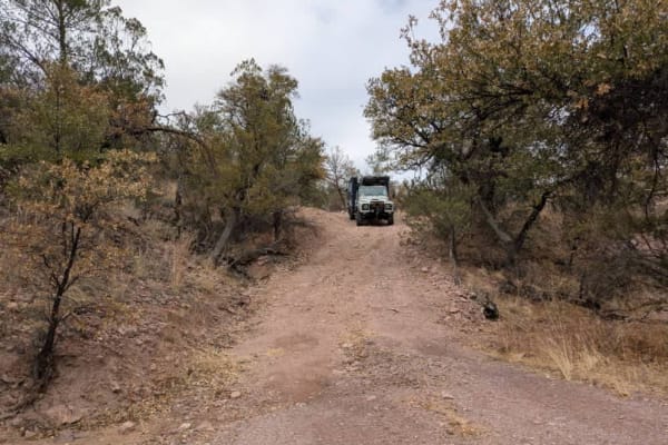
Pauline Ridge - FR4892
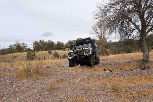
Pauline Ridge begins with a steep, winding, and off-camber entrance, making four-wheel drive preferable for a safe and controlled ascent. Once past this initial climb, the trail levels out and follows a ranch fence along the ridge, offering expansive views of the surrounding landscape. Despite the r...
Learn more about Pauline Ridge - FR4892
Chuparosa Road
Chuparosa is a narrow, rocky, single-track trail that winds through open grasslands, offering a rugged yet scenic off-road experience. As the route follows the ridge, drivers will encounter several gates along the way, adding to the sense of adventure. The trail eventually leads to a steep and rocky...
Learn more about Chuparosa Road
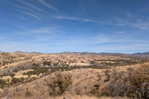
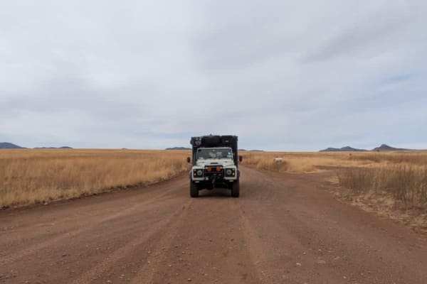
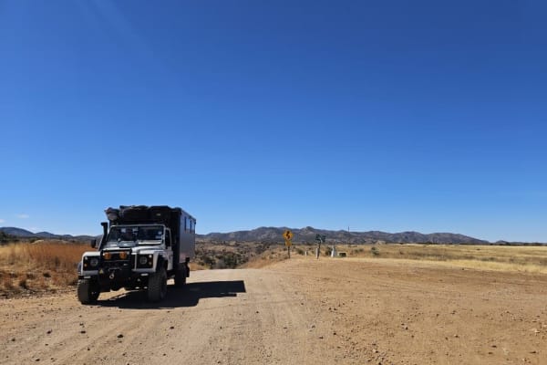
Patagonia Loop
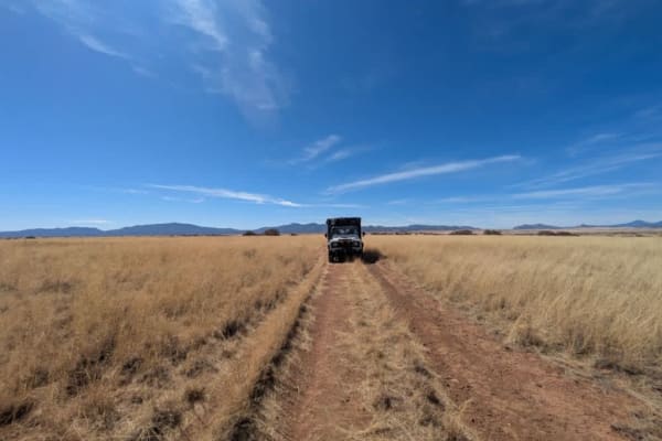
This trail will take you through the Sonoita area's 4,970-foot elevation, featuring high-rolling grasslands surrounded by spectacular mountains and canyons. This region offers some of Arizona's most beautiful weather and landscapes. Mount Wrightson, one of the tallest peaks in Arizona, dominates the...
Learn more about Patagonia Loop
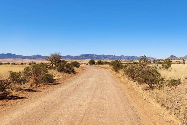
Jones Road - FR766
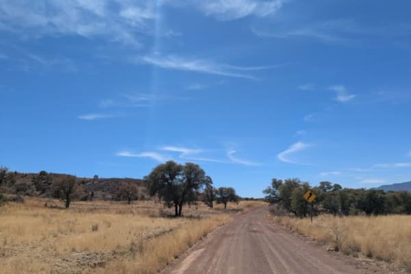
FR 766 is a well-maintained dirt road that winds through the sweeping grass highlands of Coronado National Forest, offering beautiful panoramic views of distant mountain ranges. Along the way, you'll pass a cattle guard crossing and find a few spots suitable for dispersed camping--just be prepared f...
Learn more about Jones Road - FR766
FR4740 Williamson Tank
Williamson Tank Trail is a scenic off-road trail that begins on private land, meandering through rolling grasslands and past a quiet farmstead, where travelers may receive a friendly wave. The trail starts as a single-track route with a mostly smooth surface, though occasional bumps and rocky patche...
Learn more about FR4740 Williamson Tank
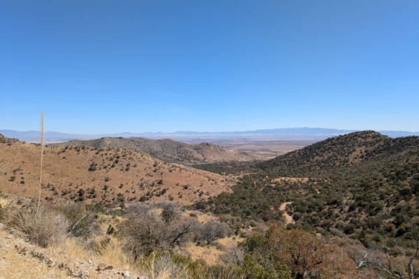
Middlemarch Pass
At the base of Middlemarch Pass lies the popular Slavin Trail, offering numerous dispersed camping spots with sweeping views of Tombstone. The area is known for its scenic beauty, but strong winds can pick up in the afternoon and may return during the night. The trail begins as a wide and relativel...
Learn more about Middlemarch Pass
Washington Montezuma Pass
The Washington Montezuma Pass is a maintained dirt road, though frequent corrugations make for a bumpy ride. Border Patrol vehicles are a common sight along the route, as the trail runs parallel to the border, which is marked by a simple fence. The terrain varies, with rocky sections appearing inter...
Learn more about Washington Montezuma Pass
Mine Road
This trail is comprised of a bunch of different two-track roads. This trail is reasonably fun, but not too difficult. Some of these roads are well maintained, while others are old mining roads that would only be suited for off-road machines, like dirt bikes, Jeeps, or side x side. Most of the other ...
Learn more about Mine Road
North Harshaw Road
North Harshaw Road is a well-traveled double-track route that winds into the upper grasslands, eventually connecting with the Patagonia Loop Trail. The road is generally well-maintained, with a flat and mostly straight path, making it accessible to a variety of vehicles. However, drivers should proc...
Learn more about North Harshaw Road
Apache Tank 214
The Apache Tank Road is a pleasant, easy drive through grassland and undulating hills. The trail drops down from the grassland into a forested area that is prone to flash flooding. There are a number of smaller trails branching off from the main trail, and there are many campsites to choose from, mo...
Learn more about Apache Tank 214
North Harshaw Road
The pavement ends at the junction of South Harshaw Road and North Harshaw Road, and you will cross the first of two streams running across the trail. A broad and well-traveled trail, the North Harshaw trail offers multiple campsites with fire rings, and most campsites are large enough to accommodate...
Learn more about North Harshaw Road
Beginner ATV trails near Sierra Vista Southeast, Arizona
Explore ATV-friendly trails near you. These trails are accessible for vehicles up to 50 inches wide, perfect for ATVs and smaller off-road machines.
Montezuma Pass
Montezuma Pass is a heavily corrugated service road that provides access to Parker Canyon Lake. The route is a double-lane mountain pass with winding curves and rolling elevation changes, making for a scenic but bumpy drive. On Sundays, the road is a popular destination for motorcyclists looking to ...
Learn more about Montezuma Pass
Sunnyside Canyon
Sunnyside Canyon is a narrow, single-track dirt road with numerous spurs and offshoots that invite exploration. The trail is unmaintained and rocky, stretching long and flat with certain sections that require slow, careful navigation due to rough terrain. Following the boundary of a fenced area, the...
Learn more about Sunnyside Canyon
Sunnyside
The trail winds its way to the Sunnyside Canyon Trailhead along the iconic Arizona Trail, beginning with a rugged, rocky path that gradually softens into a smoother journey. As the trail descends into the valley, a pine forest unfolds, however, after heavy rain, the road may become impassable, as de...
Learn more about Sunnyside
Parker Canyon
Parker Canyon is a rugged off-road trail characterized by rocky and bumpy terrain, though it remains mostly level throughout. The route follows a ridge line, offering dispersed camping opportunities along the way. The trail initially runs alongside a fence line before opening up to stunning panorami...
Learn more about Parker Canyon
Beginner UTV/side-by-side trails near Sierra Vista Southeast, Arizona
Find UTV and side-by-side trails near you. These trails accommodate vehicles up to 60 inches wide, ideal for UTVs, side-by-sides, and wider off-road rigs.
Montezuma Pass
Montezuma Pass is a heavily corrugated service road that provides access to Parker Canyon Lake. The route is a double-lane mountain pass with winding curves and rolling elevation changes, making for a scenic but bumpy drive. On Sundays, the road is a popular destination for motorcyclists looking to ...
Learn more about Montezuma Pass
Sunnyside Canyon
Sunnyside Canyon is a narrow, single-track dirt road with numerous spurs and offshoots that invite exploration. The trail is unmaintained and rocky, stretching long and flat with certain sections that require slow, careful navigation due to rough terrain. Following the boundary of a fenced area, the...
Learn more about Sunnyside Canyon
Sunnyside
The trail winds its way to the Sunnyside Canyon Trailhead along the iconic Arizona Trail, beginning with a rugged, rocky path that gradually softens into a smoother journey. As the trail descends into the valley, a pine forest unfolds, however, after heavy rain, the road may become impassable, as de...
Learn more about Sunnyside
Parker Canyon
Parker Canyon is a rugged off-road trail characterized by rocky and bumpy terrain, though it remains mostly level throughout. The route follows a ridge line, offering dispersed camping opportunities along the way. The trail initially runs alongside a fence line before opening up to stunning panorami...
Learn more about Parker Canyon
The onX Offroad Difference
onX Offroad combines trail photos, descriptions, difficulty ratings, width restrictions, seasonality, and more in a user-friendly interface. Available on all devices, with offline access and full compatibility with CarPlay and Android Auto. Discover what you're missing today!
Open Trail Map