
Beginner Off-Road Trails
Near Rock River, Wyoming
Explore All Beginner Trails Near Rock River, Wyoming
Beginner Off-Road Trails Near Rock River, Wyoming
Discover the best beginner-friendly off-road trails near you. These easier, lower-rated trails are a great place to start — browse trail maps, check difficulty ratings, and find your next adventure.
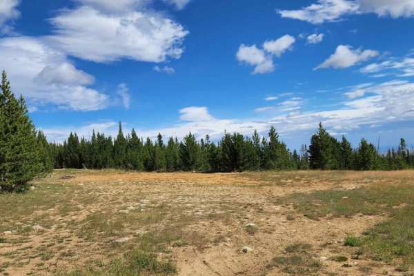
Fallen Pines
You will enjoy this road with its amazing views at the top that sneak out of the trees every now and again. There are a bunch of camping spots at the beginning of the road, enough space for a large group at some. Dirt or rocky road with gentle grades. Safe for most 4WD and high-clearance 2WD vehicle...
Learn more about Fallen Pines
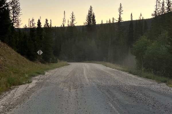
Sand Lake Road - FS 101
This route covers the portion of Forest Service Road 101(Sand Lake Road) from Highway 130 to the Deep Creek Campground. It is a scenic and easy drive through the eastern edge of Wyoming’s Medicine Bow National Forest. This gravel road is mostly two lanes wide and suitable for stock SUVs, passenger v...
Learn more about Sand Lake Road - FS 101
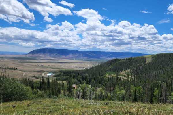
Ehlin Road
You will enjoy this road with its amazing views. There are a few spots that look like they would be good for camping. Road can be muddy when wet, with some water puddles. Dirt or rocky road with gentle grades. Safe for most 4WD and high-clearance 2WD vehicles. Roads are typically two vehicles wide.
Learn more about Ehlin Road
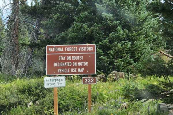
Towner Lake
Towner Lake is an easy, scenic dirt and rock route in Wyoming's Snowy Range that is ideal for beginners and those looking for a quick, visually stunning drive past alpine lakes and vibrant meadows. Spanning approximately 2.8 miles within the Medicine Bow-Routt National Forests, this trail begins jus...
Learn more about Towner Lake

Bear Lake
This popular, fun four-wheeling route leads to Bear Lake in the beautiful Snowy Range. The road begins from Libby Pass near timberline and descends into a subalpine forest where you can spot elk and marmots. The roadbed is typically found with some small puddles and a bumpy surface, but late melting...
Learn more about Bear Lake

USFS Road 307 - Centennial Ridge
Trail winds through a heavily wooded area with fantastic views of the Centennial Ridge down to the flatlands and Sheep Mountain below. Look out for the abandoned mining equipment near the end of the trail. The trail is easy with some mud and ruts year-round but can have ice and deep snow through the...
Learn more about USFS Road 307 - Centennial Ridge
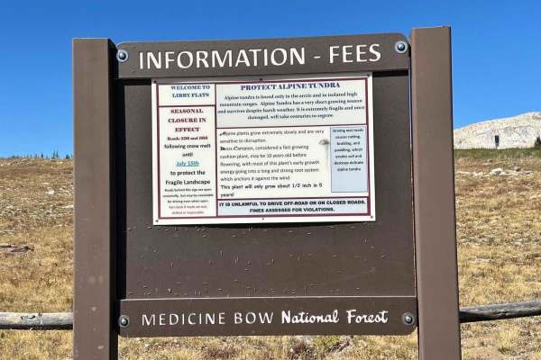
Libby Flats Road 336
Road 336 is one mile off of Road 396 to Bear Lake. A high-clearance vehicle is needed for this trail. A good portion of the trail is covered with rocks. Be prepared for strong winds and changing weather conditions. Highway 130 is only open from late May to late autumn until the snow accumulation get...
Learn more about Libby Flats Road 336
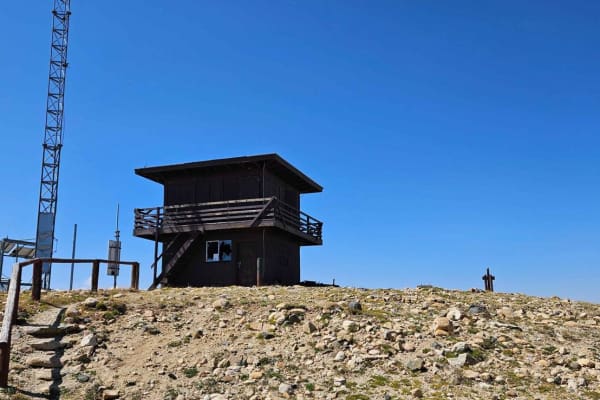
Kennaday Peak
This trail takes you to the top of Kennaday Peak, where you will find a historic fire lookout. The trail starts out as a well-maintained forest service road, a little narrow at the bottom but two-way traffic is possible. As you near the top it does become narrow and very rocky, only allowing one-way...
Learn more about Kennaday Peak
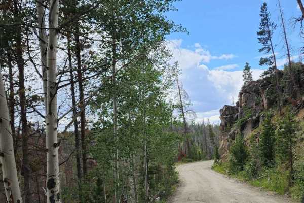
Keystone
Beautiful road with amazing views and tall trees. There isn't much for camping, maybe a spot or two, but it is a quick simple enjoyable road to take a drive on. This road takes you into the small town of Keystone; please drive slowly! Dirt or rocky road with gentle grades. Safe for most 4WD and high...
Learn more about Keystone
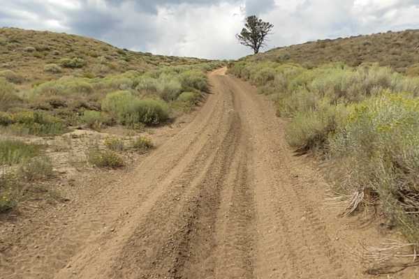
Squaw Ridge Road
Heading from Fox Road (County Road 47), you'll come to the Squaw Ridge Road Trailhead, which is also known as Forest Service Road 311.A. This trail starts off with deep sand ruts, which will get you off camber pretty quickly on the ascent to the top. Once you pass the initial loose sand, the terrain...
Learn more about Squaw Ridge Road
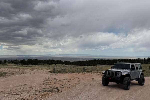
Govt Gully
This is a well-maintained dirt road leading to an amazing viewpoint overlooking the city of Laramie, with the Snowy Range peaks visible in the distance. There are several dispersed camping sites along the way. Do not open any gates at the top of the trail, as this marks the edge of the National Fore...
Learn more about Govt Gully
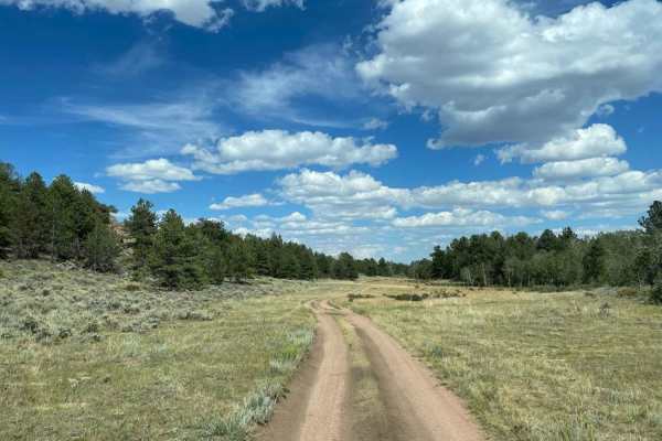
North Ridge Road
This route takes you through the northern area of the Pole Mountain unit of Medicine Bow National Forest between Laramie and Cheyenne and provides access to numerous dispersed campsites. It is a well-graded road consisting of dirt and decomposed granite sand, with numerous bump rocks and water holes...
Learn more about North Ridge Road
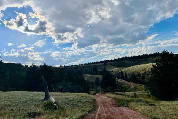
Telephone Extension
Telephone Extension is an engaging connector trail designed for offroaders seeking a scenic, slightly challenging shortcut through the Pole Mountain area of Medicine Bow National Forest. Connecting Happy Jack Road and Eagle Rock Road between Laramie and Cheyenne, this route features rolling terrain ...
Learn more about Telephone Extension
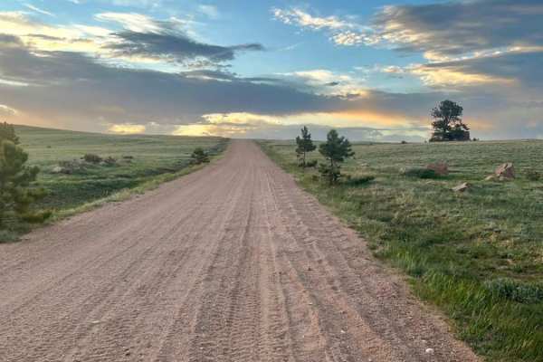
Caretakers
This graded and well-maintained backroad cuts through the Medicine Bow National Forest, just north of HWY 210 and the unique Vedauwoo area. This route offers undulating country roads and provides access to lots of dispersed camping. You'll pass North Crow Creek, which offers amazing views of ranch l...
Learn more about Caretakers
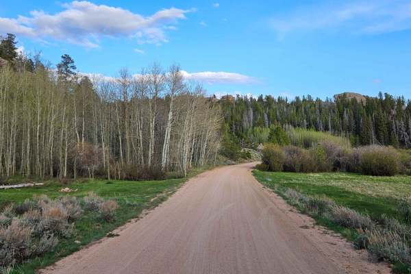
Blair Wallis Road
This is an amazing road that takes you through the heart of Vedauwoo. The trail takes you along a creek through a beautiful valley full of beaver ponds. There is plenty of dispersed camping along the way, as well as some side roads that lead to fun adventures. The road is closed annually starting Fe...
Learn more about Blair Wallis Road
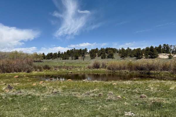
Weir 3 Road
This trail takes you through the northern part of the National Forest, offering a variety of views along the way. The eastern section features a more open landscape, with plenty of chances to spot wildlife. In contrast, the western portion is denser and rockier. At the west end of the trail, the Nor...
Learn more about Weir 3 Road
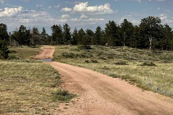
Eagle Rock
This Forest Service backroad cuts through the Medicine Bow National Forest, just north of HWY 210 and the unique Pole Mountain and Vedauwoo areas. This route offers single-lane country roads and provides access to lots of dispersed camping. There are several side tracks that can be driven to hone yo...
Learn more about Eagle Rock
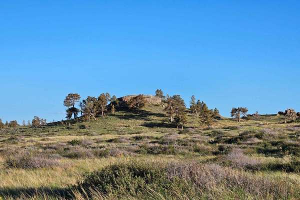
North Beaver Loop
This trail takes you through the north part of Pole Mountain. About halfway through, you will pass by an old uranium mine. It is filled in, but you can still walk around it. The northwest end of the trail has many beaver ponds right along the trail that offer good fishing. There are multiple gates a...
Learn more about North Beaver Loop
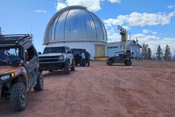
Jelm Mountain
This is a well-maintained road that climbs to a stunning 10,000 feet. The views on the way up are breathtaking. Once at the top, you will find the U.W. Infrared Telescope Observatory, as well as amazing 360-degree views of the valleys and mountains below. There are multiple dispersed camping sites a...
Learn more about Jelm Mountain
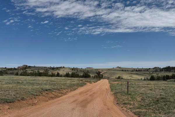
713
Head north on Road 713 to reach the trails that follow the northernmost edge of the National Forest. This is an excellent area for spotting wildlife and taking in expansive open views of the surrounding landscape. There are a few camping spots along the main route, but two spur roads near the beginn...
Learn more about 713
Beginner ATV trails near Rock River, Wyoming
Explore ATV-friendly trails near you. These trails are accessible for vehicles up to 50 inches wide, perfect for ATVs and smaller off-road machines.
Fallen Pines
You will enjoy this road with its amazing views at the top that sneak out of the trees every now and again. There are a bunch of camping spots at the beginning of the road, enough space for a large group at some. Dirt or rocky road with gentle grades. Safe for most 4WD and high-clearance 2WD vehicle...
Learn more about Fallen Pines
Sand Lake Road - FS 101
This route covers the portion of Forest Service Road 101(Sand Lake Road) from Highway 130 to the Deep Creek Campground. It is a scenic and easy drive through the eastern edge of Wyoming’s Medicine Bow National Forest. This gravel road is mostly two lanes wide and suitable for stock SUVs, passenger v...
Learn more about Sand Lake Road - FS 101
Ehlin Road
You will enjoy this road with its amazing views. There are a few spots that look like they would be good for camping. Road can be muddy when wet, with some water puddles. Dirt or rocky road with gentle grades. Safe for most 4WD and high-clearance 2WD vehicles. Roads are typically two vehicles wide.
Learn more about Ehlin Road
Towner Lake
Towner Lake is an easy, scenic dirt and rock route in Wyoming's Snowy Range that is ideal for beginners and those looking for a quick, visually stunning drive past alpine lakes and vibrant meadows. Spanning approximately 2.8 miles within the Medicine Bow-Routt National Forests, this trail begins jus...
Learn more about Towner Lake
Beginner UTV/side-by-side trails near Rock River, Wyoming
Find UTV and side-by-side trails near you. These trails accommodate vehicles up to 60 inches wide, ideal for UTVs, side-by-sides, and wider off-road rigs.
Fallen Pines
You will enjoy this road with its amazing views at the top that sneak out of the trees every now and again. There are a bunch of camping spots at the beginning of the road, enough space for a large group at some. Dirt or rocky road with gentle grades. Safe for most 4WD and high-clearance 2WD vehicle...
Learn more about Fallen Pines
Sand Lake Road - FS 101
This route covers the portion of Forest Service Road 101(Sand Lake Road) from Highway 130 to the Deep Creek Campground. It is a scenic and easy drive through the eastern edge of Wyoming’s Medicine Bow National Forest. This gravel road is mostly two lanes wide and suitable for stock SUVs, passenger v...
Learn more about Sand Lake Road - FS 101
Ehlin Road
You will enjoy this road with its amazing views. There are a few spots that look like they would be good for camping. Road can be muddy when wet, with some water puddles. Dirt or rocky road with gentle grades. Safe for most 4WD and high-clearance 2WD vehicles. Roads are typically two vehicles wide.
Learn more about Ehlin Road
Towner Lake
Towner Lake is an easy, scenic dirt and rock route in Wyoming's Snowy Range that is ideal for beginners and those looking for a quick, visually stunning drive past alpine lakes and vibrant meadows. Spanning approximately 2.8 miles within the Medicine Bow-Routt National Forests, this trail begins jus...
Learn more about Towner Lake
The onX Offroad Difference
onX Offroad combines trail photos, descriptions, difficulty ratings, width restrictions, seasonality, and more in a user-friendly interface. Available on all devices, with offline access and full compatibility with CarPlay and Android Auto. Discover what you're missing today!
Open Trail Map