
Beginner Off-Road Trails
Near Robbinsville, North Carolina
Explore All Beginner Trails Near Robbinsville, North Carolina
Beginner Off-Road Trails Near Robbinsville, North Carolina
Discover the best beginner-friendly off-road trails near you. These easier, lower-rated trails are a great place to start — browse trail maps, check difficulty ratings, and find your next adventure.
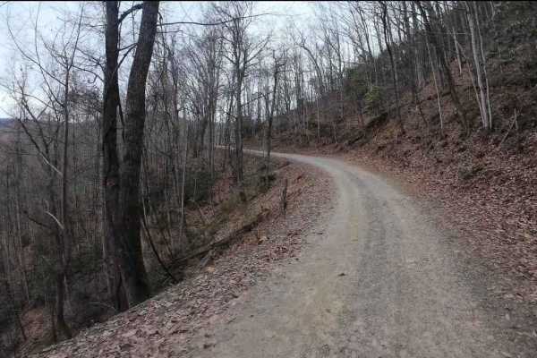
Tatham Gap Road - FS 423
Tatham Gap Road, also known as Forest Service Road 423, is a 7.1-mile long two-way gravel road that connects Andrews, North Carolina, with Robbinsville, North Carolina. Passing through the Nantahala National Forest, Tatham Gap Road also connects with FS423B, which takes travelers to the Joanna Bald ...
Learn more about Tatham Gap Road - FS 423
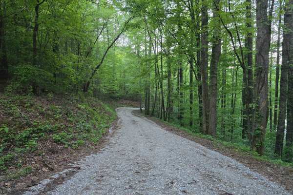
Long Hungry Branch
Long Hungry Branch (FS 2586) is a gravel road that skirts the edge of beautiful Lake Santeetlah in Nantahala National Forest. It features several free designated campsites along the water's edge that can accommodate 1 to 2 vehicles per site. Keep in mind that several of these are "walk-in" camps, so...
Learn more about Long Hungry Branch
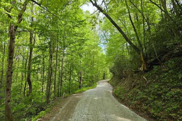
Atoah Gap
Atoah Gap Road - FS 383 is a well-graded, low-difficulty forest service route rated at 1/10, making it accessible for a wide range of vehicles and camping trailers. The road follows the scenic course of Atoah Creek through tranquil forested terrain, offering peaceful surroundings and direct access t...
Learn more about Atoah Gap
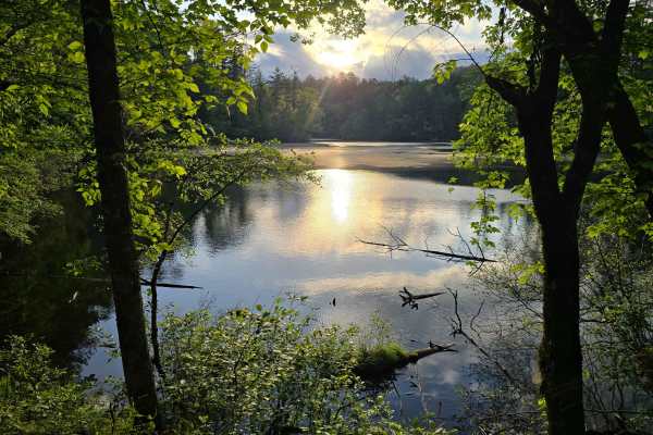
Blue Boar Road
Blue Boar Road (FS 2369) features beautiful views of Lake Santeetlah as it winds around its southern perimeter. At the western end, you'll find the Blue Boar Inn with cozy room and board if you prefer a more civilized experience while exploring the North Carolina mountains. While this is a very easy...
Learn more about Blue Boar Road
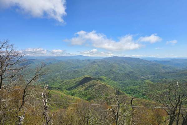
Joanna Tower Road
This 2/10 gravel road - FS 423B climbs steadily to the Joanna Bald Lookout Tower on Teyahalee Bald and offers occasional openings with mountain views along the route. Keep a sharp eye out for the mysterious old stone building on the right shortly after you begin the drive—an interesting historical s...
Learn more about Joanna Tower Road
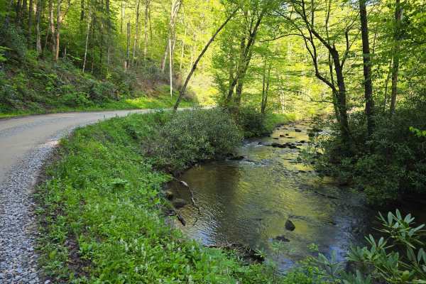
Little Snowbird Road
This 1/10 groomed gravel road runs alongside Little Snowbird Creek and leads to an access road for Nantahala National Forest, making it a great segment for avoiding pavement while getting a taste of Appalachia. While there is no dispersed camping along this route, there is a beautiful HipCamp at its...
Learn more about Little Snowbird Road
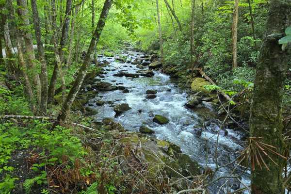
Snowbird Road
Snowbird Road (FS 75) runs alongside the stunning Snowbird Creek and features beautiful views of the stream and plentiful camping options complete with picnic tables, fire rings, and direct access to the water. Bring your fly reels, waders, and hiking boots since there are plenty of activities to ke...
Learn more about Snowbird Road
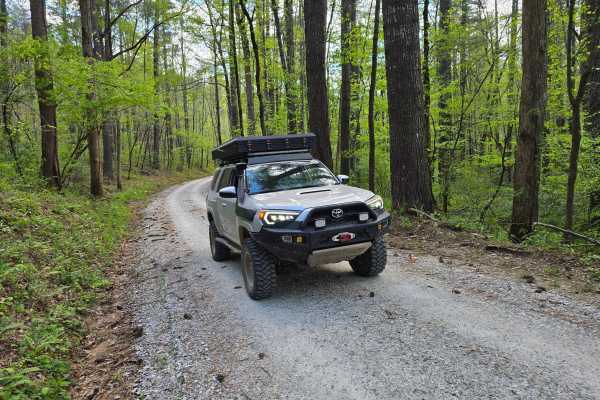
Farley Cove - FS 407
This is a 2/10 primarily gravel route that winds through the mountains alongside Lake Santeetlah with beautiful views peeking through the trees with a few spots granting access to the lake for fishing. It terminates at a wide turnaround alongside a small stream. Please note that there are some small...
Learn more about Farley Cove - FS 407
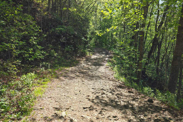
Webb Mill Road
This 2/10 gravel trail, FS 304, has occasional small rocks/dirt sections and traverses the southern side of the Snowbird Mountains. It features views of the valley below peeking through the trees as you meander through the thick canopy. It's highly recommended to bring a chainsaw when you're explori...
Learn more about Webb Mill Road
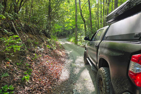
Porterfield Gap Road
This 2/10 gravel road has been recently restored, granting easy access to the Nantahala National Forest. Its narrow and winding length climbs the mountains quickly, so Four Wheel Drive is encouraged to help maintain the integrity of the road. There is a pull-off at its southernmost point, where it c...
Learn more about Porterfield Gap Road
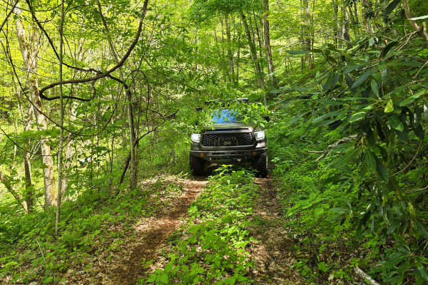
Shell Stand Road
Shell Stand Road - FR 418 is a narrow, low-traffic forest service route rated at 3/10 difficulty, primarily due to encroaching vegetation and tight passages resulting from limited maintenance and low use. Officially open only during March. Toward the end of the route, travelers are rewarded with str...
Learn more about Shell Stand Road
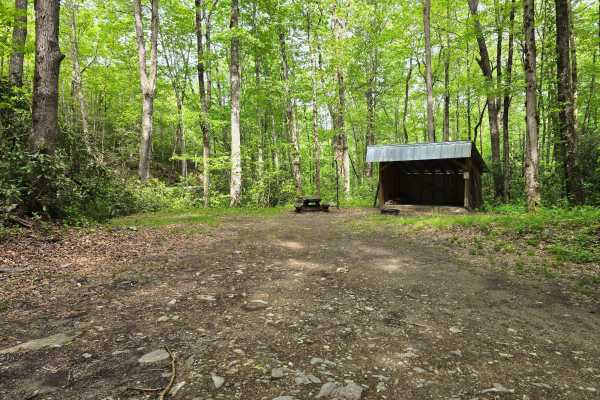
Deep Creek Road
Deep Creek Road - FS 445 is a freshly graded and well-maintained forest road that takes you right to one of the nicest campsites in the region alongside a small stream. The spot comes with a solid wood shed, making it super convenient for longer stays and keeping your firewood dry (it is often fully...
Learn more about Deep Creek Road
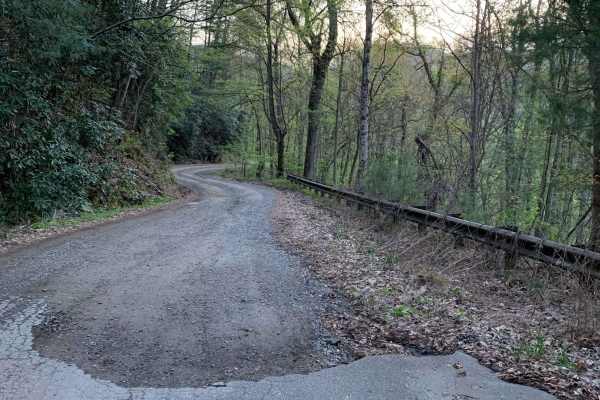
Upper Santeetlah - 81
This is a very easy and maintained gravel road. Safe for most 4WD and high-clearance 2WD vehicles. There are lots of places to camp but you are required to camp in designated areas...we saw some very large campers towards the end of the trail. The road runs next to Santeetlah Creek and there are lot...
Learn more about Upper Santeetlah - 81
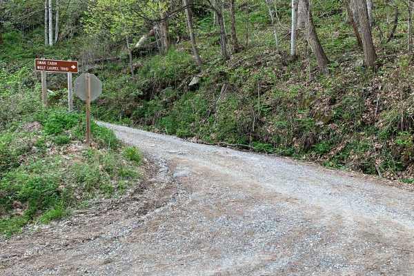
Wolf Laurel - 81F
This trail is not too bad but can be rutted in places and loose gravel on steep grades. The views from this trail are great, especially in the winter when the leaves are off the trees. There is a cabin along the trail called Swan Cabin that can be rented through the recreation.gov website. There are...
Learn more about Wolf Laurel - 81F
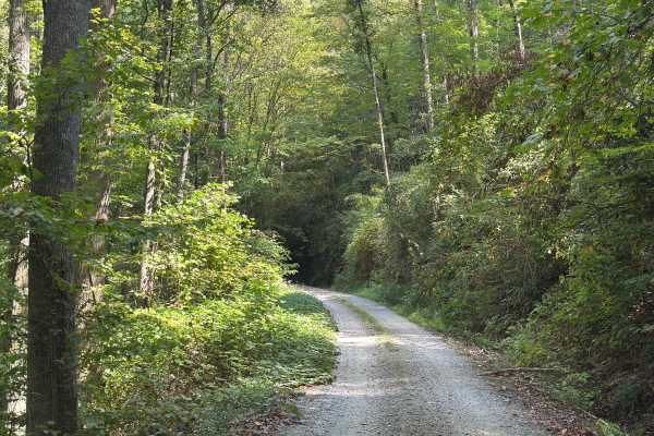
Slickrock Road
Slickrock Road is a gravel route that winds through the Nantahala National Forest. It is primarily one vehicle wide, though there are plenty of areas with room to pass. The road begins at Tapoco Road at an elevation of 1,277 feet and climbs to 3,062 feet over the course of seven miles. At the summit...
Learn more about Slickrock Road
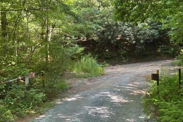
Beachertown (FS 308)
Beachertown (FS 308) is a solid choice for drivers looking for an easy to moderate forest road in Nantahala National Forest that connects two scenic corridors without demanding hardcore equipment. Running between Junaluska Road and Wayah Road in the Nantahala Ranger District, this National Forest Sy...
Learn more about Beachertown (FS 308)
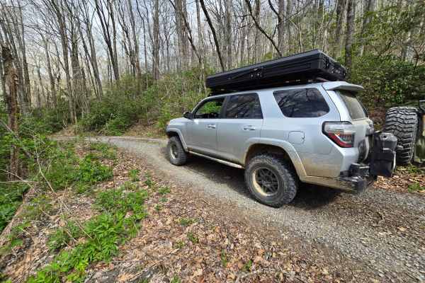
Swan Cabin - FS 807
This is a short spur to the Swan historical cabin which you can reserve for camping through the USFS. Trail is rated a 2/10 only for deep dips built for water control but is otherwise graded and gravel for easy access. This is a worthwhile side-trip to see an impressive two story cabin that has been...
Learn more about Swan Cabin - FS 807
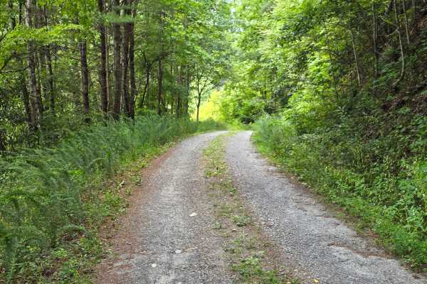
Derreberry Gap - FS 6148
Derreberry Gap Road - FS 6148 is an easy 1/10 gravel road that winds beneath the Appalachian canopy, crossing a couple of small but beautiful creeks along the way. It's a relaxed, shaded drive that dead-ends at a trailhead, so you can leave the truck at the end and continue on foot. This is good opt...
Learn more about Derreberry Gap - FS 6148
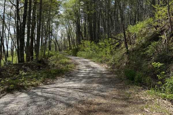
Big Stamp - FS 427
Big Stamp branches off of Long Branch 340C and climbs up to 4300' into the Nantahala National Forest. The first few switchbacks are pretty steep with heavy washboarding and loose gravel, causing an uneven surface. This trail is a single track with very few places to turn around or pass other vehicle...
Learn more about Big Stamp - FS 427
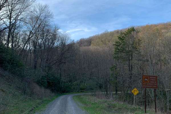
North River Rd to Upper Santeetlah - 81
This trek starts at North River which is a well-maintained gravel road and then transitions to the Upper Santeetlah(81) trail which is less maintained. The Upper Santeetlah is not too bad and can be navigated by 2WD vehicles but you would need to go slow...make note that it is narrow in places. Lots...
Learn more about North River Rd to Upper Santeetlah - 81
Beginner ATV trails near Robbinsville, North Carolina
Explore ATV-friendly trails near you. These trails are accessible for vehicles up to 50 inches wide, perfect for ATVs and smaller off-road machines.
Upper Santeetlah - 81
This is a very easy and maintained gravel road. Safe for most 4WD and high-clearance 2WD vehicles. There are lots of places to camp but you are required to camp in designated areas...we saw some very large campers towards the end of the trail. The road runs next to Santeetlah Creek and there are lot...
Learn more about Upper Santeetlah - 81
Wolf Laurel - 81F
This trail is not too bad but can be rutted in places and loose gravel on steep grades. The views from this trail are great, especially in the winter when the leaves are off the trees. There is a cabin along the trail called Swan Cabin that can be rented through the recreation.gov website. There are...
Learn more about Wolf Laurel - 81F
Slickrock Road
Slickrock Road is a gravel route that winds through the Nantahala National Forest. It is primarily one vehicle wide, though there are plenty of areas with room to pass. The road begins at Tapoco Road at an elevation of 1,277 feet and climbs to 3,062 feet over the course of seven miles. At the summit...
Learn more about Slickrock Road
Big Stamp - FS 427
Big Stamp branches off of Long Branch 340C and climbs up to 4300' into the Nantahala National Forest. The first few switchbacks are pretty steep with heavy washboarding and loose gravel, causing an uneven surface. This trail is a single track with very few places to turn around or pass other vehicle...
Learn more about Big Stamp - FS 427
Beginner UTV/side-by-side trails near Robbinsville, North Carolina
Find UTV and side-by-side trails near you. These trails accommodate vehicles up to 60 inches wide, ideal for UTVs, side-by-sides, and wider off-road rigs.
Tatham Gap Road - FS 423
Tatham Gap Road, also known as Forest Service Road 423, is a 7.1-mile long two-way gravel road that connects Andrews, North Carolina, with Robbinsville, North Carolina. Passing through the Nantahala National Forest, Tatham Gap Road also connects with FS423B, which takes travelers to the Joanna Bald ...
Learn more about Tatham Gap Road - FS 423
Upper Santeetlah - 81
This is a very easy and maintained gravel road. Safe for most 4WD and high-clearance 2WD vehicles. There are lots of places to camp but you are required to camp in designated areas...we saw some very large campers towards the end of the trail. The road runs next to Santeetlah Creek and there are lot...
Learn more about Upper Santeetlah - 81
Wolf Laurel - 81F
This trail is not too bad but can be rutted in places and loose gravel on steep grades. The views from this trail are great, especially in the winter when the leaves are off the trees. There is a cabin along the trail called Swan Cabin that can be rented through the recreation.gov website. There are...
Learn more about Wolf Laurel - 81F
Slickrock Road
Slickrock Road is a gravel route that winds through the Nantahala National Forest. It is primarily one vehicle wide, though there are plenty of areas with room to pass. The road begins at Tapoco Road at an elevation of 1,277 feet and climbs to 3,062 feet over the course of seven miles. At the summit...
Learn more about Slickrock Road
The onX Offroad Difference
onX Offroad combines trail photos, descriptions, difficulty ratings, width restrictions, seasonality, and more in a user-friendly interface. Available on all devices, with offline access and full compatibility with CarPlay and Android Auto. Discover what you're missing today!
Open Trail Map