
Beginner Off-Road Trails
Near Richvale, California
Explore All Beginner Trails Near Richvale, California
Beginner Off-Road Trails Near Richvale, California
Discover the best beginner-friendly off-road trails near you. These easier, lower-rated trails are a great place to start — browse trail maps, check difficulty ratings, and find your next adventure.
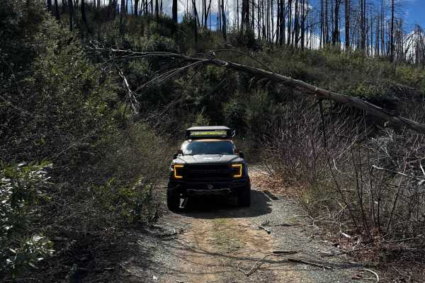
Martin Creek
This trail follows an easy ridge route with scenic views into the valley at several points. A wildfire in 2024 left areas with downed trees after storms, and a few small wash sections are present but remain easy to navigate without four-wheel drive.
Learn more about Martin Creek
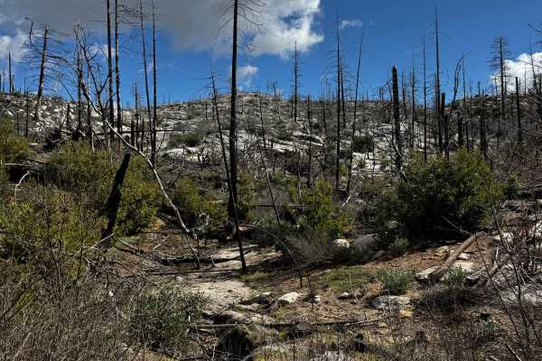
Cross Up
Easy flat gravel trail taking you around the back side of Little Bald Rock. A couple of areas to turn out and hike up. Ended at a closed gate. There was a big fire in 2024, so they are still clearing trees, but they are keeping the trail maintained. There is another trail at the end by the gate, but...
Learn more about Cross Up
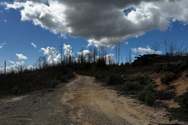
Madrone
Single wide trail with multiple turnouts and areas to pass. There were a couple of areas to disperse camp. A couple of small washes, but easy to navigate, and some good views of the valley down the ridge. Trail continues on the north side passing Galen Ridge Road, but seems deliberately blocked off ...
Learn more about Madrone
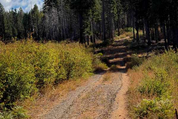
Magee Ridge
This is a short ATV trail in a remote and primitive section of the Plumas National Forest, accessed off of Four Trees Road. This area was damaged from a large fire in recent years. The entrance to this trail is not marked with a vehicle designation, and it is wide like a road, so it has probably had...
Learn more about Magee Ridge
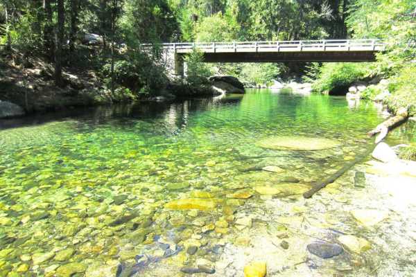
Sly Creek Trail
This trail is rated as a Level 1 difficulty. It offers a relatively easy experience, characterized by a flat, well-maintained road predominantly composed of gravel and dirt. However, it should be noted that during winter, the trail may become muddy, slippery, and snow-covered. Accessible from Laport...
Learn more about Sly Creek Trail
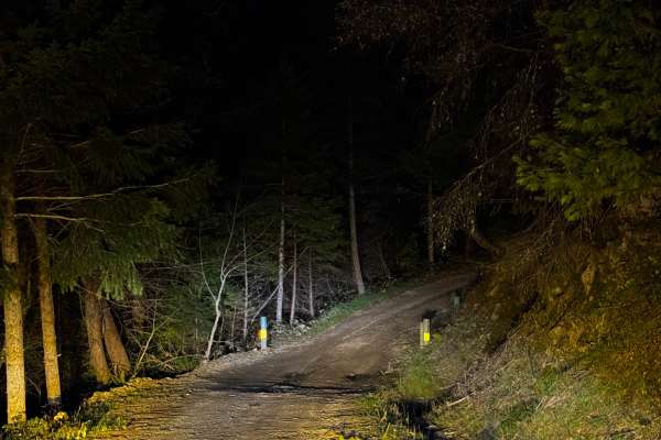
Indian Creek
The trail is a wide single-wide path that meanders alongside a creek for a portion of its length. Along the creek’s edge, there are several dispersed camping sites. There’s even an area beyond the end of the marked trail where you can disperse camp, but the trail ends slightly prematurely. If you co...
Learn more about Indian Creek
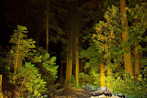
Indian Hill South
This trail is a wide, single-wide path that has been freshly cleared. There are a few dispersed camp areas along the trail. Along the way, you’ll encounter a few washes and drainage ditches. Additionally, the trail takes you through some tall, magnificent trees. Watch out for logging trucks; there a...
Learn more about Indian Hill South
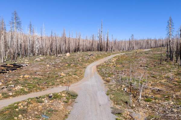
Humbug Summit Road 31
This long main route takes you from the High Lakes area to Lake Almanor. It crosses through a big burned section from the Dixie Fire. There are dozens of trails off this main one and many places to disperse camp. There are a good number of washes and ruts, but you can pick a line to make them easy.
Learn more about Humbug Summit Road 31
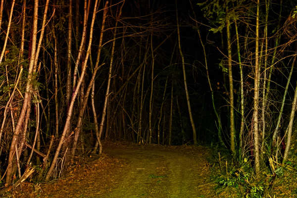
Upper Indian Creek
The trail is wider, and most of the way, it can accommodate two vehicles. The west end is still single-wide and narrow, but they are clearing the trail. There are some washouts that are about a foot deep, and there are also deep water drains. There are many blind turns, so watch your speed.
Learn more about Upper Indian Creek
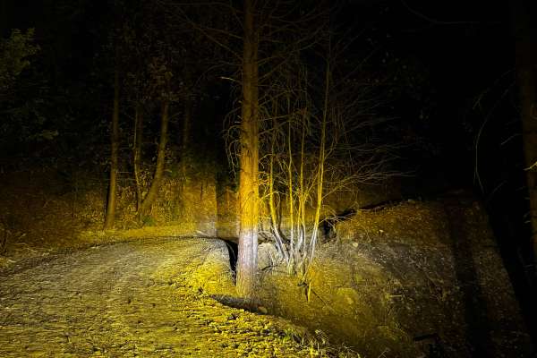
Indian Creek Connector
This new trail connects Indian Creek to Upper Indian Creek, replacing the decommissioned old trail. It’s relatively easy to navigate, but be cautious of the deep drainage cuts, as they can be rough. The trail climbs abruptly from Indian Creek to Upper Indian Creek, be cautious in wet weather.
Learn more about Indian Creek Connector
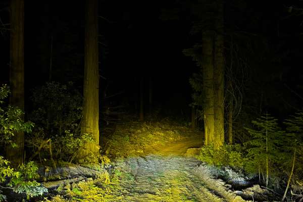
Ditch Road
This wide, single-wide trail is freshly cleared and offers a scenic journey through tall, beautiful trees. There is a small, tight area where you may touch overgrown brush. Along the trail, there are several dispersed camping spots. There are also a few smaller washes and drainage ditches to cross. ...
Learn more about Ditch Road
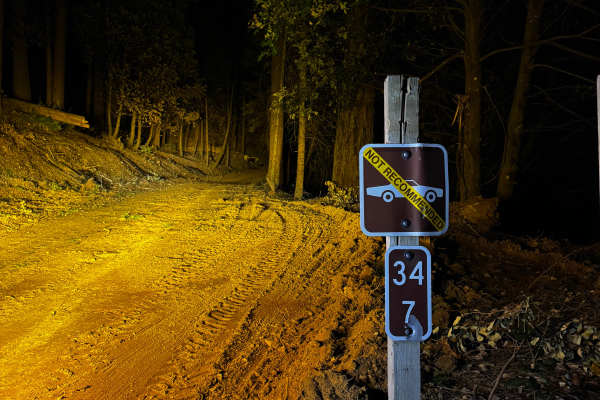
Skinner
The trail varies in width, from single to double, and is freshly cleared. There’s a sign advising against cars driving on the trail. There are drainage ditches and a couple of small washes, each less than 8 inches deep. Depending on the direction, you’ll either climb or descend the west end, and it ...
Learn more about Skinner
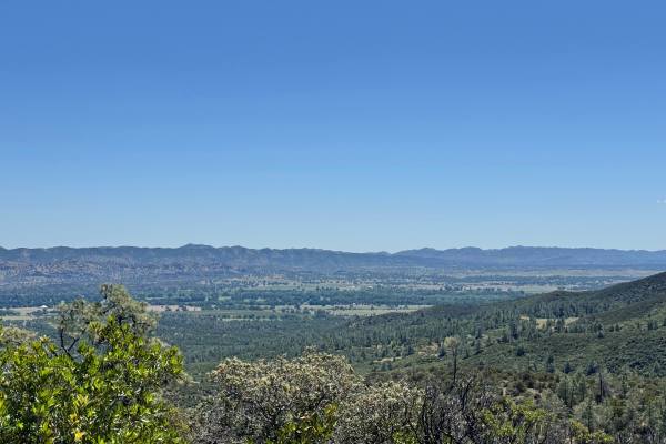
Open Ridge Black Diamond East - FS 18N02
This trail can be accessed by Main Road 306. It goes through private property for a short bit and a water crossing before reaching national forest land. There are many ruts throughout the trail due to water flow and some dips. The trail is nice and easy otherwise. There are beautiful views along the...
Learn more about Open Ridge Black Diamond East - FS 18N02
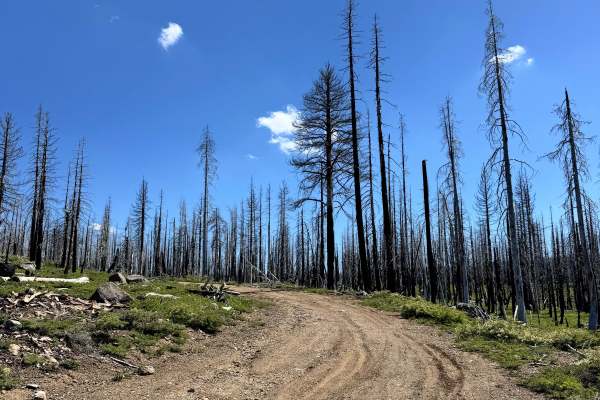
Cirby Tie - FS 26N33
This trail goes through a section of the forest that has been previously burned. The trail consists of dirt with a little bit of gravel and baseball and softball-sized rocks. There are some ruts and washes along the trail. A few miles into the trail, there were a few fallen dead trees over the trail...
Learn more about Cirby Tie - FS 26N33
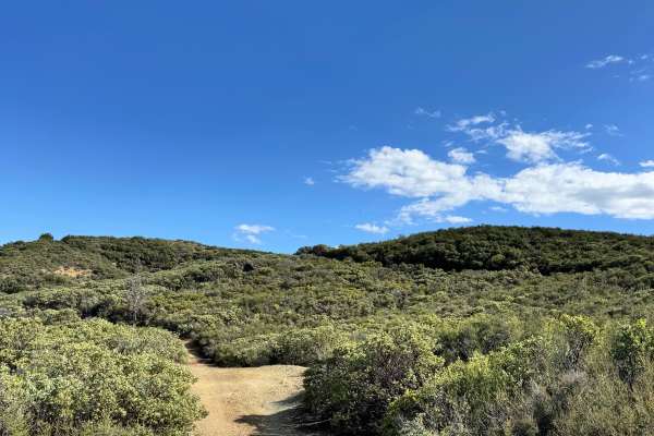
Black Diamond - FS 18N30
This trail has a spot to camp shortly after getting on the trail with a great view. There is a steep hill that a hitch will drag on, not far from the entrance, and some ruts and washes along the trail. Where the trail ends, there is only a very steep hill, nothing else indicating the end of the trai...
Learn more about Black Diamond - FS 18N30
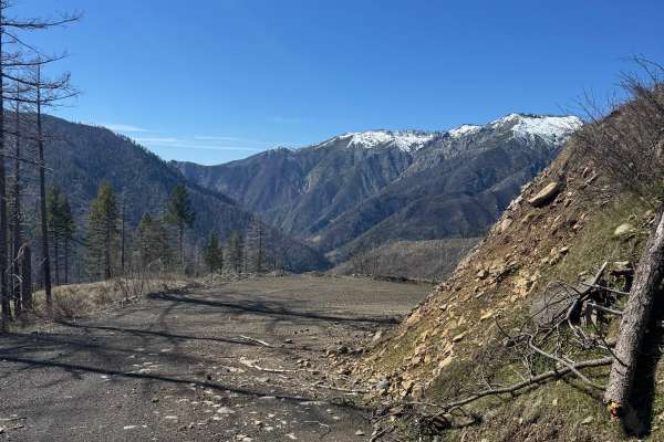
Belden-Longville
This is an Out-and-Back spur trail that ends in a big flat open area perfect for dispersed camping. There is another small spur at the end for more dispersed camping. The trail ends at a gate since that leads to a PG&E site. Lots of big views on this trail and at the end for camp, but it is not shad...
Learn more about Belden-Longville
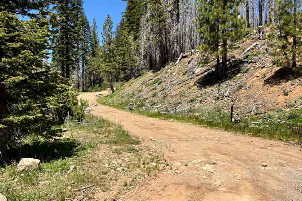
Scotts John North - FS 26N11
This trail is a mix of dirt with some rocks in it as well. There is a creek that runs parallel for a large portion of the trail. It is surrounded by beautiful green forest with some dead fallen trees within it as well. There are some sections of the trail that have trees that stick out a little into...
Learn more about Scotts John North - FS 26N11
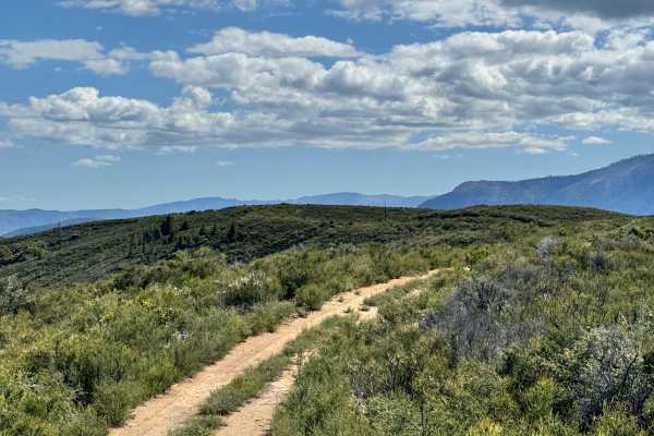
Brushy Ridge - 19N29
This slightly over 2-mile trail definitely lives up to its name. While it remains a two-track route, thick brush crowds the trail in several sections, making for a tight squeeze at times. There are also a few small washes along the edges of the trail, so some caution is recommended.
The route offer...
Learn more about Brushy Ridge - 19N29
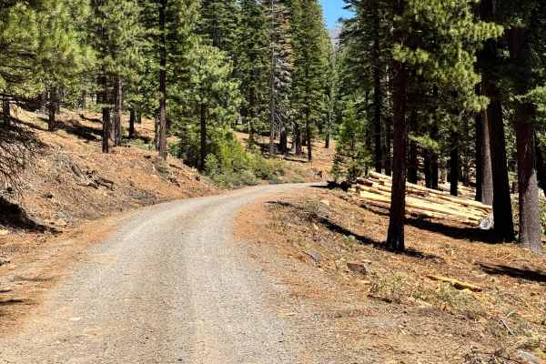
Scotts John - FS 26N27
This trail is mostly made up of gravel and dirt with some rocks here and there. This trail is like a fire road, but there are some small ruts/washes along the trail as well. The trail is really cool, as it winds through the mountain. It has great views of the surrounding mountains, and there is a ni...
Learn more about Scotts John - FS 26N27
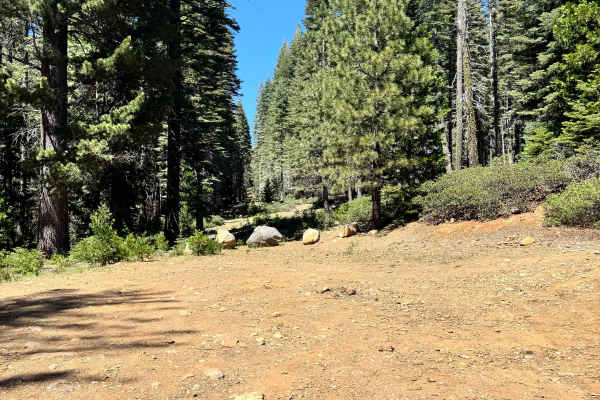
Willow Creek - FS 26N07
This is a short spur trail that has a large camp spot at the end of it that can fit multiple vehicles. This is an easy trail, no washes or ruts. There is a rust-resistant sugar pine with signs to protect it for reforestation efforts. This is a beautiful trail and a camp in dense forest.
Learn more about Willow Creek - FS 26N07
Beginner ATV trails near Richvale, California
Explore ATV-friendly trails near you. These trails are accessible for vehicles up to 50 inches wide, perfect for ATVs and smaller off-road machines.
Magee Ridge
This is a short ATV trail in a remote and primitive section of the Plumas National Forest, accessed off of Four Trees Road. This area was damaged from a large fire in recent years. The entrance to this trail is not marked with a vehicle designation, and it is wide like a road, so it has probably had...
Learn more about Magee Ridge
Sly Creek Trail
This trail is rated as a Level 1 difficulty. It offers a relatively easy experience, characterized by a flat, well-maintained road predominantly composed of gravel and dirt. However, it should be noted that during winter, the trail may become muddy, slippery, and snow-covered. Accessible from Laport...
Learn more about Sly Creek Trail
Open Ridge Black Diamond East - FS 18N02
This trail can be accessed by Main Road 306. It goes through private property for a short bit and a water crossing before reaching national forest land. There are many ruts throughout the trail due to water flow and some dips. The trail is nice and easy otherwise. There are beautiful views along the...
Learn more about Open Ridge Black Diamond East - FS 18N02
Cirby Tie - FS 26N33
This trail goes through a section of the forest that has been previously burned. The trail consists of dirt with a little bit of gravel and baseball and softball-sized rocks. There are some ruts and washes along the trail. A few miles into the trail, there were a few fallen dead trees over the trail...
Learn more about Cirby Tie - FS 26N33
Beginner UTV/side-by-side trails near Richvale, California
Find UTV and side-by-side trails near you. These trails accommodate vehicles up to 60 inches wide, ideal for UTVs, side-by-sides, and wider off-road rigs.
Sly Creek Trail
This trail is rated as a Level 1 difficulty. It offers a relatively easy experience, characterized by a flat, well-maintained road predominantly composed of gravel and dirt. However, it should be noted that during winter, the trail may become muddy, slippery, and snow-covered. Accessible from Laport...
Learn more about Sly Creek Trail
Open Ridge Black Diamond East - FS 18N02
This trail can be accessed by Main Road 306. It goes through private property for a short bit and a water crossing before reaching national forest land. There are many ruts throughout the trail due to water flow and some dips. The trail is nice and easy otherwise. There are beautiful views along the...
Learn more about Open Ridge Black Diamond East - FS 18N02
Cirby Tie - FS 26N33
This trail goes through a section of the forest that has been previously burned. The trail consists of dirt with a little bit of gravel and baseball and softball-sized rocks. There are some ruts and washes along the trail. A few miles into the trail, there were a few fallen dead trees over the trail...
Learn more about Cirby Tie - FS 26N33
Black Diamond - FS 18N30
This trail has a spot to camp shortly after getting on the trail with a great view. There is a steep hill that a hitch will drag on, not far from the entrance, and some ruts and washes along the trail. Where the trail ends, there is only a very steep hill, nothing else indicating the end of the trai...
Learn more about Black Diamond - FS 18N30
The onX Offroad Difference
onX Offroad combines trail photos, descriptions, difficulty ratings, width restrictions, seasonality, and more in a user-friendly interface. Available on all devices, with offline access and full compatibility with CarPlay and Android Auto. Discover what you're missing today!
Open Trail Map