
Beginner Off-Road Trails
Near Quartzsite, Arizona
Explore All Beginner Trails Near Quartzsite, Arizona
Beginner Off-Road Trails Near Quartzsite, Arizona
Discover the best beginner-friendly off-road trails near you. These easier, lower-rated trails are a great place to start — browse trail maps, check difficulty ratings, and find your next adventure.
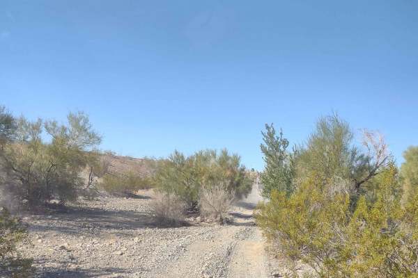
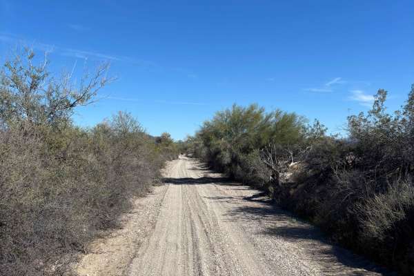
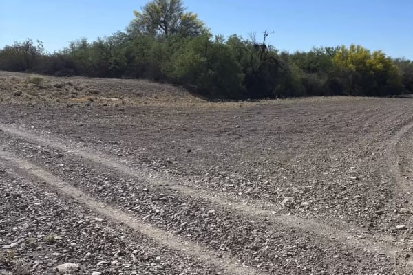
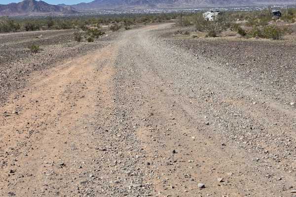
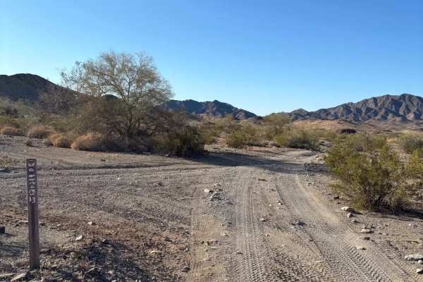
LP227
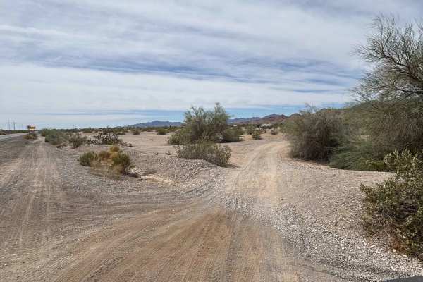
This easy two-track, rock trail can be started from either the Dome Rock BLM camping area or the Desert Gardens showgrounds. It leads you to the Tyson Wash cabin and Joseph Cone's cabin. A relatively flat road with no real obstacles, there are some off-camber areas and several small washes to cross....
Learn more about LP227
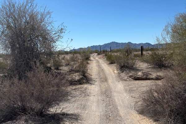
Granite Mountain Loop
This 6.75-mile trail loops around Granite Mountain, which is just south of Quartzsite. It takes you right by Joseph Cone's Stone Cabin. The track is on BLM public lands. The wildlife possibilities include bighorn sheep, wild donkeys, burros, wild horses, quail, and roadrunners, although this close t...
Learn more about Granite Mountain Loop

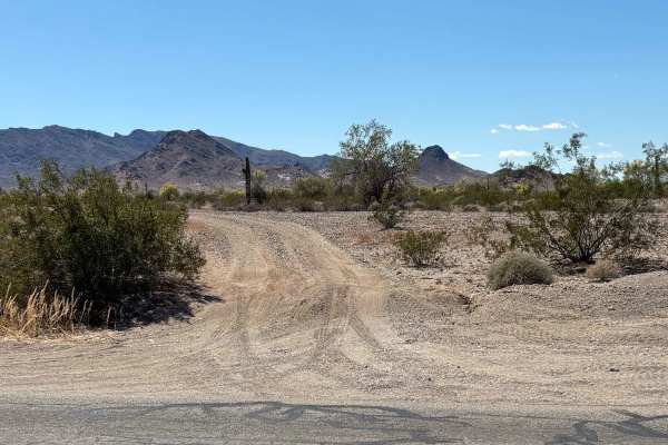
Granite Mountain Loop Connector
This is a great way to get from the Dome Rock DNR camping area to the Tyson Wells area without hitting the pavement. It is an easy trail with a decent surface. There are several washes to cross, nothing too difficult. It passes between Q Mountain and the Old Quartzsite Mine #2.
Learn more about Granite Mountain Loop Connector
Old Yuma Road North
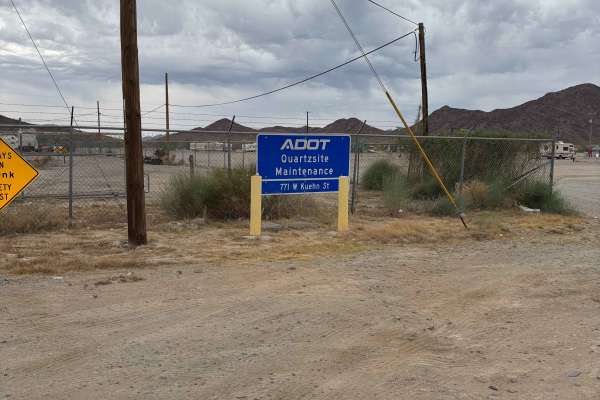
The northern portion of the Old Yuma Road starts in the La Posa West Long Term Visitors Area and ends at 53rd Street near the village of La Paz. It is a flat gravel road that, for the most part, is 2 lanes wide. It does cross several small washes. There is a 15 mph speed limit posted near the BLM ca...
Learn more about Old Yuma Road North
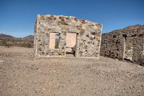
Cruikshank Cabin Spur
This is a cool, simple, short spur route to an even cooler abandoned miner's dugout cabin that is still mostly intact with artifacts present. There is easy, fairly flat terrain to walk about and explore, with great desert views galore. It's a great place to stop, have a beer and lunch, and let the k...
Learn more about Cruikshank Cabin Spur
Sunkist
This 7-mile trail across the desert on the east side of Quartzsite is one of the main trails to go north or south to other trails. It is dusty and very rough in places, but it's used by many to access other areas of the valley. Not much to see except mountains in the distance and cacti, but if it's ...
Learn more about Sunkist

LP207
The trail is mostly flat with some wash crossings. There was no water or large obstacles on the day we rode. Trail LP207 runs East and West parallel to I-10 and the large power lines. You will see some of the native trees and cactus on your ride. It's a wide-open trail with room for vehicles to pass...
Learn more about LP207
Petroglyph Access
This is a quick and easy way to get from La Posa South Long Term Visitors Area or the Rainbow Acres subdivision to see the Petroglyphs and Grinding Holes located on the edge of Tyson Wash. From Rainbow Acres, it is mostly through a narrow sandy wash. From La Posa, it is an easy-to-traverse gravel ro...
Learn more about Petroglyph Access
Beer Hill
This is a simple and quick way to get to Beer Hill. Beer Hill offers great views of the La Paz Valley, KOFA, and La Paz Village. The top of the hill is dotted with painted rocks as memorials to lost friends and family, and some are just for fun. It's another great spot to catch a sunrise or sunset. ...
Learn more about Beer Hill

0135C
This is a fairly smooth gravel trail, providing quick access to Cholla Road from the Rainbow Acres area. It also connects with 0135B, which leads south to the Cholla Road. There are rocky, open, brush-free areas along this trail that are good spots for hunting crystals.
Learn more about 0135C
LP 1944
LP1944 is short, simple, and easy. This trail gives campers in the Dome Rock BLM area easy access to the Pipeline road. Many trails start from the Pipeline road, which helps access those trails. It is a fairly smooth gravel road that passes through the Dome Rock camping area. Use caution passing thr...
Learn more about LP 1944
Tyson Wash
This is a mostly wide, gravel and sand wash. Tyson is a big wash that runs north from south of Quartzsite to just south of Parker. Don't let it fool you, during the rainy season, the water can run several feet deep. If there is any sign of weather its advised to avoid using it. In early fall, after ...
Learn more about Tyson Wash
0135B
0135B is a handy connector to get you from 0135C to Cholla Road and the trails beyond. This gravel two-track is fairly smooth, has no real obstacles to cross other than a few washes. Please use caution during the rainy season as these washes will fill with runoff from the mountains to the west.
Learn more about 0135B
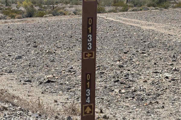
BLM 0133
This is a quick and easy way to connect to a multitude of trails around the Dome Rock area. It also gives easy access to the trail leading into Deer Run Resort, a popular Quartzsite attraction. The trailhead can be accessed from Cholla Road and is marked with a brown post showing the trail number.
Learn more about BLM 0133
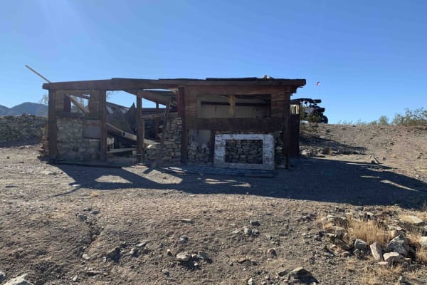
Scott's Lead Well Spur
This is a cool, simple, short spur route to an even cooler abandoned miner's mine and stone water tank and cabin foundation. It is still mostly intact with artifacts present. There is easy, fairly flat terrain to walk about and explore, with great desert views galore. It's a great place to stop, hav...
Learn more about Scott's Lead Well Spur
LP776 Connector Trail
This trail is a wide connector between other trails near the dispersed camping area at Scadden Wash BLM area. The trail is wide enough for two vehicles most of the way, leaving places to pass. It is dirt and gravel with some sand in the washes. This trail runs east and west, giving you a view of Qua...
Learn more about LP776 Connector Trail
Round the Bend (LP193)
This trail connects LP193 Western Edge Camp Connector Trail and LP189 Rockin' Ram Trail. This trail is wide and flat most of the way. There are shallow washes to cross. I would not recommend this trail in heavy rains. You will see lots of native trees and desert plants. You will even get a view in t...
Learn more about Round the Bend (LP193)
LP077
This trail is a cut across between Rockin' Ram Trail and West End Preacher Pass Trail. The views from this trail are great. It is a typical trail in the Quartzsite area. There are some twists and turns, in and out of washes and driving across flat desert terrain. You will see several different varie...
Learn more about LP077
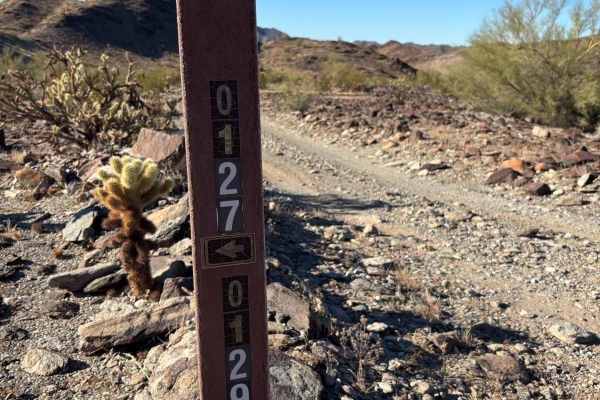
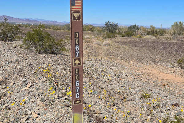
BLM 0129
0129 is a good connector trail that gets you from the Pipeline Road, via LP324, to many of the trails in the Dome Rock area. Parts of it are a 'road less traveled' and can be difficult to follow. For the most part, it is a fairly easy, gravel two-track. There are several washes to cross, some narrow...
Learn more about BLM 0129
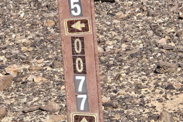
LP324
LP324 is a good connector trail that takes you from the Pipeline Road to several trails in the Dome Rock area. It is a fairly good gravel two-track road. It does have some rutted, eroded areas to watch for. Look for the old grave site that's near the intersection of LP324 and 0129.
Learn more about LP324
Beginner ATV trails near Quartzsite, Arizona
Explore ATV-friendly trails near you. These trails are accessible for vehicles up to 50 inches wide, perfect for ATVs and smaller off-road machines.
LP227
This easy two-track, rock trail can be started from either the Dome Rock BLM camping area or the Desert Gardens showgrounds. It leads you to the Tyson Wash cabin and Joseph Cone's cabin. A relatively flat road with no real obstacles, there are some off-camber areas and several small washes to cross....
Learn more about LP227
Granite Mountain Loop
This 6.75-mile trail loops around Granite Mountain, which is just south of Quartzsite. It takes you right by Joseph Cone's Stone Cabin. The track is on BLM public lands. The wildlife possibilities include bighorn sheep, wild donkeys, burros, wild horses, quail, and roadrunners, although this close t...
Learn more about Granite Mountain Loop
Granite Mountain Loop Connector
This is a great way to get from the Dome Rock DNR camping area to the Tyson Wells area without hitting the pavement. It is an easy trail with a decent surface. There are several washes to cross, nothing too difficult. It passes between Q Mountain and the Old Quartzsite Mine #2.
Learn more about Granite Mountain Loop Connector
Old Yuma Road North
The northern portion of the Old Yuma Road starts in the La Posa West Long Term Visitors Area and ends at 53rd Street near the village of La Paz. It is a flat gravel road that, for the most part, is 2 lanes wide. It does cross several small washes. There is a 15 mph speed limit posted near the BLM ca...
Learn more about Old Yuma Road North
Beginner UTV/side-by-side trails near Quartzsite, Arizona
Find UTV and side-by-side trails near you. These trails accommodate vehicles up to 60 inches wide, ideal for UTVs, side-by-sides, and wider off-road rigs.
LP227
This easy two-track, rock trail can be started from either the Dome Rock BLM camping area or the Desert Gardens showgrounds. It leads you to the Tyson Wash cabin and Joseph Cone's cabin. A relatively flat road with no real obstacles, there are some off-camber areas and several small washes to cross....
Learn more about LP227
Granite Mountain Loop
This 6.75-mile trail loops around Granite Mountain, which is just south of Quartzsite. It takes you right by Joseph Cone's Stone Cabin. The track is on BLM public lands. The wildlife possibilities include bighorn sheep, wild donkeys, burros, wild horses, quail, and roadrunners, although this close t...
Learn more about Granite Mountain Loop
Granite Mountain Loop Connector
This is a great way to get from the Dome Rock DNR camping area to the Tyson Wells area without hitting the pavement. It is an easy trail with a decent surface. There are several washes to cross, nothing too difficult. It passes between Q Mountain and the Old Quartzsite Mine #2.
Learn more about Granite Mountain Loop Connector
Old Yuma Road North
The northern portion of the Old Yuma Road starts in the La Posa West Long Term Visitors Area and ends at 53rd Street near the village of La Paz. It is a flat gravel road that, for the most part, is 2 lanes wide. It does cross several small washes. There is a 15 mph speed limit posted near the BLM ca...
Learn more about Old Yuma Road North
The onX Offroad Difference
onX Offroad combines trail photos, descriptions, difficulty ratings, width restrictions, seasonality, and more in a user-friendly interface. Available on all devices, with offline access and full compatibility with CarPlay and Android Auto. Discover what you're missing today!
Open Trail Map