
Beginner Off-Road Trails
Near Provo, South Dakota
Explore All Beginner Trails Near Provo, South Dakota
Beginner Off-Road Trails Near Provo, South Dakota
Discover the best beginner-friendly off-road trails near you. These easier, lower-rated trails are a great place to start — browse trail maps, check difficulty ratings, and find your next adventure.
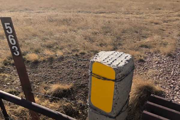
FS 563
This is a beautiful trail through the Buffalo Gap National Grassland in Fall River County, South Dakota. It has deep ruts and can be muddy. You will share the road with cattle at times. Hunting and camping are possible here, but check local regulations for both activities. You may see mule deer and ...
Learn more about FS 563
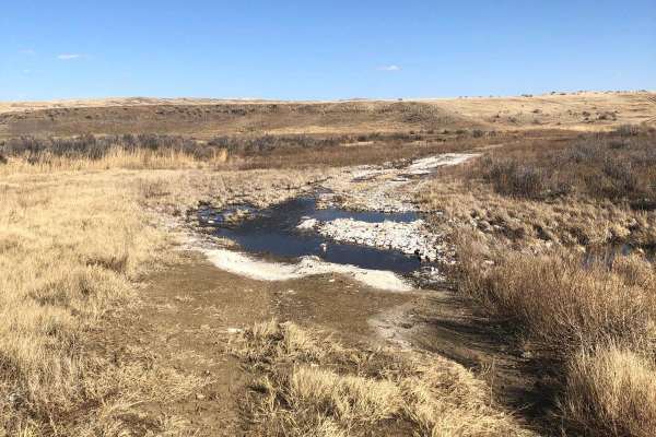
Trail 564
This is a trail within the Buffalo Gap National Grassland in Fall River County, South Dakota. It's mostly a trail through the scenic prairie and has 1-2 water crossings. There appear to be options for hunting and camping here--check local regulations on both activities. Watch out for mule deer and p...
Learn more about Trail 564
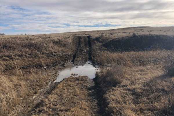
FR 562-Tri Point
This is one way to access the tri-point of Wyoming, South Dakota, and Nebraska. It's a beautiful trail through the Buffalo Gap National Grassland.There are 1-2 water crossings (seasonal) that can be muddy. You will share the road with cattle at times. Located in Fall River County, South Dakota, ther...
Learn more about FR 562-Tri Point
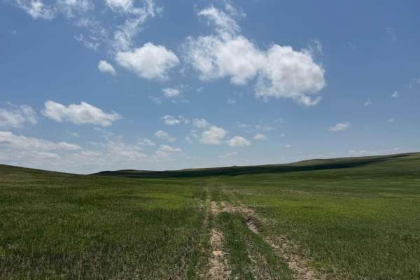
Conklin - FR 924
Conklin (Forest Road 924) is an out-and-back trail that runs north-south, meandering over rolling hills in the Oglala National Grassland. The trailhead is located a mile south of the South Dakota-Nebraska border on Hat Creek Road. The entire trail is two-track, on a grass-covered sandy surface that ...
Learn more about Conklin - FR 924
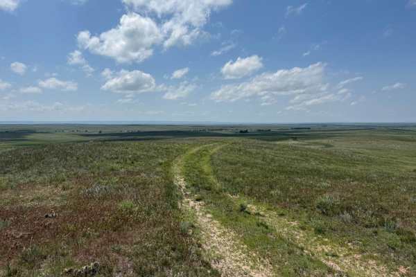
Prairie Dog - FR 925
Prairie Dog is an east-west trail that connects Hat Creek Road with Conklin (FR 924). The topography of the trail is very much like the others in the area, with rolling hills covered with mixed-grass prairie. The name of the trail is an obvious nod to the burrowing rodents that have created the thou...
Learn more about Prairie Dog - FR 925
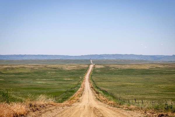
Pants Butte Road
From north to south, Pants Butte Road takes you through part of western Nebraska that makes you feel like you're driving through a painting. At both ends of the road, you're able to see for miles and miles, and the views do not disappoint. The road surface on the north half is mostly graded dirt, ev...
Learn more about Pants Butte Road
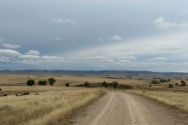
Orella Road
The road begins on the west end off of Hat Creek Road and continues east to Toadstool Road. The area is surrounded by ranch land goes through private property with cattle on the road. Unique geologic features can be seen Toadstool area of the Ogala National Grassland. Beautiful views of grasslands a...
Learn more about Orella Road
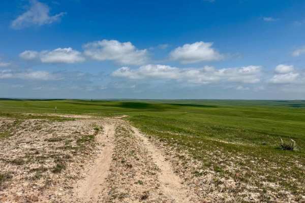
Prairie Hills - FR 939
This out-and-back spur trail off Sugarloaf Road is not quite a mile and a half in length, but it's well worth the drive. It's a sandy two-track through the grass for most of the trail, with a little bit of gravel and rock here and there. About 0.8 miles from the trailhead, a rise in elevation provid...
Learn more about Prairie Hills - FR 939
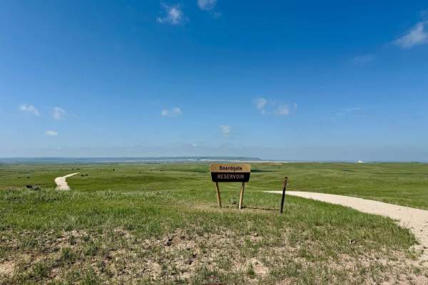
Boardgate (FR 910)
This short spur trail off Sugarloaf Road provides access to the 12-acre Boardgate Reservoir in the Oglala National Grassland. The trail itself has a sand and gravel surface. The trail is out-and-back, and has a turnaround area adjacent to the reservoir. Small washouts from seasonal rains are possibl...
Learn more about Boardgate (FR 910)
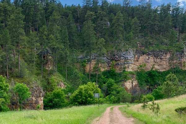
Song Dog Road
Starting from the south end of the trail on Argyle Rd, the trail begins in a lightly treed pine forest and follows a natural dirt and limestone path that is mostly packed and single-car width wide. The route includes several sections of semi-loose rocky hill climbs, with small rocks 3-4 inches in di...
Learn more about Song Dog Road
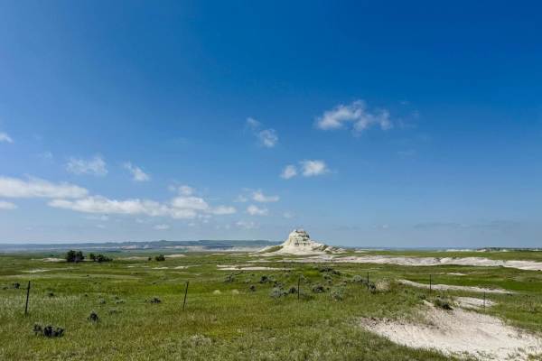
Sugarloaf Road
Sugarloaf Road is a scenic route that runs east-west about 9 miles south of the Nebraska-South Dakota border, connecting Toadstool Road in Sioux County, Nebraska, with Nebraska Highway 71 in Dawes County, Nebraska. The road weaves its way through buttes and rolling hills blanketed with mixed-grass p...
Learn more about Sugarloaf Road
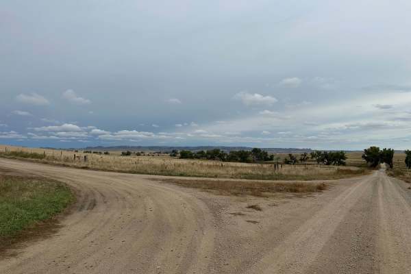
Hat Creek Road
Hat Creek Road can be accessed off of West Hat Creek Road, just northeast of the town of Harrison, and runs north to Montrose Road. This is a double-wide dirt road that is maintained and graded. Sections can become muddy in wet conditions. The surrounding area consists of large ranches, and you have...
Learn more about Hat Creek Road
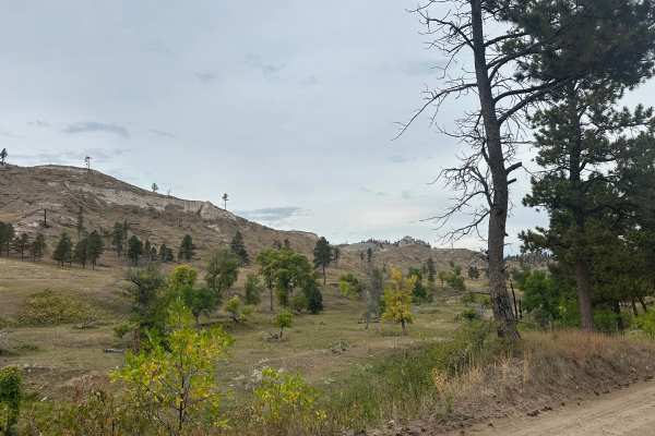
West Hat Creek Road
West Hat Creek Road can be accessed off of Highway 20 just east of the town of Harrison and runs north to Hat Creek Road. This is a double-wide dirt road that is maintained and graded. Sections can become muddy in wet conditions. The surrounding area consists of large ranches, and you have great vie...
Learn more about West Hat Creek Road
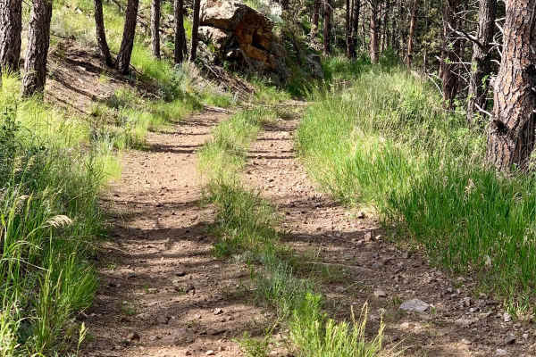
Bowman Road Loop
Bowman Road Loop is a 7.4-mile trail near Pringle, South Dakota, that flows in and out of the pine forest around Bowman Ridge. The trail is primarily composed of rock and sand, with loose sections that may pose challenges. Stock 4WD vehicles should have no issues, but motorcycles and 2WD vehicles sh...
Learn more about Bowman Road Loop
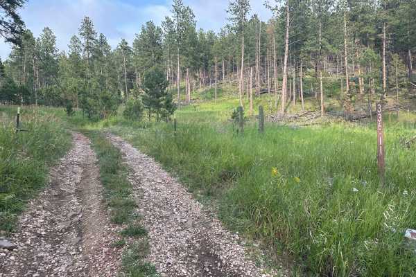
Hines Br1i / 336-11
Forestry Road 336-11, also known as Hines BR1i, is rocky with small to medium rock embedded in the soil. There are a few mud holes with very thick sticky mud after rains, but none are more than a few inches deep, so, should not present an issue. At the south end, connecting to County Road 382, also ...
Learn more about Hines Br1i / 336-11
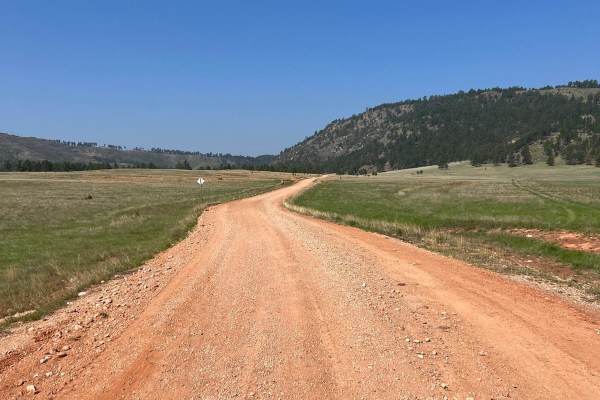
Elk Mountain Trail
This trail is west of Custer past Jewell Cave National Park, just east of the Wyoming border. It is a freshly groomed gravel to light rocky trail. Stock vehicles can run on this trail. Breathtaking views all the way up. The fire tower is at the top with restrooms! At certain times of day and year, y...
Learn more about Elk Mountain Trail
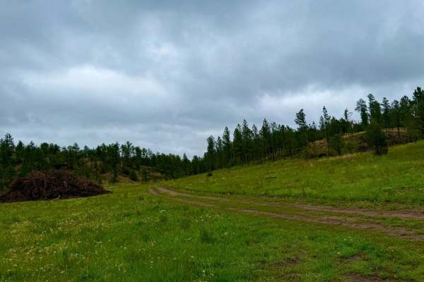
Tepee Branch Road - FS 271.1A
Tepee Branch Road (FS 271.1A) is a moderate 5.2-mile trail nestled within the Black Hills National Forest. This gravel route meanders through dense pine forests and open meadows, offering a tranquil escape for those seeking solitude. The trail features an elevation gain of approximately 413 feet and...
Learn more about Tepee Branch Road - FS 271.1A
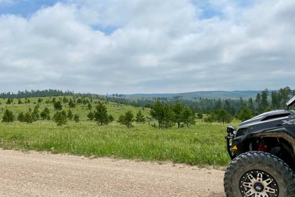
Mud Springs Road
Mud Springs Road is a scenic route that runs North/South from Custer Limestone road to US Highway 16 just West of Jewel Cave National Monument. This does take you through cattle grazing areas so expect to see some cattle on or just off the road in the spring/summer. On the South portion of the road ...
Learn more about Mud Springs Road
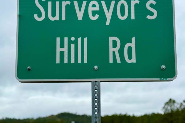
Surveyor Hill Road
Surveyor Hill Road is a rugged and scenic trail nestled within the Black Hills National Forest, offering a journey reminiscent of the Old West. This narrow, unmaintained route meanders through dense pine forests and open meadows, providing a tranquil escape for those seeking solitude. The trail feat...
Learn more about Surveyor Hill Road
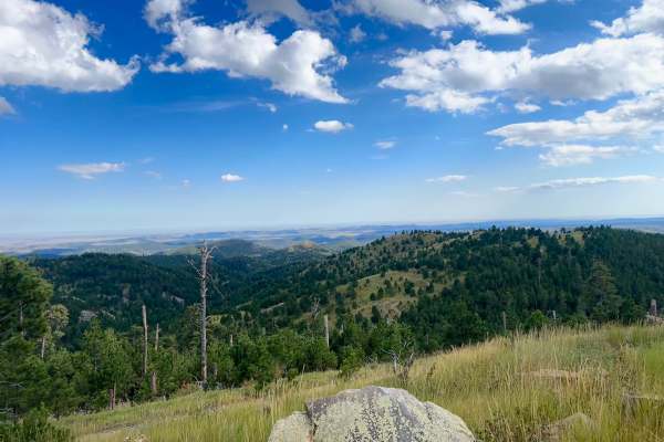
Cicero Peak Road
This is a fantastic trail leading up to the summit of Cicero Peak. The route is only 1.7 miles long but climbs 485 feet to a peak elevation of 6,165 feet. Despite its relatively short length, the climb offers rewarding views for nearly the entire ascent. Loose rocks are all over and must be navigate...
Learn more about Cicero Peak Road
Beginner ATV trails near Provo, South Dakota
Explore ATV-friendly trails near you. These trails are accessible for vehicles up to 50 inches wide, perfect for ATVs and smaller off-road machines.
FS 563
This is a beautiful trail through the Buffalo Gap National Grassland in Fall River County, South Dakota. It has deep ruts and can be muddy. You will share the road with cattle at times. Hunting and camping are possible here, but check local regulations for both activities. You may see mule deer and ...
Learn more about FS 563
Trail 564
This is a trail within the Buffalo Gap National Grassland in Fall River County, South Dakota. It's mostly a trail through the scenic prairie and has 1-2 water crossings. There appear to be options for hunting and camping here--check local regulations on both activities. Watch out for mule deer and p...
Learn more about Trail 564
FR 562-Tri Point
This is one way to access the tri-point of Wyoming, South Dakota, and Nebraska. It's a beautiful trail through the Buffalo Gap National Grassland.There are 1-2 water crossings (seasonal) that can be muddy. You will share the road with cattle at times. Located in Fall River County, South Dakota, ther...
Learn more about FR 562-Tri Point
Conklin - FR 924
Conklin (Forest Road 924) is an out-and-back trail that runs north-south, meandering over rolling hills in the Oglala National Grassland. The trailhead is located a mile south of the South Dakota-Nebraska border on Hat Creek Road. The entire trail is two-track, on a grass-covered sandy surface that ...
Learn more about Conklin - FR 924
Beginner UTV/side-by-side trails near Provo, South Dakota
Find UTV and side-by-side trails near you. These trails accommodate vehicles up to 60 inches wide, ideal for UTVs, side-by-sides, and wider off-road rigs.
FS 563
This is a beautiful trail through the Buffalo Gap National Grassland in Fall River County, South Dakota. It has deep ruts and can be muddy. You will share the road with cattle at times. Hunting and camping are possible here, but check local regulations for both activities. You may see mule deer and ...
Learn more about FS 563
Trail 564
This is a trail within the Buffalo Gap National Grassland in Fall River County, South Dakota. It's mostly a trail through the scenic prairie and has 1-2 water crossings. There appear to be options for hunting and camping here--check local regulations on both activities. Watch out for mule deer and p...
Learn more about Trail 564
FR 562-Tri Point
This is one way to access the tri-point of Wyoming, South Dakota, and Nebraska. It's a beautiful trail through the Buffalo Gap National Grassland.There are 1-2 water crossings (seasonal) that can be muddy. You will share the road with cattle at times. Located in Fall River County, South Dakota, ther...
Learn more about FR 562-Tri Point
Conklin - FR 924
Conklin (Forest Road 924) is an out-and-back trail that runs north-south, meandering over rolling hills in the Oglala National Grassland. The trailhead is located a mile south of the South Dakota-Nebraska border on Hat Creek Road. The entire trail is two-track, on a grass-covered sandy surface that ...
Learn more about Conklin - FR 924
The onX Offroad Difference
onX Offroad combines trail photos, descriptions, difficulty ratings, width restrictions, seasonality, and more in a user-friendly interface. Available on all devices, with offline access and full compatibility with CarPlay and Android Auto. Discover what you're missing today!
Open Trail Map