
Beginner Off-Road Trails
Near Northlakes, North Carolina
Explore All Beginner Trails Near Northlakes, North Carolina
Beginner Off-Road Trails Near Northlakes, North Carolina
Discover the best beginner-friendly off-road trails near you. These easier, lower-rated trails are a great place to start — browse trail maps, check difficulty ratings, and find your next adventure.
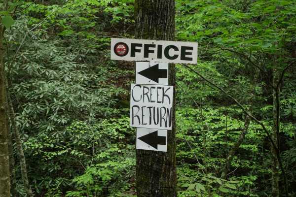
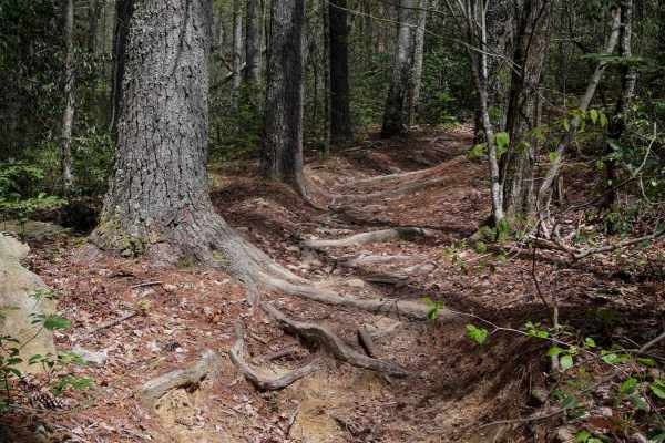
Creek Office Return
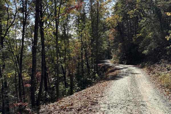
This two-way trail at Brushy Mountain Motorsports Park begins on the west side at the intersection of Trails 1A, 2A, and 1B. The route starts off narrow between dense bushes before opening slightly as it parallels a scenic creek. Minor loose and embedded rocks are present, but the trail surface is m...
Learn more about Creek Office Return
4B
Trail 4B at Brushy Mountain Motorsports Park is a directional, one-way route traveling northwest to southeast, serving as a bailout from Trail 1B to return toward the office and staging area. This half-mile trail features a steep descent, dropping approximately 350 feet in elevation with a few sweep...
Learn more about 4B
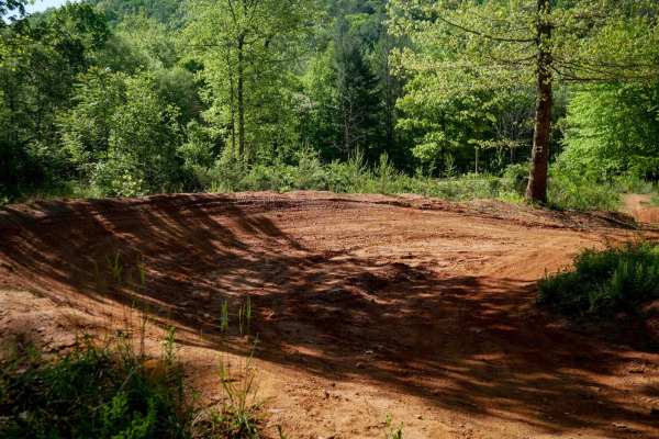
MX Track
Brushy Mountain's motocross track offers a natural terrain loop that's ideal for warming up or honing skills before hitting the trails. With hard pack red dirt and scenic views in the trees, it has medium-sized table jumps and banked berms. The track features split lines, sweeping corners, and natur...
Learn more about MX Track
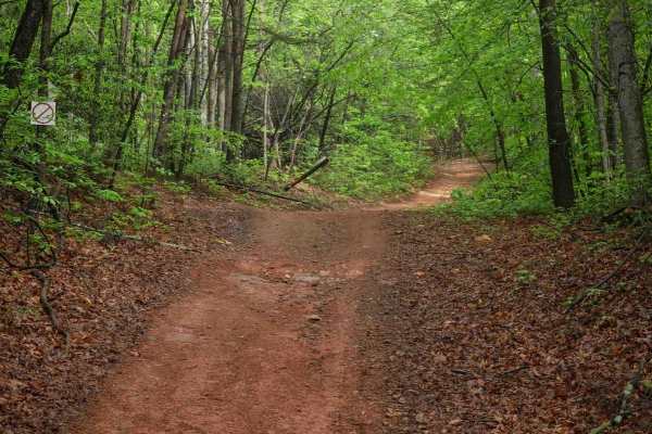
1C
This 1.4-mile off-road trail at Brushy Mountain Motorsports Park near Taylorsville, North Carolina, offers an easy, scenic ride for SxS vehicles, ATVs, and dirt bikes. Starting and ending at the main staging area, the loop features a gradual climb and descent under the pleasant cover of leafy ash an...
Learn more about 1C
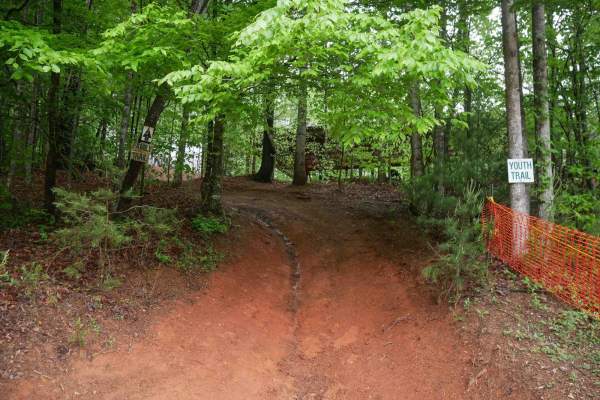
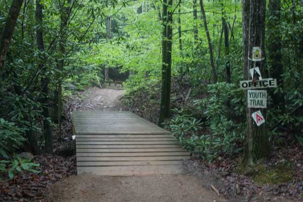
Youth Trail
The Youth Trail at Brushy Mountain Motorsports Park is a 2.1-mile loop starting and ending at the main staging area, featuring a gradual climb followed by a descent. The trail is wide, well-marked at intersections and shortcut points, and offers a very curvy, twisty ride. Riders will encounter small...
Learn more about Youth Trail
2C
Trail 2C at Brushy Mountain Motorsports Park is a 2.8-mile, easy SxS loop beginning and ending at the main staging area. Riders experience a gradual ascent for the first half, followed by a smooth descent, with one-way travel in a counterclockwise direction. The wide trail surface features mostly sm...
Learn more about 2C
1B Shortcut
The 1B Shortcut is a short, less-than-quarter-mile connector trail linking two segments of Trail 1B. It cuts approximately two miles off the main 1B loop. The trail features a mostly smooth, gradual surface with one minor obstacle: an embedded rock layer creating a small 6-inch drop-off, which is ea...
Learn more about 1B Shortcut
Shortcut
This shortcut provides a quick and efficient connection between the intermediate 1C OHV trail and the easy 1C OHV trail, also frequently used by dirt bikers on the 9C EXT single track. The trail is wide, with waterbars throughout the route, and features a steep ascent that gains 300 feet in just a t...
Learn more about Shortcut
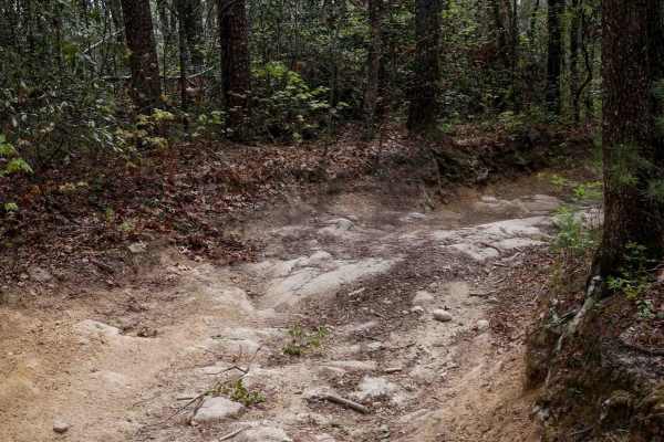
Trail 5 Ned's Knob
Ned's Knob is a directional, north-to-south singletrack trail offering a 1.4-mile gradual descent through tight, wooded terrain. The narrow path winds between small trees, with sections deeply troughed from wear. Riders can expect small roots, a few overhanging logs requiring ducking, and embedded b...
Learn more about Trail 5 Ned's Knob
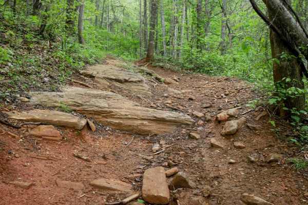
Trail 1B
Trail 1B is a well-maintained 2.5-mile UTV trail in Pisgah National Forest, offering a gradual 600-foot descent from north to south. Suitable for vehicles 65" wide or less, the trail is wide and smooth, featuring cinderblock paths, water bars, and occasional embedded rock slabs--some flush with the ...
Learn more about Trail 1B
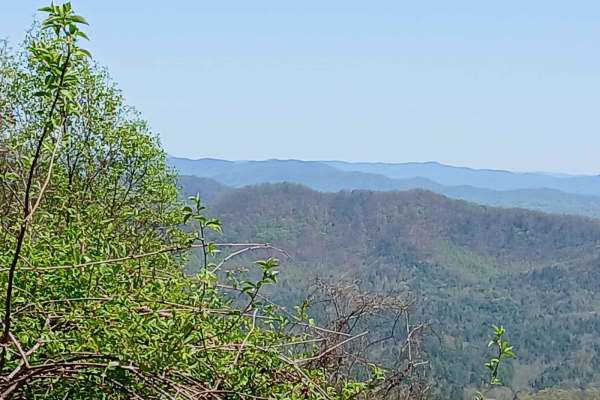
Roses Creek - FS 210
This Forest Service road through Pisgah National Forest offers access to stunning views, Table Rock, and the North Carolina Outward Bound School. The trail begins in a small town, passing through some private property before transitioning into a narrow shelf road with hard-packed gravel. Along the w...
Learn more about Roses Creek - FS 210

Trail 6 Miller Circle
Trail 6 descends from west to east, with the eastern section being the steepest. Open to vehicles 65" wide or less and allowing two-way travel, the trail offers a generally wide path that can feel narrow in spots due to encroaching bushes and low branches. Riders should be prepared for tight corners...
Learn more about Trail 6 Miller Circle
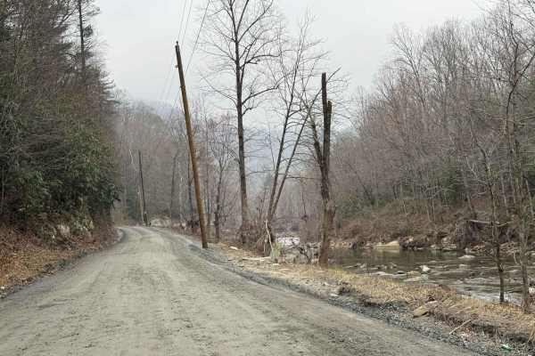
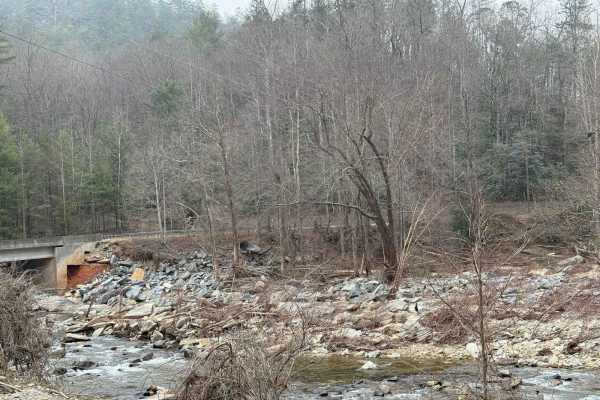
Brown Mountain Beech Road
Brown Mountain Beech Road is a smaller section of a town road that goes through Pisgah National Forest and the North Carolina Wildlife Resource Commission. The road follows Wilson Creek and offers views of the river and evidence of damage caused by Hurricane Helene in 2024. This damage includes dest...
Learn more about Brown Mountain Beech Road
Maple Sally
This dirt road is a scenic drive in the Grandfather District of Pisgah National Forest. It is open year-round and can be traveled in either direction. Gravel bikes and mountain bikes are popular on this road. There are 2 mountain bike trails that either start or finish on this road. There are some c...
Learn more about Maple Sally
Raven Cliff - FS 197
Raven Cliff is a scenic Forest Service road that follows Upper Creek, offering stunning views of the water along the way. The trail features sandy beaches, small rocky waterfalls, and rapids, with numerous walking paths leading to the river's edge for swimming, rock climbing, fishing, and playing in...
Learn more about Raven Cliff - FS 197
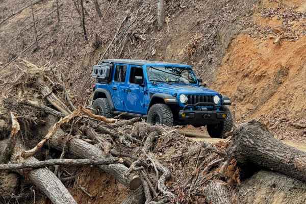
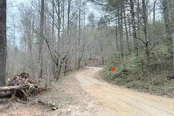
Back Irish Creek - FS 118
Back Irish Creek is a scenic Forest Service Road that travels along private property and leads into the Pisgah National Forest. It is well maintained and spacious pull offs for bypassing vehicles, but recent storm damage is present toward the beginning of the trail where an obstructed tree has been ...
Learn more about Back Irish Creek - FS 118
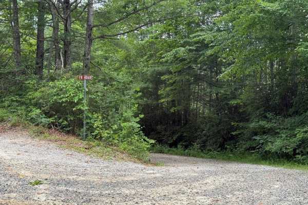
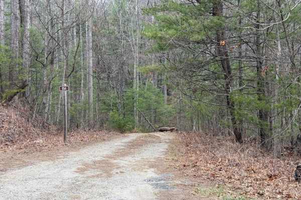
School House Ridge - FS 4068
School House Ridge is a narrower, more overgrown double-track trail that winds through a secluded area of the forest. It is slightly more challenging than other nearby roads due to less frequent maintenance, its narrow width, and the presence of occasional ruts and muddy spots. The trail surface is ...
Learn more about School House Ridge - FS 4068
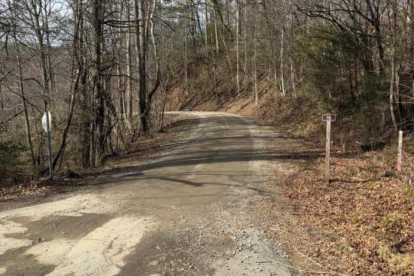
Steeles Creek - FS 228
This trail is fairly well maintained with gravel over hard-packed dirt. Some sections are narrow with pull-off areas, while others are wide enough for two vehicles to pass. A single water crossing has a warning sign advising caution during heavy rain and high water. Drivers should watch for narrow s...
Learn more about Steeles Creek - FS 228
Mortimer Piedmont - FS 982
This Forest Service road follows Upper Creek and Craig Creek, with sections that also touch Wilson Creek. While there are some views of the surrounding forest, the most notable scenery comes from the creeks below. The trail also features several scenic single-lane bridges, adding a unique element co...
Learn more about Mortimer Piedmont - FS 982
Fox Camp - FS 954
This short trail leads to two small campsites and a hiking trail. It offers a fun drive with a few mildly technical sections that require moderate ground clearance. The trail begins with a narrow, winding path that leads to the first campsite--suitable for up to two vehicles--and the first hiking tr...
Learn more about Fox Camp - FS 954
Beginner ATV trails near Northlakes, North Carolina
Explore ATV-friendly trails near you. These trails are accessible for vehicles up to 50 inches wide, perfect for ATVs and smaller off-road machines.
Creek Office Return
This two-way trail at Brushy Mountain Motorsports Park begins on the west side at the intersection of Trails 1A, 2A, and 1B. The route starts off narrow between dense bushes before opening slightly as it parallels a scenic creek. Minor loose and embedded rocks are present, but the trail surface is m...
Learn more about Creek Office Return
4B
Trail 4B at Brushy Mountain Motorsports Park is a directional, one-way route traveling northwest to southeast, serving as a bailout from Trail 1B to return toward the office and staging area. This half-mile trail features a steep descent, dropping approximately 350 feet in elevation with a few sweep...
Learn more about 4B
1C
This 1.4-mile off-road trail at Brushy Mountain Motorsports Park near Taylorsville, North Carolina, offers an easy, scenic ride for SxS vehicles, ATVs, and dirt bikes. Starting and ending at the main staging area, the loop features a gradual climb and descent under the pleasant cover of leafy ash an...
Learn more about 1C
Youth Trail
The Youth Trail at Brushy Mountain Motorsports Park is a 2.1-mile loop starting and ending at the main staging area, featuring a gradual climb followed by a descent. The trail is wide, well-marked at intersections and shortcut points, and offers a very curvy, twisty ride. Riders will encounter small...
Learn more about Youth Trail
Beginner UTV/side-by-side trails near Northlakes, North Carolina
Find UTV and side-by-side trails near you. These trails accommodate vehicles up to 60 inches wide, ideal for UTVs, side-by-sides, and wider off-road rigs.
Creek Office Return
This two-way trail at Brushy Mountain Motorsports Park begins on the west side at the intersection of Trails 1A, 2A, and 1B. The route starts off narrow between dense bushes before opening slightly as it parallels a scenic creek. Minor loose and embedded rocks are present, but the trail surface is m...
Learn more about Creek Office Return
4B
Trail 4B at Brushy Mountain Motorsports Park is a directional, one-way route traveling northwest to southeast, serving as a bailout from Trail 1B to return toward the office and staging area. This half-mile trail features a steep descent, dropping approximately 350 feet in elevation with a few sweep...
Learn more about 4B
1C
This 1.4-mile off-road trail at Brushy Mountain Motorsports Park near Taylorsville, North Carolina, offers an easy, scenic ride for SxS vehicles, ATVs, and dirt bikes. Starting and ending at the main staging area, the loop features a gradual climb and descent under the pleasant cover of leafy ash an...
Learn more about 1C
Youth Trail
The Youth Trail at Brushy Mountain Motorsports Park is a 2.1-mile loop starting and ending at the main staging area, featuring a gradual climb followed by a descent. The trail is wide, well-marked at intersections and shortcut points, and offers a very curvy, twisty ride. Riders will encounter small...
Learn more about Youth Trail
The onX Offroad Difference
onX Offroad combines trail photos, descriptions, difficulty ratings, width restrictions, seasonality, and more in a user-friendly interface. Available on all devices, with offline access and full compatibility with CarPlay and Android Auto. Discover what you're missing today!
Open Trail Map