
Beginner Off-Road Trails
Near Montrose, Colorado
Explore All Beginner Trails Near Montrose, Colorado
Beginner Off-Road Trails Near Montrose, Colorado
Discover the best beginner-friendly off-road trails near you. These easier, lower-rated trails are a great place to start — browse trail maps, check difficulty ratings, and find your next adventure.
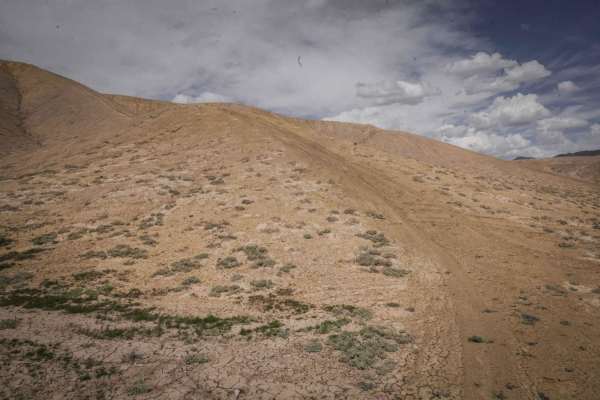
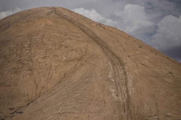
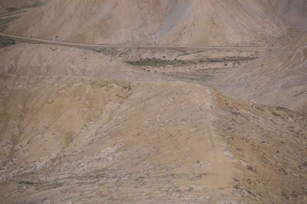
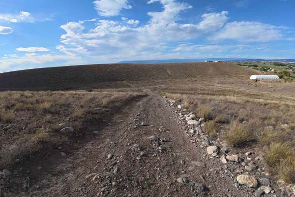
Ponds Express ATV Trail
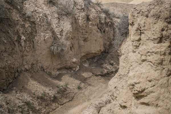
Ponds Express is a 50" trail in the adobe badlands of Peach Valley recreation area near Montrose, Colorado. The trail has a smooth clay surface, and follows several ridge lines on the adobe hills. It might be a bit narrow in certain spots on the ridge line for an ATV, but is very easy for a dirt bik...
Learn more about Ponds Express ATV Trail
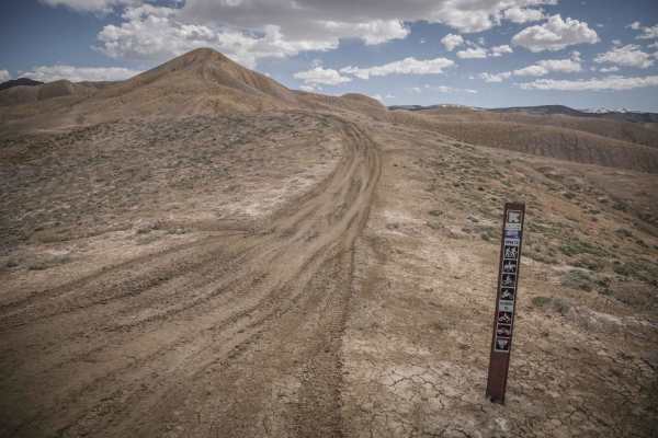
Speed Ridge
Speed Ridge is a short ATV trail on an adobe ridge line in the Flat Top - Peach Valley Recreation Area. The trail is two-track width, but not overly wide, with some whoops. It starts from Elephant Skin Road near the staging area and goes until it intersects with Kings Ditch. It starts in the valley ...
Learn more about Speed Ridge
Landfill Ridge
This unmarked single track starts at a small dirt area off of the paved Landfill Road that goes to the dump. It is an unmarked trailhead and there are no trail signs in this area. It starts as a wide road with lots of tracks going up the adobe clay badland hills and starting to meander on adobe ridg...
Learn more about Landfill Ridge
Eagle Ridge
Eagle Ridge is a short single track in the Flat Top - Peach Valley recreation area on adobe clay soil. It's a series of hill climbs and descents up and down big adobe hills in this badlands-like terrain. There are 3 really steep hill climbs and descents in the beginning, and the rest of it is more g...
Learn more about Eagle Ridge
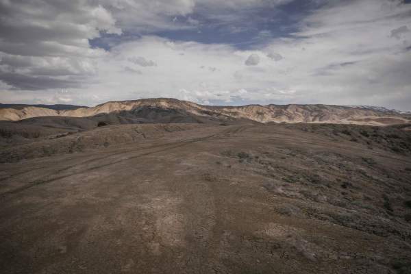
Dump Ridge ATV Trail
This is one of many ATV trails in the Flat Top - Peach Valley Recreation Area, which is a 9,700-acre area mostly of adobe clay badlands. From the east end, it starts with a steep climb up a hill that is rutted and an ATV would really have to keep their momentum and consider if the steepness is possi...
Learn more about Dump Ridge ATV Trail
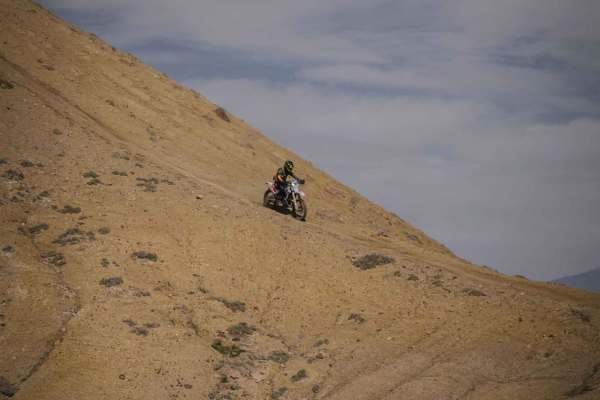
Teton Ridge
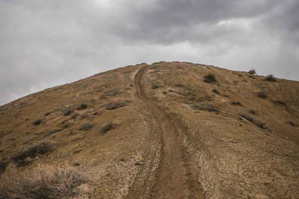
Teton Ridge trail is a narrow single track in the Flat Top - Peach Valley recreation area, which is a 9,700-acre area mostly of adobe clay badlands. It goes up and over a series of adobe hills with steep climbs and descents, and continues on top of the ridge line the whole way. The trail is easy bec...
Learn more about Teton Ridge
South Landfill Ridge
This unmarked trail is part of the trail system in the adobe badlands outside of Montrose, Colorado. This trail is fainter and less ridden than some of the ridge line trails closer to the staging areas. The SW end of the trail dead ends at a power line, making part of the trail an out and back, but ...
Learn more about South Landfill Ridge
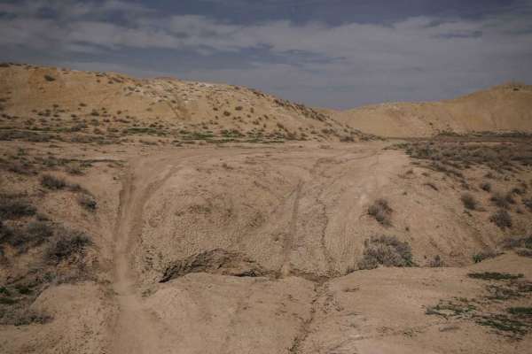
Kings Ditch
The Kings Ditch single track is part of the Flat Top - Peach Valley Trail System, a huge area outside of Montrose, Colorado made up of many adobe ridge line trails and ditch trails in the lower arroyos. This trail in particular features both the ridge lines and the ditches. From the NE end of the t...
Learn more about Kings Ditch
Tight Brush
This is a tight and narrow single track through the bottom of an adobe arroyo with several foot-high dirt walls. It's very narrow, and you have to watch out for hitting your handlebars on the dirt walls. It continues with tight twisty turns in the arroyo with spots of erosion where the bottom is ero...
Learn more about Tight Brush
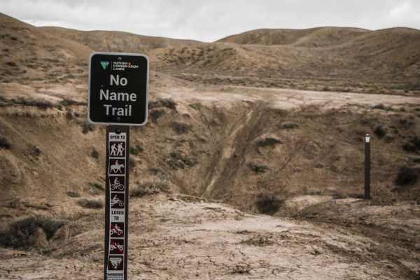
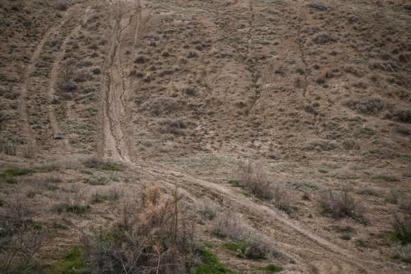
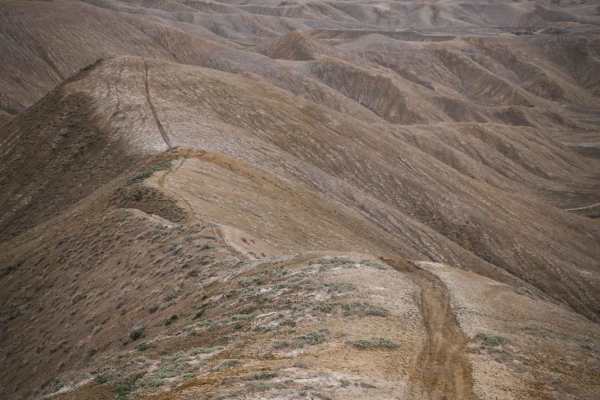
No Name Ridge
No Name Ridge is a fun single track near the Elephant Skin Staging Area of the Flat Tops-Peach Valley recreation area. The trail follows a ridge line atop the soft adobe clay hills that make up the Peach Valley badlands. From the bottom trailhead, the trail starts by crossing the Narrow Gauge Ditch ...
Learn more about No Name Ridge
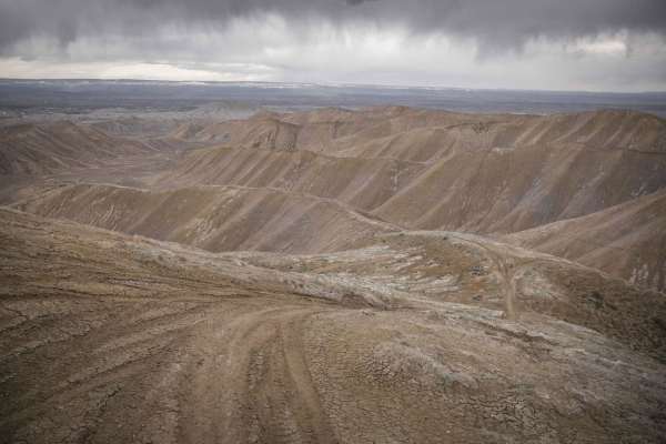
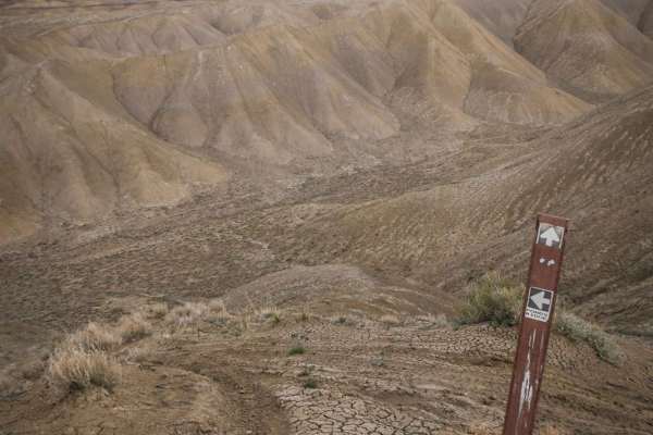
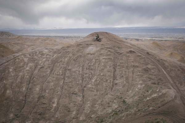
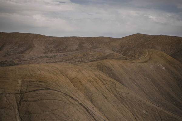
Lunar Express
Lunar Express is a fun, tight, and twisty adobe trail in the Flat Top - Peach Valley Recreation Area. There are almost 100 miles of trail in this recreation area and many of the adobe trails are very similar, with steep hill climbs to get on the ridge lines on top of the adobe hills, and steep desce...
Learn more about Lunar Express
Ponds Ridge
Ponds Ridge is an adobe ridge line trail similar to most of the ridge line trails in the Flat Top- Peach Valley Recreation Area. It's a narrow single-track trail made up of ascents and descents on the soft clay hills of the Peach Valley badlands, and rides along the ridge lines. Starting from Elepha...
Learn more about Ponds Ridge
Landfill Connector
This is an unmarked single track in the Flat Top- Peach Valley adobe badlands near the town of Montrose, Colorado. It branches off of another similar single track on a ridge line to make a loop on some lower adobe hills. Compared to some of the adobe trails that are closer to the Elephant Skin stagi...
Learn more about Landfill Connector
Teton - Kings Ditch Connector
The small unmarked single track connecting Teton Ridge and the Kings Ditch is a very narrow single track that drops 500 feet in a mile in order to get off the adobe hills and down into the flat valleys below. This is a good way to get off the adobe hills quick if need be, or to drop down to the vall...
Learn more about Teton - Kings Ditch Connector
South Elephant Ridge
South Elephant Ridge is a single track in the Flat Top - Peach Valley Recreation Area that follows a skinny ridge line on top of adobe clay hills. Like most of the trails in the area, the trail is made up of steep climbs and descents up and over lots of adobe clay hills. Starting from Elephant Skin ...
Learn more about South Elephant Ridge
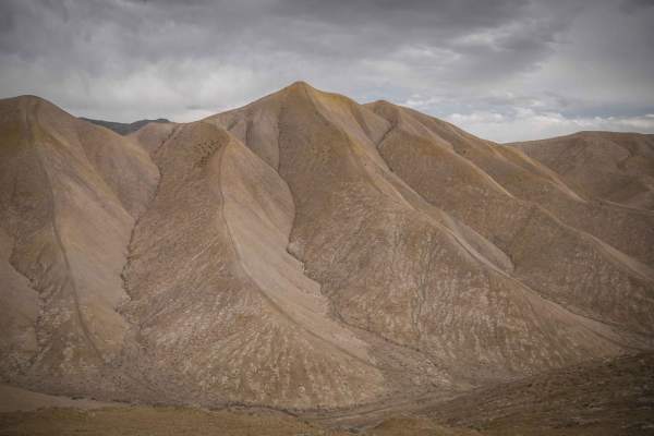
Lunar Ridge
Lunar Ridge is a narrow and steep single track through an adobe badlands landscape near Montrose, Colorado. The trail is a smooth clay surface and winds along the narrow ridge lines of the adobe hills in this recreation area. The trail goes through a very scenic grey and gold dirt landscape that fee...
Learn more about Lunar Ridge
Highway Ridge
This unmarked single track is part of the Peach Valley Recreation Area and is a fun ridge line trail along the adobe clay badlands that make up much of this trail system. This trail is relatively easy compared to some of the other ridge line trails in this trail system because the trail is pretty wi...
Learn more about Highway Ridge
Highway One (Part Two)
Highway One (Part Two) is a continuation of Highway One (Part One) ATV trail that is the main thoroughfare between the Peach Valley staging area and the Elephant Skin staging area. From the north trailhead, it drops down from Peach Valley staging area and becomes a wide major dirt trail on adobe cla...
Learn more about Highway One (Part Two)
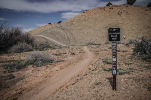
Moonlight Mesa
Moonlight Mesa is one of the longer single tracks in the adobe badlands of the Peach Valley Recreation Area. The SE trailhead on Elephant Skin Road is in the back of the adobe badlands where the hills are made up of more dirt and rocks in addition to the adobe clay. The trail drops back down into th...
Learn more about Moonlight Mesa
Gunnison Tunnel
In 2020 a locked gate was placed near the west portal (west of the canal dipper) which prevents running the complete trail. The trail can be run from the Uncompahgre River east to the gate but you can not reach the west portal. If you want to see the west portal and the canal dipper you must enter t...
Learn more about Gunnison Tunnel
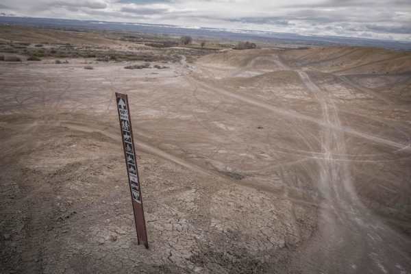
Beginner ATV trails near Montrose, Colorado
Explore ATV-friendly trails near you. These trails are accessible for vehicles up to 50 inches wide, perfect for ATVs and smaller off-road machines.
Ponds Express ATV Trail
Ponds Express is a 50" trail in the adobe badlands of Peach Valley recreation area near Montrose, Colorado. The trail has a smooth clay surface, and follows several ridge lines on the adobe hills. It might be a bit narrow in certain spots on the ridge line for an ATV, but is very easy for a dirt bik...
Learn more about Ponds Express ATV Trail
Speed Ridge
Speed Ridge is a short ATV trail on an adobe ridge line in the Flat Top - Peach Valley Recreation Area. The trail is two-track width, but not overly wide, with some whoops. It starts from Elephant Skin Road near the staging area and goes until it intersects with Kings Ditch. It starts in the valley ...
Learn more about Speed Ridge
Dump Ridge ATV Trail
This is one of many ATV trails in the Flat Top - Peach Valley Recreation Area, which is a 9,700-acre area mostly of adobe clay badlands. From the east end, it starts with a steep climb up a hill that is rutted and an ATV would really have to keep their momentum and consider if the steepness is possi...
Learn more about Dump Ridge ATV Trail
Highway One (Part Two)
Highway One (Part Two) is a continuation of Highway One (Part One) ATV trail that is the main thoroughfare between the Peach Valley staging area and the Elephant Skin staging area. From the north trailhead, it drops down from Peach Valley staging area and becomes a wide major dirt trail on adobe cla...
Learn more about Highway One (Part Two)
Beginner UTV/side-by-side trails near Montrose, Colorado
Find UTV and side-by-side trails near you. These trails accommodate vehicles up to 60 inches wide, ideal for UTVs, side-by-sides, and wider off-road rigs.
Gunnison Tunnel
In 2020 a locked gate was placed near the west portal (west of the canal dipper) which prevents running the complete trail. The trail can be run from the Uncompahgre River east to the gate but you can not reach the west portal. If you want to see the west portal and the canal dipper you must enter t...
Learn more about Gunnison Tunnel
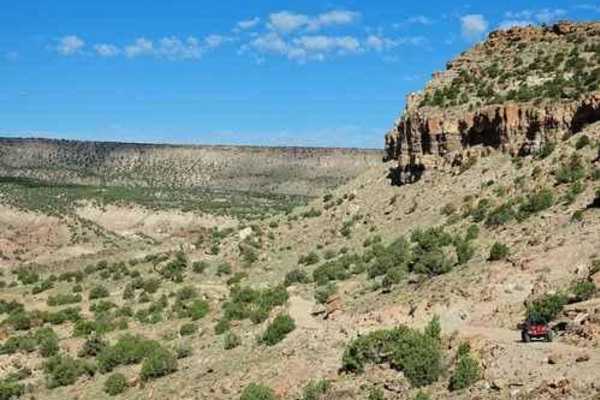
Roy's Junction Road
Roy's Junction Road provides a captivating, multi-faceted journey starting from a generous staging area capable of accommodating roughly 4–12 vehicles, located at the very onset of Rim Road. This 4.3-mile transit traverses dynamic canyon and rolling hill terrain adorned with consistent, sprawling sc...
Learn more about Roy's Junction Road
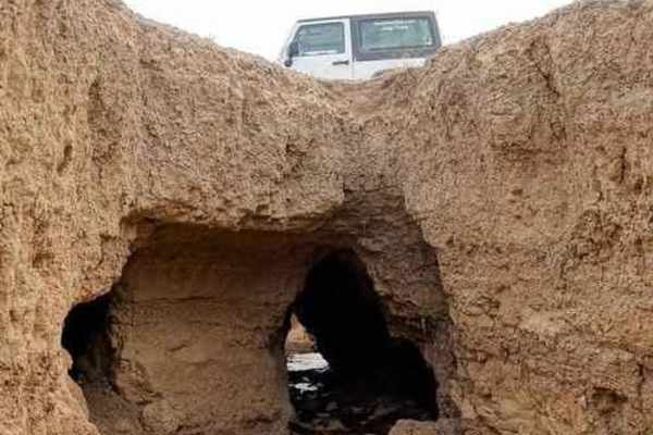
Elephant Skin Road
Elephant Skin Road is an easy Jeep trail between Montrose and Olathe. There are a few shallow gullies across the road, but can be done with any vehicle with a bit of clearance. There is a very strange occurrence in the middle of the trail. There is an area where gullies are joined by underground n...
Learn more about Elephant Skin Road
Tabeguache
Tabeguache 2.0 is a short, easy Jeep trail a short distance west of Montrose. It starts near the Dry Creek Rock Crawling Trails, and crosses Dry Creek, Piney Creek, and Cushman Creek before climbing up to the South Divide - Transfer Roads. The two obstacles that used to make this trail more difficu...
Learn more about Tabeguache
The onX Offroad Difference
onX Offroad combines trail photos, descriptions, difficulty ratings, width restrictions, seasonality, and more in a user-friendly interface. Available on all devices, with offline access and full compatibility with CarPlay and Android Auto. Discover what you're missing today!
Open Trail Map