
Beginner Off-Road Trails
Near Las Cruces, New Mexico
Explore All Beginner Trails Near Las Cruces, New Mexico
Beginner Off-Road Trails Near Las Cruces, New Mexico
Discover the best beginner-friendly off-road trails near you. These easier, lower-rated trails are a great place to start — browse trail maps, check difficulty ratings, and find your next adventure.

Check Court Entrance
A Level 1 trail featuring low sandy dirt and a maintained access road that follows along power lines. The route begins near a residential area off a main highway and is an access and entry point into the trail system. It remains mostly smooth, flat, and easy to navigate, making it suitable for begin...
Learn more about Check Court Entrance

Powerline Road Entrance
A Level 2 trail that follows a powerline access road with a mix of rocky and sandy terrain. The route features some larger hills, loose rock, and rolling ups and downs that add moderate challenge. While there are no major erosion areas or deep ruts, the uneven surfaces and hill climbs are a fun entr...
Learn more about Powerline Road Entrance

Desert Wind Way
Desert Wind Way is a Level 2 trail featuring a mix of sandy terrain, loose small rocks, and uneven surfaces. The route is maintained but includes bumpy sections and mild obstacles that add some challenge while remaining accessible for most capable 4x4 vehicles. A good beginner-to-intermediate trail ...
Learn more about Desert Wind Way

Upper Powerline Road
Upper Powerline Road is a scenic Level 3 trail featuring steep climbs, rocky terrain, and a minor rock-crawling section. The route offers great views while providing a moderate challenge with technical areas that require careful line choice and controlled driving. Suitable for capable 4x4 vehicles l...
Learn more about Upper Powerline Road

Eclipse
This is a simple scenic trail featuring small loose and broken flat rock, mild elevation changes, and occasional slight off-camber turns. Includes some ups and downs but nothing overly technical. Suitable for most capable 4x4 vehicles with basic off-road capability. This leads to numerous trailheads...
Learn more about Eclipse

Twister
This trail features a mix of loose rock terrain, moderate elevation changes, and occasional off-camber sections. The route includes a combination of uphill and downhill sections with some uneven surfaces requiring careful tire placement and steady throttle control. While there are a few technical ar...
Learn more about Twister

Across The Canyon
This is a level 3 trail due to the initial hill climb, but remains fairly simple and smooth overall. The route features small loose rock, mostly easy terrain, and a few areas beginning to develop mild ruts. A scenic trail with a moderate start that is accessible for most capable 4x4 vehicles.
Learn more about Across The Canyon
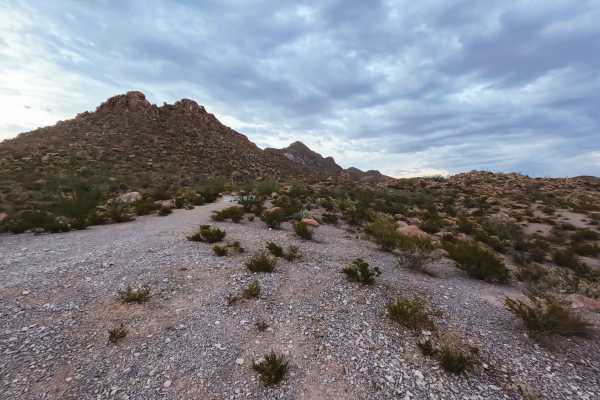
High Speed to Peak
This trail is a smooth dirt road with small rocks, suitable for higher-speed travel in good conditions. This is an out-and-back trail, leading to a dispersed camping area and a wonderful scenic overlook with views of Doña Ana Peak. Easy drive with light terrain changes and a rewarding destination.
Learn more about High Speed to Peak

Scenic Rock Access
This is an easy scenic trail with a mostly smooth terrain and one short rocky section. The route ends at a wash and serves as an access point to scenic rock formations and more technical rock-crawling trails beyond. Suitable for most high-clearance 4x4 vehicles. The trail quickly changes in rating o...
Learn more about Scenic Rock Access

Goat Hill Road Entry Point
This is a mostly smooth dirt trail with a few arroyo crossings and light sandy sections. Easy driving overall with minimal obstacles. You can use this route to enter from a paved area to enter into the Dona Anas Mountain Trail System, and turn off into trailheads or arroyos, or continue through the ...
Learn more about Goat Hill Road Entry Point

Ledge Loop
This is a quick scenic trail in the Dona Anas Mountain Trail System with rolling hills, small rock ledges, and moderate elevation changes. The route travels along hilltops with several intersections leading to additional trails, making it a great connector for exploring the area. Suitable for most h...
Learn more about Ledge Loop

Rock Mountain
This is a short but fun trail in the Dona Ana Mountain Trail System. It is a large, smooth rock mountain that has you drop 126 feet in under 400 yards of trail. There are no obstacles on the trail, and there is a nearby bypass from a trail one can take if they don't feel like making this climb.
Learn more about Rock Mountain

Dona Ana Rolling Hills
This 5-mile trail has areas to pull off, with lots of steep, loose-rock hills. There are minor ruts. This leads to multiple trailheads. Mostly easy terrain with no major obstacles. Includes a small rock crawl section featuring loose rock and ledges under 12 inches, along with several steep loose-roc...
Learn more about Dona Ana Rolling Hills
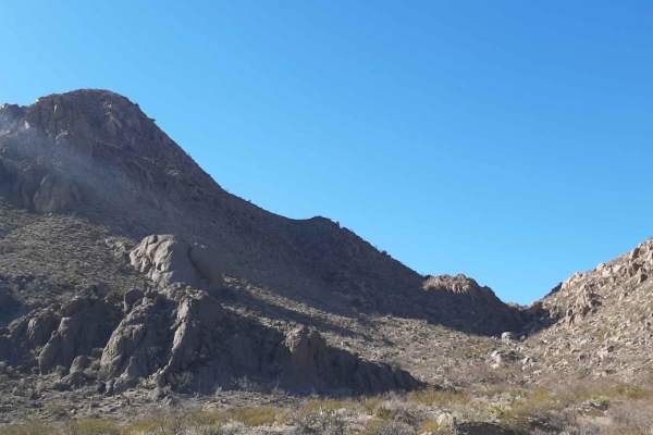
Lookout Point
Lookout Point is an ideal route for beginner to intermediate offroaders looking for a scenic run through the eastern-middle Doña Ana Mountains that ends with a rewarding overlook. Spanning approximately 3.4 miles, this trail starts east of the South mountain bike parking lot off of Desert Wind Road ...
Learn more about Lookout Point

County Road D053 Entrance
This section begins at the County Road D053 entrance and follows mostly smooth dirt terrain with minor erosion and occasional uneven areas. The route includes gentle rolling hills with slight elevation changes and is generally easy to navigate.
The trail is suitable for most vehicles in normal cond...
Learn more about County Road D053 Entrance
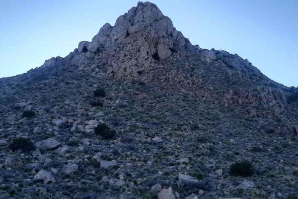
Nalgas Rock Overlook via Powerline Road
This short ride in the Dona Ana Mountains starts from the end of the desert wind way past the Dona Ana Trailhead. The road was in generally good condition with a few rock ledges and washouts where it crosses arroyos. Nalgas Rock is a rather large boulder near the end of the trail at the overlook/end...
Learn more about Nalgas Rock Overlook via Powerline Road

Border to Las Cruces
This trail starts on Highway 9 in New Mexico. This Highway parallels the border wall for a good while. Once you turn off onto the trail, you have the opportunity to air down. Though the trail is not very technical and is pretty well maintained, there are occasional pockets of silt you must watch for...
Learn more about Border to Las Cruces
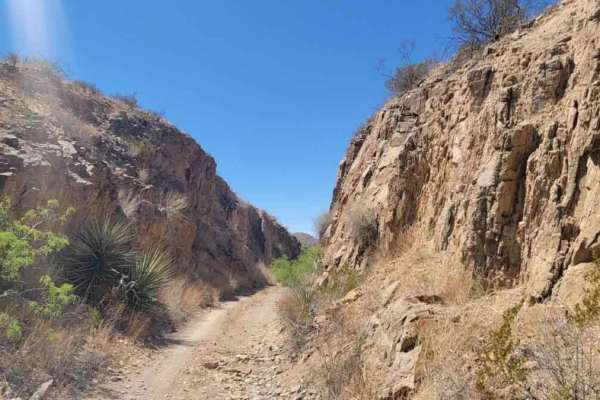
Cut Out Loop
This trail is about 6 miles long right outside of Oro Grande New Mexico. There are many trails in the area that lead to old prospected mines. Many of the mines are closed off but a few are open and should be explored with precaution. On this trail, you will encounter a variety of terrains. This is a...
Learn more about Cut Out Loop
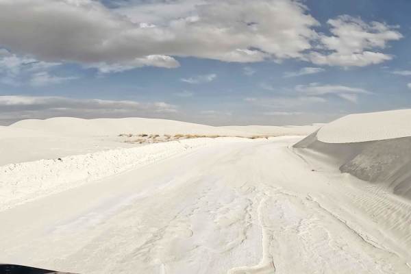
Dunes Drive, White Sands NP
Dunes Drive is an exciting and easy drive through White Sands National Park to experience the ancient gypsum dune field. The "sand" is hard-packed gypsum crystals and can easily be driven in a low clearance 2wd. Many people bring waxed sleds for sliding down the soft dunes throughout the park. Cover...
Learn more about Dunes Drive, White Sands NP

Gateway to Red Sands
The Gateway to Red Sands is a shallow, washed-out trail that has been used for years. While the majority of the trail is comparable to a dry riverbed and suitable for any 4WD vehicle, there are areas with obstacles suitable for built off-road rigs with ledges up to three feet tall. The trail runs th...
Learn more about Gateway to Red Sands
Beginner ATV trails near Las Cruces, New Mexico
Explore ATV-friendly trails near you. These trails are accessible for vehicles up to 50 inches wide, perfect for ATVs and smaller off-road machines.
Check Court Entrance
A Level 1 trail featuring low sandy dirt and a maintained access road that follows along power lines. The route begins near a residential area off a main highway and is an access and entry point into the trail system. It remains mostly smooth, flat, and easy to navigate, making it suitable for begin...
Learn more about Check Court Entrance
Powerline Road Entrance
A Level 2 trail that follows a powerline access road with a mix of rocky and sandy terrain. The route features some larger hills, loose rock, and rolling ups and downs that add moderate challenge. While there are no major erosion areas or deep ruts, the uneven surfaces and hill climbs are a fun entr...
Learn more about Powerline Road Entrance
Desert Wind Way
Desert Wind Way is a Level 2 trail featuring a mix of sandy terrain, loose small rocks, and uneven surfaces. The route is maintained but includes bumpy sections and mild obstacles that add some challenge while remaining accessible for most capable 4x4 vehicles. A good beginner-to-intermediate trail ...
Learn more about Desert Wind Way
Upper Powerline Road
Upper Powerline Road is a scenic Level 3 trail featuring steep climbs, rocky terrain, and a minor rock-crawling section. The route offers great views while providing a moderate challenge with technical areas that require careful line choice and controlled driving. Suitable for capable 4x4 vehicles l...
Learn more about Upper Powerline Road
Beginner UTV/side-by-side trails near Las Cruces, New Mexico
Find UTV and side-by-side trails near you. These trails accommodate vehicles up to 60 inches wide, ideal for UTVs, side-by-sides, and wider off-road rigs.
Check Court Entrance
A Level 1 trail featuring low sandy dirt and a maintained access road that follows along power lines. The route begins near a residential area off a main highway and is an access and entry point into the trail system. It remains mostly smooth, flat, and easy to navigate, making it suitable for begin...
Learn more about Check Court Entrance
Powerline Road Entrance
A Level 2 trail that follows a powerline access road with a mix of rocky and sandy terrain. The route features some larger hills, loose rock, and rolling ups and downs that add moderate challenge. While there are no major erosion areas or deep ruts, the uneven surfaces and hill climbs are a fun entr...
Learn more about Powerline Road Entrance
Desert Wind Way
Desert Wind Way is a Level 2 trail featuring a mix of sandy terrain, loose small rocks, and uneven surfaces. The route is maintained but includes bumpy sections and mild obstacles that add some challenge while remaining accessible for most capable 4x4 vehicles. A good beginner-to-intermediate trail ...
Learn more about Desert Wind Way
Upper Powerline Road
Upper Powerline Road is a scenic Level 3 trail featuring steep climbs, rocky terrain, and a minor rock-crawling section. The route offers great views while providing a moderate challenge with technical areas that require careful line choice and controlled driving. Suitable for capable 4x4 vehicles l...
Learn more about Upper Powerline Road
The onX Offroad Difference
onX Offroad combines trail photos, descriptions, difficulty ratings, width restrictions, seasonality, and more in a user-friendly interface. Available on all devices, with offline access and full compatibility with CarPlay and Android Auto. Discover what you're missing today!
Open Trail Map