
Beginner Off-Road Trails
Near Lafayette, Oregon
Explore All Beginner Trails Near Lafayette, Oregon
Beginner Off-Road Trails Near Lafayette, Oregon
Discover the best beginner-friendly off-road trails near you. These easier, lower-rated trails are a great place to start — browse trail maps, check difficulty ratings, and find your next adventure.
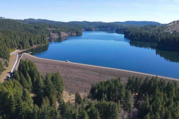
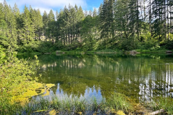
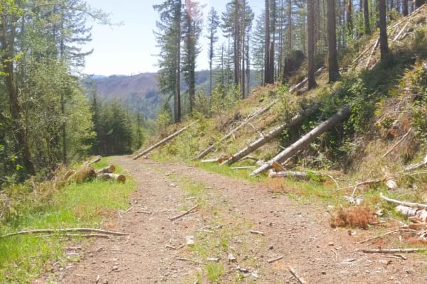
Yamhill Reservoir to Barney Reservoir
Start at the Yamhill Reservoir on Northwest Turner Creek Road, about 8 miles northwest of Yamhill, Oregon. The Yamhill Reservoir is a small body of water on the south side of the road, and just past the Yamhill Reservoir is the water treatment plant. After the water treatment plant is a gate. As wit...
Learn more about Yamhill Reservoir to Barney Reservoir
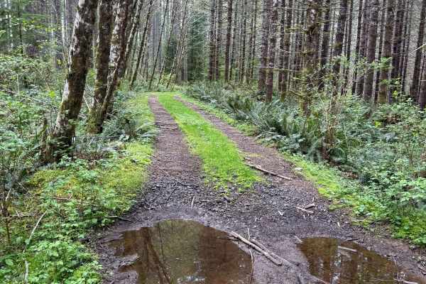
Bell Mountain Loop
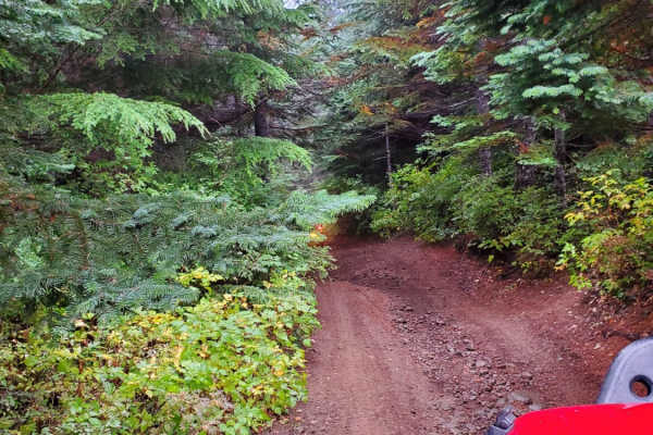
Right before you head up this loop you will go through an unnamed road. You will go through a big puddle and up a steep, loose hill with water running down one of the rutted sides, up and over a few water bars that you may think twice if you are in a car. But you never know. May also give it a shot ...
Learn more about Bell Mountain Loop
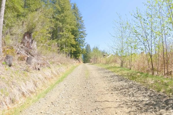
Bald Mountain
Start just west of McGuire Reservoir, turn left into an opening, and look for a bridge. This is a 6.7-mile route. Be aware that it crosses through Weyerhaeuser land with gates. The gates may be open or closed. At the end of the first section, there is a short (approximately 25 yards) of pavement on ...
Learn more about Bald Mountain
Ginger Creek Road
Scenic trail starting off in the foothills of the Oregon Coastal range, ascends to close to Dovre Peak at roughly 2,800ft elevation, then follows the meandering creeks and rivers on the way to the South Fork Trask River at the trail's end. Continue on Trask River Road to head to the beautiful coasta...
Learn more about Ginger Creek Road
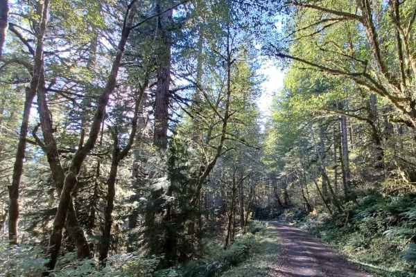
Hoag Pass Road
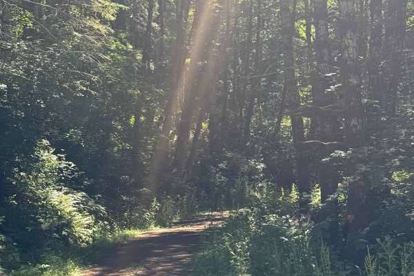
This gentle, winding gravel road travels through the BLM’s Nestucca River Recreation Area, connecting Bald Mountain Road to Nestucca River Rd. It provides access to numerous ATV trails, so be aware of trail crossings and oncoming traffic. The canopy is predominantly old-growth Douglas Fir, Western ...
Learn more about Hoag Pass Road
Dovre Peak Bypass
As of early April 2024, there is a landslide just to the east of the Elk Bend Campground blocking the Nestucca River Road. This bypass is from the Fan Creek Campground up to Dovre Peak (elevation 2,841 feet) to Elk Bend Campground. This route also allows access to areas of the Tillamook State Forest...
Learn more about Dovre Peak Bypass
Boundary Road
This gravel route runs through the BLM Nestucca River Recreation Area, connecting Elk Creek Road to Ginger Creek Road, with access to spur roads and pullouts for day-use. The road is generally well-maintained and graded, with compacted gravel, though potholes and seasonal overgrowth, and downed tre...
Learn more about Boundary Road

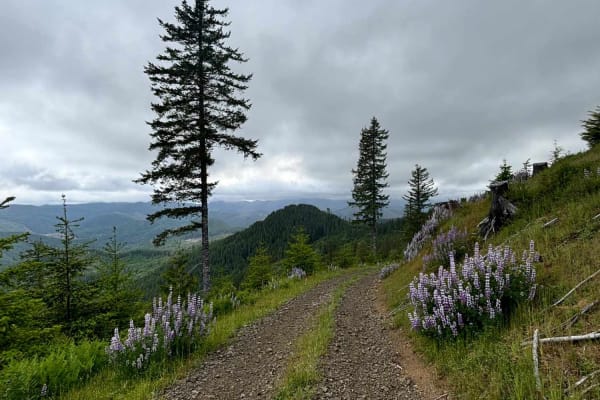
Gobblers Knob
Gobblers Knob is a 3,054-foot hill in the Tillamook State Forest south of the North Fork Trask River. It offers a spectacular view of the surrounding forest and mountains, especially to the south. The trail is not difficult aside from the final climb to the summit. Of course, weather conditions will...
Learn more about Gobblers Knob
Bell Mountain to Rye Mountain
Bell Mountain is located in the Upper Nestucca OHV Area west of McMinnville, Oregon. Bell Mountain is 2,608 feet and once housed a fire lookout tower which was removed in 1951. You can park nearby and it's a short hike to the top of the area. Rye Mountain is due west of Bell Mountain and is 2,425 fe...
Learn more about Bell Mountain to Rye Mountain
Dovre Peak to Tahoe Lake
From the south side, the trail to Tahoe Lake starts with the Dovre Peak Bypass, either from Fan Creek Campground or Elk Bend Campground. There are several options where the Dovre Peak Bypass meets the Tahoe Lake Trail. Near the top of the Tahoe Lake Trail, there are multiple overlooks to choose from...
Learn more about Dovre Peak to Tahoe Lake
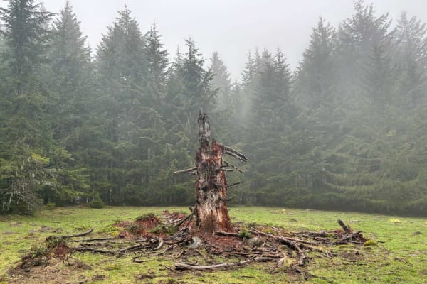
Murphy Guard Station Loop
The route consists of basic logging roads similar to much of the Tillamook State Forest area. There is a modest climb to the viewpoint at approximately 2,500 feet. The viewpoint overlooks the valley of the East Fork/South Fork Trask River area. From the west, the upper route consists of Steamboat Ro...
Learn more about Murphy Guard Station Loop
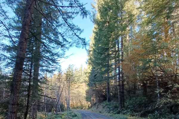
Niagara
Niagara Road runs through the Siuslaw National Forest. It is a one-lane gravel road with turnouts. Some sections of the road are more natural surfaces with sections that get muddy and slippery when wet. There are a few small spots off the side of the road that you could pull over for a night.
Learn more about Niagara
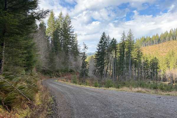
Grindstone View
Grindstone View road runs through the Tillamook State Forest and Siuslaw National Forest. It is an easy gravel road with sections that become more natural, some spots can be muddy when wet. There are some pretty views to enjoy on this route and a couple of good camp spots for a smaller group of vehi...
Learn more about Grindstone View
ZigZag Road - South
Zig Zag Road is an easy 3.8 mile gravel forest service road in the Tillamook Range. It is split into three sections (ZigZag Road North - 2.8miles, ZigZag Road South - .5 miles, and the ZigZag Trail - .5 miles) by a change in road surface and character. This easy level-two gravel road changes to a le...
Learn more about ZigZag Road - South
Nook Road
This is a narrow trail stretching approximately 1.5 miles, connecting to several trail networks in the Hebo region. Along this path, I encountered small mud holes and sections only wide enough for a single vehicle. The surroundings are lush, with ferns and moss-covered trees lining the route, and th...
Learn more about Nook Road
Square Top
Square Top Road runs through the Siuslaw National Forest. It is an easy one-lane gravel road with pullouts. Some sections of this road can get slippery when wet, and at one end of it, there is a spot that tends to be flooded when it rains or has snowmelt. If water is over the road, be careful when c...
Learn more about Square Top
ZigZag Road - North
Zig Zag Road is an easy 3.8 mile gravel forest service road in the Tillamook Range. It is split into three sections (ZigZag Road North - 2.8 miles, ZigZag Road South - .5 miles, and the ZigZag Trail - .5 miles) by a change in road surface and character. This easy level-two gravel road changes to a l...
Learn more about ZigZag Road - North
7 Up Ez
This is the easy side of 7 Up. It is fun and not as extreme as the hard side of 7 Up. Winding through the forest, there is a little bit of rutted-out dirt trial, some mud, rock sections, and lots of switchback turns. Lockers are not needed; just about any high clearance 4wd vehicle should be able to...
Learn more about 7 Up Ez
Military #43
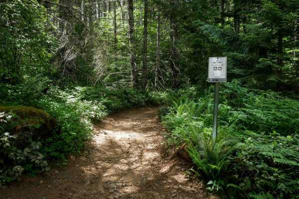
Military is a 2-mile graded and maintained trail featuring sections lined with cement pavers and a wide two-track surface through dense forest. Although mostly wide, there are occasional narrow tree pinches where trees closely line the trail. The route is fast and flowy with gentle curves, a few lar...
Learn more about Military #43
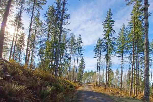
Coast Ridge - FS 2202
This is a smooth, gravel-based forest road that is narrow and one vehicle wide with places to pass. The trail has some two-track sections in places, has minor washboard in areas, and has some potholes to avoid. The trail travels through dense coastal forest, but you will also have views of the surro...
Learn more about Coast Ridge - FS 2202
Beginner ATV trails near Lafayette, Oregon
Explore ATV-friendly trails near you. These trails are accessible for vehicles up to 50 inches wide, perfect for ATVs and smaller off-road machines.
Bell Mountain Loop
Right before you head up this loop you will go through an unnamed road. You will go through a big puddle and up a steep, loose hill with water running down one of the rutted sides, up and over a few water bars that you may think twice if you are in a car. But you never know. May also give it a shot ...
Learn more about Bell Mountain Loop
Hoag Pass Road
This gentle, winding gravel road travels through the BLM’s Nestucca River Recreation Area, connecting Bald Mountain Road to Nestucca River Rd. It provides access to numerous ATV trails, so be aware of trail crossings and oncoming traffic. The canopy is predominantly old-growth Douglas Fir, Western ...
Learn more about Hoag Pass Road
Boundary Road
This gravel route runs through the BLM Nestucca River Recreation Area, connecting Elk Creek Road to Ginger Creek Road, with access to spur roads and pullouts for day-use. The road is generally well-maintained and graded, with compacted gravel, though potholes and seasonal overgrowth, and downed tre...
Learn more about Boundary Road
Murphy Guard Station Loop
The route consists of basic logging roads similar to much of the Tillamook State Forest area. There is a modest climb to the viewpoint at approximately 2,500 feet. The viewpoint overlooks the valley of the East Fork/South Fork Trask River area. From the west, the upper route consists of Steamboat Ro...
Learn more about Murphy Guard Station Loop
Beginner UTV/side-by-side trails near Lafayette, Oregon
Find UTV and side-by-side trails near you. These trails accommodate vehicles up to 60 inches wide, ideal for UTVs, side-by-sides, and wider off-road rigs.
Hoag Pass Road
This gentle, winding gravel road travels through the BLM’s Nestucca River Recreation Area, connecting Bald Mountain Road to Nestucca River Rd. It provides access to numerous ATV trails, so be aware of trail crossings and oncoming traffic. The canopy is predominantly old-growth Douglas Fir, Western ...
Learn more about Hoag Pass Road
Boundary Road
This gravel route runs through the BLM Nestucca River Recreation Area, connecting Elk Creek Road to Ginger Creek Road, with access to spur roads and pullouts for day-use. The road is generally well-maintained and graded, with compacted gravel, though potholes and seasonal overgrowth, and downed tre...
Learn more about Boundary Road
Murphy Guard Station Loop
The route consists of basic logging roads similar to much of the Tillamook State Forest area. There is a modest climb to the viewpoint at approximately 2,500 feet. The viewpoint overlooks the valley of the East Fork/South Fork Trask River area. From the west, the upper route consists of Steamboat Ro...
Learn more about Murphy Guard Station Loop
Niagara
Niagara Road runs through the Siuslaw National Forest. It is a one-lane gravel road with turnouts. Some sections of the road are more natural surfaces with sections that get muddy and slippery when wet. There are a few small spots off the side of the road that you could pull over for a night.
Learn more about Niagara
The onX Offroad Difference
onX Offroad combines trail photos, descriptions, difficulty ratings, width restrictions, seasonality, and more in a user-friendly interface. Available on all devices, with offline access and full compatibility with CarPlay and Android Auto. Discover what you're missing today!
Open Trail Map