
Beginner Off-Road Trails
Near Houston, Missouri
Explore All Beginner Trails Near Houston, Missouri
Beginner Off-Road Trails Near Houston, Missouri
Discover the best beginner-friendly off-road trails near you. These easier, lower-rated trails are a great place to start — browse trail maps, check difficulty ratings, and find your next adventure.
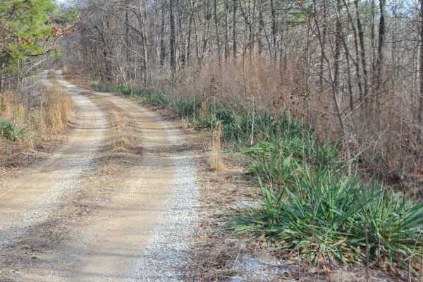
Perkins Ridge - FS 423
Perkins Ridge (FS 423) is a semi-maintained gravel forest service road within the Willow Springs Unit of Mark Twain National Forest. The Perkins Ridge begins at Missouri Route AM, heading west along the raised ridge top spines, first dropping downhill as it overlooks deep valleys on both sides of th...
Learn more about Perkins Ridge - FS 423
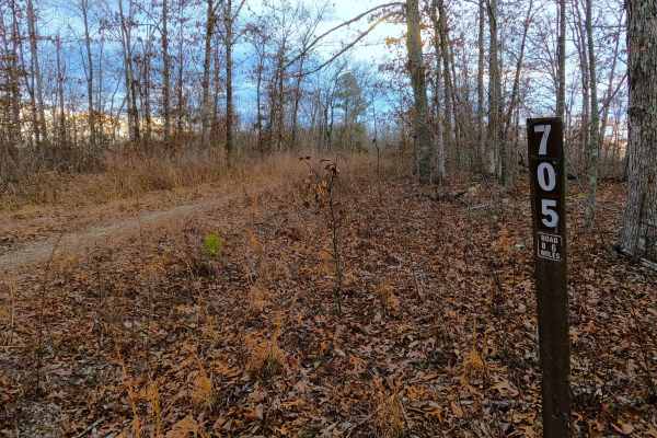
Section 8 - FS 705
Section 8 (FS 705) is a fading gravel dirt forest service road within the Willow Springs Unit of Mark Twain National Forest. Section 8 logistically connects between the Middle Ridge FS 424 on the east, and the Howell County Road 5830 on the west. The road features a thinning gravel, and natural dirt...
Learn more about Section 8 - FS 705
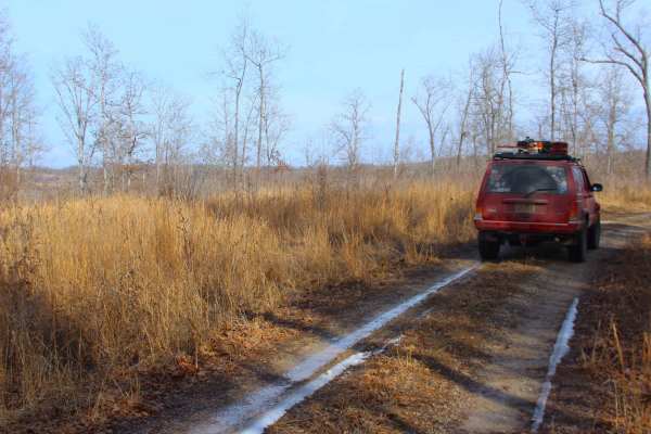
Tick Hollow - FS 423A
Tick Hollow (FS 423A), also known as Perkins Ridge Spur, is a semi-maintained gravel forest service road within the Willow Springs Unit of Mark Twain National Forest. The Tick Hollow road begins as the northern offshoot from the Perkins Ridge FS 423, turning northward, going down a short hill, up to...
Learn more about Tick Hollow - FS 423A
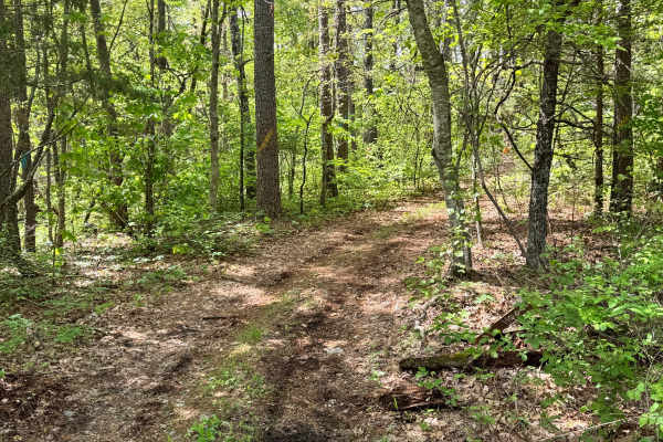
Coyote - FS 1790
This route is a narrow and lightly traveled out-and-back trail that feels far more remote than the main roads nearby. Overgrown trees and brush crowd the path, making pinstriping very likely for wider vehicles or those with fresh paint. The trail surface is mostly dirt with shallow ruts, leaf cover,...
Learn more about Coyote - FS 1790
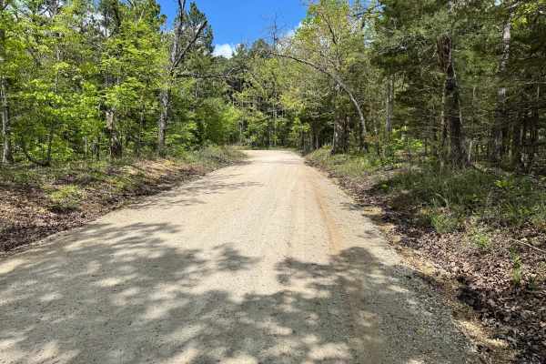
County Road 6630
This route follows a graded and maintained gravel road through a scenic forest setting, making it an easy and relaxing drive for nearly any vehicle. The road is generally wide enough for two vehicles to pass comfortably, with good visibility through most sections. There are no major obstacles or tec...
Learn more about County Road 6630
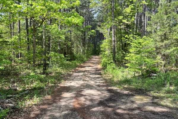
Gallings - FS 1791
This forest route offers an easy and relaxing drive on a gravel surface that is generally well-maintained and simple to navigate. It is mostly one vehicle wide, though there are several spots where drivers can pull toward the trees to allow oncoming traffic to pass. Because the trail has a little ex...
Learn more about Gallings - FS 1791
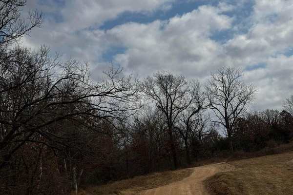
Main Park Entrance Trail
This trail is your main road for accessing different areas within the park. Please follow the signs designating areas where you can camp and also speed limits while some areas may have young riders terrain varies on the trail with some sections being washed out and a bit more difficult to navigate.
Learn more about Main Park Entrance Trail
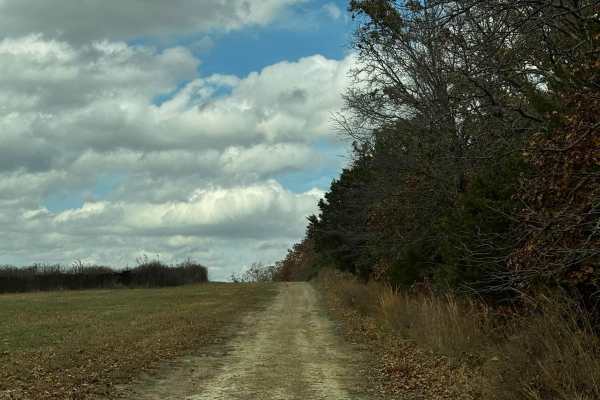
Turkey
This is an absolutely beautiful trail featuring loose rocks and some mild obstacles. Although it's a bit longer of a trail it's truly an enjoyable relaxing experience taking you deep into the trees and surrounding you with nature. Please be mindful of others and do your part with keeping the trail c...
Learn more about Turkey
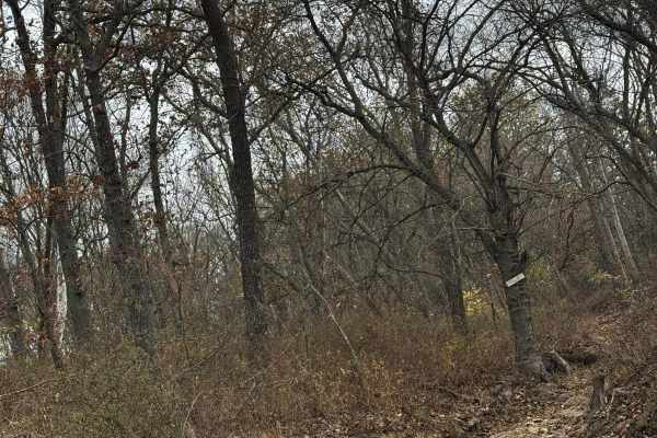
AXC Kids Loop
This loop is very fun for the kids to run laps on. The trail is easy and mellow with a few little "challenges" along the way. Located centrally in the park gives you a chance to relax and let them wear themselves out. With rain and other weather it can change the track so make sure to check it out b...
Learn more about AXC Kids Loop
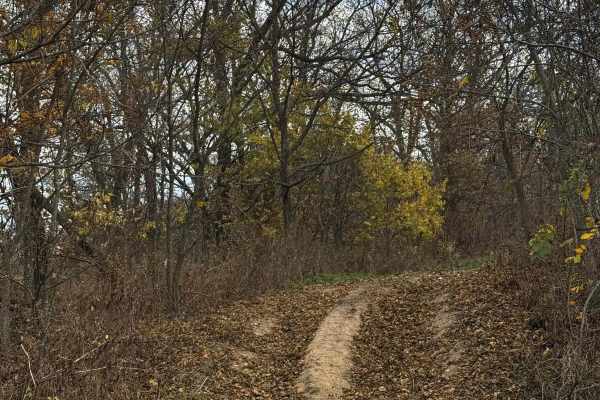
AXC Crossing
This crossing is a medium-lengthed trail that features some ruts and rock. The trail still provides beautiful scenery and a good way to get access to other challenges located close by, Be mindful of trail traffic and make sure to do your part in keeping the park clean and friendly for everyone.
Learn more about AXC Crossing

Jog It
Jog It is a quick and relatively easy trail for most rigs that have high clearance and all-terrain/mud-terrain tires. This trail has loose terrain and a climb that will require just a bit of offroading skills. Make sure to be mindful of others on the trail and please keep the trails clean for others...
Learn more about Jog It

Maze Jaunt
This is a quick trail spur off of the "maze" while the trails surrounding it are a bit more difficult this is an optional trail featuring a very scenic cut through the thick trees and greenery surrounding you. Take the time to take a few pictures and as always please remember to keep the trails clea...
Learn more about Maze Jaunt

Pocket Eddy Ford - FS 1792
This route follows a mostly one-vehicle-wide gravel trail through the forest with several dispersed campsites located along the way. It begins as an easy scenic drive, but conditions become rougher as you near the Big Piney River. The closer you get to the water, the rockier the trail surface become...
Learn more about Pocket Eddy Ford - FS 1792

Connector
This is an easy connector trail taking you across the field from one side of the bird loop to the other. There is nothing particularly notable or interesting with both obstacle E and E obstacle giving you a few options to spice things up and try a few challenges along the way. Be mindful of others; ...
Learn more about Connector

Cut Through
This trail is exactly what it's named a cut thru still a fun scenic trail but it gives you quick access without having to go all the way around! With just a few of these cuts in the park they're good to know and can save you some time on your trip!
Learn more about Cut Through

Maple Trail
This trail consists of absolutely breathtaking scenery taking you through some wash outs and soft terrain that will require your attention. Make sure to not get stuck in any of the softer sections. Please be mindful of others on this trail a few other trails spur off from this one!
Learn more about Maple Trail

Maze Jaunt 2
This is another cut through the maze featuring some soft sand and rock sections and tight turns through absolutely beautiful scenery. Make sure you pay attention to the map you do not want to end up on the wrong trail on the "maze" and as always please keep the trails clean!
Learn more about Maze Jaunt 2
Middle Ridge - FS 424
Middle Ridge (FS 424) is a semi-maintained gravel forest service road within the Willow Springs Unit of Mark Twain National Forest. The road begins at Missouri Route AM, heading north along the elevated ridge. When at the half-mile mark from the entry of the track, there is a small peak of a ridge s...
Learn more about Middle Ridge - FS 424
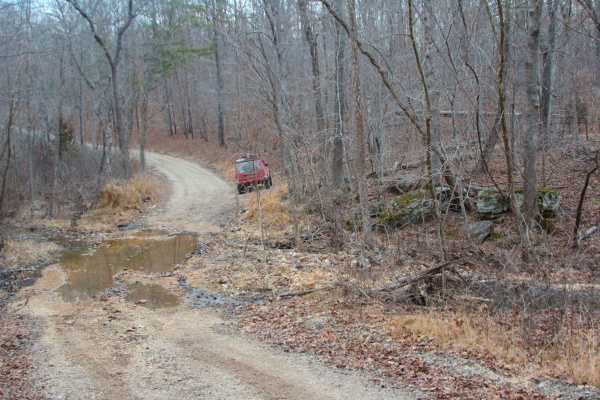
Indian Narrows - FS 426
Indian Narrows (FS 426) is a semi-maintained gravel Forest Service road within the Willow Springs Unit of Mark Twain National Forest. Indian Narrows begins at the Missouri Route AM along the ridge top, heading south, slowly losing elevation at first, then gradually getting steeper in grade to the po...
Learn more about Indian Narrows - FS 426

Trike Flat Track
The Trike Flat Track is a fun little spot in the park for messing around or running a couple of laps with your buddies. Be mindful of others that may be using the track and also please do your part in helping keep the track and park clean for everyone to enjoy.
Learn more about Trike Flat Track
Beginner ATV trails near Houston, Missouri
Explore ATV-friendly trails near you. These trails are accessible for vehicles up to 50 inches wide, perfect for ATVs and smaller off-road machines.
Perkins Ridge - FS 423
Perkins Ridge (FS 423) is a semi-maintained gravel forest service road within the Willow Springs Unit of Mark Twain National Forest. The Perkins Ridge begins at Missouri Route AM, heading west along the raised ridge top spines, first dropping downhill as it overlooks deep valleys on both sides of th...
Learn more about Perkins Ridge - FS 423
Section 8 - FS 705
Section 8 (FS 705) is a fading gravel dirt forest service road within the Willow Springs Unit of Mark Twain National Forest. Section 8 logistically connects between the Middle Ridge FS 424 on the east, and the Howell County Road 5830 on the west. The road features a thinning gravel, and natural dirt...
Learn more about Section 8 - FS 705
Tick Hollow - FS 423A
Tick Hollow (FS 423A), also known as Perkins Ridge Spur, is a semi-maintained gravel forest service road within the Willow Springs Unit of Mark Twain National Forest. The Tick Hollow road begins as the northern offshoot from the Perkins Ridge FS 423, turning northward, going down a short hill, up to...
Learn more about Tick Hollow - FS 423A
Main Park Entrance Trail
This trail is your main road for accessing different areas within the park. Please follow the signs designating areas where you can camp and also speed limits while some areas may have young riders terrain varies on the trail with some sections being washed out and a bit more difficult to navigate.
Learn more about Main Park Entrance Trail
Beginner UTV/side-by-side trails near Houston, Missouri
Find UTV and side-by-side trails near you. These trails accommodate vehicles up to 60 inches wide, ideal for UTVs, side-by-sides, and wider off-road rigs.
Perkins Ridge - FS 423
Perkins Ridge (FS 423) is a semi-maintained gravel forest service road within the Willow Springs Unit of Mark Twain National Forest. The Perkins Ridge begins at Missouri Route AM, heading west along the raised ridge top spines, first dropping downhill as it overlooks deep valleys on both sides of th...
Learn more about Perkins Ridge - FS 423
Section 8 - FS 705
Section 8 (FS 705) is a fading gravel dirt forest service road within the Willow Springs Unit of Mark Twain National Forest. Section 8 logistically connects between the Middle Ridge FS 424 on the east, and the Howell County Road 5830 on the west. The road features a thinning gravel, and natural dirt...
Learn more about Section 8 - FS 705
Tick Hollow - FS 423A
Tick Hollow (FS 423A), also known as Perkins Ridge Spur, is a semi-maintained gravel forest service road within the Willow Springs Unit of Mark Twain National Forest. The Tick Hollow road begins as the northern offshoot from the Perkins Ridge FS 423, turning northward, going down a short hill, up to...
Learn more about Tick Hollow - FS 423A
Main Park Entrance Trail
This trail is your main road for accessing different areas within the park. Please follow the signs designating areas where you can camp and also speed limits while some areas may have young riders terrain varies on the trail with some sections being washed out and a bit more difficult to navigate.
Learn more about Main Park Entrance Trail
The onX Offroad Difference
onX Offroad combines trail photos, descriptions, difficulty ratings, width restrictions, seasonality, and more in a user-friendly interface. Available on all devices, with offline access and full compatibility with CarPlay and Android Auto. Discover what you're missing today!
Open Trail Map