
Beginner Off-Road Trails
Near Helena West Side, Montana
Explore All Beginner Trails Near Helena West Side, Montana
Beginner Off-Road Trails Near Helena West Side, Montana
Discover the best beginner-friendly off-road trails near you. These easier, lower-rated trails are a great place to start — browse trail maps, check difficulty ratings, and find your next adventure.

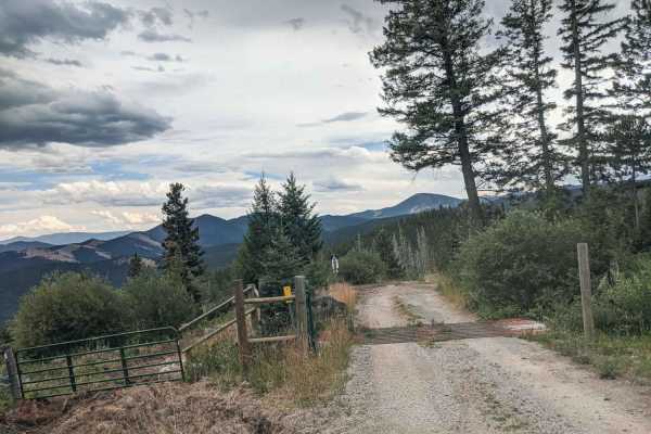
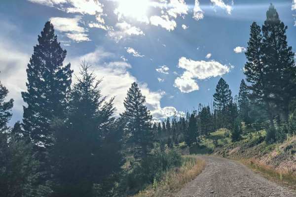
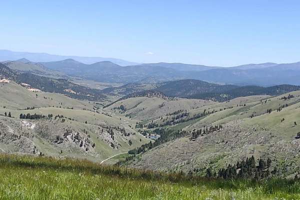
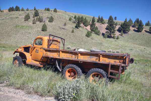
Birdseye-Mullan Road
This exciting trail generally follows the railroad route over the Continental Divide. Fans of train watching have six railroad crossings, a trestle bridge and multiple miles of track in view from the trail. Keep an eye out for one of the many freight or coal trains that pass along this route daily. ...
Learn more about Birdseye-Mullan Road
Microwave
Beautiful road with amazing views to enjoy, there isn't much for camping, there is camp at top of the road, big cell or power towers at top? Spotty cell phone service. Offers skiing trail in winter. Dirt or rocky road, typically unmaintained after rain or snow. You may encounter shallow water crossi...
Learn more about Microwave
Telegraph
This road has pretty views, with some camp spots, it dead ends at small camp, the road seems to go on, but it become impassible for a vehicle. It does go through private property so please be respectful.Dirt or rocky road, typically unmaintained after rain or snow. You may encounter shallow water cr...
Learn more about Telegraph
Treasure Mountain
This road has beautiful views, there seems to be no camping, it does ends at a gate, but open is to motorized under 50inchs wide, as well as bike, and hiking.Dirt or rocky road with gentle grades. Safe for most 4WD and high-clearance 2WD vehicles. Roads are typically two vehicles wide.
Learn more about Treasure Mountain
Minnehaha
You will enjoy this road with its amazing views. There are a few spots that look like they would be good for camping. Road can be muddy when wet, with some water puddles. One section of this road is steep, and can be slippery when wet.Dirt or rocky road, typically unmaintained after rain or snow. Yo...
Learn more about Minnehaha

Little Blackfoot
The road starts off as pavement for only 4 short miles, it goes through private property, after that you will enjoy amazing views. There are a bunch of camping spots, enough space for a large group at some spots. This road also offers access to man hiking, biking and horse back riding trails.Dirt or...
Learn more about Little Blackfoot
Elliston Spotted Dog
You will enjoy this road with its amazing views. There are a few spots that look like they would be good for camping. Road can be muddy when wet, with some water puddles. Dirt or rocky road, typically unmaintained after rain or snow. You may encounter shallow water crossings and obstacles under 12" ...
Learn more about Elliston Spotted Dog
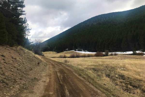
TV Tower/ Slate Creek Road
The trail begins steeply from Elliston Spotted Dog Road. It starts with a rocky section, rated a 2 on a scale of 1-10 in difficulty. During the winter, this steep portion can be slippery, but in the summer and spring, it is more manageable. The rest of the trail transitions to a flat dirt road, lead...
Learn more about TV Tower/ Slate Creek Road
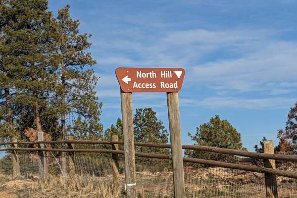
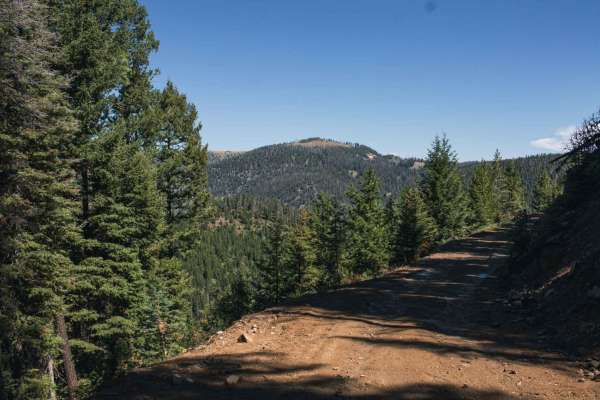
North Hills Recreation Area
The North Hills Recreation Area trail is a dirt road in overall good condition. The trail is accessible by 2WD car if you can stay out of the ruts. Along the North Hills Recreation Area trail, watch for rocks, ruts, and others out enjoying the area. You will be rewarded with lovely views of the surr...
Learn more about North Hills Recreation Area
Prickly Pear to Tizer Lakes
Starting from Montana Highway 282, you will take the bend onto Tizer Lake Road, which leads to Prickly Pear Road. Prickly Pear Road goes through private land, but there is a designated route to access Tizer Lake. A compressor or other method to air tires up or down is recommended since the majority ...
Learn more about Prickly Pear to Tizer Lakes

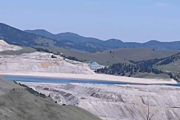
Mina Gulch Spur
This Mina Gulch Spur takes you from the Bluebird Mine Loop past the Mina Mine and to an overlook of the lake on Montana Tunnels Mining. It's just under a mile, and your elevation is about 6600 feet. All private property crossings are allowed if you stay on the trail. The scenery is beautiful. The vi...
Learn more about Mina Gulch Spur
Clancy Creek Road
Clancy Creek Road takes you from Mina Gulch/Between Gulch west a little further into the Helena National Forest. If you follow it further than our track, you pass the Crawley Camp Mine and get an overlook of the lake at Montana Tunnels Mining. All private property crossings are allowed if you stay o...
Learn more about Clancy Creek Road
Bluebird Mine Trail Loop
This 2-mile loop connects the Bluebird Mine Trail to Between Gulch Trail and Flynn Gulch Road. It travels through the Helena National Forest at an average elevation of 6500 feet. All private property crossings are allowed if you stay on the trail. The scenery is beautiful. The views are amazing. Th...
Learn more about Bluebird Mine Trail Loop
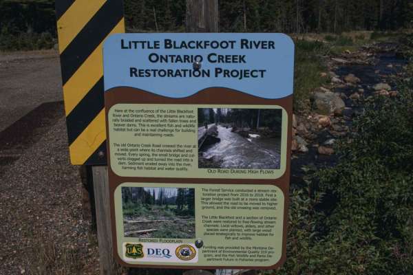
Ontario
The road has been rerouted due to a bridge giving out, but you will still be able to get to this road to enjoy its views. There are a bunch of camping spots, enough space for a large group at some spots.Dirt or rocky road, typically unmaintained after rain or snow. Roads are typically one to two veh...
Learn more about Ontario
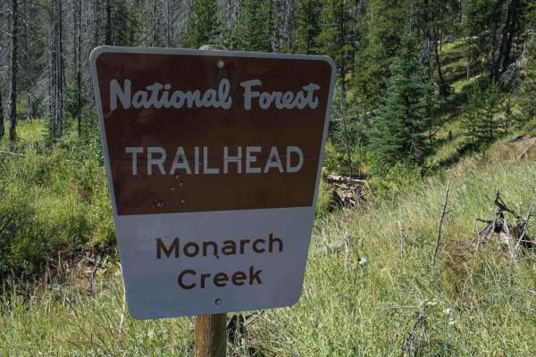
Monarch
Beautiful road with views to enjoy. When wet there will be water puddles that can be deep. There isn't much for camping, maybe a spot or two, the road ends at a hiking trail with a fire pit and a small to medium size area to turn around.Dirt or rocky road, typically unmaintained after rain or snow. ...
Learn more about Monarch
Bluebird Mine Road
This 1.68-mile trail takes you from Bluebird Mine Loop to Wood Chute Cr to Bluebird Mine Trail. All private property crossings are allowed if you stay on the trail. The scenery is beautiful. The views are amazing. This forest is home to deer, elk, and bears. If you are here in the early springtime, ...
Learn more about Bluebird Mine Road
Wood Chute to Blue Bird Mine
This 7-mile trail takes you from the Wickes Tunnel: Corbin to Basin Trail up to an elevation of 7500 feet, with fantastic views of Boulder. This route includes steep inclines and declines, as you gain 2300 feet. All private property crossings are allowed if you stay on the trails.
Learn more about Wood Chute to Blue Bird Mine
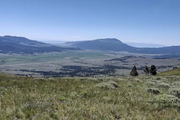
Marsh Creek
Marsh Creek Trail is a popular access point to Granite Peak Lookout in the Helena National Forest. This trail is also part of the Continental Divide Route, so in the summer be on the lookout for mountain bikers, Jeeps and adventure motorcycles. It is not uncommon to see deer and elk while on this tr...
Learn more about Marsh Creek
Bison Mountain
This road can be muddy when wet, with water puddles, it has beautiful views, there seems to be no camping. There is a hiking trail but it is very overgrown and hard to find. Not very many spots to turn around, a short-wheelbase vehicle will be able to, but a long vehicle will have a hard time.Dirt o...
Learn more about Bison Mountain
Wickes Road
Wickes Road Trail is an alternate way to go from Basin to Corbin, and you go up over the top of the mountain. The highest elevation is just under 6800 feet, but if the tunnel is full of snow or water, ice, or for some other reason impassable, this is a good option. It's just over 3 miles. The views ...
Learn more about Wickes Road
Beginner ATV trails near Helena West Side, Montana
Explore ATV-friendly trails near you. These trails are accessible for vehicles up to 50 inches wide, perfect for ATVs and smaller off-road machines.
Birdseye-Mullan Road
This exciting trail generally follows the railroad route over the Continental Divide. Fans of train watching have six railroad crossings, a trestle bridge and multiple miles of track in view from the trail. Keep an eye out for one of the many freight or coal trains that pass along this route daily. ...
Learn more about Birdseye-Mullan Road
Microwave
Beautiful road with amazing views to enjoy, there isn't much for camping, there is camp at top of the road, big cell or power towers at top? Spotty cell phone service. Offers skiing trail in winter. Dirt or rocky road, typically unmaintained after rain or snow. You may encounter shallow water crossi...
Learn more about Microwave
Minnehaha
You will enjoy this road with its amazing views. There are a few spots that look like they would be good for camping. Road can be muddy when wet, with some water puddles. One section of this road is steep, and can be slippery when wet.Dirt or rocky road, typically unmaintained after rain or snow. Yo...
Learn more about Minnehaha
Little Blackfoot
The road starts off as pavement for only 4 short miles, it goes through private property, after that you will enjoy amazing views. There are a bunch of camping spots, enough space for a large group at some spots. This road also offers access to man hiking, biking and horse back riding trails.Dirt or...
Learn more about Little Blackfoot
Beginner UTV/side-by-side trails near Helena West Side, Montana
Find UTV and side-by-side trails near you. These trails accommodate vehicles up to 60 inches wide, ideal for UTVs, side-by-sides, and wider off-road rigs.
Birdseye-Mullan Road
This exciting trail generally follows the railroad route over the Continental Divide. Fans of train watching have six railroad crossings, a trestle bridge and multiple miles of track in view from the trail. Keep an eye out for one of the many freight or coal trains that pass along this route daily. ...
Learn more about Birdseye-Mullan Road
Microwave
Beautiful road with amazing views to enjoy, there isn't much for camping, there is camp at top of the road, big cell or power towers at top? Spotty cell phone service. Offers skiing trail in winter. Dirt or rocky road, typically unmaintained after rain or snow. You may encounter shallow water crossi...
Learn more about Microwave
Telegraph
This road has pretty views, with some camp spots, it dead ends at small camp, the road seems to go on, but it become impassible for a vehicle. It does go through private property so please be respectful.Dirt or rocky road, typically unmaintained after rain or snow. You may encounter shallow water cr...
Learn more about Telegraph
Treasure Mountain
This road has beautiful views, there seems to be no camping, it does ends at a gate, but open is to motorized under 50inchs wide, as well as bike, and hiking.Dirt or rocky road with gentle grades. Safe for most 4WD and high-clearance 2WD vehicles. Roads are typically two vehicles wide.
Learn more about Treasure Mountain
The onX Offroad Difference
onX Offroad combines trail photos, descriptions, difficulty ratings, width restrictions, seasonality, and more in a user-friendly interface. Available on all devices, with offline access and full compatibility with CarPlay and Android Auto. Discover what you're missing today!
Open Trail Map