
Beginner Off-Road Trails
Near Eddington, Maine
Explore All Beginner Trails Near Eddington, Maine
Beginner Off-Road Trails Near Eddington, Maine
Discover the best beginner-friendly off-road trails near you. These easier, lower-rated trails are a great place to start — browse trail maps, check difficulty ratings, and find your next adventure.
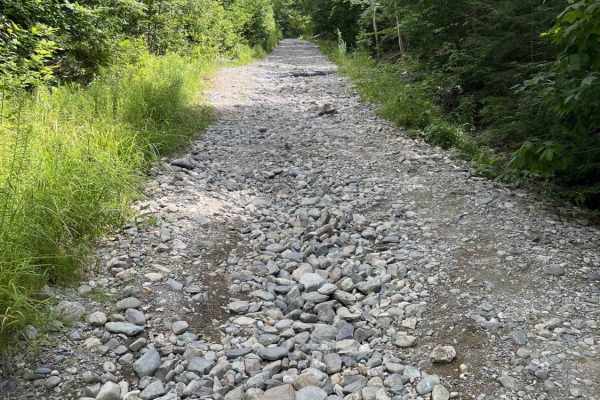
Bald Mountain Trail
A mostly gravel road with a few washouts. A few snowmobile side trails that are not 4x4 friendly. Towards the top, there are a few ledges with some concrete filler and a granite bluff with some ledge steps to play on. The top is shared with a hiking trail, and the road is hiked as well.
Learn more about Bald Mountain Trail
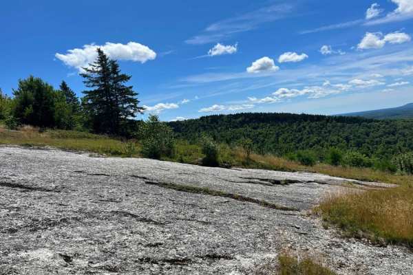
Bald Mountain
Granite rock face. Very steep up and down with a few off-camber angles with a few in excess of 27 degrees over some ledges. Amazing views on both sides of the trail going up and past the antenna towers overlooking Phillips Lake up to Bangor.
Learn more about Bald Mountain
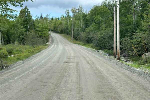
Nicolin Road
Nicolin Road is a well-maintained road primarily bordered by private land. The eastern portion has several potholes that are easily avoided, and the route is passable by most vehicles. While the road itself isn't particularly exciting, the real treat comes at the end. Nicolin Road provides public ac...
Learn more about Nicolin Road
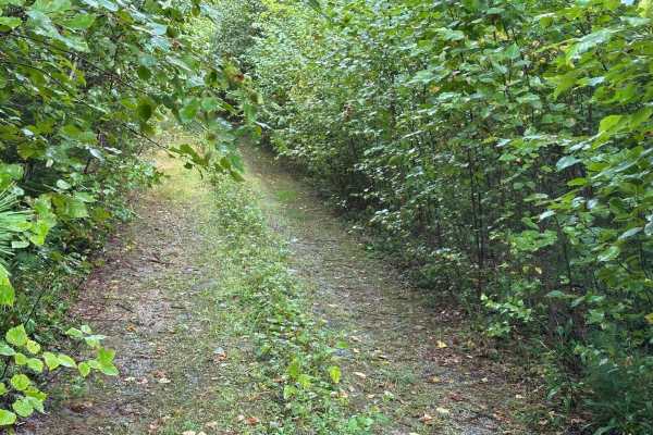
Forrest Moore Way
Forrest Moore Way is an easy but very overgrown route. It passes through thick brush, low-hanging branches, and tall grass, so heavy pinstriping should be expected. While the route is overgrown, the road itself is very easy and passable by most vehicles. Mud may be present after heavy rain. The trai...
Learn more about Forrest Moore Way
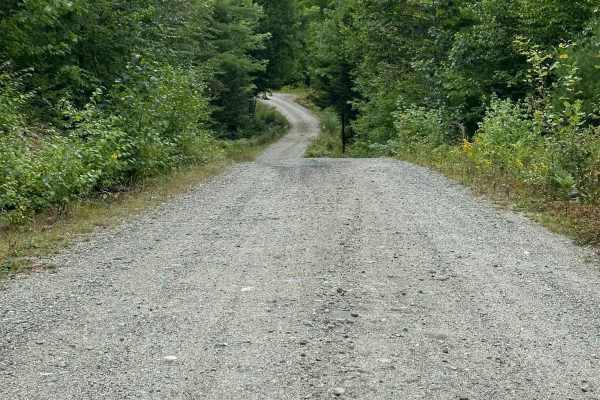
Branch Lake Forest Access Road
Branch Lake Forest Access Road is a maintained dirt road with a few potholes and one section of loose rock designed for drainage. Mud can be expected after heavy rain, but the road should be passable by most vehicles. There is no winter maintenance along this route, so be prepared in colder months. ...
Learn more about Branch Lake Forest Access Road

Buffalo Stream East
This trail provides access to the eastern side of Buffalo Stream. The trail is primarily dirt/grass and is very narrow due to the soft white pine needles. Use caution as the narrowness of this trail may result in scratches on the vehicle. This trail dead ends at Buffalo Stream, where there used to b...
Learn more about Buffalo Stream East
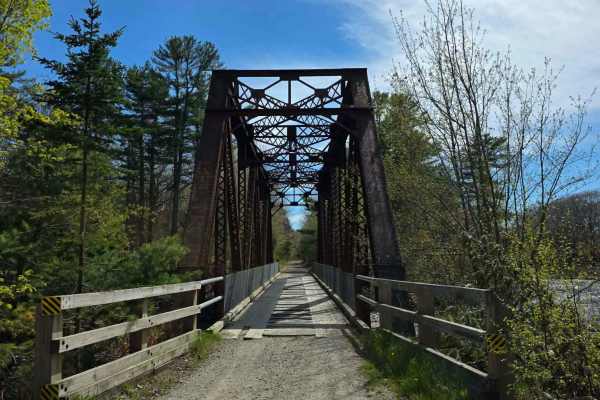
Down East Sunrise Trail
87 Miles of Pure Maine woods, Cherryfields, dense pine and birch forests with views of Schoodic Mountain and bog. Bridges going across the Narraguagus River. Trails that will bring you to some of Machias coastal waters and bridges that span salmon rivers. Remote crossings in wetland areas. All bits ...
Learn more about Down East Sunrise Trail
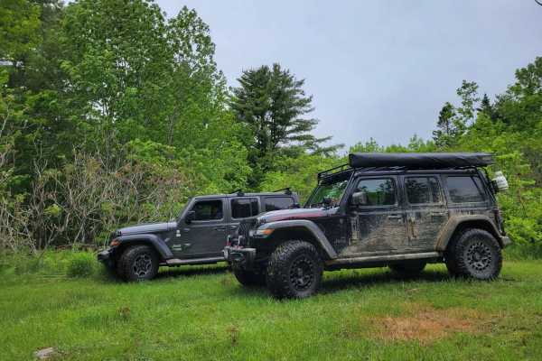
Baker Hill Summit
This trail takes you to the top of Baker Hill. The trail is dirt and grass and somewhat elevated. The trail is less developed than some of the other larger trails and is more accepting of single-vehicle traffic. Towards the top, the trail spurs out into a few smaller dead ends and becomes a bit tigh...
Learn more about Baker Hill Summit
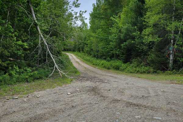
Brandy Pond West
This trail provides access to the western side of Brandy Pond. The trail is primarily dirt road, with some sections that are more water-saturated and could be evaluated during the spring or other wet times of the year. The trail is less developed than some of the other larger trails and is more acce...
Learn more about Brandy Pond West
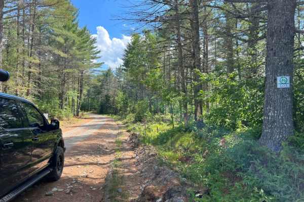
Spectacle Pond
Spectacle Pond is an inviting trail network for offroaders seeking a scenic and accessible drive through the beautiful, dense forests of eastern Maine near Osborn. Stretching approximately 19.3 miles, this route features a mix of wide, well-maintained gravel roads and narrower spur trails that provi...
Learn more about Spectacle Pond
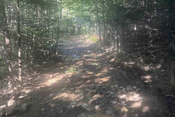
Corinna Loop Trail
This route starts on the Newport - Dover multi use trail. The trail contains a lot of riding on the edge of farmers fields, and access roads to get back to the multi- use trail. The trail does had a spot with some deep mud but does have a bypass around the mud pit. The trail uses a lot of farmer fie...
Learn more about Corinna Loop Trail
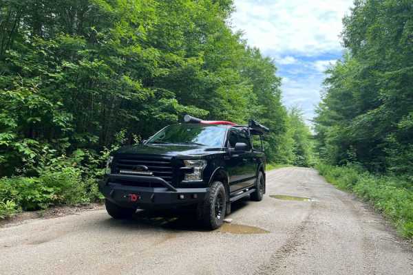
Narraguagus Lake
Narraguagus Lake is an easy, highly accessible point-to-point gravel route perfect for beginners, scenic cruisers, and all vehicle types, including stock four-wheel-drive vehicles, SxSs, and high-clearance two-wheel-drive rigs looking to explore the remote backcountry of eastern Maine. Starting near...
Learn more about Narraguagus Lake
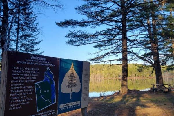
Oxhead Lakes Trail
This trail provides access to the Oxhead Ponds and a variety of other trails to be explored. The trail is dirt and wide enough for 2 vehicles to pass with ease. As a primary access road, it can be considered busy at times, but as a connector, it is a crucial part of other trails to be explored. Ther...
Learn more about Oxhead Lakes Trail

West to Oxhead Connector
This trail is a connector between the West Lake Southern Tip and Oxhead Lakes Trail. The trail is primarily a dirt road, with some sections that are more water saturated and could be evaluated during the spring or other wet times of the year. The trail is less developed than some of the other larger...
Learn more about West to Oxhead Connector
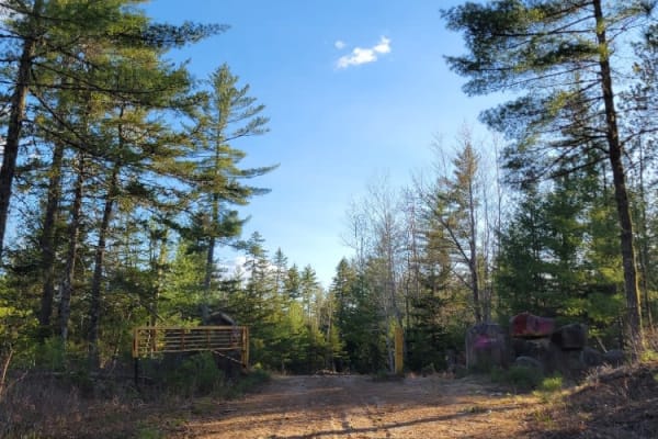
West Lake Southern Tip
This trail traverses between Nicatous Lake to the east and West Lake to the west. The trail is primarily dirt and wide enough for vehicles to pass each other. There is a variety of spurs from this trail leading to either lake and to some private seasonal camps. Woods, water, and wildlife are abundan...
Learn more about West Lake Southern Tip

Donnell Pond
Donnell Pond is a gravel road that is mostly wide open, but some spur roads can become quite narrow. Sections of this road serves as snowmobile trails in the wintertime. Camping in this area is allowed, but campfires are prohibited for non-established sites. The trail becomes progressively rougher t...
Learn more about Donnell Pond

Otter Creek
Otter Creek is a quick out and back trail with a few dispersed campsites along the side of the road. It's narrower than most in the area and ends at a rock gatekeeper. The trail seems to disappear into the woods beyond that but serves as a hiking trail to get to Trunk Stream. The road is well mainta...
Learn more about Otter Creek

Newport to Onawa
This is a great trail with a fantastic train trestle at the end. The trail is mostly two-track, with a few standard ATV trails. Trails are well marked and maintained, and the views from the trestle are amazing. Other interesting things along the way include waterfalls, beaver dams and lakes. Stop in...
Learn more about Newport to Onawa
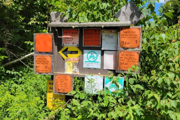
Frye Mountain - High Ridge to Getchell
The Frye Mountain - High Ridge to Getchell trail is a West to East crossing through the Frye Mountain State Game Management Area. This trail is just over 8 miles passing by the Carter Cemetery and includes a small 3 mile (out and back) to another private Cemetery, where the trail becomes a turnarou...
Learn more about Frye Mountain - High Ridge to Getchell
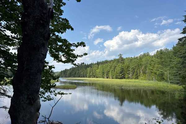
Long Pond Fire Road
The Long Pond Fire Road Trail is one of the few dirt roads in the Acadia National Park where you can escape the crowds. The trail starts at the Tremont Road and takes you to several trailheads, a beautiful swimming area at the Long Pond, Hodgdon Pond, and the Seal Cove Pond. The trail is a gravel fo...
Learn more about Long Pond Fire Road
Beginner ATV trails near Eddington, Maine
Explore ATV-friendly trails near you. These trails are accessible for vehicles up to 50 inches wide, perfect for ATVs and smaller off-road machines.
Bald Mountain Trail
A mostly gravel road with a few washouts. A few snowmobile side trails that are not 4x4 friendly. Towards the top, there are a few ledges with some concrete filler and a granite bluff with some ledge steps to play on. The top is shared with a hiking trail, and the road is hiked as well.
Learn more about Bald Mountain Trail
Buffalo Stream East
This trail provides access to the eastern side of Buffalo Stream. The trail is primarily dirt/grass and is very narrow due to the soft white pine needles. Use caution as the narrowness of this trail may result in scratches on the vehicle. This trail dead ends at Buffalo Stream, where there used to b...
Learn more about Buffalo Stream East
Down East Sunrise Trail
87 Miles of Pure Maine woods, Cherryfields, dense pine and birch forests with views of Schoodic Mountain and bog. Bridges going across the Narraguagus River. Trails that will bring you to some of Machias coastal waters and bridges that span salmon rivers. Remote crossings in wetland areas. All bits ...
Learn more about Down East Sunrise Trail
Baker Hill Summit
This trail takes you to the top of Baker Hill. The trail is dirt and grass and somewhat elevated. The trail is less developed than some of the other larger trails and is more accepting of single-vehicle traffic. Towards the top, the trail spurs out into a few smaller dead ends and becomes a bit tigh...
Learn more about Baker Hill Summit
Beginner UTV/side-by-side trails near Eddington, Maine
Find UTV and side-by-side trails near you. These trails accommodate vehicles up to 60 inches wide, ideal for UTVs, side-by-sides, and wider off-road rigs.
Bald Mountain Trail
A mostly gravel road with a few washouts. A few snowmobile side trails that are not 4x4 friendly. Towards the top, there are a few ledges with some concrete filler and a granite bluff with some ledge steps to play on. The top is shared with a hiking trail, and the road is hiked as well.
Learn more about Bald Mountain Trail
Bald Mountain
Granite rock face. Very steep up and down with a few off-camber angles with a few in excess of 27 degrees over some ledges. Amazing views on both sides of the trail going up and past the antenna towers overlooking Phillips Lake up to Bangor.
Learn more about Bald Mountain
Buffalo Stream East
This trail provides access to the eastern side of Buffalo Stream. The trail is primarily dirt/grass and is very narrow due to the soft white pine needles. Use caution as the narrowness of this trail may result in scratches on the vehicle. This trail dead ends at Buffalo Stream, where there used to b...
Learn more about Buffalo Stream East
Down East Sunrise Trail
87 Miles of Pure Maine woods, Cherryfields, dense pine and birch forests with views of Schoodic Mountain and bog. Bridges going across the Narraguagus River. Trails that will bring you to some of Machias coastal waters and bridges that span salmon rivers. Remote crossings in wetland areas. All bits ...
Learn more about Down East Sunrise Trail
The onX Offroad Difference
onX Offroad combines trail photos, descriptions, difficulty ratings, width restrictions, seasonality, and more in a user-friendly interface. Available on all devices, with offline access and full compatibility with CarPlay and Android Auto. Discover what you're missing today!
Open Trail Map