
Beginner Off-Road Trails
Near East Cathlamet, Washington
Explore All Beginner Trails Near East Cathlamet, Washington
Beginner Off-Road Trails Near East Cathlamet, Washington
Discover the best beginner-friendly off-road trails near you. These easier, lower-rated trails are a great place to start — browse trail maps, check difficulty ratings, and find your next adventure.

Trunkline
This is the longest OHV trail in the Nicolai Mountain system at 3.4 miles. It offers a fun mix of terrain with big crisscrossing root bands, tight curves through dense forest, and embedded rocks or muddy patches. A narrow section winds through thick vegetation with low branches that will grab at UTV...
Learn more about Trunkline
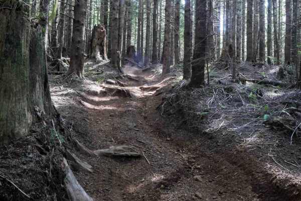
Hunt Loop
This is an easy and flowy loop that adds some extra mileage off of Hunt Creek. It's a wide OHV trail through a forest of spruce and firs for 1.2 miles. Expect some large root bands, narrower spots between the trees closely lining the trail, some deep ruts in spots, and semi-steep but manageable grad...
Learn more about Hunt Loop

Hunt Creek
Hunt Creek is a 3-mile easy OHV trail that gently descends from south to north through dense forest. The trail features scattered loose rock, embedded root bands, and several road and wooden bridge crossings. It remains gradual throughout and provides access to Hunt Loop and Hunt Hill. Although the ...
Learn more about Hunt Creek
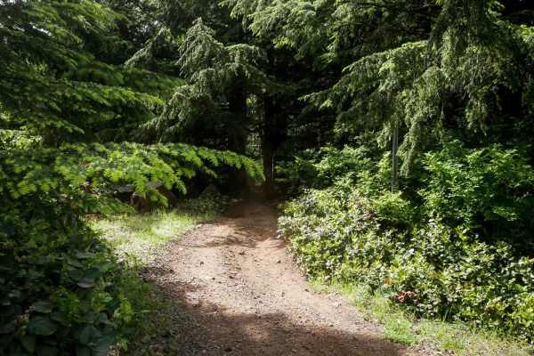
Cake Walk
Cake Walk is an easy trail, leaving from the quarry staging area and immediately presenting multiple split lines that can be a bit confusing at first. Once on the main path, the trail stays relatively easy despite frequent muddy sections, embedded and loose rock, and large root bands. The surface ha...
Learn more about Cake Walk
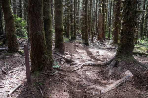
MW10
This short connector trail is less than half a mile long and offers a scenic route through thick mossy spruce trees. Similar to the terrain of Microwave, it includes muddy spots, large root bands, and a few tight pinches between trees that may be challenging for wider UTVs. There are split lines ava...
Learn more about MW10
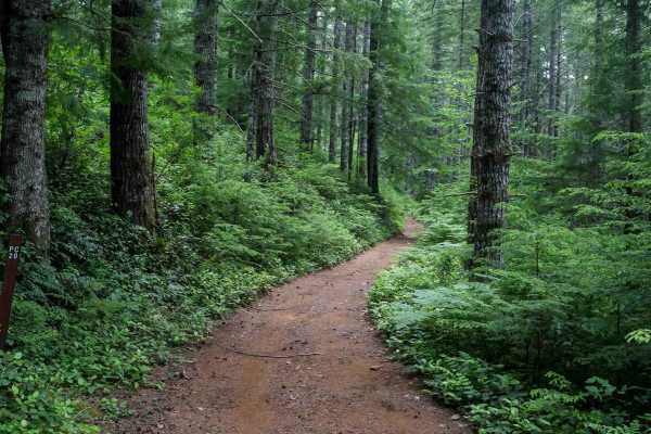
PC20
PC20 is a short and easy connector trail that links the forest road to Plympton Creek trail. About a quarter mile long, it's mostly flat and gradual with a smooth surface and no obstacles. The trail winds through dense forest and may have a few muddy spots, but it remains very manageable and ideal f...
Learn more about PC20
PC40
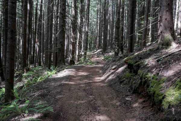
PC40 is a short and scenic connector trail linking Plympton Creek Trail to Plympton Ridge Road. It winds through a lush forest of Sitka spruce and Douglas fir, passing the stumps of a few massive old-growth trees. The trail features root bands, muddy spots, and scattered loose rocks, but remains man...
Learn more about PC40
Porter Ridge
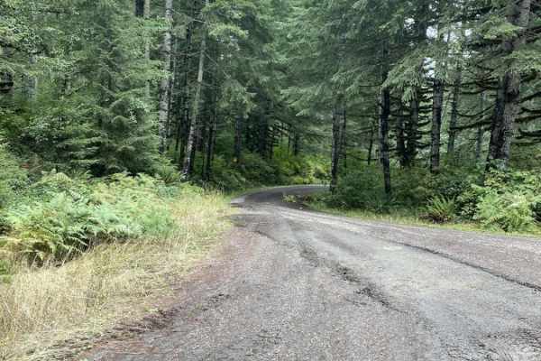
Porter Ridge is a 6.1-mile gravel route through Clatsop State Forest. Starting near Nicolai Mountain, the trail winds north and descends from 1,752 feet to 663 feet. The route follows narrow, well-maintained gravel logging roads through a dense canopy of hemlock, spruce, and Douglas-fir.
Rated 1 fo...
Learn more about Porter Ridge
Wage to Walker Ridge
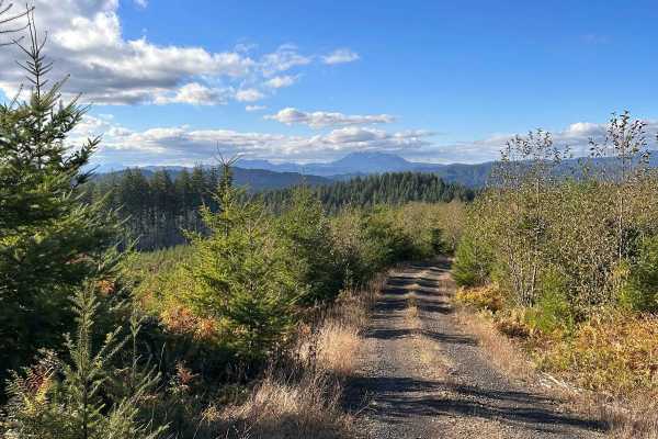
Wage to Walker Ridge offers an accessible and highly scenic escape into the lush timberlands of the Clatsop State Forest, making it perfect for novice offroaders, scenic tourers, and families looking for an easy day on the trail. This 16.8-mile loop traverses gravel and dirt logging roads, reaching ...
Learn more about Wage to Walker Ridge
Butler Creek Mainline
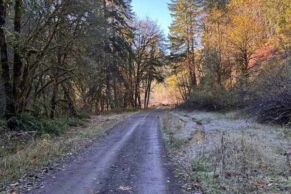
Butler Creek Mainline offers an easy and scenic 5.4-mile driving experience for offroaders looking to explore the dense greenery of Oregon's Clatsop State Forest. Serving as the primary logging artery into the heart of this coastal forest, the route is well-suited for stock SUVs and high-clearance f...
Learn more about Butler Creek Mainline

Shaffer Road
Shaffer Road offers a scenic off-road route, providing an alternative to Apiary Road for travelers between Rainier and Vernonia, especially during its closures due to a washout at milepost 11. This route winds along the upper Clatskanie River through private timberlands, offering glimpses of serene ...
Learn more about Shaffer Road
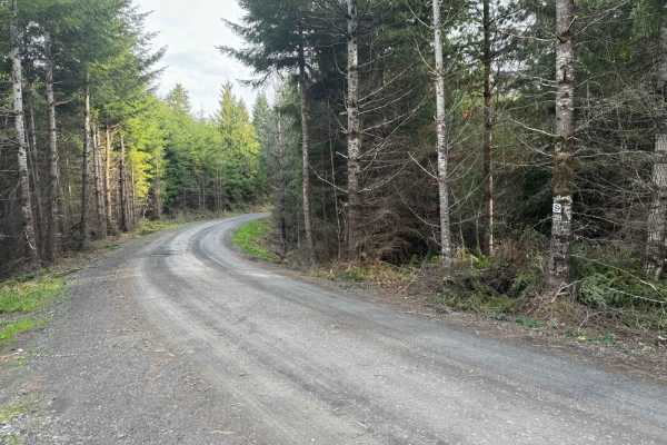
Karth Road
This forest road connects Apiary Road with Pittsburg Road and is relatively level. It is, however, a typical logging road with potholes, washboard, and the occasional windfall tree in the way. This route begins on Apiary Road adjacent to the Columbia County Park Camp Wilkerson. There's nothing extra...
Learn more about Karth Road
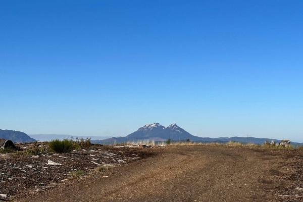
Osweg Creek Loop
A quick little run right off of Sunset Highway (US Route 26) that traverses the lower portion of the Clatsop State Forest. Don't be fooled by the appearance of a loopback to the main road, this is definitely an "out and back" run. There's a variety of spurs to explore along the way including a few v...
Learn more about Osweg Creek Loop
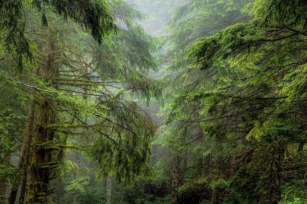
A Line
Off the main trail, you will hit A Line which ends at G Line and exits the large network of trails. About half way through the trail A line turns into G Line. This trail offers a more beautiful pathway going through thick forested growth and lichen-covered trees. The trail remains a well-groomed gra...
Learn more about A Line
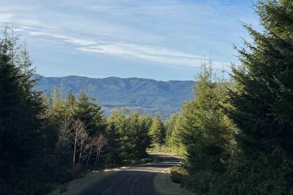
Snag and Western Lake
This route takes you to two small lakes in the forest of the Willapa Hills. There is a steady and gradual incline until you level out at the top, where the lakes are. The road is mostly gravel mixed with some dirt, and there are several deep potholes that were full of water, as well as washboard sec...
Learn more about Snag and Western Lake
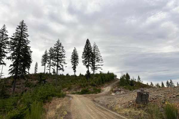
McGregor Road
McGregor Road is accessed directly from Hwy 26 (Sunset Hwy) in the Tillamook Forest. At the northern end, it intersects with NoFo Road. It also intersects with Music Road and North Fork Wolf Creek Road. It's a typical Tillamook Forest road, relatively smooth, with washboards and potholes. There may ...
Learn more about McGregor Road

Pittsburg Road
This timberland traverse route offers a journey through lush landscapes of private timber company land and access to the pristine Tillamook State Forest. Adventurers are immediately greeted with a canopy of towering conifers and the soothing sounds of nature. The trail gradually ascends, providing g...
Learn more about Pittsburg Road
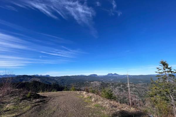
Lost Lake
This is a fairly short route that branches off from Nehalem River Road, taking you to the beautiful Lost Lake in the Oregon Coast Range. The road can get pretty washer boarded with some pot holes but is still accessible by most vehicles. Just past the lake, you will find a few landing areas to camp ...
Learn more about Lost Lake
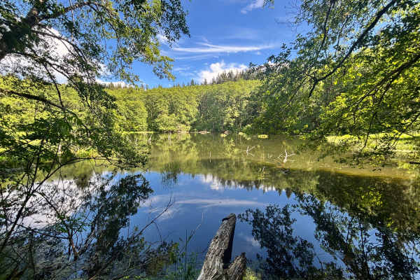
Bloom Lake
This route takes you from Flat Iron Mountain to Bloom Lake, then continues to a hill near the start of the Lost Lake trail in the Clatsop State Forest. While Bloom Lake is usually reached by a 1.25-mile hiking trail starting right off Highway 26, this path lets you drive most of the way via forest g...
Learn more about Bloom Lake
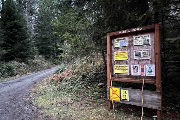
Music Road
Music Road is accessed directly from Hwy 26 (Sunset Hwy) in the Tillamook Forest. At the northern end, it intersects with McGregor Road. It's a typical Tillamook Forest road, relatively smooth, with washboards and potholes. There may be logging traffic during the week, so be on the lookout for loggi...
Learn more about Music Road
Beginner ATV trails near East Cathlamet, Washington
Explore ATV-friendly trails near you. These trails are accessible for vehicles up to 50 inches wide, perfect for ATVs and smaller off-road machines.
Trunkline
This is the longest OHV trail in the Nicolai Mountain system at 3.4 miles. It offers a fun mix of terrain with big crisscrossing root bands, tight curves through dense forest, and embedded rocks or muddy patches. A narrow section winds through thick vegetation with low branches that will grab at UTV...
Learn more about Trunkline
Hunt Loop
This is an easy and flowy loop that adds some extra mileage off of Hunt Creek. It's a wide OHV trail through a forest of spruce and firs for 1.2 miles. Expect some large root bands, narrower spots between the trees closely lining the trail, some deep ruts in spots, and semi-steep but manageable grad...
Learn more about Hunt Loop
Hunt Creek
Hunt Creek is a 3-mile easy OHV trail that gently descends from south to north through dense forest. The trail features scattered loose rock, embedded root bands, and several road and wooden bridge crossings. It remains gradual throughout and provides access to Hunt Loop and Hunt Hill. Although the ...
Learn more about Hunt Creek
Cake Walk
Cake Walk is an easy trail, leaving from the quarry staging area and immediately presenting multiple split lines that can be a bit confusing at first. Once on the main path, the trail stays relatively easy despite frequent muddy sections, embedded and loose rock, and large root bands. The surface ha...
Learn more about Cake Walk
Beginner UTV/side-by-side trails near East Cathlamet, Washington
Find UTV and side-by-side trails near you. These trails accommodate vehicles up to 60 inches wide, ideal for UTVs, side-by-sides, and wider off-road rigs.
Trunkline
This is the longest OHV trail in the Nicolai Mountain system at 3.4 miles. It offers a fun mix of terrain with big crisscrossing root bands, tight curves through dense forest, and embedded rocks or muddy patches. A narrow section winds through thick vegetation with low branches that will grab at UTV...
Learn more about Trunkline
Hunt Loop
This is an easy and flowy loop that adds some extra mileage off of Hunt Creek. It's a wide OHV trail through a forest of spruce and firs for 1.2 miles. Expect some large root bands, narrower spots between the trees closely lining the trail, some deep ruts in spots, and semi-steep but manageable grad...
Learn more about Hunt Loop
Hunt Creek
Hunt Creek is a 3-mile easy OHV trail that gently descends from south to north through dense forest. The trail features scattered loose rock, embedded root bands, and several road and wooden bridge crossings. It remains gradual throughout and provides access to Hunt Loop and Hunt Hill. Although the ...
Learn more about Hunt Creek
Cake Walk
Cake Walk is an easy trail, leaving from the quarry staging area and immediately presenting multiple split lines that can be a bit confusing at first. Once on the main path, the trail stays relatively easy despite frequent muddy sections, embedded and loose rock, and large root bands. The surface ha...
Learn more about Cake Walk
The onX Offroad Difference
onX Offroad combines trail photos, descriptions, difficulty ratings, width restrictions, seasonality, and more in a user-friendly interface. Available on all devices, with offline access and full compatibility with CarPlay and Android Auto. Discover what you're missing today!
Open Trail Map