
Beginner Off-Road Trails
Near Deposit, New York
Explore All Beginner Trails Near Deposit, New York
Beginner Off-Road Trails Near Deposit, New York
Discover the best beginner-friendly off-road trails near you. These easier, lower-rated trails are a great place to start — browse trail maps, check difficulty ratings, and find your next adventure.
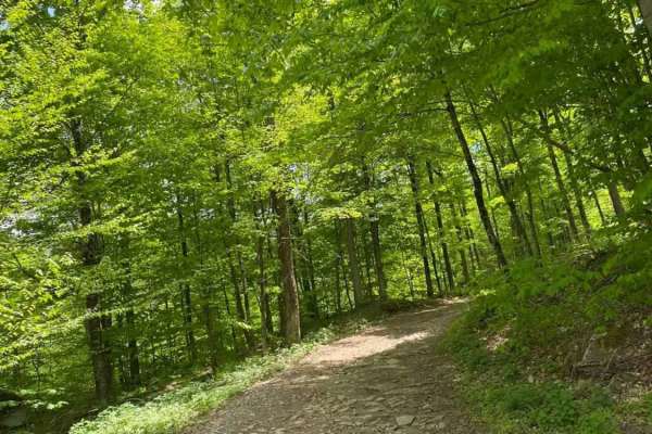
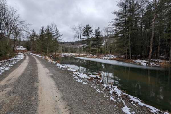
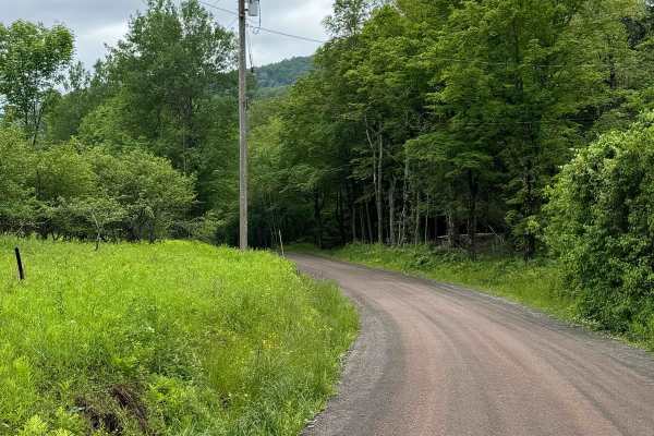
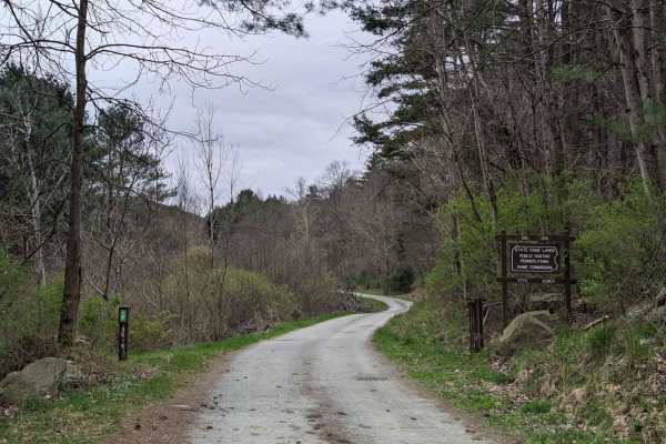
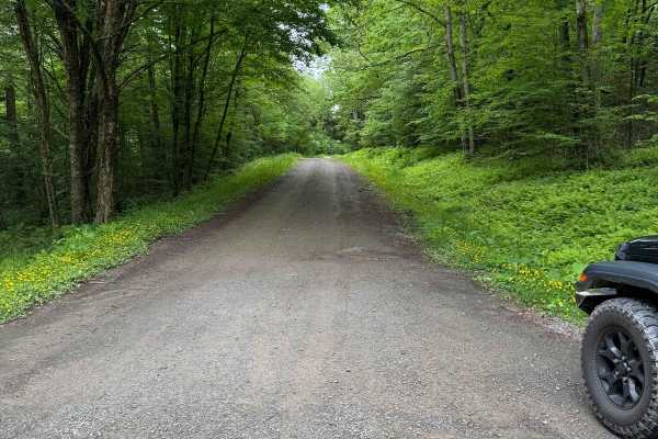
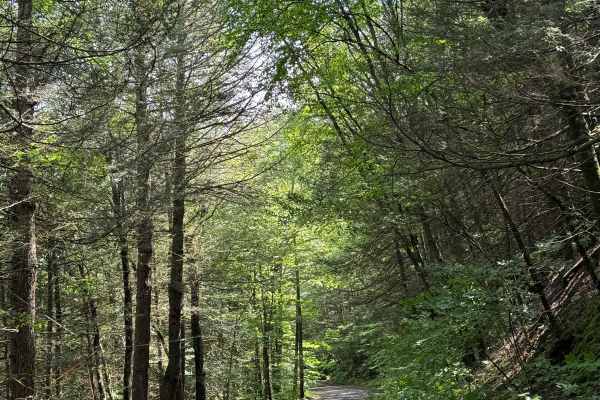
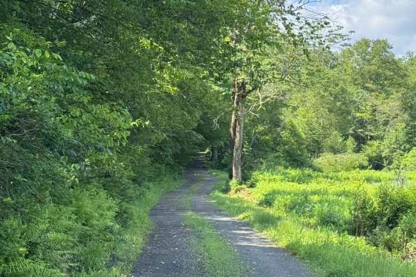
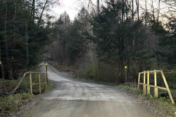
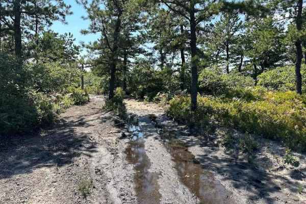
Big Valley Road
Big Valley Road offers a scenic and highly accessible offroad driving experience for novice drivers and seasoned explorers alike, serving as a tranquil passage through Pennsylvania's dense State Game Lands. Stretching approximately 2.2 miles, this winding forest road climbs from an elevation of 1,29...
Learn more about Big Valley Road
Slocum Hill Road
This is a somewhat maintained dirt/rock road near Pennsylvania State Game Lands with a good mix of gravel base, rocks, and some mud. There are small areas of mud and washes. Evidence of downed trees more recently. The road is much less maintained in the center section though passing is possible alon...
Learn more about Slocum Hill Road

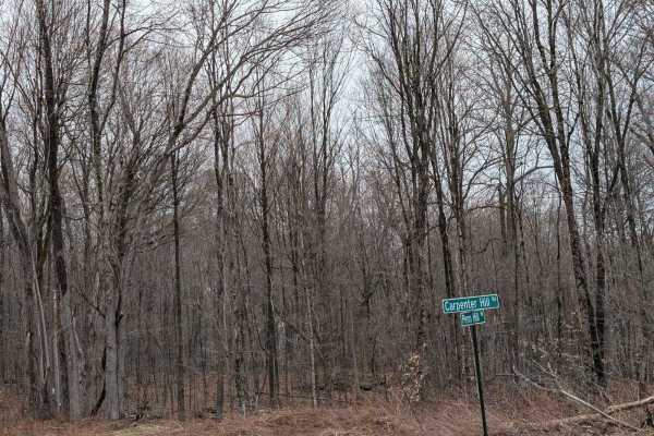
Carpenter Hill Road
Carpenter Hill Road from the Southern end to the town line is very well maintained and graded, once you cross into the Northern Section it becomes very much less maintained and nearly abandoned, with evidence of trees down, brush, large rocks, mud, and ruts. Potential for pin striping through the ti...
Learn more about Carpenter Hill Road
T-743/T-727
The trail starts off in Poyntelle as Township-727 and in Winterdale as T-743. This section of the O and W Trail is a recognized Township route open to street-licensed 4x4s. The trail follows the former route of the Ohio and Western Railroad. Multiple former stations can be observed along the route. ...
Learn more about T-743/T-727
Readburn Road
This is a seasonal road that is all loose gravel. There was nothing technical on this. It is mostly wide enough for two vehicles to pass by. There is a section that gets too narrow for two vehicles, but it does have a few pull-overs.
Learn more about Readburn Road
Bedbug Road to Million Dollar Highway South
Just a short way outside of Halstead, Pennsylvania, this series of roads goes around State Game Land #35 to the southern end of Million Dollar Highway. It appears to be a gravel base that can be slick at times, with minimal road maintenance. Along the way, you will see several offshoots to natural g...
Learn more about Bedbug Road to Million Dollar Highway South
Carcass Brook Road
This is a seasonal road that is all loose gravel. There was nothing technical on this road. It is wide enough for two vehicles to pass by. This follows the Carcass Brook, which is a nice drive. There are pull-outs to check the book out.
Learn more about Carcass Brook Road
Million Dollar Highway
This is a route through Pennsylvania State Game Lands #35 just outside of Great Bend/Hallstead, Pennsylvania. The route takes you through the game lands in its entirety with several sections that can become muddy. It is a well-maintained trail with some nice forest views. This is a true seasonal-use...
Learn more about Million Dollar Highway
West Trout Brook Road
This is a loose gravel road, starts wide enough for two vehicles, but some spots are only one lane with plenty of pull-over spots to let vehicles go. It runs with the West Trout Brook, with plenty of spots to pull over and enjoy the brook. Nothing technical on this route.
Learn more about West Trout Brook Road
Old Union Road
This is a non-maintained road made of mostly loose gravel. It is mostly wide enough for two vehicles, but there are some pull-over spots where it is only wide enough for one vehicle. There is nothing technical about this; it's just a nice, easy ride through the mountain.
Learn more about Old Union Road
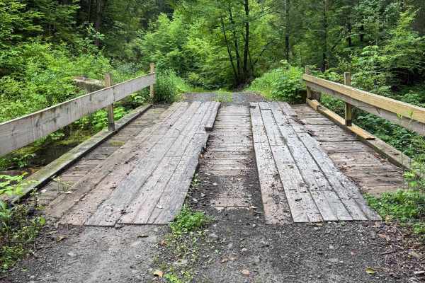
Hoolihan Brook Rd
This started as a single-lane loose-gravel trail following a stream through the woods. You do cross over a man-made bridge to cross the stream. There are limited pullouts for most of the road to let other vehicles through. After you come out of the woods, it becomes a loose gravel section past house...
Learn more about Hoolihan Brook Rd
Behrmann Hill Road
This is a seasonal, limited-use road, and it was all loose gravel. There was nothing technical on this route. For the most part, two vehicles can get through only a few sections that are only one car width, with some pullovers. This is a nice short road to other trails around this area.
Learn more about Behrmann Hill Road
River Road
This narrow woodland path turns into a narrow rocky shelf road along the Upper Delaware River. The trail is in a non-maintenance Township and does pass through private property. STAY ON THE TRAIL! You will encounter landslides, downed trees, and snow/ice. The trail's highlight is where it passes thr...
Learn more about River Road
Blum Road
This is a non-maintained road, mostly made up of loose gravel. Most of the road is wide enough for two vehicles, and where it isn't, you have enough room to move over. There is nothing technical on this road; it is just a nice, easy road that follows a river.
Learn more about Blum Road
Johnston Road
This is a loose gravel, non-maintained road. This goes up the mountain and connects Basket Cr Road and Route 28. Nothing technical, loose stone for the most part, either way you enter, it's a climb up a mountain and drop down on the other side. There are some places to pull over and let another vehi...
Learn more about Johnston Road
Cross Road
This route connects Lower Rhiney Creek Road to Upper Rhiney Creek Road. This is an all-dirt road that is mainly one car wide but is two cars wide at entrances and exits. This road has some elevation changes and rolling turns that make it a lot of fun when dry or wet.
Learn more about Cross Road
Howard Hill Road
Howard Hill Road connects Lower Rhiney Creek Road to Camp Road. This road is mainly 1.5 cars wide and is a gravel road with minimal washouts or potholes. This road goes up a steep grade at the beginning before it curves towards an intersection at the top of the road.
Learn more about Howard Hill Road
Mill Road
Mill Road is a gravel road that has some great ups and downs and a bridge about halfway down. There is a gas pad at the northern end, as you head south the trail gets tighter and has more turns. Great connection south towards other good dirt road riding.
Learn more about Mill Road
Cooley Creek Road
This is a loose gravel road. There is nothing technical on this road; it follows Cooley Creek. The road is wide enough for two vehicles, and it can still fit two cars where it narrows a little. Towards the end is a small pond.
Learn more about Cooley Creek Road
Camp Road
Brinton Road connects Tripp Lake Road to Howard Hill Road. This is an all-dirt road that is mainly 2 cars wide but does thin down to one car width at higher elevations. The surface is a mix of dirt and gravel and is maintained. A ride can be connected from Brackney, Pennsylvania, to Brookdale.
Learn more about Camp Road
Beginner ATV trails near Deposit, New York
Explore ATV-friendly trails near you. These trails are accessible for vehicles up to 50 inches wide, perfect for ATVs and smaller off-road machines.
Big Valley Road
Big Valley Road offers a scenic and highly accessible offroad driving experience for novice drivers and seasoned explorers alike, serving as a tranquil passage through Pennsylvania's dense State Game Lands. Stretching approximately 2.2 miles, this winding forest road climbs from an elevation of 1,29...
Learn more about Big Valley Road
T-743/T-727
The trail starts off in Poyntelle as Township-727 and in Winterdale as T-743. This section of the O and W Trail is a recognized Township route open to street-licensed 4x4s. The trail follows the former route of the Ohio and Western Railroad. Multiple former stations can be observed along the route. ...
Learn more about T-743/T-727
11 Blue
Trail 11 is a very mixed terrain trail. There are plenty of water puddles and rocks all over this trail. Then add in the hills and slightly off camber areas and it is a great mix. The bear caves are also along this trail. It is also fun to look out to the highway as it runs parallel to the trail.
Learn more about 11 Blue
30 Blue
Trail 30 is an alternate loop that can be taken to mix up your trail route. This includes "shipwreck". Shipwreck is a boat off to the side of the trail. The trail includes plenty of rocks, wash outs, and puddles while working through the brush and trees.
Learn more about 30 Blue
Beginner UTV/side-by-side trails near Deposit, New York
Find UTV and side-by-side trails near you. These trails accommodate vehicles up to 60 inches wide, ideal for UTVs, side-by-sides, and wider off-road rigs.
Big Valley Road
Big Valley Road offers a scenic and highly accessible offroad driving experience for novice drivers and seasoned explorers alike, serving as a tranquil passage through Pennsylvania's dense State Game Lands. Stretching approximately 2.2 miles, this winding forest road climbs from an elevation of 1,29...
Learn more about Big Valley Road
T-743/T-727
The trail starts off in Poyntelle as Township-727 and in Winterdale as T-743. This section of the O and W Trail is a recognized Township route open to street-licensed 4x4s. The trail follows the former route of the Ohio and Western Railroad. Multiple former stations can be observed along the route. ...
Learn more about T-743/T-727
11 Blue
Trail 11 is a very mixed terrain trail. There are plenty of water puddles and rocks all over this trail. Then add in the hills and slightly off camber areas and it is a great mix. The bear caves are also along this trail. It is also fun to look out to the highway as it runs parallel to the trail.
Learn more about 11 Blue
30 Blue
Trail 30 is an alternate loop that can be taken to mix up your trail route. This includes "shipwreck". Shipwreck is a boat off to the side of the trail. The trail includes plenty of rocks, wash outs, and puddles while working through the brush and trees.
Learn more about 30 Blue
The onX Offroad Difference
onX Offroad combines trail photos, descriptions, difficulty ratings, width restrictions, seasonality, and more in a user-friendly interface. Available on all devices, with offline access and full compatibility with CarPlay and Android Auto. Discover what you're missing today!
Open Trail Map