
Beginner Off-Road Trails
Near Cascade, Idaho
Explore All Beginner Trails Near Cascade, Idaho
Beginner Off-Road Trails Near Cascade, Idaho
Discover the best beginner-friendly off-road trails near you. These easier, lower-rated trails are a great place to start — browse trail maps, check difficulty ratings, and find your next adventure.
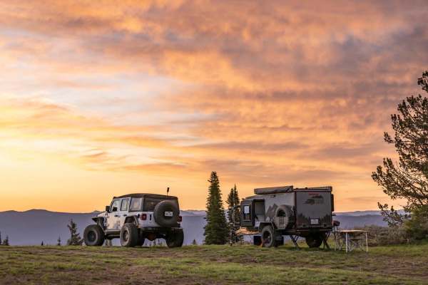
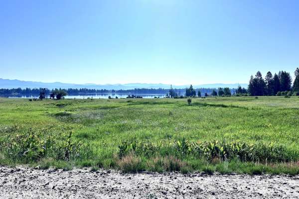
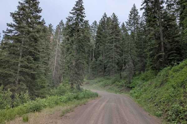
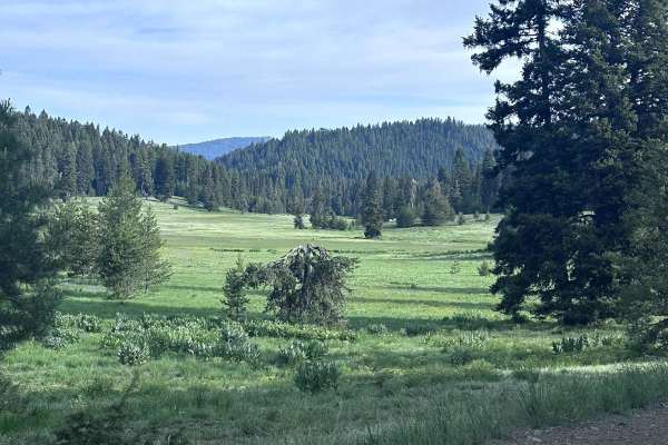
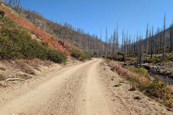
Forest Service Road 446
Forest Service Road 446 is located in the Boise National Forest Cascade, ID. It is a mixed-use, out-and-back road, approximately 12.6 miles long with nearly 4,100 feet of elevation gain. With a starting elevation at nearly 4,100 feet above sea level, the well-maintained dirt road will wind its way t...
Learn more about Forest Service Road 446
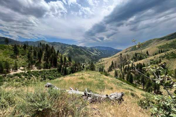
West Mountain
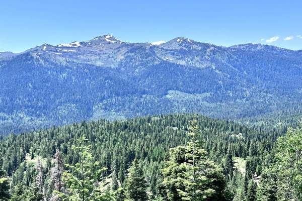
West Mountain is a 9-mile point-to-point trail that has multiple cut-off trails giving access to the West Mountain Jeep trail. The mountain views along this trail are spectacular. The trail is a maintained Forest Service road with light washboarding and shallow mud holes. The southern end of the tra...
Learn more about West Mountain
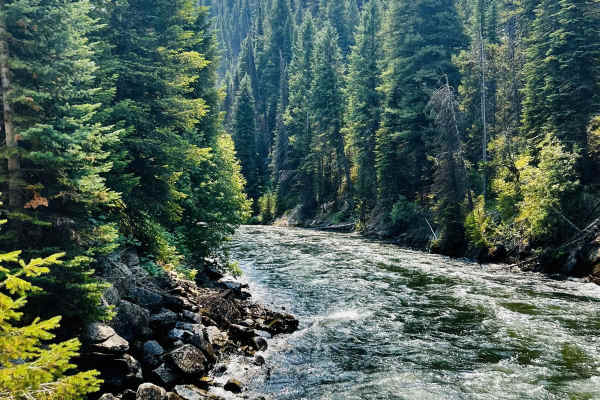
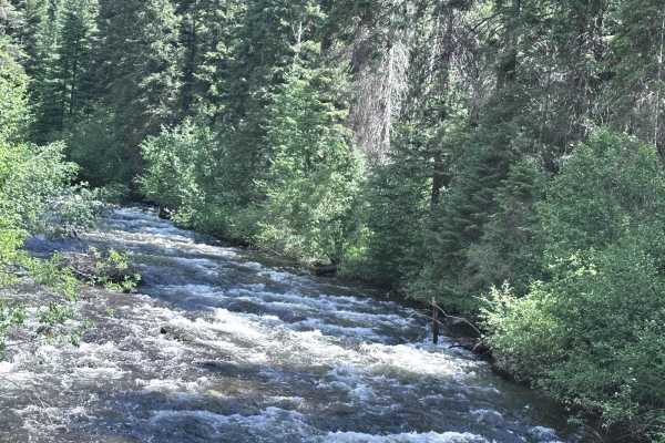
Middle Fork Weiser
Middle Fork Weiser is a 25.8-mile point-to-point road that crosses the West Mountains and parallels the Middle Fork of the Weiser River. This road gives access to several good hiking trails (Sheep Creek and Warm Spring Creek) and the Cabin Creek Campground. This is a maintained forest service road w...
Learn more about Middle Fork Weiser
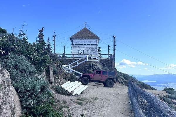
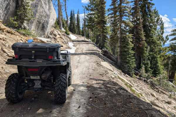
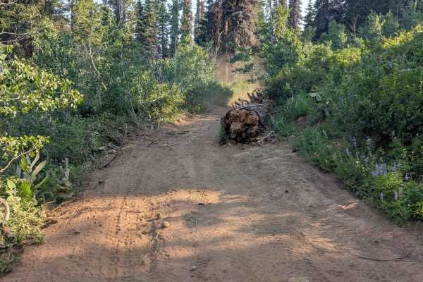
No Business Lookout
No Business Lookout is a 7.6-mile out and back trail in the West Mountains that travels up to an old fire lookout on top of No Business Mountain. This trail is single vehicle width, with erosion damage and loose rocks under 12" in height/depth. The last section up to the Lookout is the roughest port...
Learn more about No Business Lookout
Old Cascade
Old Cascade is a 7.2 mile point to point trail that travels into the West Mountains. The trail starts from North Mill Creek at Cutoff Saddle. Upon leaving North Mill Creek the trail becomes more rough and narrows, with erosion damage and loose rocks under 12 inches in height/depth. Enjoy the three m...
Learn more about Old Cascade
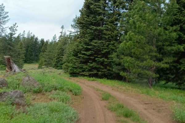
West Mountain Road
West Mountain Road is an 8.8-mile point-to-point road that gives access to many trails in the West Mountains. This is a maintained county road that has light washboarding and shallow mud holes. West Mountain Road passes private property; be respectful and drive slowly to reduce dust.
Learn more about West Mountain Road
Cottonwood Rd 50199
Cottonwood Road is a scenic dirt trail that gradually ascends approximately 2,700 feet into the mountains, winding through dense pine forests and groves of cottonwood trees. The route is graded in sections for a smooth but engaging drive. Along the way, you'll be treated to beautiful views of the ca...
Learn more about Cottonwood Rd 50199
Bulldog Loop
It's a nice, easy ride if you are looking to take your dog on their first SxS ride. The trail starts at the Deer Creek Campground, where wildlife shows itself to us every night. The trail flows through the mountains, where there are a lot of burn areas, eventually making it down to Deadwood Reservoi...
Learn more about Bulldog Loop
Blue Bunch Ridge
Blue Bunch Ridge is a 7.1-mile point-to-point trail that follows the ridge line and gives majestic views of Payette Lake and the valley below. Blue Bunch Ridge trail also provides great views of Council Mountain. This trail is single vehicle width and has erosion damage and loose rocks under 12" in ...
Learn more about Blue Bunch Ridge
North Mill Creek 50150
North Mill Creek 50150 is a scenic dirt trail that hugs the edge of a cliff, offering breathtaking views of the surrounding valleys and mountains. The trail is lined with tall pine trees, creating a serene forested atmosphere as you drive. Expect small ruts and washboard sections along the way, whic...
Learn more about North Mill Creek 50150
Forest Service Road 555BC - Scott Mtn. Lookout
This in-and-out trail is around 8 miles round trip. Don't let the length discourage you from exploring this trail. The road is packed sand and dirt with rocky stretches. There are narrow spots, so watch for other vehicles, especially around the blind corners. When completing this ride in mid-June, t...
Learn more about Forest Service Road 555BC - Scott Mtn. Lookout
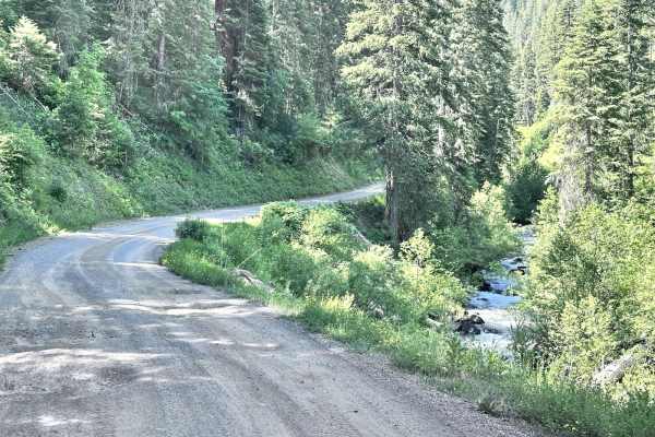
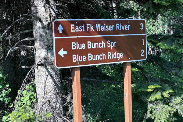
East Fork Weiser
East Fork Weiser is a 13.5-mile point-to-point trail that parallels the East Fork of the Weiser River. This winding trail takes you up into the West Mountains and connects to several other trails. This is a maintained Forest Service Road with light washboarding and shallow mud holes. This trail may ...
Learn more about East Fork Weiser
Full Creek Crossing
This trail is a gravel road with many potholes along the way. The scenery is beautiful, with many different locations to pull over and camp. At the end of the route, you will come to a water crossing at Full Creek, which is only passable by a higher clearance vehicle, mainly due to the transition in...
Learn more about Full Creek Crossing
Brundage Mountain
Brundage Mountain trail is an 11.2-mile point-to-point trail that traverses the east slope of Brundage Mountain and ends at Brundage Reservoir. While traveling this trail, you will have the opportunity to see several types of wildlife. This is a single vehicle width trail with erosion damage and loo...
Learn more about Brundage Mountain
Bear Valley to Lowman
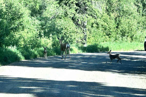
Starting at over 7,000' and dropping to an altitude of 3,800', this 23-mile dirt road connects the Bear Valley to Lowman from the north. Overall, this route is easy to travel with washboard roads and many twists and turns. It passes through a phenomenally beautiful country where you are likely to se...
Learn more about Bear Valley to Lowman
Goose Creek
Goose Creek is a 7.1-mile point-to-point trail that starts off of Highway 55 and travels along Goose Creek and connects with the Meadows Goose Lake Trail. This trail also gives access to the Last Chance Campground. Goose Creek Trail is a well-maintained Forest Service road up to the campground. Afte...
Learn more about Goose Creek
Spur 374BD
Road 374BD is a spur off of Road 374. The road is mainly dirt with sand. Some areas have rocks under 6 inches. There are ruts throughout this route. The road is one lane. Although it is wide enough for full-sized vehicles, there were large sections of fallen trees that could inhibit larger vehicles ...
Learn more about Spur 374BD

Forest Service Road 555 (FS 555) Scott Mtn-Deadwood
The starting point at this end of FS 555 (Scott Mtn-Deadwood) is on Hwy 17 (Banks-Lowman Hwy). There is a nice-sized parking area on Hwy 17 for unloading and loading rigs. It's a short drive of about 30 yards from the parking area to FS 555. Be aware of traffic on the highway as you cross. FS 555 im...
Learn more about Forest Service Road 555 (FS 555) Scott Mtn-Deadwood
Red Mountain - FS 515
Red Mountain (FS 515) is 4.5 miles from the point it forks off the Bear Valley to Lowman Road, to where it ends at the Red Mountain Transfer Camp. This is a scenic drive with many parts following along Clear Creek. The road is a dirt and sand mixture with small rocks under 3 to 4 inches in places. I...
Learn more about Red Mountain - FS 515
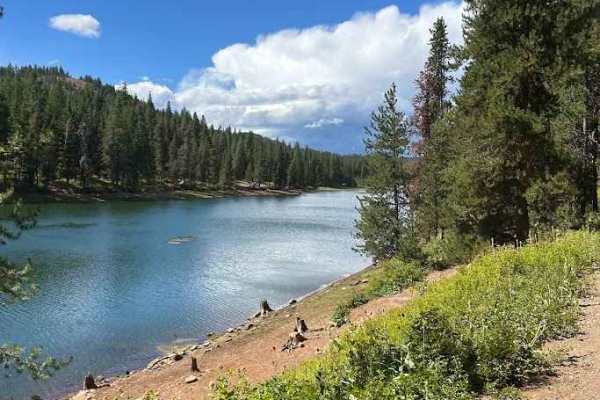
Lost Valley Reservoir Loop
The Lost Valley Reservoir Loop in Idaho offers a scenic and enjoyable off-road drive that combines easy cruising with plenty of sights worth stopping for. The road surface is primarily well-graded dirt and gravel, making it accessible to most high-clearance vehicles and ideal for those looking for a...
Learn more about Lost Valley Reservoir Loop
Beginner ATV trails near Cascade, Idaho
Explore ATV-friendly trails near you. These trails are accessible for vehicles up to 50 inches wide, perfect for ATVs and smaller off-road machines.
Forest Service Road 446
Forest Service Road 446 is located in the Boise National Forest Cascade, ID. It is a mixed-use, out-and-back road, approximately 12.6 miles long with nearly 4,100 feet of elevation gain. With a starting elevation at nearly 4,100 feet above sea level, the well-maintained dirt road will wind its way t...
Learn more about Forest Service Road 446
West Mountain
West Mountain is a 9-mile point-to-point trail that has multiple cut-off trails giving access to the West Mountain Jeep trail. The mountain views along this trail are spectacular. The trail is a maintained Forest Service road with light washboarding and shallow mud holes. The southern end of the tra...
Learn more about West Mountain
Middle Fork Weiser
Middle Fork Weiser is a 25.8-mile point-to-point road that crosses the West Mountains and parallels the Middle Fork of the Weiser River. This road gives access to several good hiking trails (Sheep Creek and Warm Spring Creek) and the Cabin Creek Campground. This is a maintained forest service road w...
Learn more about Middle Fork Weiser
No Business Lookout
No Business Lookout is a 7.6-mile out and back trail in the West Mountains that travels up to an old fire lookout on top of No Business Mountain. This trail is single vehicle width, with erosion damage and loose rocks under 12" in height/depth. The last section up to the Lookout is the roughest port...
Learn more about No Business Lookout
Beginner UTV/side-by-side trails near Cascade, Idaho
Find UTV and side-by-side trails near you. These trails accommodate vehicles up to 60 inches wide, ideal for UTVs, side-by-sides, and wider off-road rigs.
Forest Service Road 446
Forest Service Road 446 is located in the Boise National Forest Cascade, ID. It is a mixed-use, out-and-back road, approximately 12.6 miles long with nearly 4,100 feet of elevation gain. With a starting elevation at nearly 4,100 feet above sea level, the well-maintained dirt road will wind its way t...
Learn more about Forest Service Road 446
West Mountain
West Mountain is a 9-mile point-to-point trail that has multiple cut-off trails giving access to the West Mountain Jeep trail. The mountain views along this trail are spectacular. The trail is a maintained Forest Service road with light washboarding and shallow mud holes. The southern end of the tra...
Learn more about West Mountain
Middle Fork Weiser
Middle Fork Weiser is a 25.8-mile point-to-point road that crosses the West Mountains and parallels the Middle Fork of the Weiser River. This road gives access to several good hiking trails (Sheep Creek and Warm Spring Creek) and the Cabin Creek Campground. This is a maintained forest service road w...
Learn more about Middle Fork Weiser
No Business Lookout
No Business Lookout is a 7.6-mile out and back trail in the West Mountains that travels up to an old fire lookout on top of No Business Mountain. This trail is single vehicle width, with erosion damage and loose rocks under 12" in height/depth. The last section up to the Lookout is the roughest port...
Learn more about No Business Lookout
The onX Offroad Difference
onX Offroad combines trail photos, descriptions, difficulty ratings, width restrictions, seasonality, and more in a user-friendly interface. Available on all devices, with offline access and full compatibility with CarPlay and Android Auto. Discover what you're missing today!
Open Trail Map