
Beginner Off-Road Trails
Near Canadohta Lake, Pennsylvania
Explore All Beginner Trails Near Canadohta Lake, Pennsylvania
Beginner Off-Road Trails Near Canadohta Lake, Pennsylvania
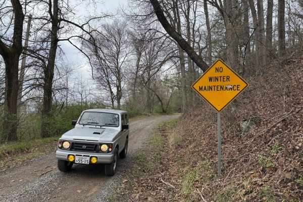
Discover the best beginner-friendly off-road trails near you. These easier, lower-rated trails are a great place to start — browse trail maps, check difficulty ratings, and find your next adventure.
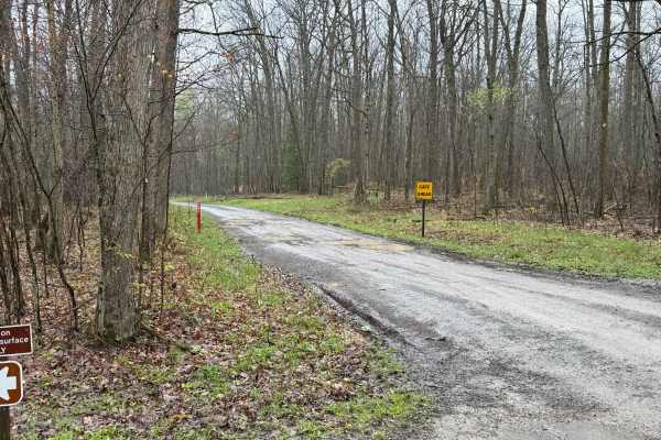
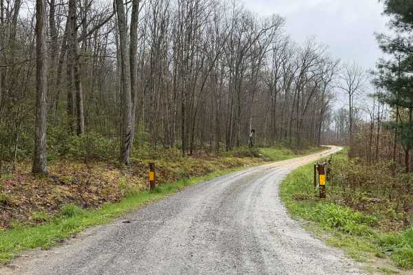
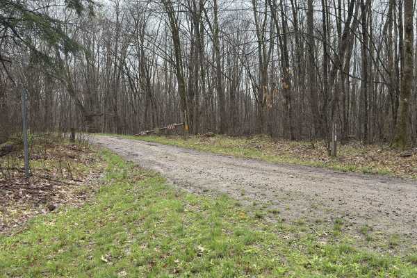
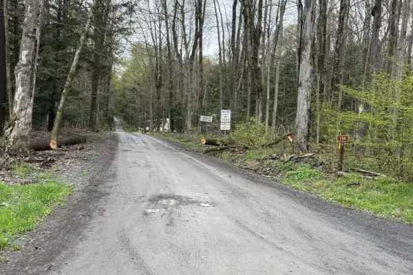
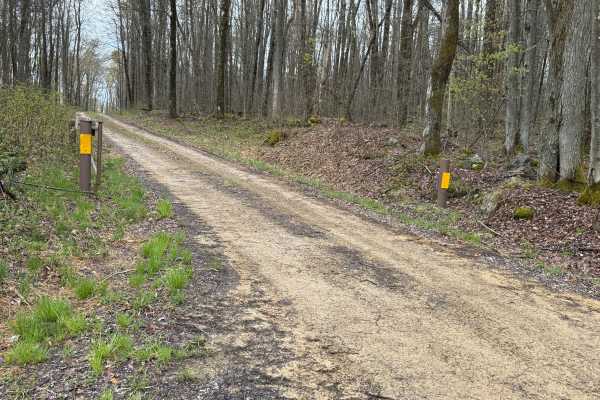
Elk Horn Run - FS 155
Elk Horn Run (FS 155) starts out at a paved parking lot with Restrooms available. The surface is packed dirt with some potholes. It is a very nice drive that takes you through some fir forests. This road is open year-round to highway-legal vehicles. Accessibility: Like many forest roads, its conditi...
Learn more about Elk Horn Run - FS 155
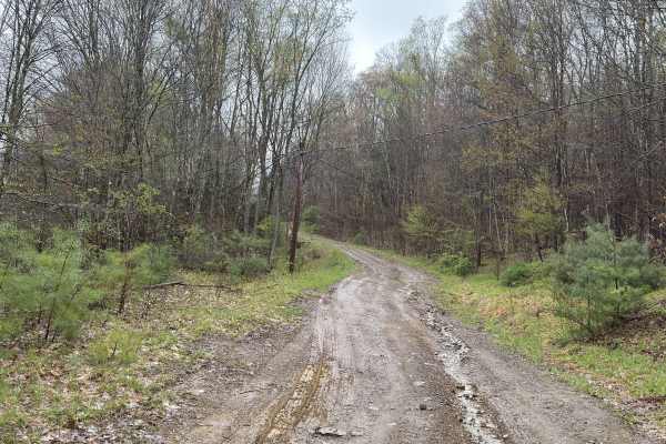
Grunder Run - FS 245
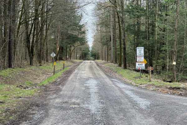
Grunder Run (FS 245) has a rutted dirt surface from rainfall runoff. It is a fun road. At the end is a closed gate, so this is one way. Accessibility: Like many forest roads, its condition can vary, and it is best to check the Allegheny National Forest Motor Vehicle Use Map (MVUM) for the latest inf...
Learn more about Grunder Run - FS 245
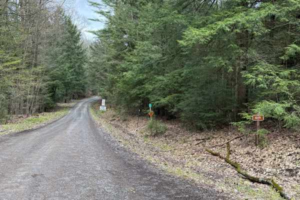
Midway - FS 449
Midway (FS 449) is a very nice drive. It has a dirt-packed surface. There are scenic views along this road. This road is open year-round to highway-legal vehicles. Accessibility: Like many forest roads, its condition can vary, and it is best to check the Allegheny National Forest Motor Vehicle Use M...
Learn more about Midway - FS 449
FS 85337
FS 85337 is a dirt-packed surface road. Portions are rutted due to rain washout. Accessibility: Like many forest roads, its condition can vary, and it is best to check the Allegheny National Forest Motor Vehicle Use Map (MVUM) for the latest information on its status. Conditions are also subject to ...
Learn more about FS 85337
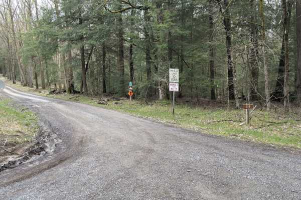
Grunder Ridge - FS 362
Grunder Ridge (FS 362) starts out on a gravel surface and turns to packed dirt. There are some soft spots and medium-sized potholes. Along Grunder Ridge, there are some scenic views and mountain streams that make for a nice drive. There are also some grassy areas to park and put up your RTT for the ...
Learn more about Grunder Ridge - FS 362
Dunham Siding - FS 116
Dunham Siding (FS 116) is a gravel and dirt-packed surface road. There are scenic views along this road, along with spots of fir trees. This road is open all year long to highway-legal vehicles. Accessibility: Like many forest roads, its condition can vary, and it is best to check the Allegheny Nati...
Learn more about Dunham Siding - FS 116
Wheeler - FS 119
Wheeler (FS 119) runs along the southern end of Hickory Creek Wilderness, which makes for a beautiful drive. The surface is dirt packed with potholes, ruts, and some gravel in spots. There are newly planted trees along the way. At the western end of the wilderness is a nice trout stream, East Hickor...
Learn more about Wheeler - FS 119
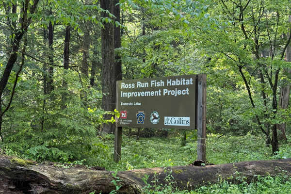
Ross Run Road - FS 85116A
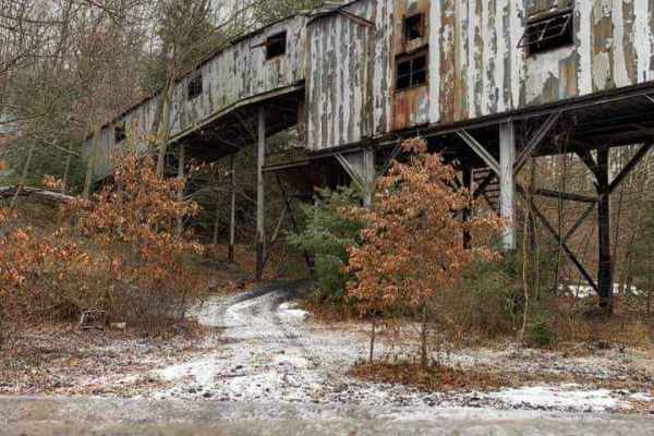
Ross Run Road (FS 85116A) is a rougher, steep road that goes up the hillside. We had the pleasure of going up this road just after a major rainfall, and the sun came out. Made the remaining rain look like diamonds falling. Ross Run is a habitat improvement project area. Nearby, Tionesta Creek is ver...
Learn more about Ross Run Road - FS 85116A
FS 675
FS 675 is a nice short drive that has scenic views at the end of it. You could even park your vehicle and pitch the RTT for the night. The surface is packed dirt with an occasional pothole. There might be some downed trees, but nothing too big to handle. Along this route, you will find a very old sk...
Learn more about FS 675
Cross PA Adventure Trail - FS 85116
Cross PA Adventure Trail (FS 85116) is a beautiful drive along Tionesta Creek. There are plenty of nice views and places to pull off the road to take a hike or just go fishing. The surface is dirt-packed with some potholes. This is a more traveled road. You will find wildlife like deer. This road ca...
Learn more about Cross PA Adventure Trail - FS 85116
Adams Run - FS 437
Adams Run (FS 437) starts out coming from Chapman State Park. The surface is packed dirt with a little mix of gravel. There can be some muddy ruts and potholes. Nothing a high-clearance 4x4 can't handle. This road is open year-round and is labeled suitable for passenger cars. You might even see some...
Learn more about Adams Run - FS 437
Hermit Springs - FS 114
Hermit Springs (FS 114) is a dirt-packed road. It is a short, nice drive open year-round to highway-legal vehicles. Accessibility: Like many forest roads, its condition can vary, and it is best to check the Allegheny National Forest Motor Vehicle Use Map (MVUM) for the latest information on its stat...
Learn more about Hermit Springs - FS 114
Farnsworth - FS 154
Farnsworth (FS 154) is a packed gravel and dirt surface road. This is a nice road to drive as it has lots of scenery and fir trees. Along this road is Farnsworth Creek, along with the Farnsworth Trout Club and Trout Nursery. This was established between the Pennsylvania Fish Commission and the Alleg...
Learn more about Farnsworth - FS 154
Fools Creek - FS 255
Fools Creek (FS 255) is a dirt-packed surface road. It has some scenic views and a few motorized dispersed camping spots. This road is open year-round to highway-legal vehicles. Accessibility: Like many forest roads, its condition can vary, and it is best to check the Allegheny National Forest Motor...
Learn more about Fools Creek - FS 255
The Branch Spur A - FS 180A
The surface of this road is a bit more rocky. Only highway legal vehicles are allowed to travel this road. This road has some great views of the surrounding valleys. There are typical small stream runoffs coming off from the surrounding hills that have large boulders scattered along them. At the end...
Learn more about The Branch Spur A - FS 180A
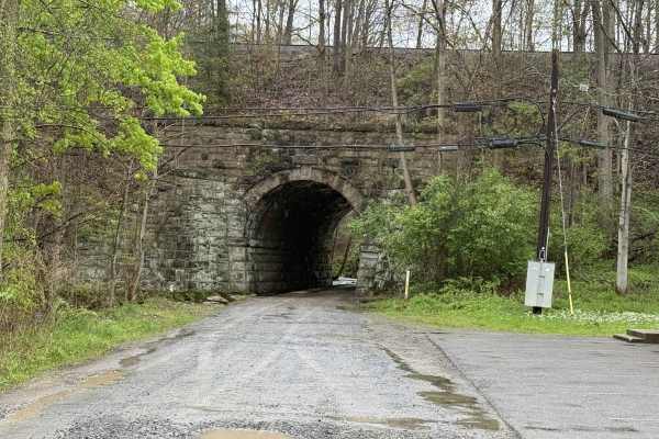
Warrpen - FS 156
Warrpen (FS 156) is a nice scenic road with mountain streams and fir trees. It starts off under the railroad with a stream built into the side of the road, which is the Morrison Run watershed. Along this road, you can find the Warren Archery Club. This road is open year-round to highway-legal vehicl...
Learn more about Warrpen - FS 156
Fools Creek A - FS 255A
Fools Creek A (FS 255A) is a dirt-packed surface road. It has some scenic views. This road is open year-round to highway-legal vehicles. Accessibility: Like many forest roads, its condition can vary, and it is best to check the Allegheny National Forest Motor Vehicle Use Map (MVUM) for the latest in...
Learn more about Fools Creek A - FS 255A
Hook Run Road - FSR 160
Hook Run Road - FSR 160 is a wide dirt road that is easy to navigate. Hook Run leads into Allegheny National Forest south of Warren, Pennsylvania. There are nice mountain vistas with breathtaking views. At the end of Hook Run is the Seneca Pump Storage for Kinzua Reservoir and the back entry to Jake...
Learn more about Hook Run Road - FSR 160
Gusher Plank - FS 256
Gusher Plank (FS 256) is a dirt-packed surface road. It is a nice road, with lots of trees and scenery. There are a few motorized dispersed camping spots. This road is open year-round to highway-legal vehicles. Accessibility: Like many forest roads, its condition can vary, and it is best to check th...
Learn more about Gusher Plank - FS 256
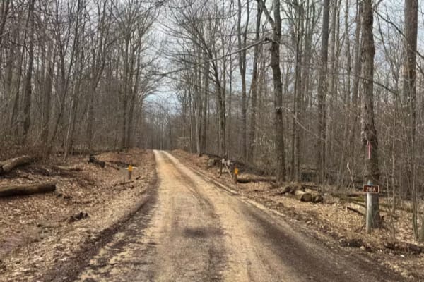
Hastings A - FS 218A
This route is heavily traveled by heavy trucks, so it is very flat with some potholes. The drive takes you through some evergreen forest. Some gas pumps and heavy equipment are scattered, along with new pumps being installed. Accessibility: Like many forest roads, its condition can vary, and it is b...
Learn more about Hastings A - FS 218A
Beginner ATV trails near Canadohta Lake, Pennsylvania
Explore ATV-friendly trails near you. These trails are accessible for vehicles up to 50 inches wide, perfect for ATVs and smaller off-road machines.
Piney Rail Trail
Please Note: A Piney Rail Riders membership or day pass is required to drive this trail. The trail is designated for dirt bikes, quads, trikes, side by sides, argos, snowmobiles, horses, dual sport bikes, and go karts. Trucks, jeeps, and vehicles designed for on-road driving that are converted for o...
Learn more about Piney Rail Trail
Rock Pit Road
This is a rough dirt/gravel single lane road that varies in difficulty with the season and maintenance. After storms, the road gets very rutted out but is sometimes graded. There is a nice view from the top. The road connects to the piney rail trail for SXSs, but this road is open to vehicles as we...
Learn more about Rock Pit Road
Spring Creek Rd
This forest road is the unpaved connector between the western and eastern parts of the Clear Creek & Callen Run tract of Clear Creek State Forest. It connects to PA 949 at either end. Though this featured route ends at the boundary for State Game Land 54 on the eastern end, it does go through. The L...
Learn more about Spring Creek Rd
Firetower Road
From the rolling fields to the south to the forest on the north end, this is a very pleasant unpaved road. If coming from Interstate 80, this may be how you enter this forest, especially if camping in this tract. Get gas before heading into the forest this way. The Love's truck stop off Interstate 8...
Learn more about Firetower Road
Beginner UTV/side-by-side trails near Canadohta Lake, Pennsylvania
Find UTV and side-by-side trails near you. These trails accommodate vehicles up to 60 inches wide, ideal for UTVs, side-by-sides, and wider off-road rigs.
Piney Rail Trail
Please Note: A Piney Rail Riders membership or day pass is required to drive this trail. The trail is designated for dirt bikes, quads, trikes, side by sides, argos, snowmobiles, horses, dual sport bikes, and go karts. Trucks, jeeps, and vehicles designed for on-road driving that are converted for o...
Learn more about Piney Rail Trail
Rock Pit Road
This is a rough dirt/gravel single lane road that varies in difficulty with the season and maintenance. After storms, the road gets very rutted out but is sometimes graded. There is a nice view from the top. The road connects to the piney rail trail for SXSs, but this road is open to vehicles as we...
Learn more about Rock Pit Road
Spring Creek Rd
This forest road is the unpaved connector between the western and eastern parts of the Clear Creek & Callen Run tract of Clear Creek State Forest. It connects to PA 949 at either end. Though this featured route ends at the boundary for State Game Land 54 on the eastern end, it does go through. The L...
Learn more about Spring Creek Rd
Firetower Road
From the rolling fields to the south to the forest on the north end, this is a very pleasant unpaved road. If coming from Interstate 80, this may be how you enter this forest, especially if camping in this tract. Get gas before heading into the forest this way. The Love's truck stop off Interstate 8...
Learn more about Firetower Road
The onX Offroad Difference
onX Offroad combines trail photos, descriptions, difficulty ratings, width restrictions, seasonality, and more in a user-friendly interface. Available on all devices, with offline access and full compatibility with CarPlay and Android Auto. Discover what you're missing today!
Open Trail Map