
Beginner Off-Road Trails
Near Beattyville, Kentucky
Explore All Beginner Trails Near Beattyville, Kentucky
Beginner Off-Road Trails Near Beattyville, Kentucky
Discover the best beginner-friendly off-road trails near you. These easier, lower-rated trails are a great place to start — browse trail maps, check difficulty ratings, and find your next adventure.

White Ash Road
This is a well-traveled gravel road with a tunnel that passes under a train bridge. This trail is fairly uncomplicated and is part of the Kentucky Adventure Trail. It has some minor puddles and washouts, and when freshly graded, it may be a little slippery. However, you can still run it in 2WD.
Learn more about White Ash Road

Bald Rock Fork Rd
Bald Rock Fork Road is an excellent, beginner-friendly off-road route that offers a scenic introduction to the rugged beauty of Kentucky's Red River Gorge. Extending roughly 2.3 miles, this trail features a diverse mix of terrain including mostly well-maintained gravel surfaces, a couple of shallow ...
Learn more about Bald Rock Fork Rd
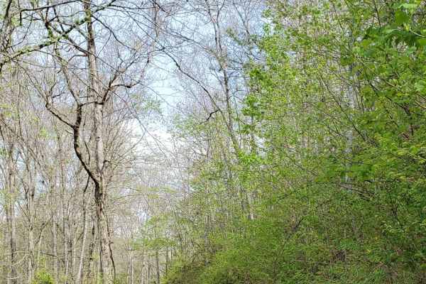
Beech Timber
Beech Timber is a connector road off of Highway 399. This is a scenic ride through the Daniel Boone National Forest. Along this route, you can find the "GOE" cemetery, where you can find some of Daniel Boone's descendants. You can also find one of the moonshiners (Backwoods Moonshine Museum) from th...
Learn more about Beech Timber

Fish Creek
Fish Creek Road is a pretty scenic ride that follows along the south fork of the Kentucky River. It is primarily a maintained gravel road with little to no issues along the way. You may find washouts or ruts after heavy rains or snow. In most areas, you do have room for two vehicles to pass.
Learn more about Fish Creek
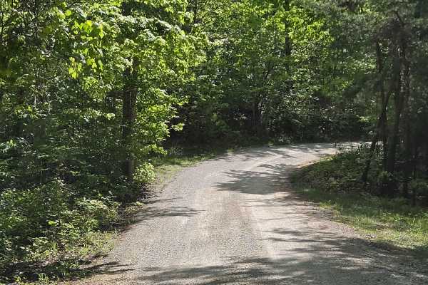
Indian Valley/Arrowhead Trace
This track is made up of two county roads. It has recently had maintenance done and isn't as bad as it was. It is a shelf road with one tight switchback. It offers an amazing view from the top of the valley below. It can have deep ruts and rock ledges after heavy rains and time with no maintenance
Learn more about Indian Valley/Arrowhead Trace
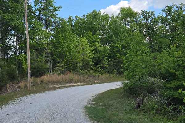
Mt Laurel/Cable Cemetery
This is an easy ride off Highway 1036 that leads to multiple trail heads and lodging. This trail has awesome views in the fall and winter as it rides the ridge top of Mountt Laurel. This track is often maintained and has a posted speed limit to accommodate the local residents.
Learn more about Mt Laurel/Cable Cemetery
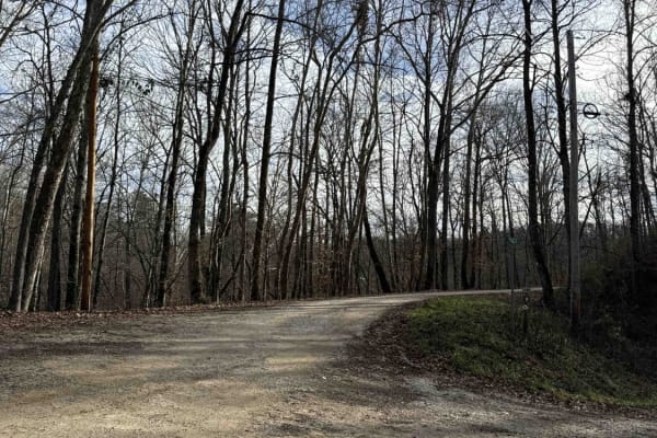
Todds Road
This is a very well-maintained gravel road with no major obstacles. This turns off the paved road and continues along the Kentucky Adventure Trail. It follows along the Sheltowee Trace and winds along Sturgeon Creek. This road continues past the gravel area marked here to a stop sign where you can c...
Learn more about Todds Road
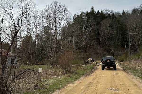
Lairson Road
Lairson Road is a two-lane dirt road that winds through the county side following Big Sinking Creek. We then ended up on Fixer Road making for a nice scenic ride. The trail/road is not difficult but a nice drive taking us to our destination for more exploring in the Slade Kentucky area.
Learn more about Lairson Road
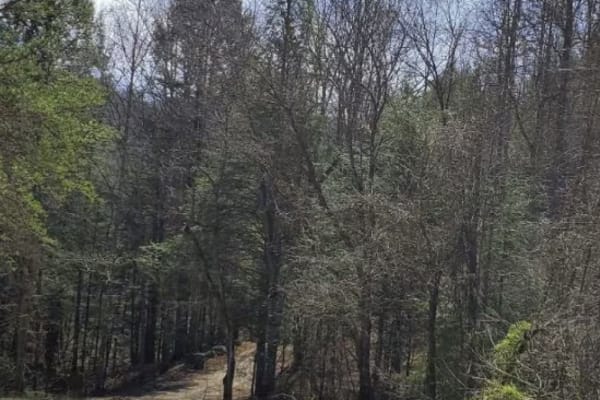
Highway 1036
Scenic gravel/dirt connector road for 1036. This route takes you through part of the Daniel Boone National Forest, offering views of cool geological formations and the surrounding forest that is full of tall, mature pines and hardwoods. There are multiple cave entrances that can be found along this ...
Learn more about Highway 1036

Earnestville Road to KAT Hard 2
This is the start of the Hard 2 Section of the Kentucky Adventure Trail. This section is pitted with many mud puddles and is roughly maintained. It leads to a split to continue the Kentucky Adventure Trail Hard 2 or to turn and take Wild Dog Trail. This portion has few obstacles other than the many ...
Learn more about Earnestville Road to KAT Hard 2
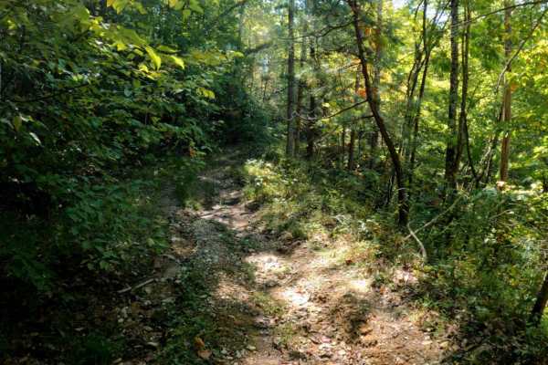
Wentworth School Rd
Wentworth School Rd is an easy, lightly traveled dirt route ideal for SxSs, ATVs, and dirt bikes looking for a quiet, scenic journey through dense Kentucky woodland. This historic corridor winds through a lush forest canopy to the Smyth Cemetery, offering a peaceful offroad experience away from more...
Learn more about Wentworth School Rd

County Line/Brandenburg Road
This is a hidden county road, that takes you along the Owsley County line. It is mainly gravel with a few patches of dirt along the way. It is covered heavily by trees in the spring and summer, offering a cool drive on hot days. There isn't any obstacles along this route outside of a couple of shall...
Learn more about County Line/Brandenburg Road
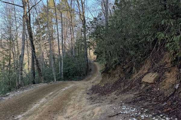
Trail 1
This is the main trailhead that leads into the park from the General Store, the Main Parking Lot, and other Camping and Parking Lots. The trail starts on gravel and is mostly dirt and gravel. The trail travels by a small lake and a dam. A couple of small inclines at the immediate start, leaving the ...
Learn more about Trail 1
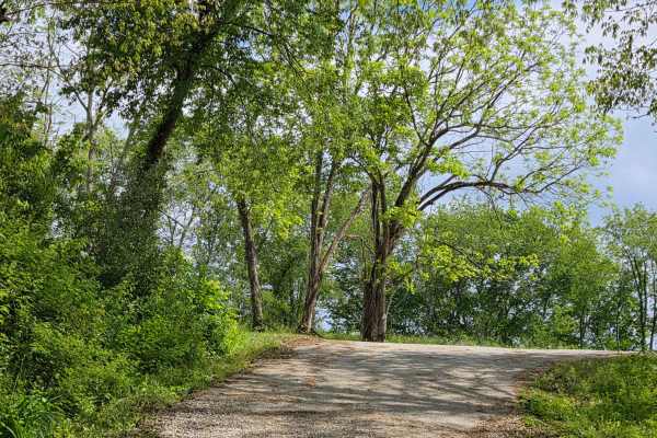
Pierson Road
This is a scenic gravel drive through some of Owsley County's small farm lands. This trail is maintained for the most part, but it does have some small mudholes along the way, which is nothing that causes any issues. This is a connector road from Highway 399 to Marcum Ridge Road.
Learn more about Pierson Road
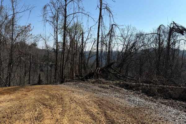
Trail 2
This trail runs from Barker Branch Road to Trail 1 in the park. This trail circles around the view of the lake and the dam area. The trail travels downward away from a paved road called Barkers Branch Road and goes to the trail split of Trail 1, 4, and 46, all at the Sand Lick Fork.
Learn more about Trail 2
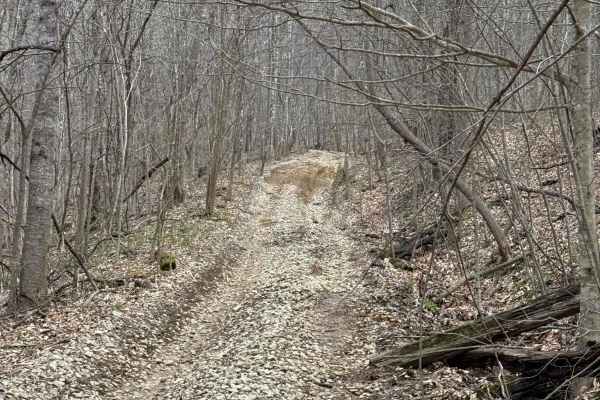
Trail 16
Trail 16 is a fairly new trail that is maintained gravel and dirt road. This trail goes into the park at Trail 29 and 31, and wraps into the park and comes back down. This is a parallel trail that goes along with Trail 15. Between the two trails connecting each other is Trail 44.
Learn more about Trail 16
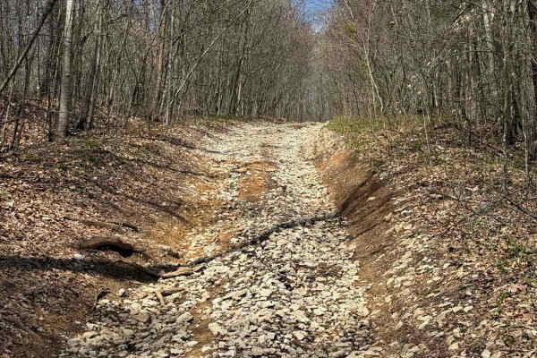
Trail 15
Trail 15 is a fairly new trail that is maintained gravel and dirt road. This trail goes into the park at Billey Fork and wraps into the park and comes back down to a dead-end area. There appears to be other trails that will be coming out of this area and further into the park in the future.
Learn more about Trail 15
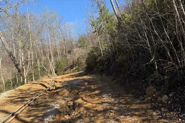
Trail 4A
This trail is a short loop off of Trail 4. This trail travels around and beside an old oil pump. The trail then goes down and beside Sand Lick Fork. The creek that flows through this area is surrounded by trees and is a nice place to stop before heading into the park.
Learn more about Trail 4A
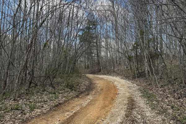
Trail 29
Trail 29 is a short gravel road trail that will allow the connection of Trail 15, 31, and Billey Fork Road. Additionally, Red Hollow Road is off of this trail as well, which will lead into the park as Billey Fork travels all along this southwestern side of the park.
Learn more about Trail 29
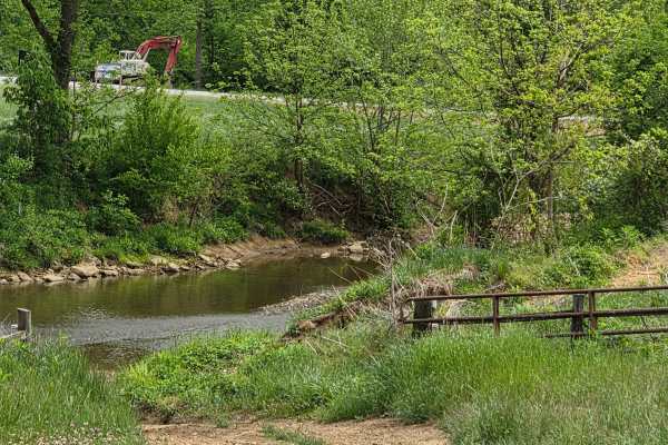
AOT Expressway
This is a cool scenic ride along Sturgeon Creek. This trail is narrow with only a couple of spots that may permit passing. It is made up mainly of dirt along this route, with no obstacles to traverse. There is a spot or two that is being washed out, so attention to detail should be the top priority ...
Learn more about AOT Expressway
Beginner ATV trails near Beattyville, Kentucky
Explore ATV-friendly trails near you. These trails are accessible for vehicles up to 50 inches wide, perfect for ATVs and smaller off-road machines.
Bald Rock Fork Rd
Bald Rock Fork Road is an excellent, beginner-friendly off-road route that offers a scenic introduction to the rugged beauty of Kentucky's Red River Gorge. Extending roughly 2.3 miles, this trail features a diverse mix of terrain including mostly well-maintained gravel surfaces, a couple of shallow ...
Learn more about Bald Rock Fork Rd
Beech Timber
Beech Timber is a connector road off of Highway 399. This is a scenic ride through the Daniel Boone National Forest. Along this route, you can find the "GOE" cemetery, where you can find some of Daniel Boone's descendants. You can also find one of the moonshiners (Backwoods Moonshine Museum) from th...
Learn more about Beech Timber
Fish Creek
Fish Creek Road is a pretty scenic ride that follows along the south fork of the Kentucky River. It is primarily a maintained gravel road with little to no issues along the way. You may find washouts or ruts after heavy rains or snow. In most areas, you do have room for two vehicles to pass.
Learn more about Fish Creek
Indian Valley/Arrowhead Trace
This track is made up of two county roads. It has recently had maintenance done and isn't as bad as it was. It is a shelf road with one tight switchback. It offers an amazing view from the top of the valley below. It can have deep ruts and rock ledges after heavy rains and time with no maintenance
Learn more about Indian Valley/Arrowhead Trace
Beginner UTV/side-by-side trails near Beattyville, Kentucky
Find UTV and side-by-side trails near you. These trails accommodate vehicles up to 60 inches wide, ideal for UTVs, side-by-sides, and wider off-road rigs.
Bald Rock Fork Rd
Bald Rock Fork Road is an excellent, beginner-friendly off-road route that offers a scenic introduction to the rugged beauty of Kentucky's Red River Gorge. Extending roughly 2.3 miles, this trail features a diverse mix of terrain including mostly well-maintained gravel surfaces, a couple of shallow ...
Learn more about Bald Rock Fork Rd
Beech Timber
Beech Timber is a connector road off of Highway 399. This is a scenic ride through the Daniel Boone National Forest. Along this route, you can find the "GOE" cemetery, where you can find some of Daniel Boone's descendants. You can also find one of the moonshiners (Backwoods Moonshine Museum) from th...
Learn more about Beech Timber
Fish Creek
Fish Creek Road is a pretty scenic ride that follows along the south fork of the Kentucky River. It is primarily a maintained gravel road with little to no issues along the way. You may find washouts or ruts after heavy rains or snow. In most areas, you do have room for two vehicles to pass.
Learn more about Fish Creek
Indian Valley/Arrowhead Trace
This track is made up of two county roads. It has recently had maintenance done and isn't as bad as it was. It is a shelf road with one tight switchback. It offers an amazing view from the top of the valley below. It can have deep ruts and rock ledges after heavy rains and time with no maintenance
Learn more about Indian Valley/Arrowhead Trace
The onX Offroad Difference
onX Offroad combines trail photos, descriptions, difficulty ratings, width restrictions, seasonality, and more in a user-friendly interface. Available on all devices, with offline access and full compatibility with CarPlay and Android Auto. Discover what you're missing today!
Open Trail Map