
Beginner Off-Road Trails
Near Baileys Harbor, Wisconsin
Explore All Beginner Trails Near Baileys Harbor, Wisconsin
Beginner Off-Road Trails Near Baileys Harbor, Wisconsin
Discover the best beginner-friendly off-road trails near you. These easier, lower-rated trails are a great place to start — browse trail maps, check difficulty ratings, and find your next adventure.
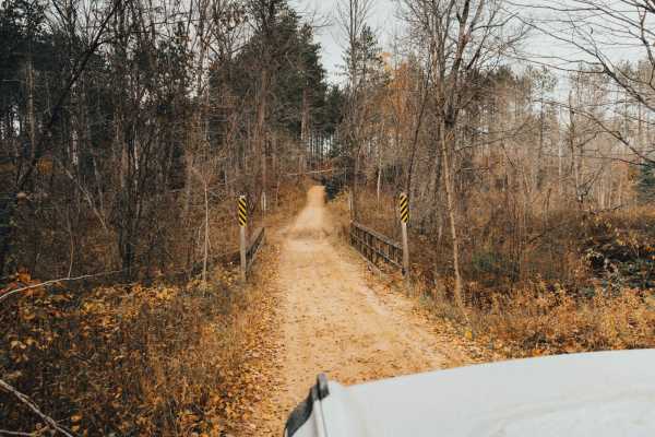
Cedar River Run
This route is a baseline for exploration in the Escanaba Forest Management Unit. It is primarily sand/dirt logging roads without any serious obstacles. Some areas can be slick and muddy after rainfall or during the snowmelt season. The trail can be completed by 2WD vehicles and is plenty wide for fu...
Learn more about Cedar River Run
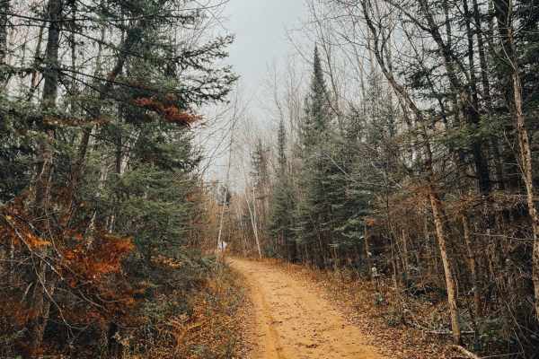
Cedar River Side Spur
This loop provides a change of scenery and meanders through varying species of trees that provide a tunnel-like canopy in some areas. Even this side trail has side trails! Detour from the route to explore the Escanaba Forest Management Unit. The route is for mixed-use traffic and you may encounter "...
Learn more about Cedar River Side Spur
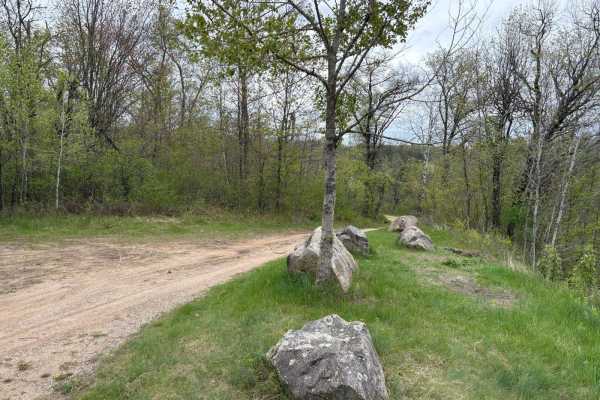
Dam Dead End
This easily flowing trail runs along the Peshtigo River, which flows down from the Johnson Fall Hydroelectric Dam. The trail features a mix of sandy whoops, hills, and scenic lookouts over the river. It eventually reaches a three-way dead end with gates at each split. A nice camping spot in one of t...
Learn more about Dam Dead End
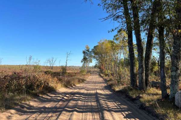
Trail 5 Southeastern Section
If traveling this trail from south to north it will start off in some twisty but wide open areas, of clear-cut forest. The trail surface in this section is very soft sand. This creates a very fun section of the trail to run. As the trail progresses it will enter into a state forest where the trail w...
Learn more about Trail 5 Southeastern Section

#409-425 Pipeline Road to HWY 64 East
Fast and twisty sections with large banked corners. Best trail I've ridden in Oconto county. Used the railroad grade south from Lakewood down to mountain and chute pond area. Hidden gem! Rode this on a holiday weekend on Friday afternoon and saw one other machine between the sections 409-425. Long n...
Learn more about #409-425 Pipeline Road to HWY 64 East

Pete de Foure Road
This trail is part of the Oconto County ATV trail system and runs roughly north to south along Pete de Foure Road. On the north end, it ends on Old Highway 64, which you can use to access other trails in the area. The trail is mostly a mix of dirt and sand, with a few blind corners, but it has frequ...
Learn more about Pete de Foure Road
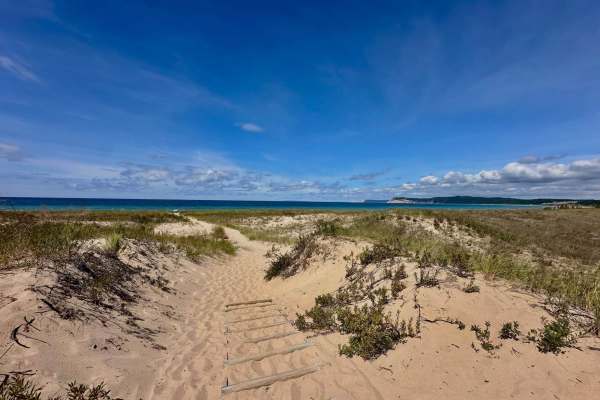
Peterson Road
Peterson Road is a fantastic two-lane gravel dirt road that winds through amazing views of Sleeping Bear Dunes National Lakeshore. Along the route, there are a couple of turnouts and hiking trails that spur off this road. There is also campground access off of this road as well as Lasso Road. Cell s...
Learn more about Peterson Road
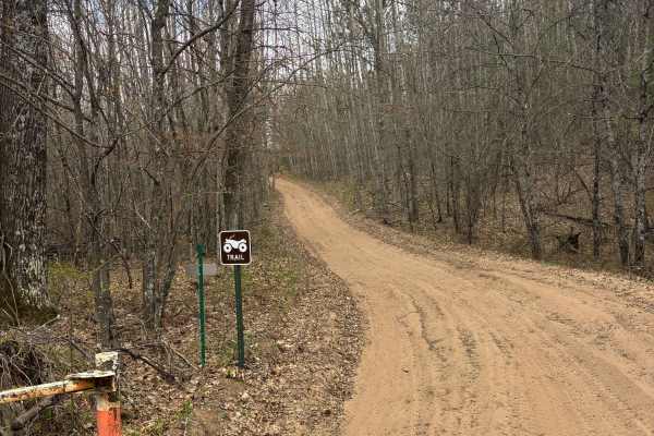
Pansy Lane Trail
Pansy Lane Trail runs between the Butler Rock loop and contains dirt, sandy hills, a few mud holes, and winding turns that create blind corners and a few gravel sections. Because of the winding turns and sandy hills, passing can become difficult on occasion, but there are generally many places to pa...
Learn more about Pansy Lane Trail
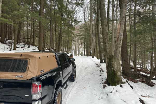
Shauger Hill Road
This is a wonderful drive through Sleeping Bear Dunes National Lakeshore. The trail is accessed off of South Dune Highway or off of North Bar Lake Road. The terrain is quite hilly and is primarily a beech-maple forest. Starting the trail off of North Bar Lake, you will start with ascending 368 feet ...
Learn more about Shauger Hill Road
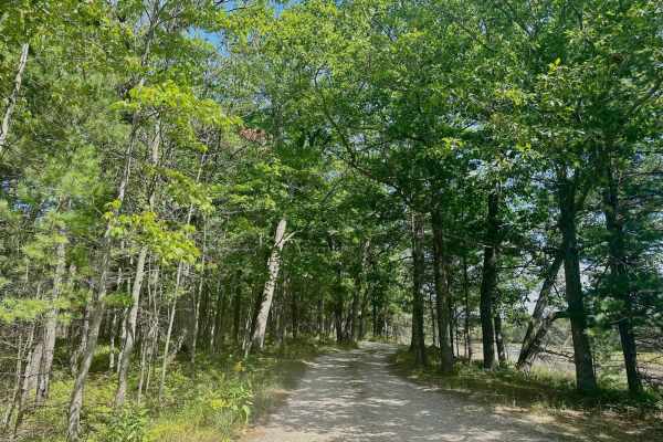
Lasso Road
Lasso Road is a two-mile two track that winds along some marshland within the National Lakeshore boundary. There is lots of terrain diversity along this route from wooded lakes, sandy areas, and thick groves of pines. The trail terrain is mostly sand/dirt with some areas that have some rocks. The tr...
Learn more about Lasso Road
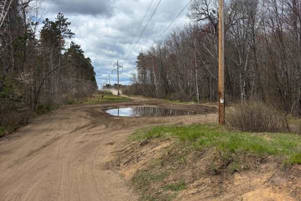
East Butler Rock Road - FS 5556
This trail is a collection of different-named roads that take you north or south through Crooked Lake, depending on your direction of travel. It has a mix of sandy trails and gravel roads that snake through the forest and contains few to many mud holes to navigate, depending on the trail conditions.
Learn more about East Butler Rock Road - FS 5556
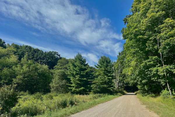
Aral Hills Road
Aral Hills Road is a very fun two-lane gravel road that travels north and south. The south end of the trail starts off of Esch Road and you will start by driving up Aral hill until you get to an open area at the top. After a short drive on top of the hill, you will begin to descend down towards an i...
Learn more about Aral Hills Road
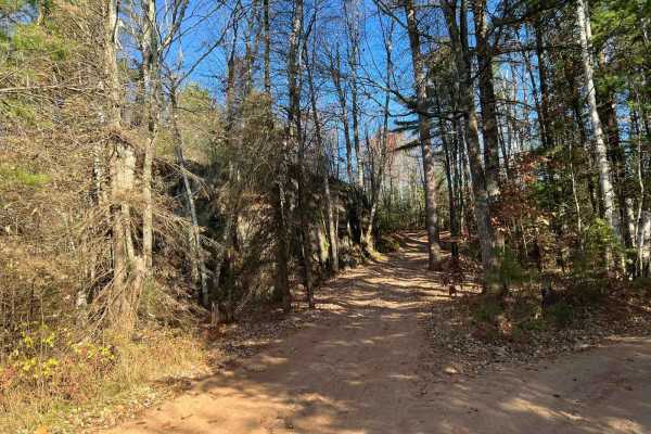
Pembine 16 East Trail Head FR 1006
This is Marinette County Trail 16 East Intersection 104 to 102. This trail runs from the town of Pembine to the trail system known as the Marinette County East Trail System. If coming from Pembine, this trail is very scenic,, passing a large rock formation and a small,, slightly technical hill climb...
Learn more about Pembine 16 East Trail Head FR 1006
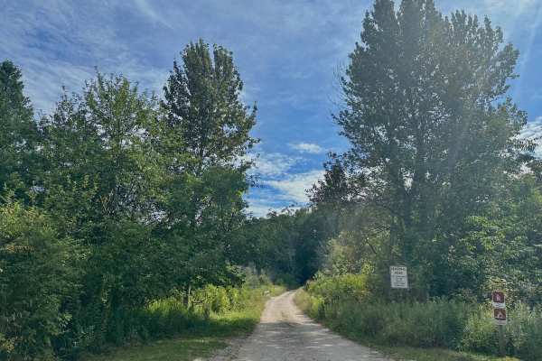
Aral Road
Aral Road is a wonderful two-track that winds alongside Otter Creek. Right at the beginning you will traverse a very cool wooden bridge that crosses the creek. This will provide wonderful scenery of the amazingly clear water as well as the wide open watershed area of the creek. Most of the route wil...
Learn more about Aral Road
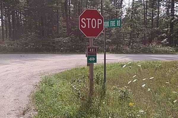
Butler Rock Loop
We traveled Southeast into Marinette County to access the Butler Rock Trails, which was a sandy route through multiple pine and birch forests. The Butler Rock area is a blast with tight twisty terrain with a good bit of elevation change. This route can be accessed via several Nicolet State Trail rou...
Learn more about Butler Rock Loop
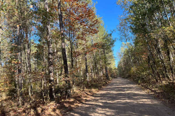
Trail 5- Forest Road 219
This trail is a portion of Marinette County Trail 5 which runs from the town of Athelstane to Dunbar. The trail surface is primarily sand as it winds through several different types of forest. The trail starts if traveled south to north on some gravel forest roads. Slowly transitioning into a sandy ...
Learn more about Trail 5- Forest Road 219
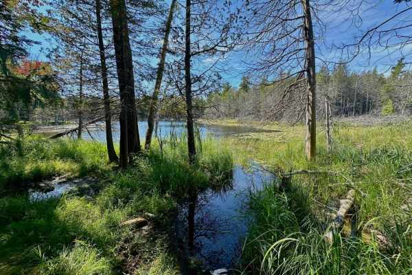
Deer Lake Road
Deer Lake is considerably different than other trails in Sleeping Bear Dunes National Lakeshore. There are multiple tree roots that will need to be traversed as well as areas that are tight and careful driving will need to be done so you don't side-swipe trees. There are washouts that will test cert...
Learn more about Deer Lake Road

FS 2973
FS 2973 Navigates from its intersection with Jack Pine Road FS 2301 to its intersection with FS 2086B. This is a rugged two-track trail which runs east to west in the southeastern portion of the Nicolet National Forest. The trail has a sandy base throughout most of its length and navigates through m...
Learn more about FS 2973
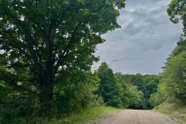
Burnham Road
Burnham Road is yet another beautiful drive through a small part of the national lakeshore land. This road cuts between West Macfarlane Road on the east side and South Leelanau Highway on the west. The east side of the trail is more of a two-track while the west side opens up a bit to a gravel road ...
Learn more about Burnham Road
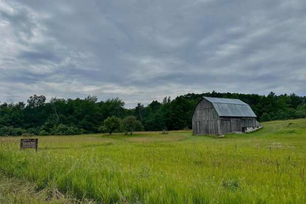
South Thoreson Road
South Thoreson Road offers incredible views of what this national lakeshore has to offer. From Great Lakes views to wooded forests and rolling farmlands. This route is accessible for all vehicles. The road is well-graded but can be quite dusty. The north end of the trail is two vehicles wide while t...
Learn more about South Thoreson Road
Beginner ATV trails near Baileys Harbor, Wisconsin
Explore ATV-friendly trails near you. These trails are accessible for vehicles up to 50 inches wide, perfect for ATVs and smaller off-road machines.
Cedar River Run
This route is a baseline for exploration in the Escanaba Forest Management Unit. It is primarily sand/dirt logging roads without any serious obstacles. Some areas can be slick and muddy after rainfall or during the snowmelt season. The trail can be completed by 2WD vehicles and is plenty wide for fu...
Learn more about Cedar River Run
Cedar River Side Spur
This loop provides a change of scenery and meanders through varying species of trees that provide a tunnel-like canopy in some areas. Even this side trail has side trails! Detour from the route to explore the Escanaba Forest Management Unit. The route is for mixed-use traffic and you may encounter "...
Learn more about Cedar River Side Spur
Dam Dead End
This easily flowing trail runs along the Peshtigo River, which flows down from the Johnson Fall Hydroelectric Dam. The trail features a mix of sandy whoops, hills, and scenic lookouts over the river. It eventually reaches a three-way dead end with gates at each split. A nice camping spot in one of t...
Learn more about Dam Dead End
Trail 5 Southeastern Section
If traveling this trail from south to north it will start off in some twisty but wide open areas, of clear-cut forest. The trail surface in this section is very soft sand. This creates a very fun section of the trail to run. As the trail progresses it will enter into a state forest where the trail w...
Learn more about Trail 5 Southeastern Section
Beginner UTV/side-by-side trails near Baileys Harbor, Wisconsin
Find UTV and side-by-side trails near you. These trails accommodate vehicles up to 60 inches wide, ideal for UTVs, side-by-sides, and wider off-road rigs.
Cedar River Run
This route is a baseline for exploration in the Escanaba Forest Management Unit. It is primarily sand/dirt logging roads without any serious obstacles. Some areas can be slick and muddy after rainfall or during the snowmelt season. The trail can be completed by 2WD vehicles and is plenty wide for fu...
Learn more about Cedar River Run
Cedar River Side Spur
This loop provides a change of scenery and meanders through varying species of trees that provide a tunnel-like canopy in some areas. Even this side trail has side trails! Detour from the route to explore the Escanaba Forest Management Unit. The route is for mixed-use traffic and you may encounter "...
Learn more about Cedar River Side Spur
Dam Dead End
This easily flowing trail runs along the Peshtigo River, which flows down from the Johnson Fall Hydroelectric Dam. The trail features a mix of sandy whoops, hills, and scenic lookouts over the river. It eventually reaches a three-way dead end with gates at each split. A nice camping spot in one of t...
Learn more about Dam Dead End
Trail 5 Southeastern Section
If traveling this trail from south to north it will start off in some twisty but wide open areas, of clear-cut forest. The trail surface in this section is very soft sand. This creates a very fun section of the trail to run. As the trail progresses it will enter into a state forest where the trail w...
Learn more about Trail 5 Southeastern Section
The onX Offroad Difference
onX Offroad combines trail photos, descriptions, difficulty ratings, width restrictions, seasonality, and more in a user-friendly interface. Available on all devices, with offline access and full compatibility with CarPlay and Android Auto. Discover what you're missing today!
Open Trail Map