
Beginner Off-Road Trails
Near Alamosa East, Colorado
Explore All Beginner Trails Near Alamosa East, Colorado
Beginner Off-Road Trails Near Alamosa East, Colorado
Discover the best beginner-friendly off-road trails near you. These easier, lower-rated trails are a great place to start — browse trail maps, check difficulty ratings, and find your next adventure.
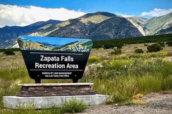
Zapata Falls
This is a short drive over a well-maintained gravel road to Zapata Falls which are really cool to hike to and enjoy. The falls have about a 30' drop, but the section you walk to inside of a cave is much shorter. The walk is about a half mile up the rocks and rapids flowing out of the cave. You ca...
Learn more about Zapata Falls
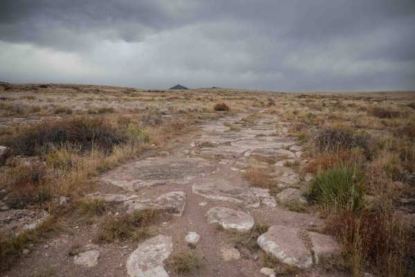
Chillax
Chillax starts at the end of the Loma de San Jose trail and heads west for almost 2 miles until it connects with Valley View. It starts out as a wider track, more like a two-track, with more flat embedded rock surfaces. It's very easy to ride over the rock, and then it's smooth dirt for most of the ...
Learn more about Chillax
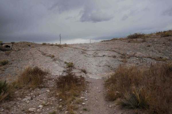
Loma de San Jose
This 2-mile-long single track starts right next to the staging area for the Limekiln area right off Highway 160. It's a skinny trail through the flat sagebrush valley along the base of the mesa. It's very fast and flowy, with wide gradual curves, but mostly straight. It goes on a road for a moment b...
Learn more about Loma de San Jose
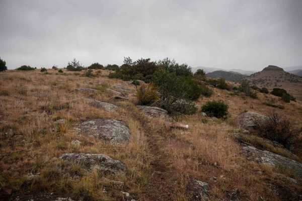
Fata Morgana
From the north end, Fata Morgana starts as a narrow single track over the rolling hills, with small dips into ravines and gradual curves up the mesas. The trail has a bit of infrequent embedded rock surfaces on the top of the mesa, but it's all easy to ride over. It gradually climbs up a couple hund...
Learn more about Fata Morgana
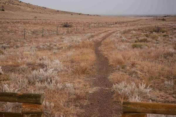
SPF50
The south end of this single track starts at the intersection with Valley View, and it heads through a flat grassy valley on a wide trail along a fence. It goes really fast and straight, then makes a sharp northern left turn at a fence and trail marker. The portion going north is also really wide, m...
Learn more about SPF50
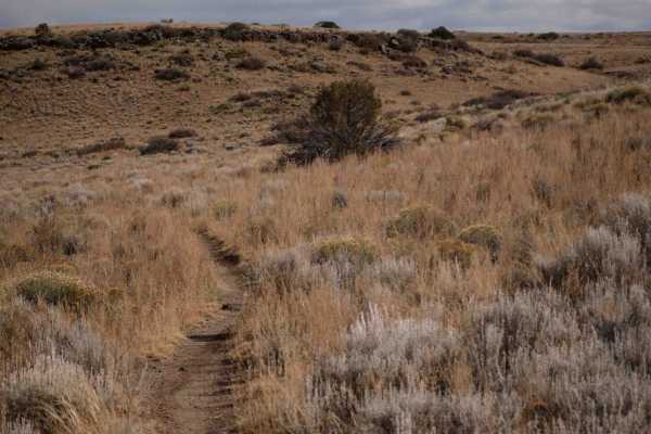
Popsico
This is a short trail off of Chillax that is fast and flowy through the rolling hills and valleys. This is one of the easier trails in the area and is great for beginners learning to ride singletrack, as it has almost zero rocks, and just weaves gradually through the flat terrain. This is a good way...
Learn more about Popsico
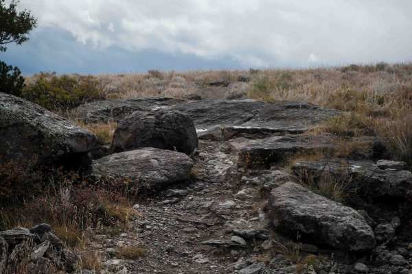
Limekiln Peak
Limekiln Peak is the most scenic of the trails in the Limekiln area. From the east end, this singletrack starts climbing up the mesa on an easy trail and comes up to a pinch between two small boulders that you can either ride between or pop over the 1-foot tall boulder. There are more trees on the m...
Learn more about Limekiln Peak
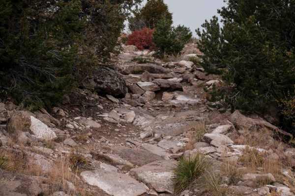
Valley View
Valley View starts at the west end of Chillax, and heads south through a flat and barren valley of sage brush, riding directly towards the mesas. It goes through a fence and continues straight and fast until it starts curving up the mesa. The trail gets a bit rockier as it climbs up the mesa, with b...
Learn more about Valley View
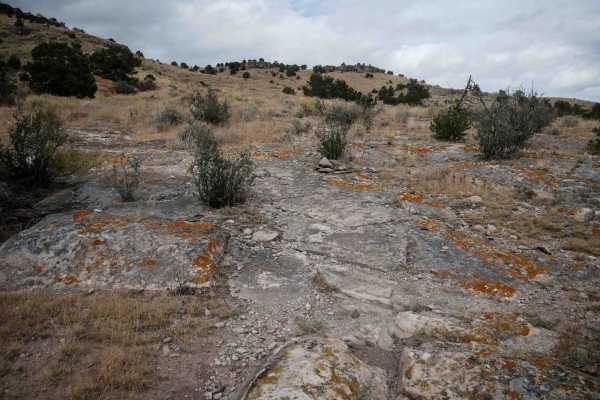
Pura Vida
The south end of this single track starts on a dirt road and heads north towards the intersection with Limekiln Peak. It gets more interesting than some of the surrounding trails in the area, as it has larger slabs of embedded rock that you ride over, sometimes like a ramp up the mesa. It weaves thr...
Learn more about Pura Vida
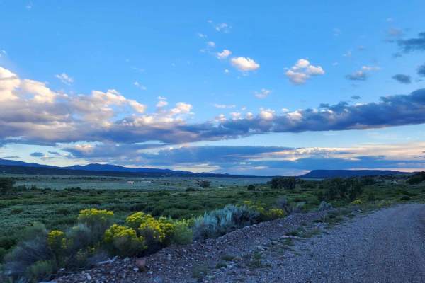
Old Highway
This is the old unmaintained highway, the surface is broken pavement and gravel mix. This route can be easily traversed with any roadworthy car, precipitation may make the route impassable for passenger cars. It is a great quick detour from the main highway, perfect for a picnic or just to get off t...
Learn more about Old Highway
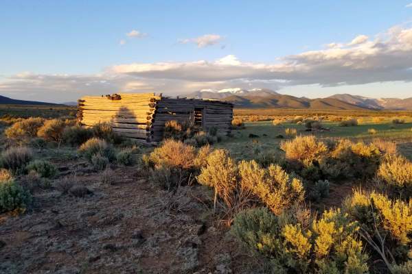
Taos Valley Road 5030 North
If quiet and solitude are what you're looking for, you've found the right trail. This is one of the most remote sections of trail in the San Luis Valley. The stunning scenery of the vast Rio Grande Del Norte National Monument, wildlife (deer, elk, antelope, bighorn sheep) viewing opportunities, and...
Learn more about Taos Valley Road 5030 North
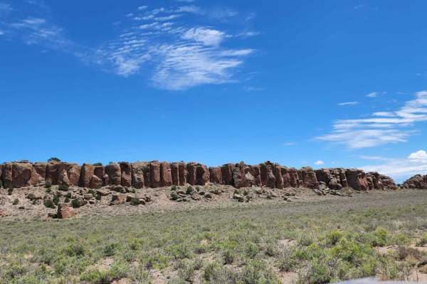
Old Dry Drainage
This road can be muddy when wet with water puddles. It has beautiful views of the big open desert, and there are some pretty cool rocks. There seems to be no camping. It's a dirt or rocky road with gentle grades that is safe for most 4WD and high-clearance 2WD vehicles. Roads are typically two vehic...
Learn more about Old Dry Drainage
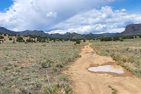
East Butte
Beautiful road with amazing views. This road can be muddy when wet and has some water puddles. There is no camping, but it is a quick, simple, enjoyable road to take a drive on. Dirt or rocky road, typically unmaintained after rain or snow. You may encounter shallow water crossings and obstacles und...
Learn more about East Butte
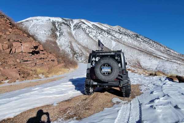
Old La Veta Pass
This trail is an old train route that connected the east and west sides of the Sangre de Cristo mountains until the 1960s when the highway was put in. It is now an unmaintained road with no obstacles. There are several spots where you will traverse over the old paved road that has become little more...
Learn more about Old La Veta Pass
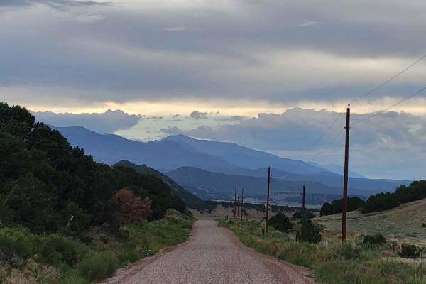
Medano's Back Door
This is a well-maintained graded dirt road. It will be passable for any road-worthy vehicle in good weather conditions. If poor weather does occur, it could be trouble for road cars. A 4x4 with clearance will be able to travel this road year-round, so long as it's been plowed in the winter.
Learn more about Medano's Back Door
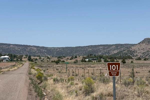
FS 101
FR 101 is approximately 17 miles long from its start at the intersection of SH 17 to where it dead-ends at the border between the La Jara State Trust Land and the Rio Grande National Forest. It begins as a well-maintained two-lane dirt road with some washboarding. At approximately 9.3 miles in, the ...
Learn more about FS 101
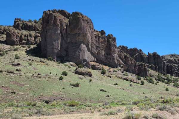
Barrel Springs
This road can be muddy when wet with water puddles. It has beautiful views of the big open valley desert, and really cool rocks. There seems to be no camping. Dirt or rocky road, typically unmaintained after rain or snow. You may encounter shallow water crossings and obstacles under 12" on the trail...
Learn more about Barrel Springs
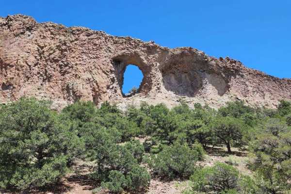
La Ventana
La Ventana is an easy and scenic 1.6-mile dirt road in the Rio Grande National Forest that provides a quick, enjoyable drive leading directly to the trailhead for the striking Natural Arch geologic formation. Perfect for beginners, scenic drivers, and hikers alike, this short route climbs gently fro...
Learn more about La Ventana
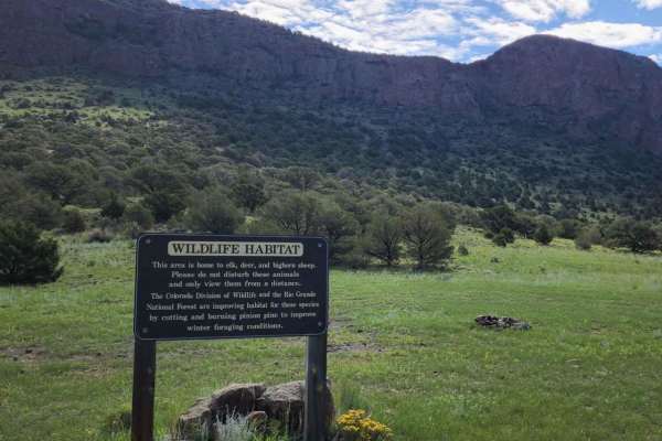
Canada Ancha
This road can be muddy when wet with water puddles. It has beautiful views, but there seems to be no camping. This is a very busy area for dirt bikes and SxSs. Dirt or rocky road, typically unmaintained after rain or snow. You may encounter shallow water crossings and obstacles under 12" on the trai...
Learn more about Canada Ancha
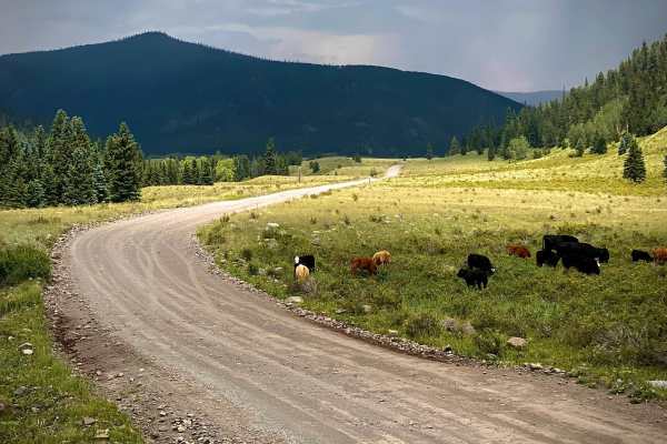
Alamosa Conjeos-Fr Rd 250
Alamosa Conejos Forest Road 250 is a scenic 29-mile overland route following the Conejos River in the Rio Grande National Forest. Beginning off Highway 17, the road heads north along the river, providing access to developed campgrounds and popular trout fishing spots. The first section to the histor...
Learn more about Alamosa Conjeos-Fr Rd 250
Beginner ATV trails near Alamosa East, Colorado
Explore ATV-friendly trails near you. These trails are accessible for vehicles up to 50 inches wide, perfect for ATVs and smaller off-road machines.
Old Dry Drainage
This road can be muddy when wet with water puddles. It has beautiful views of the big open desert, and there are some pretty cool rocks. There seems to be no camping. It's a dirt or rocky road with gentle grades that is safe for most 4WD and high-clearance 2WD vehicles. Roads are typically two vehic...
Learn more about Old Dry Drainage
East Butte
Beautiful road with amazing views. This road can be muddy when wet and has some water puddles. There is no camping, but it is a quick, simple, enjoyable road to take a drive on. Dirt or rocky road, typically unmaintained after rain or snow. You may encounter shallow water crossings and obstacles und...
Learn more about East Butte
Old La Veta Pass
This trail is an old train route that connected the east and west sides of the Sangre de Cristo mountains until the 1960s when the highway was put in. It is now an unmaintained road with no obstacles. There are several spots where you will traverse over the old paved road that has become little more...
Learn more about Old La Veta Pass
FS 101
FR 101 is approximately 17 miles long from its start at the intersection of SH 17 to where it dead-ends at the border between the La Jara State Trust Land and the Rio Grande National Forest. It begins as a well-maintained two-lane dirt road with some washboarding. At approximately 9.3 miles in, the ...
Learn more about FS 101
Beginner UTV/side-by-side trails near Alamosa East, Colorado
Find UTV and side-by-side trails near you. These trails accommodate vehicles up to 60 inches wide, ideal for UTVs, side-by-sides, and wider off-road rigs.
Old Dry Drainage
This road can be muddy when wet with water puddles. It has beautiful views of the big open desert, and there are some pretty cool rocks. There seems to be no camping. It's a dirt or rocky road with gentle grades that is safe for most 4WD and high-clearance 2WD vehicles. Roads are typically two vehic...
Learn more about Old Dry Drainage
East Butte
Beautiful road with amazing views. This road can be muddy when wet and has some water puddles. There is no camping, but it is a quick, simple, enjoyable road to take a drive on. Dirt or rocky road, typically unmaintained after rain or snow. You may encounter shallow water crossings and obstacles und...
Learn more about East Butte
Old La Veta Pass
This trail is an old train route that connected the east and west sides of the Sangre de Cristo mountains until the 1960s when the highway was put in. It is now an unmaintained road with no obstacles. There are several spots where you will traverse over the old paved road that has become little more...
Learn more about Old La Veta Pass
FS 101
FR 101 is approximately 17 miles long from its start at the intersection of SH 17 to where it dead-ends at the border between the La Jara State Trust Land and the Rio Grande National Forest. It begins as a well-maintained two-lane dirt road with some washboarding. At approximately 9.3 miles in, the ...
Learn more about FS 101
The onX Offroad Difference
onX Offroad combines trail photos, descriptions, difficulty ratings, width restrictions, seasonality, and more in a user-friendly interface. Available on all devices, with offline access and full compatibility with CarPlay and Android Auto. Discover what you're missing today!
Open Trail Map