

Ready to explore this trail?
View Trail Map in AppRegional Classic
A must do route for the area handpicked by local experts.
The trail names for the Browns Creek Trail #1429 and Wagon Loop Trail #1427 were switched several years ago to reduce confusion. However, that means that older maps and some online resources don't align with the trail signs. If in doubt, refer to the route shown here.
Path Type
There and Back
The hike to Browns Creek Falls begins at a well-developed trailhead equipped with a pit toilet and a large parking area. Because this is a highly popular destination, the parking lot frequently fills up early on weekends, particularly during the spring runoff when the waterfall is at its best.
Starting to the right of the pit toilet, the route follows the Browns Creek Trail (#1429). The initial segment features a moderately steep and rocky climb that quickly rises to offer expansive views of the Arkansas River Valley below. The trail is shared with equestrians and mountain bikers, requiring hikers to remain alert for other trail users. Note that older maps may label this path as the Wagon Loop Trail due to a historic trail-name swap intended to reduce navigation confusion.
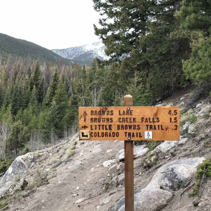
After about 1.5 miles, the route meets the Colorado Trail. Turn left and follow the Colorado Trail for a short distance before taking a right-hand turn to rejoin the signed Browns Creek Trail. From here, the path eases into a gentler grade, winding through a beautiful, open meadow that frames views of Mount White to the left and Mount Antero to the right.
The final stretch of the hike snakes through dense pine forests and crosses Browns Creek over several sturdy wooden bridges. A clearly signed spur trail on the left leads directly to the base of the thundering, multi-tiered Browns Creek Falls. After enjoying the waterfall, retrace your steps along the same route to return to the trailhead.
No Condition Reports
Browns Lake
Browns Lake
Mount Antero via Little Browns Creek
Mount Antero via Little Browns Creek
Colorado Trail: Segment 14
Colorado Trail: Segment 14
Mount Princeton
Mount Princeton
Agnes Vaille Falls
Agnes Vaille Falls
Mount Shavano East Slopes
Mount Shavano East Slopes
Contributors

