

Ready to explore this trail?
View Trail Map in AppRegional Classic
A must do route for the area handpicked by local experts.
Overnight parking is restricted to the designated backpackers' parking lot located just before the trailhead, while the immediate trailhead area is limited to day-use parking. Wilderness permits are required year-round for all overnight stays in the John Muir Wilderness (Inyo National Forest), with a quota system in effect from May 1 through November 1. Permits must be reserved in advance through Recreation.gov under the "Big Pine Creek - North Fork" entry point. Day use does not require a permit.
Path Type
There and Back
The route starts at Glacier Lodge, west of Big Pine, and ends at the summit of Mount Sill, about 8 miles and roughly 6,500 vertical feet away.
From the trailhead, follow the North Fork Big Pine Creek Trail past First Falls at 1.1 miles and Second Falls at 2.0 miles, then continue past the Big Pine Lakes and turn left (south) off the maintained trail toward Sam Mack Meadow, reached around 6 miles. Cross the meadow and climb loose talus onto the Palisade Glacier moraine, about 1.25 miles and 1,100 vertical feet farther — this section requires route-finding, with no continuous tread.
From the moraine, cross the remnant Palisade Glacier for several hundred yards, contouring below Mount Gayley. Bring an ice axe and crampons; the glacier is in long-term retreat and conditions vary significantly by year, so check current-season trip reports before relying on this description for snow and crevasse conditions. At the west side of Glacier Notch, climb a loose Class 3 scree chute to gain the notch itself, the low point on the ridge between Mount Gayley and Mount Sill's north buttress.
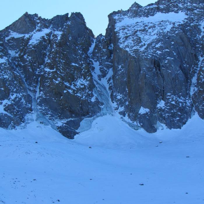
From Glacier Notch, the North Couloir climbs northwest for about 500 vertical feet — a Class 3 snow climb early in the season that turns to loose, disagreeable talus once the snowfield melts out later in summer. If you'd rather avoid the snow or the talus, Class 3 rock along the right side of the couloir, under Apex Peak, offers an alternative line.
Crux: Near the top, the couloir meets a rib; trend right (east) onto easier ground just south of it. This upper section is the crux: a short, exposed Class 4 step gains a ledge system that crosses Sill's west face, and at the south end of that ledge, another brief Class 4 move gains the southwest ridge. Parties uncomfortable on Class 4 terrain can protect this short section with a few slings or cams and a short rope, though it isn't strictly required.
Once on the southwest ridge, Class 2-3 terrain leads directly to the summit.
Retrace the same route to descend. Downclimbing the couloir and re-crossing the glacier both warrant extra care — snow that's firm and secure in the morning often softens badly by afternoon.
No Condition Reports
Middle Palisade East Chute
Middle Palisade East Chute
Glacier Lodge to Palisade Glacier
Glacier Lodge to Palisade Glacier
Finger Lake via Big Pine Creek South Fork Trail
Finger Lake via Big Pine Creek South Fork Trail
First Falls Day Hike
First Falls Day Hike
Big Pine Lakes Loop
Big Pine Lakes Loop
Split Mountain (Red Lake / North Slope)
Split Mountain (Red Lake / North Slope)
Contributors

