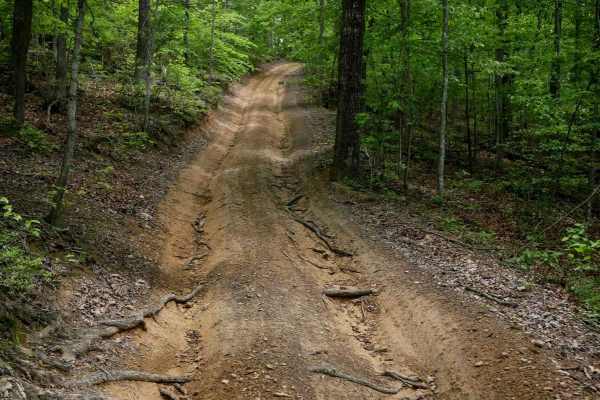
Trail Overview
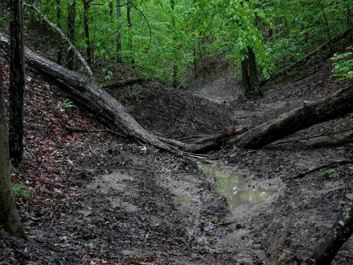
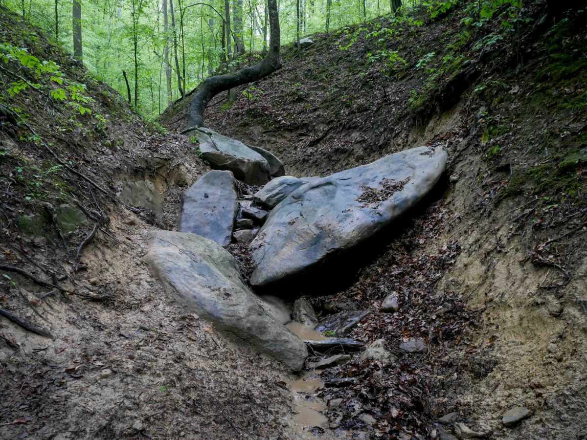
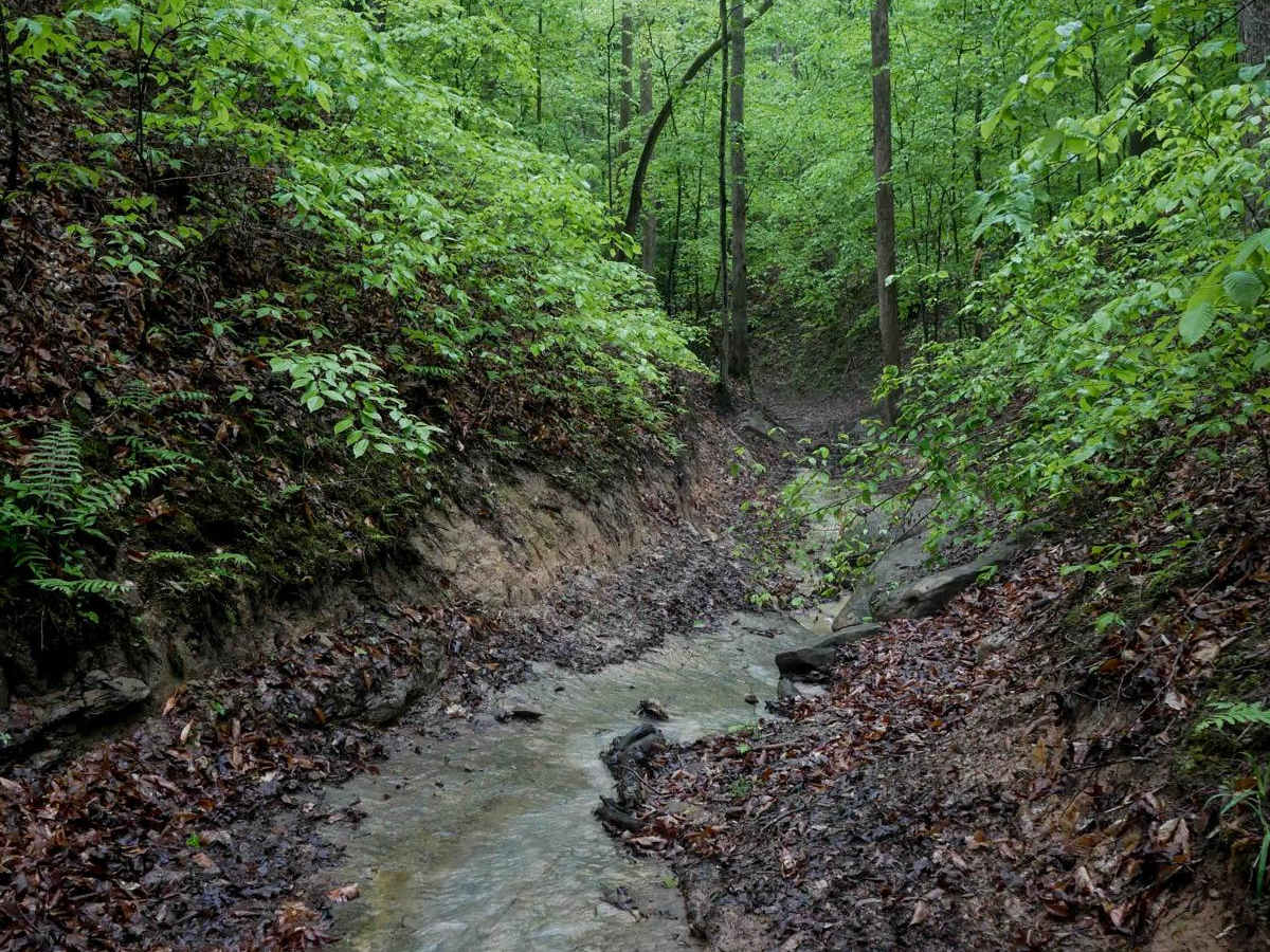
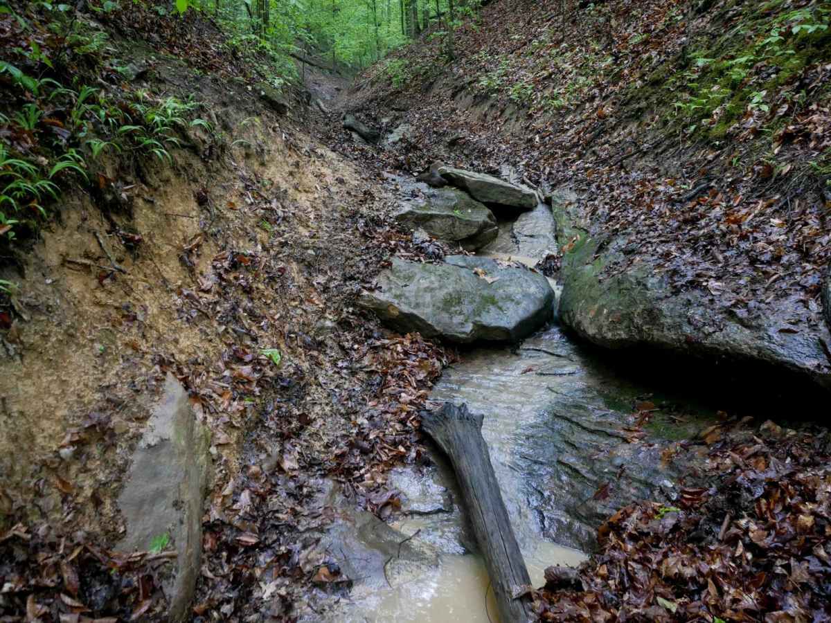
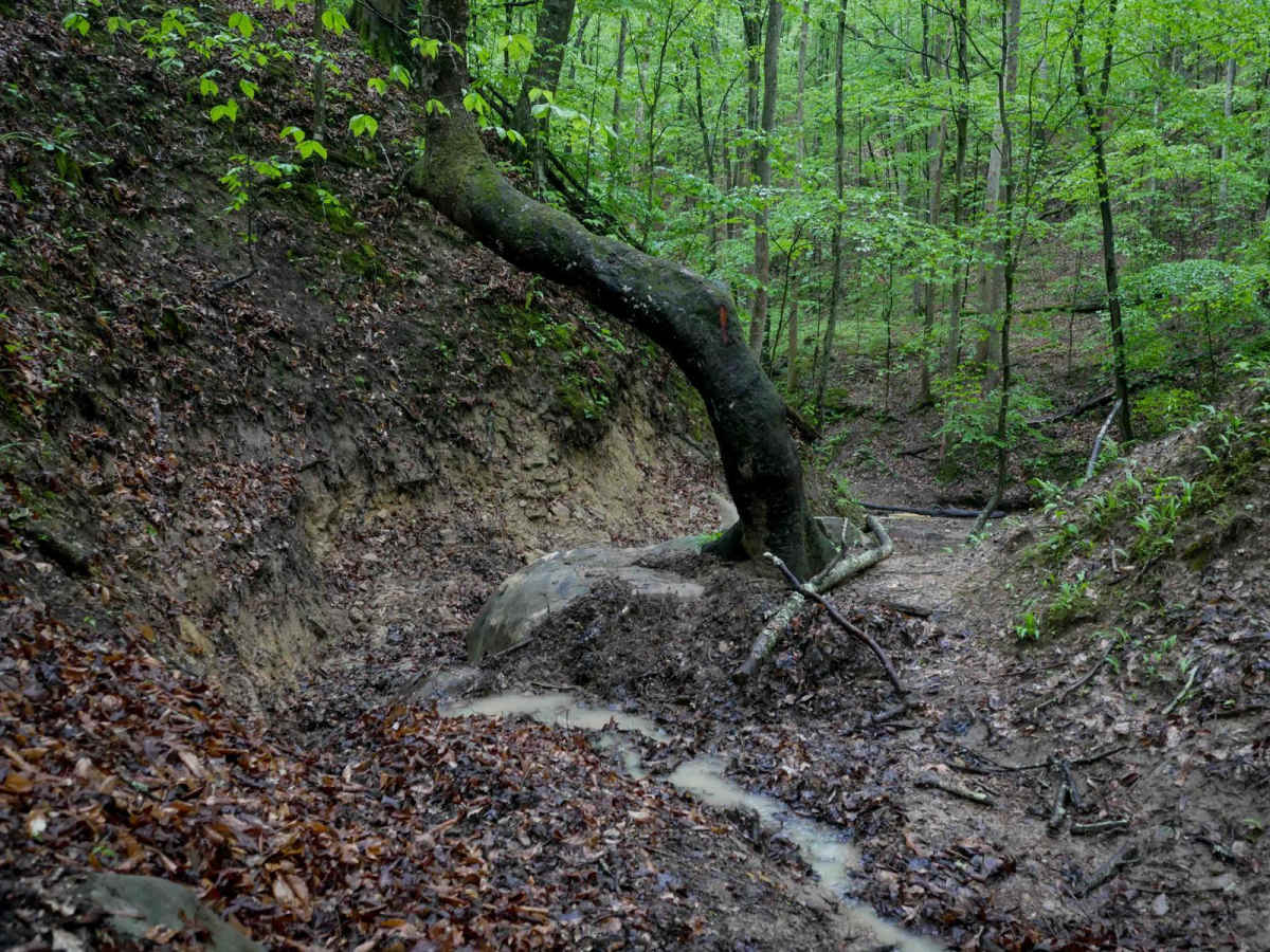
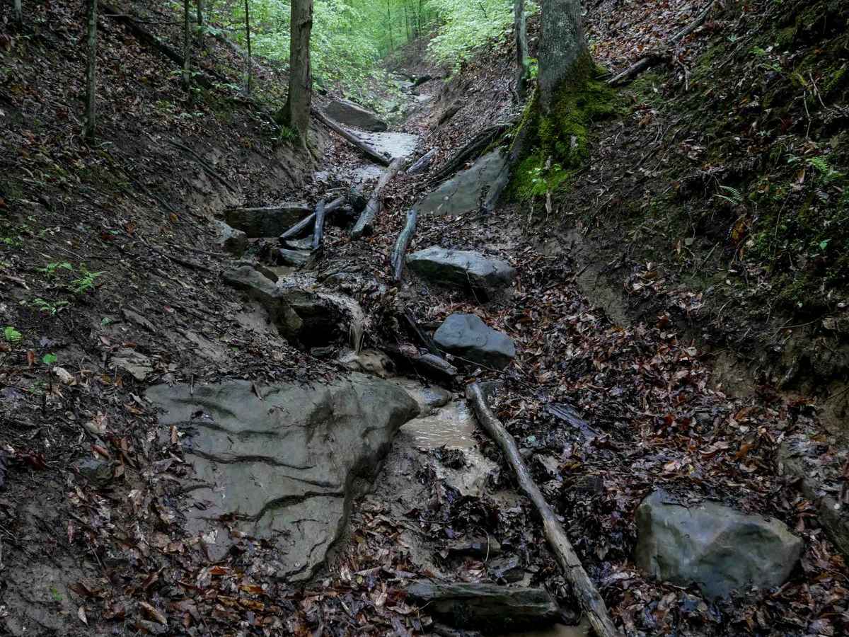
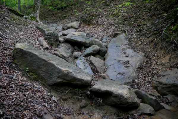
IB 89 is a short, 200-yard advanced trail that spurs off of IB 52 and descends into a tight, technical ravine before connecting to IB 49. The drop-in is steep and narrow, with large downed logs lying at awkward angles across the ravine floor--drivers of wider vehicles will need to get their tires up and over these logs. The entire trail stays within the narrow ravine, which is lined with banked dirt walls, slick roots, and layers of embedded rock. Wider vehicles will have to keep their tires up on the edges of the ravine to pass through the narrowest sections. Near the bottom, several embedded boulders in the middle of the trail form shelves over a couple of feet tall, with holes and gaps between them that challenge tire placement. A large tree growing directly in the ravine adds a clearance issue. This is a rough, slick, and technical trail intended for experienced drivers only. Conditions worsen significantly when wet.
Difficulty
This is an advanced trail with narrow sections, large logs, tall rock shelves, and deep ruts and roots, best suited for highly skilled drivers. This is considered an Extreme trail by Hatfield McCoy's rating system.