Derek G
May 02, 2026
1996 Isuzu Bighorn
Open
Normal
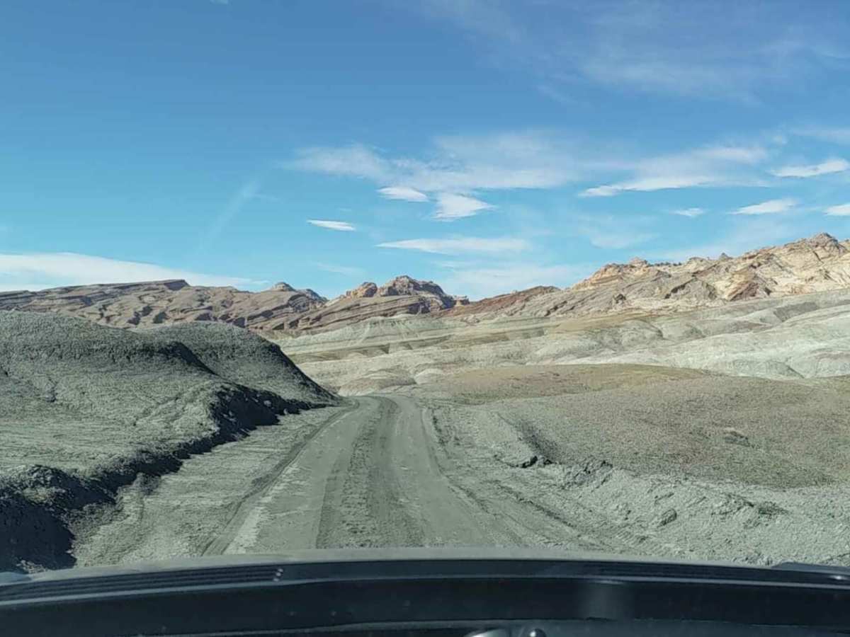
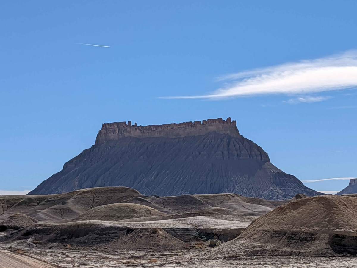
Started on Coal Mine Road west of Hanksville. Factory Butte was a sight to see from the road. Hit Moonscape Overlook, which was equally amazing. Joined up with Wild Horse. The Muddy Creek crossing was very easy. Water was about 4" in depth. Finished at Goblin Valley.
Lamont JR
Apr 29, 2026
2022 Ford Bronco
Open
NormalDusty
Amazing views the first section is like another planet. Factory butte is awesome and moonscape overlook is absolutely worth it. The trail is easy and can be done in 2wd the route out to goblin valley is also amazing.
O J
Apr 26, 2026
2019 Ford F-150
Open
DustyMuddy/Wet
Great trail with some good camp spots along the way. In the middle by the creek there is a spot with some very deep ruts. Wouldn’t advise without some sort of recovery method.
Dusty Miles
Apr 20, 2026
Open
Great trail. Lots of different terrain. Beware of the area around Muddy Creek. Knee deep thick mud you will get stuck if you go in to it. Its a long way back to Goblin if you cant go through
Brad RV
Apr 06, 2026
Open
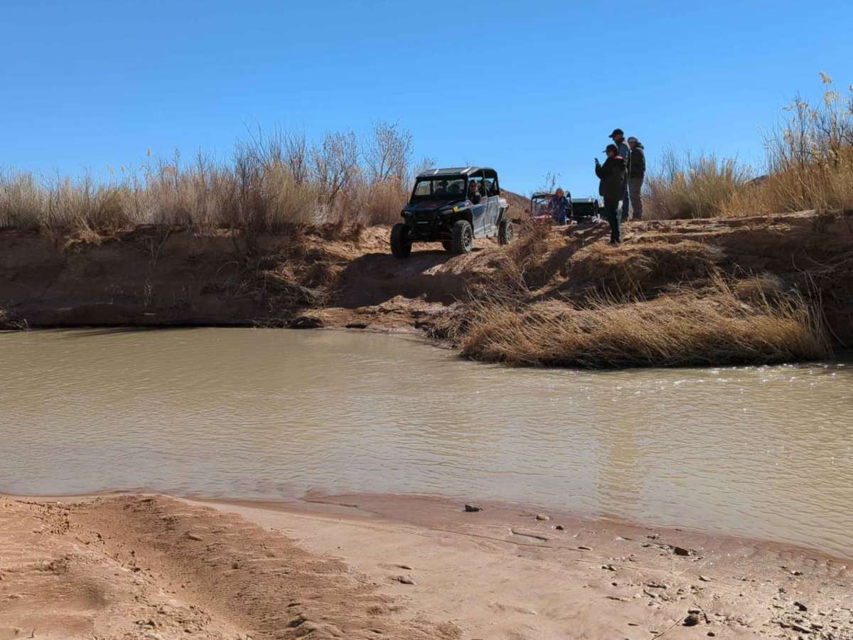
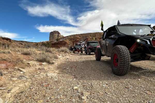
Made to muddy creek crossing but went to the left for a shallower crossing and there were about 18” dips alternating in the road with deep mud ruts on either side we backed out and went back. Maybe a jeep could have taken that on or another path but this way seemed a pretty tough obstacle. Looking at the map there appears to be some other off shoots to get to the water crossing you may want to explore for an easier cross. I didn’t want to risk it in a tall van. Ours is lifted with 35’s an awd, so plenty of clearance but itlooked pretty technical. Zoom in on the picture.
Nick Bishop
Mar 29, 2026
2016 Ford F150
Open
NormalDustyRough/Deteriorated
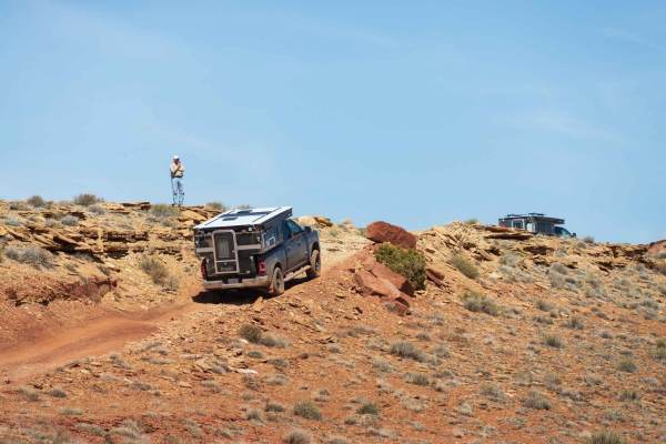
It was difficult to gather information about this trail prior to committing to driving. The ranger at Goblin Valley offered an extremely conservative report of what would be required to travel down it. After having seen the types of vehicles that some people attempted to drive down it, I can understand why. There is a series of technical obstacles at 38.54949, -110.82293 which required extra caution. My F150 with stock suspension and 33"s pulled our Xpedition Voyager up them with no problem.
Farther down the trail at the Muddy Cr crossing, you could quite clearly see where a previous trail reporter had run into what can only be imagined as the stickiest mud on Earth. The trail is passible now, though any ran in the area is likely to make this area much "spicier".
Overall, an amazing trail with a wide variety of terrain and landscapes. This served as an excellent path to travel from Goblin Valley to the Cathedral Valley road.
Vincent Hirsch
Mar 19, 2026
Open
Trail is easily made with a stock jeep.
JD Swannack
Oct 19, 2025
Obstructed
Impassable Water Crossing
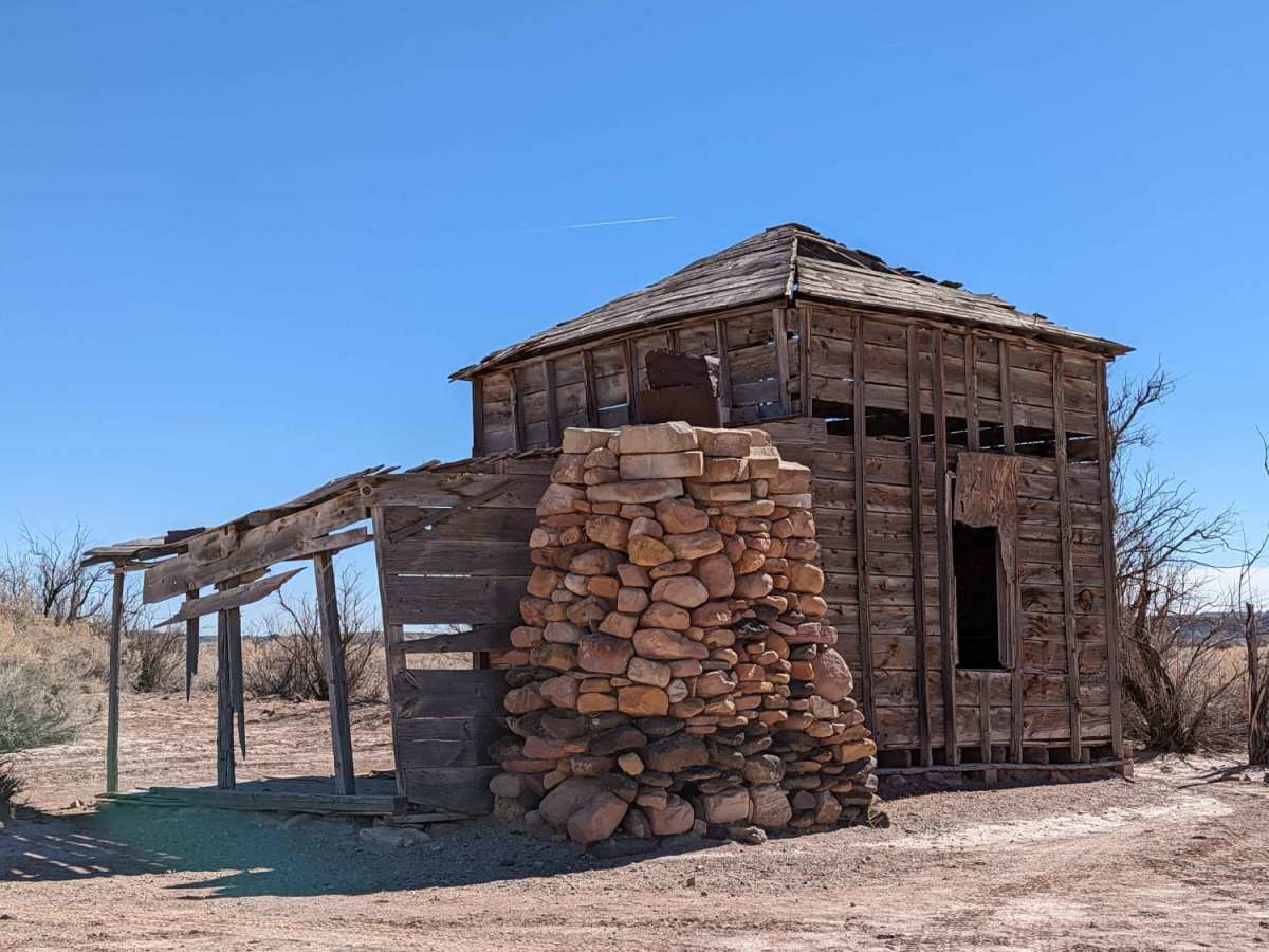
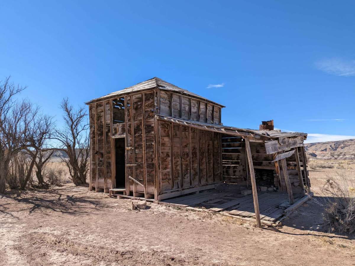
Road from Goblin good condition. About 1 miles past the old Homestead the road is impassable for about 1/2 miles due to deep mud. Right after the river crossing the road is impassable. I got stuck in deep mud. Thanks to G&C Mobile Mechanic for pulling me out before the bank collapsed!
P J
Sep 27, 2025
2011 Toyota 4Runner
Open
Normal
Water crossing is shallow and non issue. Easy in stock 4Runners
Kraig Reynolds
Sep 15, 2025
2018 Toyota Tacoma
Obstructed
Washout
Deep mud in the wash.
Paul Smith
Jun 15, 2025
2024 Toyota 4Runner
Open
Normal
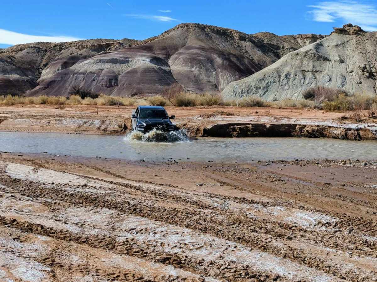
River was maybe 6-12" when we crossed. Rest of the trail was great! A few slick rocks and off-camber but nothing too difficult.
Damon Coombs
Jun 08, 2025
2021 RAM 2500
Open
Muddy/WetWashboard
Must have 4 wheel drive and high clearance for a couple areas but for the most part an easy trail. Seems like scenery changes around every corner. Had rain 2 days before I was there and a couple parts right after river crossing where very deep and slick mud but 4 low and MTs got me through. River crossing was less than a foot deep. The last part coming into Capital Reef has bad washboarding for multiple miles but found if you go 20+ mph it makes it slightly less unbearable. It hit 96 degrees and saw no one else until closer to Capitol Reef so be sure to have plenty of water, fuel, and a way to call for help if needed.
Cameron Martindell
Mar 24, 2025
Open
Normal
Overall, this trail was pretty easy—I'd rate most of this road a 2 but the Muddy Creek crossing was about 1-foot deep. We only did 30 miles from Goblin Valley and exited via Coal Mine Road (had a dinner reservation at Hell's Backbone Grill!).
There are a few steep drops into dry-washes and steep climbs. Had the truck in 4WD, but didn't need to. Trail was totally dry. Lots of vehicles at trailheads near Goblin Valley, but after that we had the road to ourselves.
The 1-foot deep Muddy Creek crossing isn't until right before we climbed out of the flats (thought it might be dry already). There seems to be two options for crossing, we took the one further up-river (west) after a nice lunch stop by the river—great to let the kids run around and play.
Ethan Gibbs
Feb 15, 2025
Obstructed
Extremely muddy and slick.
Mingwei Xu
Dec 28, 2024
2024 Lexus GX
Open
Normal
Trail condition was great. A few muddy spots but no concern of getting stuck. The water crossing part has been rerouted, but the signs and tracks were easy to follow. The water was about 8 inches deep with mild current.