10 trails found in Missouri
Which "ridge" are you looking for?
We found 10 off-road trails in Missouri matching your search. Pick the one you're looking for below.
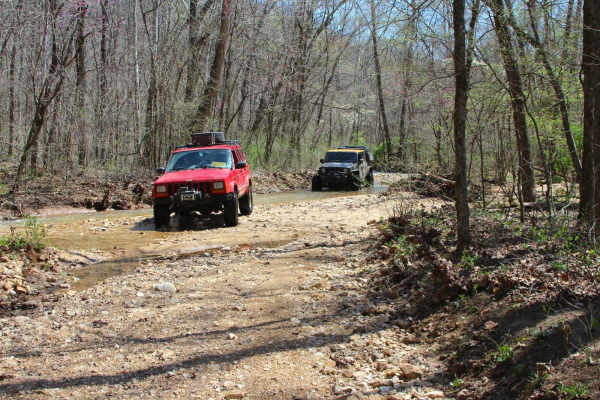
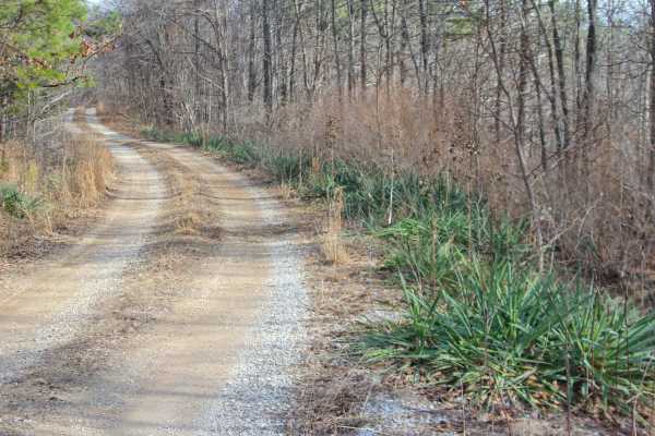
River Ridge Road
River Ridge Road is a natural gravel-dirt terrain and creek bottom road within Carter County, Missouri, over Ozark National Scenic Riverways and the Missouri Department of Conservation's Rocky Creek Conservation Area Land. The River Ridge features hit the mark of a true Missouri Ozark road, featurin...
Learn more about River Ridge Road
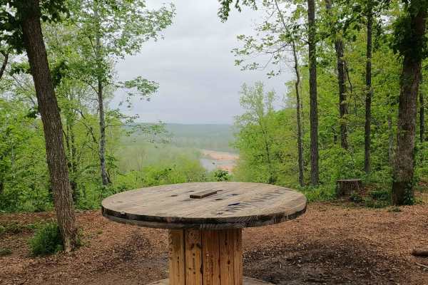
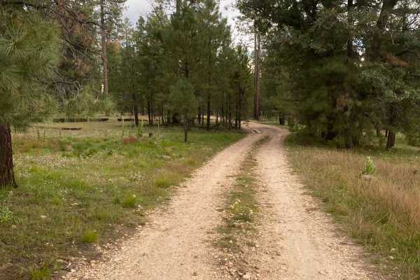
Mid Ridge Road
Mid Ridge Road is a natural coarse gravel and dirt-based road within the Roger's Creek Natural Area, Missouri Department of Conservation Land. The road begins at the bottom of the Current River Valley, just northwest of Van Buren, MO. It quickly elevates from the entry off Carter County Road 151, cl...
Learn more about Mid Ridge Road
Spool Ridge Trail
Spool Ridge Trail, or simply The Spool Trail, is a natural dirt/coarse gravel and small rock trail through the north center portion of the Black River Bottoms area within the Clearwater Lake U.S. Army Corps of Engineer Land. The Spool Trail rides ridge tops overlooking the Black River below, trackin...
Learn more about Spool Ridge Trail
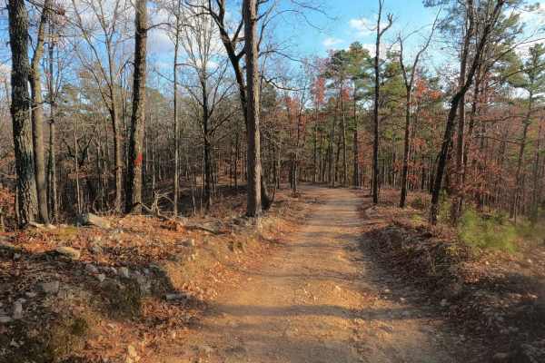
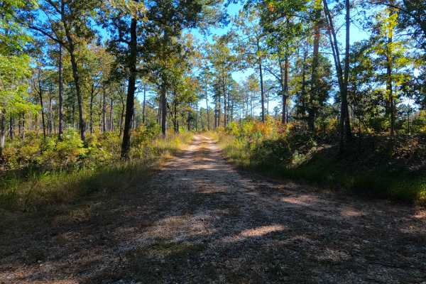
Middle Ridge - FS 424
Middle Ridge (FS 424) is a semi-maintained gravel forest service road within the Willow Springs Unit of Mark Twain National Forest. The road begins at Missouri Route AM, heading north along the elevated ridge. When at the half-mile mark from the entry of the track, there is a small peak of a ridge s...
Learn more about Middle Ridge - FS 424
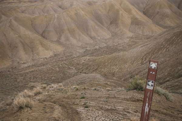
Ponds Ridge
Ponds Ridge is an adobe ridge line trail similar to most of the ridge line trails in the Flat Top- Peach Valley Recreation Area. It's a narrow single-track trail made up of ascents and descents on the soft clay hills of the Peach Valley badlands, and rides along the ridge lines. Starting from Elepha...
Learn more about Ponds Ridge
West Buzzard Ridge
West Buzzard Ridge trail (FS RD 9015H) is a scenic point-to-point trail under the Ponderosa pines of the Coconino National Forest northwest of Sedona, AZ. The trail, which can be accessed by most vehicles, does not offer much as far as technicality but does offer several viewpoints of the surroundin...
Learn more about West Buzzard Ridge

Old Bald Ridge - FS 4652
Old Bald Ridge Trail is a mildly used out-and-back two-track through the Nantahala National Forest. The trail is accessed from Moses Creek Road, which is asphalt up to the entry into the National Forest, where its designation changes to FS4651. 3.2 miles up Moses Creek Road, the Old Bald Ridge trail...
Learn more about Old Bald Ridge - FS 4652
Perkins Ridge - FS 423
Perkins Ridge (FS 423) is a semi-maintained gravel forest service road within the Willow Springs Unit of Mark Twain National Forest. The Perkins Ridge begins at Missouri Route AM, heading west along the raised ridge top spines, first dropping downhill as it overlooks deep valleys on both sides of th...
Learn more about Perkins Ridge - FS 423
High Ridge - FS 3750
High Ridge (FS 3750) is a semi-maintained gravel forest service road within the Poplar Bluff Unit of Mark Twain National Forest, with seasonal open dates of 6-1 to 3-14 yearly. The High Ridge Road begins leaving the Wayne County Road 426, heading east past a closure gate, onto the ridge road, lined ...
Learn more about High Ridge - FS 3750
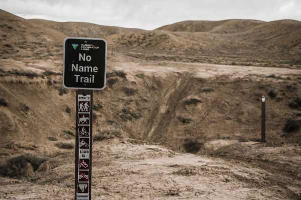
No Name Ridge
No Name Ridge is a fun single track near the Elephant Skin Staging Area of the Flat Tops-Peach Valley recreation area. The trail follows a ridge line atop the soft adobe clay hills that make up the Peach Valley badlands. From the bottom trailhead, the trail starts by crossing the Narrow Gauge Ditch ...
Learn more about No Name Ridge