Trail Overview
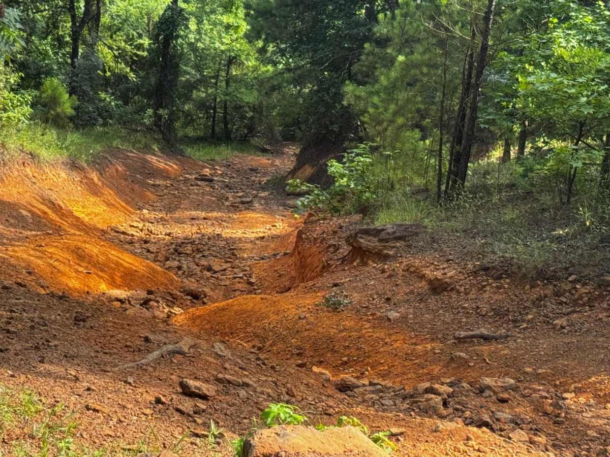
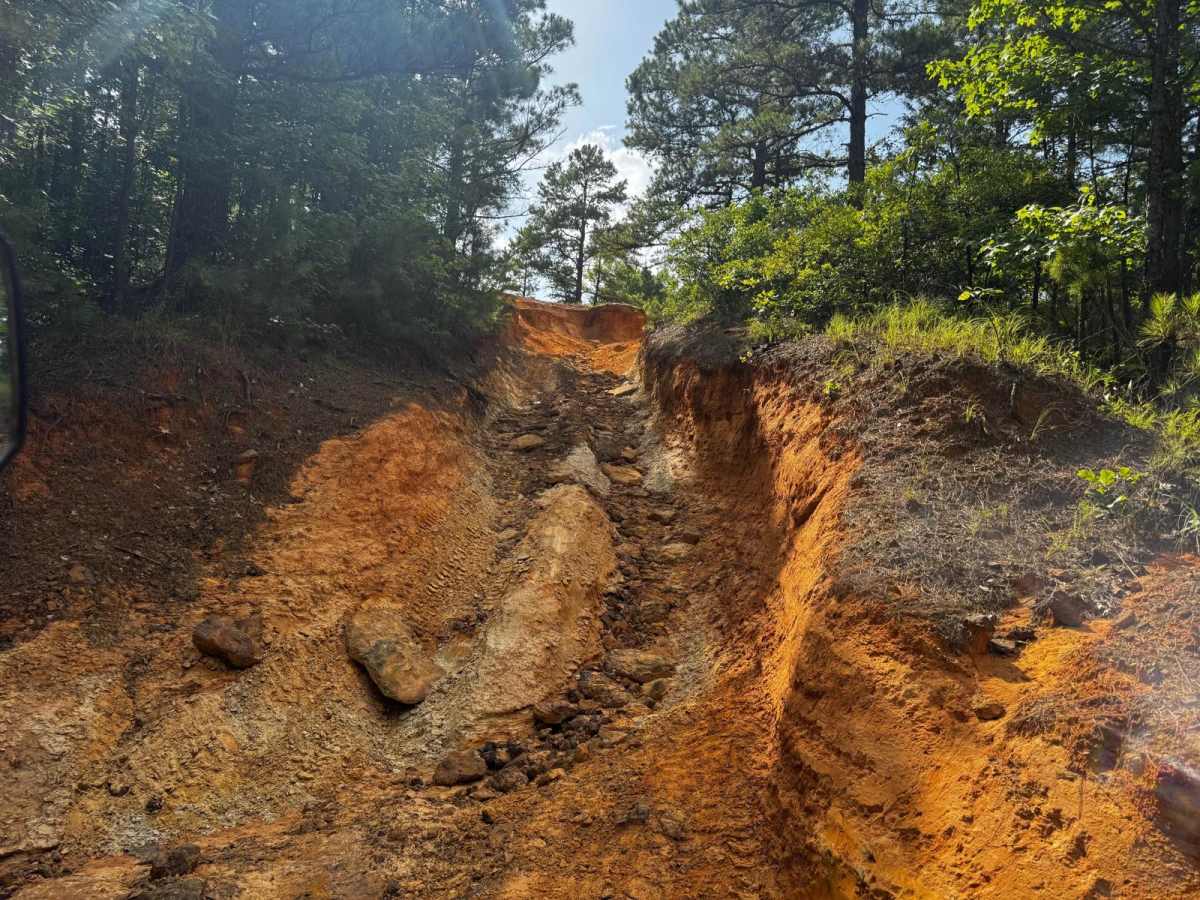
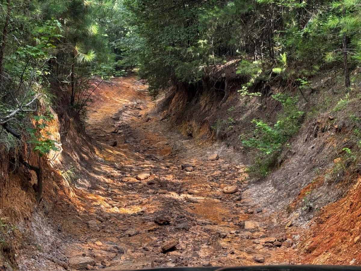
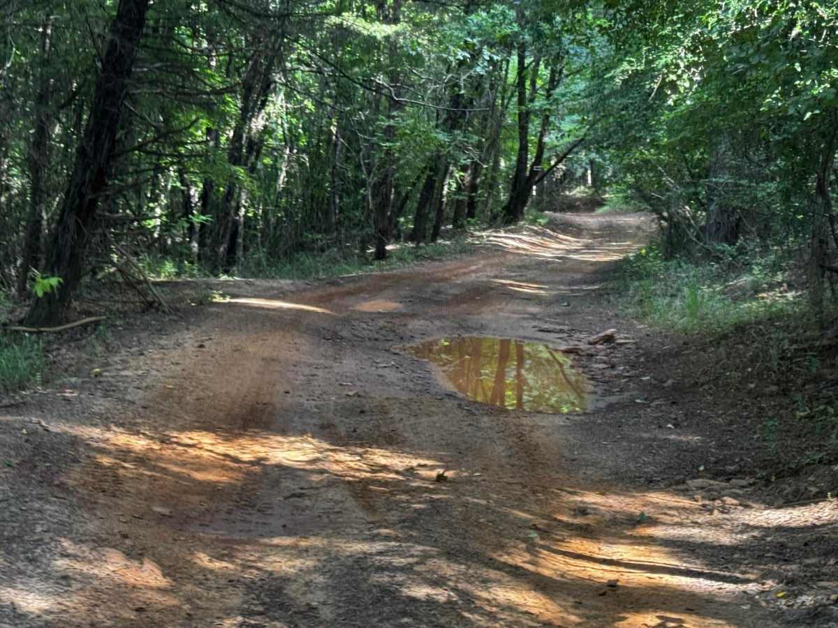
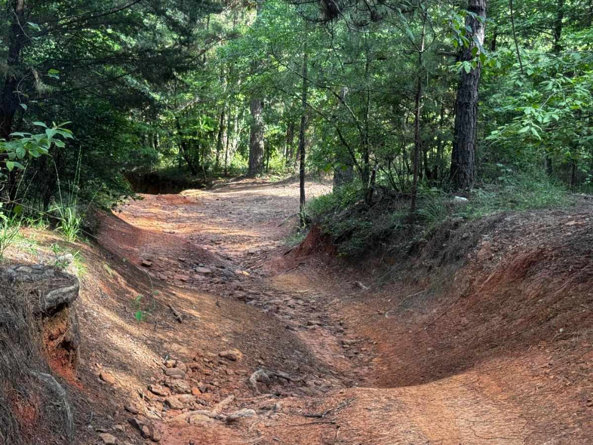
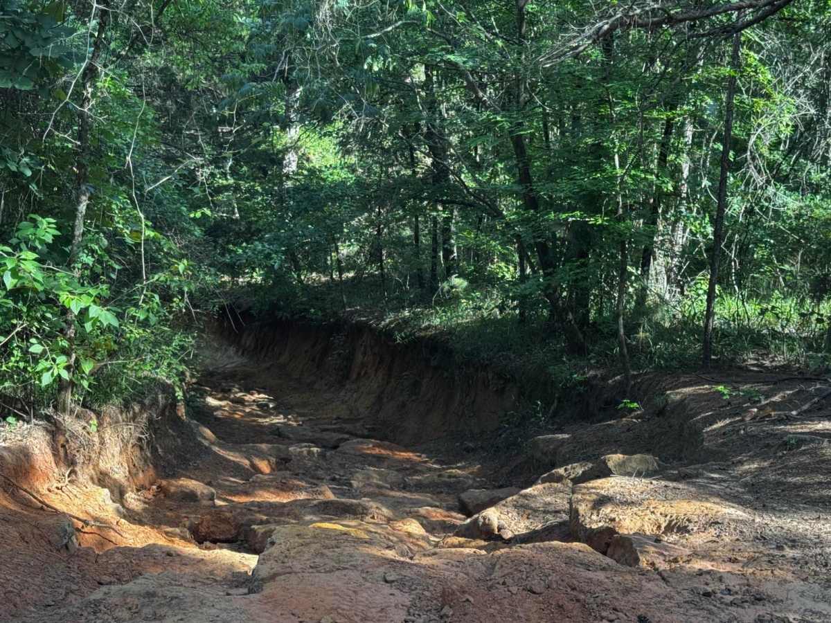
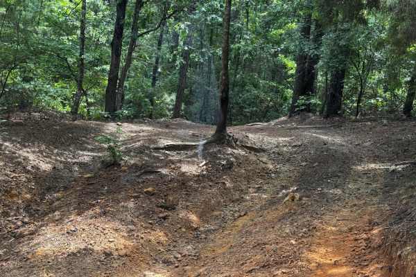
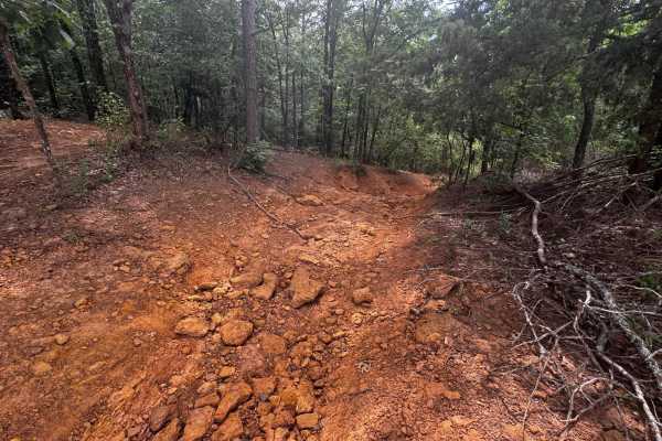
Clyde's Ravine ** Park Rating: 3/5 ** Technical Rating: 7/10 ** Detailed Notes ** Rocky and muddy terrain with steep drop-ins and loose, off-camber sections. Multiple creek crossings and flexy lines. Tight turns and exposed roots and rocks can snag undercarriages. Bypasses available but still require awareness. Trail crosses "Whatever?" and connects to Sierra Skyview. ** Vehicle Recommendations ** Lift with 33" tires minimum, can run stock if taking all bypasses and dry, but not recommended after rain. Lockers helpful in main lines. ** Full Description ** Clyde's Ravine is an engaging trail that combines flexi creek crossings, rocky drops, and off-camber lines. Roots and rocks jut out, forcing careful tire placement to avoid undercarriage hits. While there are bypass options, the main sections provide a solid intermediate challenge. After rain, the trail turns into a slippery, technical route that ups the difficulty significantly. Ideal for drivers looking to refine their articulation skills while enjoying beautiful wooded creek scenery.
Difficulty
Clyde's Ravine** Park Rating: 3/5 ** Technical Rating: 7/10 ** Notes ** Rocky, muddy, steep drop, off-camber, creek crossings, good flex areas. Clyde's Ravine offers a fun mix of rocks, mud, and off-camber lines. Expect steep drops and flexy sections, with roots and rocks that can snag underbody parts. The creek crossings and tight turns keep drivers alert, especially after rain. While some bypasses exist, it's a solid intermediate trail that balances technical elements and scenic moments for adventurous drivers.