Bryan Hunter
Jun 22, 2026
Temporarily Closed
Trail has been closed for two years. Do not travel on this road and check with rangers office before driving.
Bo L
May 28, 2026
2023 Ford F-Series Super Duty
Open
Muddy/WetRough/Deteriorated
Started off strong, thinking my rig and myself could handle this trail. Didn’t read many of the previous trail reports so I sandbagged myself which led to a serious epic towards the end in one of the last mud holes. Got wicked stuck, no winch. Was rescued by a random electric mountain biker that was kind enough to ride out, go to tractor supply and pick up two 4 Ton come-alongs that we used to pull the rig out while my wife drove. Was stuck for close to 5 hours. Last time I’ll ever go wheeling unprepared. Will research my route selection more thoroughly and have a winch, recovery boards and newer, bigger tires for my next adventure. Thanks again Luke Mudwalker for saving the day!!!
Jack Allyn
May 25, 2026
Open
Muddy/Wet
Went on today by myself. The trail starts very easy. It is very flat the whole time. There are 4 bogs at the end of the trail that connect to Yellowjacket Road. If you are in a full size 4x4 Jeep or Truck you most likely WILL NOT have enough room to go around. My jeep has a 3 in lift with 37s so it has some great clearance. These bogs were very deep, short, and steep. This is not your average red clay mud bog. This is blue clay. It molds perfectly to your tires and is incredibly heavy. I had to get the winch out and promise you I wasn’t getting out without it. Please keep this in mind!
wes
Apr 10, 2026
2001 Toyota Sequoia
Open
Muddy/WetWashboardDustyRough/Deteriorated
This was epic
Jonathan Kish
Mar 08, 2026
2025 Jeep Wrangler
Open
Muddy/WetRough/Deteriorated
Multiple deep holes full of water. Made it through with 33 inch tires and 2.5 lift on the jeep but barely. Had to winch out of one of the holes being caught on the front diff.
Julian Kelly
Feb 23, 2026
2021 Chevy Silverado
Open
Muddy/Wet
Very deep mud holes. Non lifted vehicles will not make it
KO
Dec 25, 2025
Open
Normal
Good trail with a good size mud hole
Elijah Johnson
Sep 06, 2025
1997 Jeep Cherokee
Open
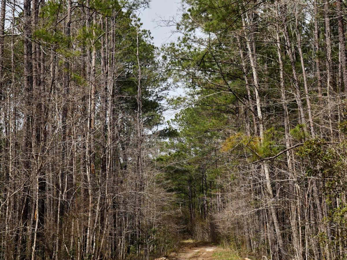
The trails were very narrow no way around any of the holes we ended up having to turn around because some of them were way too deep and was very close to almost flipping over… I forgot to take pictures of the other holes, but they were really deep!! one of them you can tell scraped the side of other vehicles so if you care about your paint at all, don’t go down this one… 10/10 fun though 😂
Kyle Cooper
Jul 26, 2025
1997 Jeep Cherokee
Obstructed
Downed Tree
HOT! Mud holes were not too bad, has not rained in a while. Tree is about halfway down the trail.
Matthew Sommeso
Jun 26, 2025
Obstructed
Downed Tree
Some mud pits that were able to be maneuvered around for the most part. There was a downed tree towards the end that we moved the best we could with what we had. We got most of it out of the way, but some of it still remains. We were in a slightly lifted Jeep and were able to make it past what remains.
Gabriel Medeiros
Jun 01, 2025
Open
The last 80% of the trail has 3 major challenges. I went into the mud to see how deep it was, I believe it was around 16" to 18" deep. I managed to get through because my car is narrow and high, but I think it was a risky trail for me.
Victor Calalang
May 26, 2025
Open
Fresh rain and mud holes are are mostly filled. Some holes, especially the one at the northern end of the road, are deep, to around 30” (above the knee). Bring waders and buddies!
Victor Calalang
Feb 09, 2025
Open
Muddy/Wet
The large mud hole midway through the trail had boards and small (4”) cut trees in it. The boards had nails and screws typically found in pallets. We do not know if this was a malicious act to cause damage to tires or vehicles, or if someone tried to use the wood as a means of traction.
Chris de Jong
Feb 01, 2025
Open
This was a tough one. If you approach from Halfway Creek road, it will get progressively harder with bigger obstacles. By the end of slash road you’d better have a winch ready, there are at least 3ft drop down gulch and uneven 3ft return back up. Very hard. Recommend having a buddy car on this trail.
Douglas Repass
Sep 01, 2024
Open
Normal
Deep mud holes that are easily bypassed in a 4X4 if you take your time. I wouldn’t call this a “5”, but there are 3 holes that definitely make it a more technical trail.