Huy Thach
Dec 29, 2025
Open
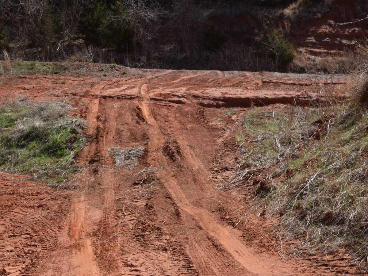
Trail was good. But on E 1170 between county st 2640 and county st 2650 the road has a really deep ledge maybe 4ft drop.
TRD Sani
Dec 06, 2025
Open
Great trail for beginners! My 2024 Tacoma ran through the trail with no problem. Keep in mind I have a RWD Tacoma but a simple air down is all you really need there are some area on Purgatory road that might require a 4WD, however when I Air’d down to about 20-25 psi I was able to climb up with little to no issue.
Check out my Page on Instagram @trdsani for more 2WD trail running!
Chris Farris
Nov 22, 2025
Open
A friend and I did the loop counter clockwise. Purgatory Road was closed. As a bypass, we took E1210 east out of Spring Creek, and then north on N2710 Rd. The bypass is still plenty of fun, and has some small climbs. If you’re worried about purgatory road (even on a dry day), this is alternate route is a great option. The east/west road that connects N2650 and N2640 (north of highway 8) is completely washed out. We used E1180 to bypass.
Greg Eriksen
Oct 14, 2025
Open
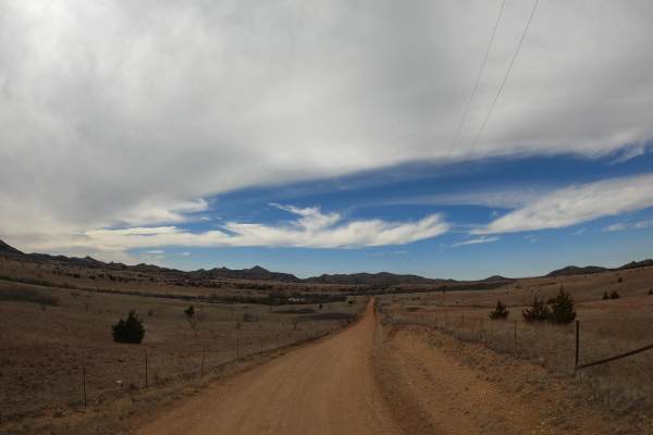
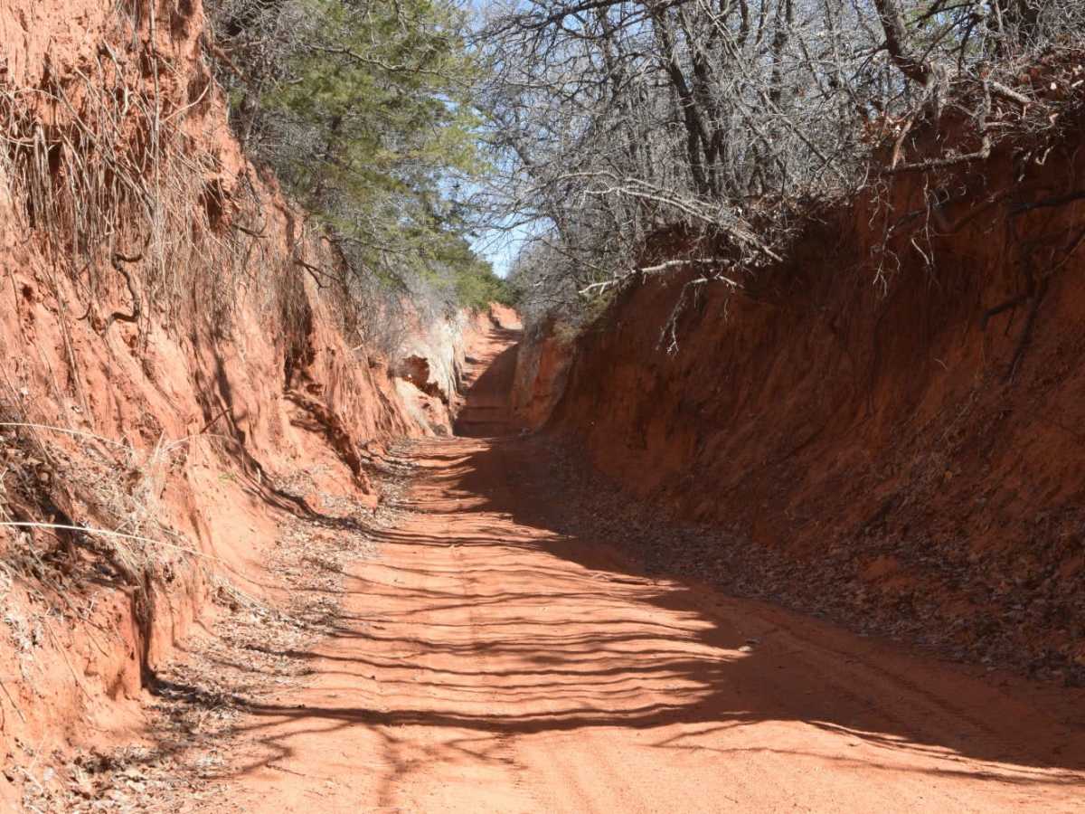
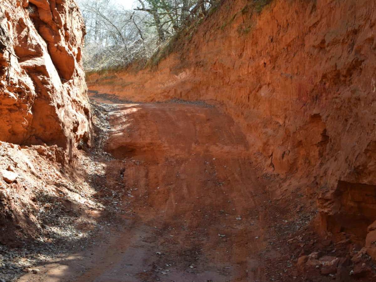
We only ran the SE and East side of the loop. We started our trip playing down around Lake Chickasha and then drove north to the SE corner of the loop and continued north up the eastern side. The road was sandy in spots and has steep side walls that is an interesting feature. During or after heavy storms it appears that road could easily get washed out so something to keep in mind.
David Wininger
Oct 10, 2025
Open
Road Closed sign is accurate, although the fun bit is open. Keep in mind before you go down the hill, the only way out is back up. It's doable, my 02 CR-V on all seasons was able to make it down and back up, although I would advise more careful planning. 🙃
Seth Schwarm
Aug 11, 2025
Open
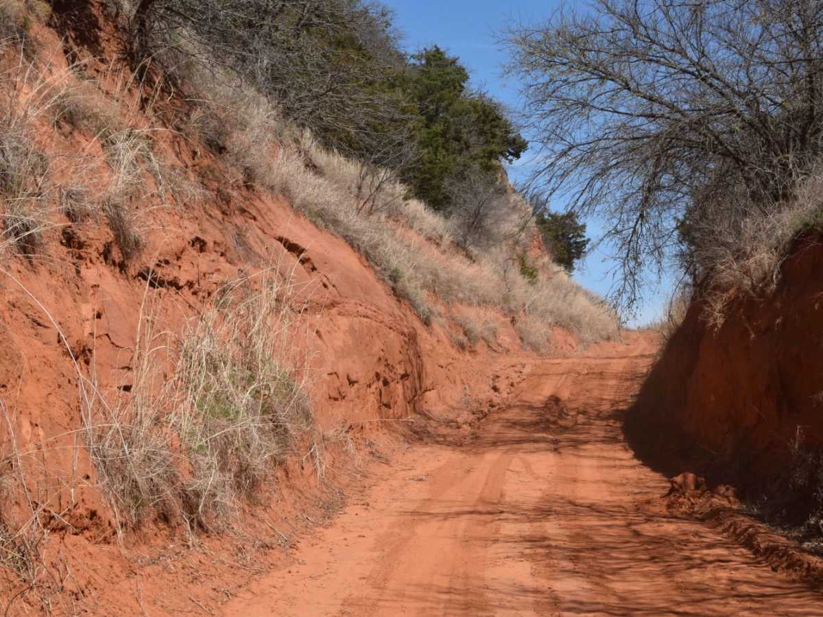
Traveled the loop clockwise. There is a standing fenceline cutting across trail about ¾ of the way down E 1770 Rd. (East of County Rd. 2640) (midway down the loop on the east side of the loop). As you turn onto E 1770 Rd. there is a sign which says 'Road Closed' and it is true. Of course the fenceline appears after you drive through all the tough spots (downhill). I had to build a rock ramp to get through the deep washout spot (going uphill, on the way out) as the wheelbase of my Sequoia was too wide by about one foot. There was also a 'Road Closed' sign as we turned West onto Purgatory Road. We drove west on Purgatory til the first uphill obstacle, then turned around and went back (east) to the main road we were on. The three cool water crossings are on the west side of the loop (north of Binger and at the NW corner of the circle area located in the far NW corner of the loop. Absolutely need high clearance & 4X4 due to the deep deep sand in many parts.
Kevin Reyes
Jul 27, 2025
Open
Not sure when’s the last time someone has been here but there is a 3 foot climb that my stock Mojave did not like at Purgatory. The whole route before this was amazing just didn’t like this portion.
Edgar Paniagua
Jul 19, 2025
Open
The road to purgatory is closed. There is a closed of metal barrier.
Randy Haas
Jul 12, 2025
Open
Did part of the loop most was pretty easy a couple of challenges that was good to get a feel for a new 4x
Trevor Allman
Jul 11, 2025
Open
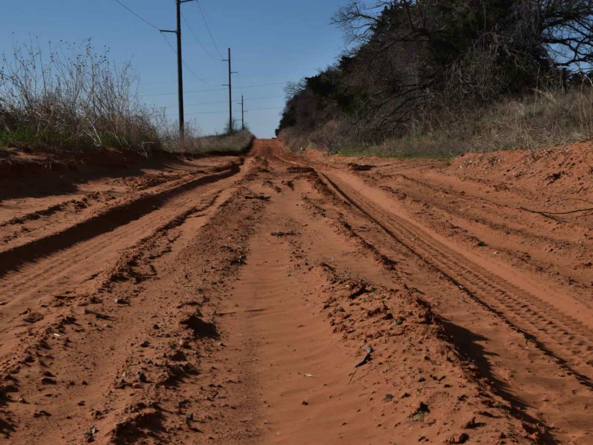
Most of the loop was easy, there were more paved sections then I was expecting. Some of the roads have sandy sections and were fun due to being partially washed out but not impassable. Nothing a normal 4x4 (Jeep/4Runner/Bronco) couldn't handle. Purgatory road is closed due to three washouts along with E1170Rd (Small Drop) so those were bypassed. Also watch out for loose cattle and deer.
Jimmy Bell
Jun 23, 2025
Open
Trail has degraded with the spring rains. Is still passable but sections will absolutely require 4x4 and low range is advisable. Did not need to engage lockers at any point b
Rodney Drye
Jun 14, 2025
Open
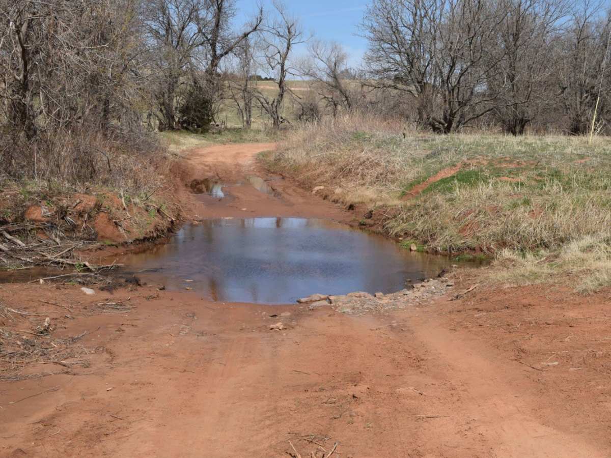
I ran into four obstacles on this trail. One minor washout, two major washouts (neither were passable) and the last one was standing water on the road.
Justin Credible
May 31, 2025
Open
There is a road sign in the pic on the left. I believe this was the rock climb. When I rerouted I looked at that road and there was a sign that said road closed.
Adam Kessler
May 20, 2025
Open
I tried to go back to the proper date with no luck 🍀 so here’s my readjusted trail report. I actually did some of this trail on October 26 of 2024 and then again about a few months or so later after getting larger 235/75R17’s - 31” I was able to safely complete the rest of it with my son & the trail got a bit less challenging at the steps due to a slightly less difficult go around area to the left. The stair stepped hill brought it up to moderate rating for me. There were also a few water crossings that were no more than about 6” to 8” inches deep no problem. There was also of course sandy silty terrain that was typically quite smooth to travel through. There’s also slightly stair stepped hard packed clay like terrain. Mostly of this is a somewhat scenic trail that is easily traveled with typical stock 4x4’s. Anyway HAPPY TRAILS 🤗
Jeremy Ech
May 11, 2025
Open
2 sections are closed for washed out road and 4ft drop off in middle of road. both roads do have road closed signs coming from 1 direction.