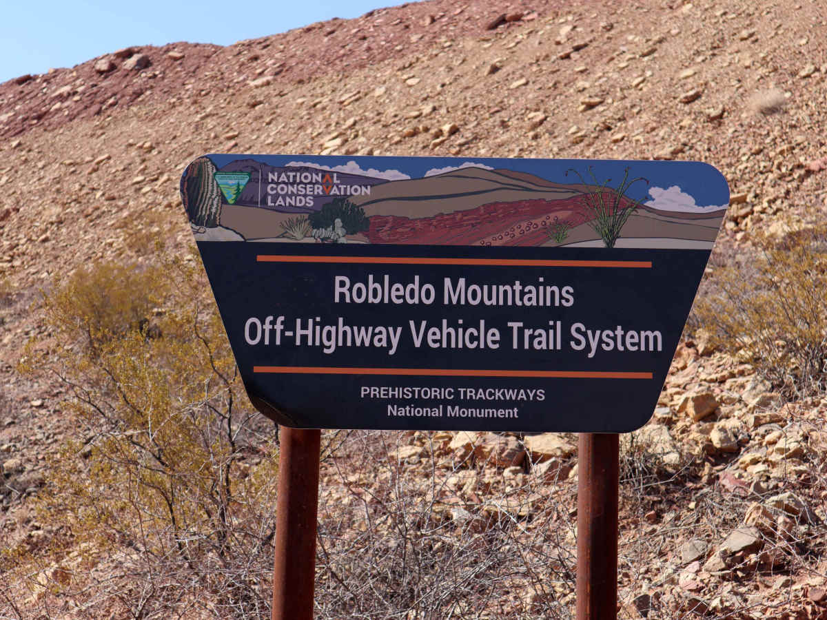
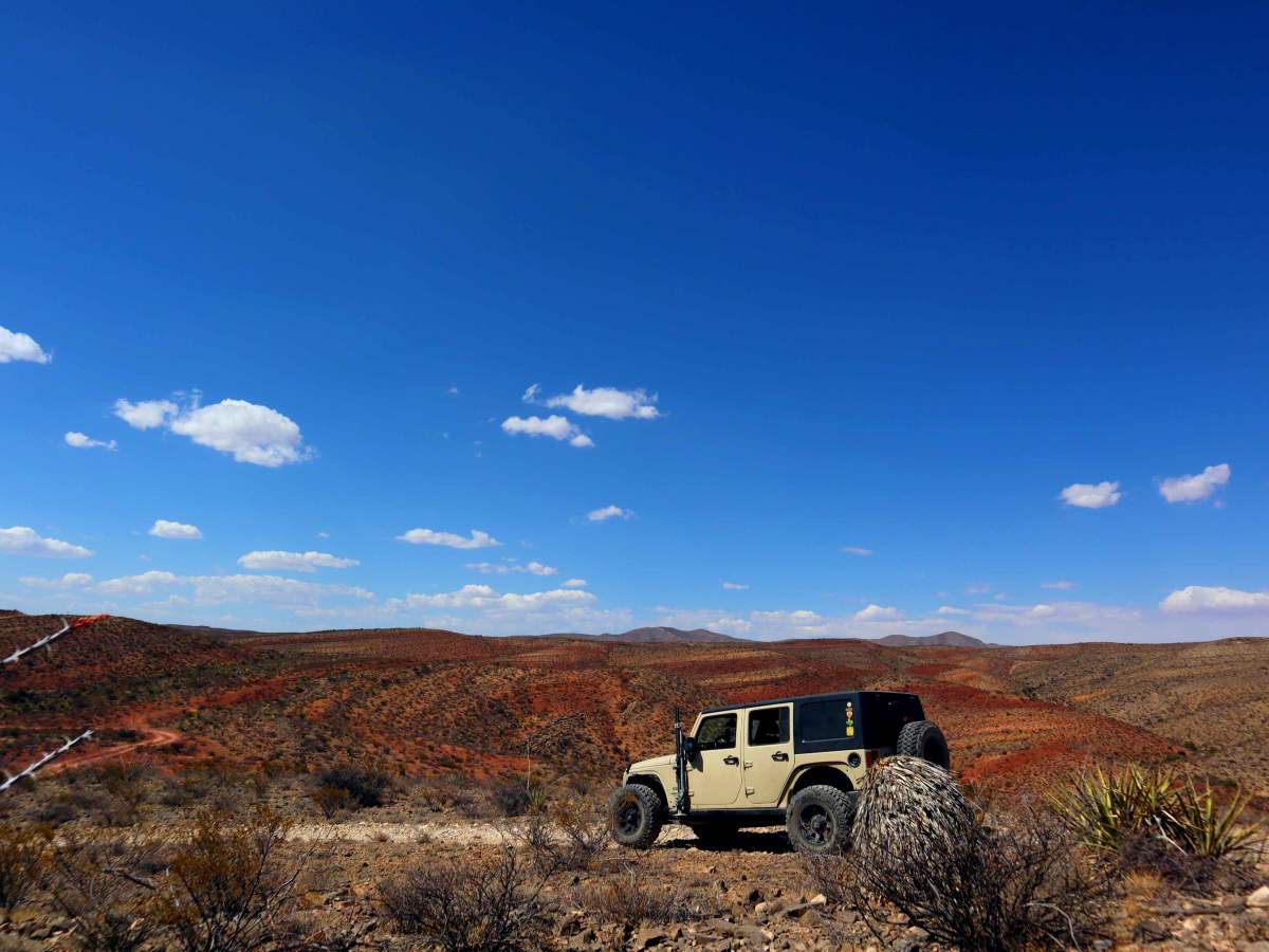
Robledo Chili Canyons Loop

Total Miles 9.7
Technical Rating
4 Moderate
Best Time Spring, Fall, Winter
Trail Type High-Clearance 4x4 Trail
Accessible By
Open Trail Map

Trail Overview

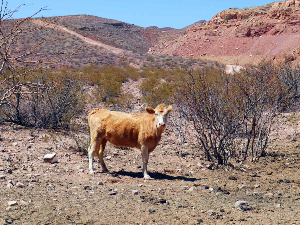
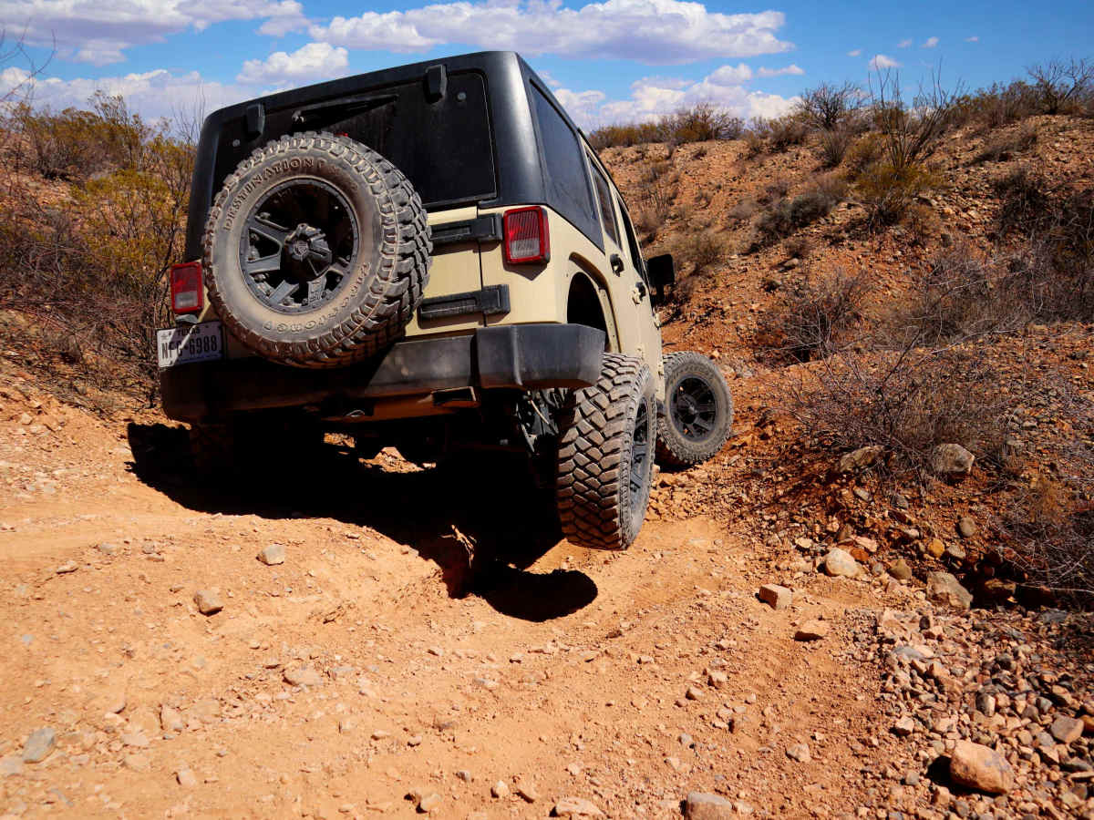
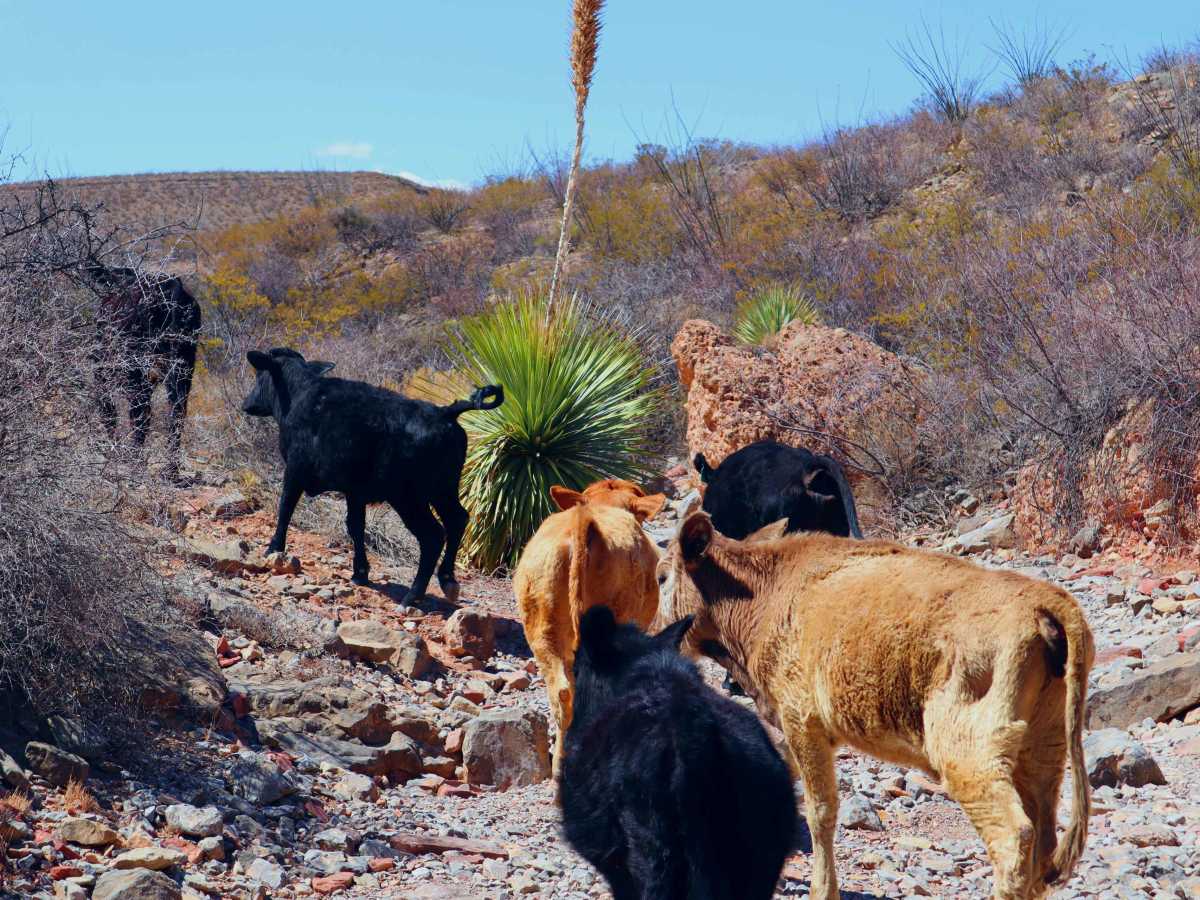
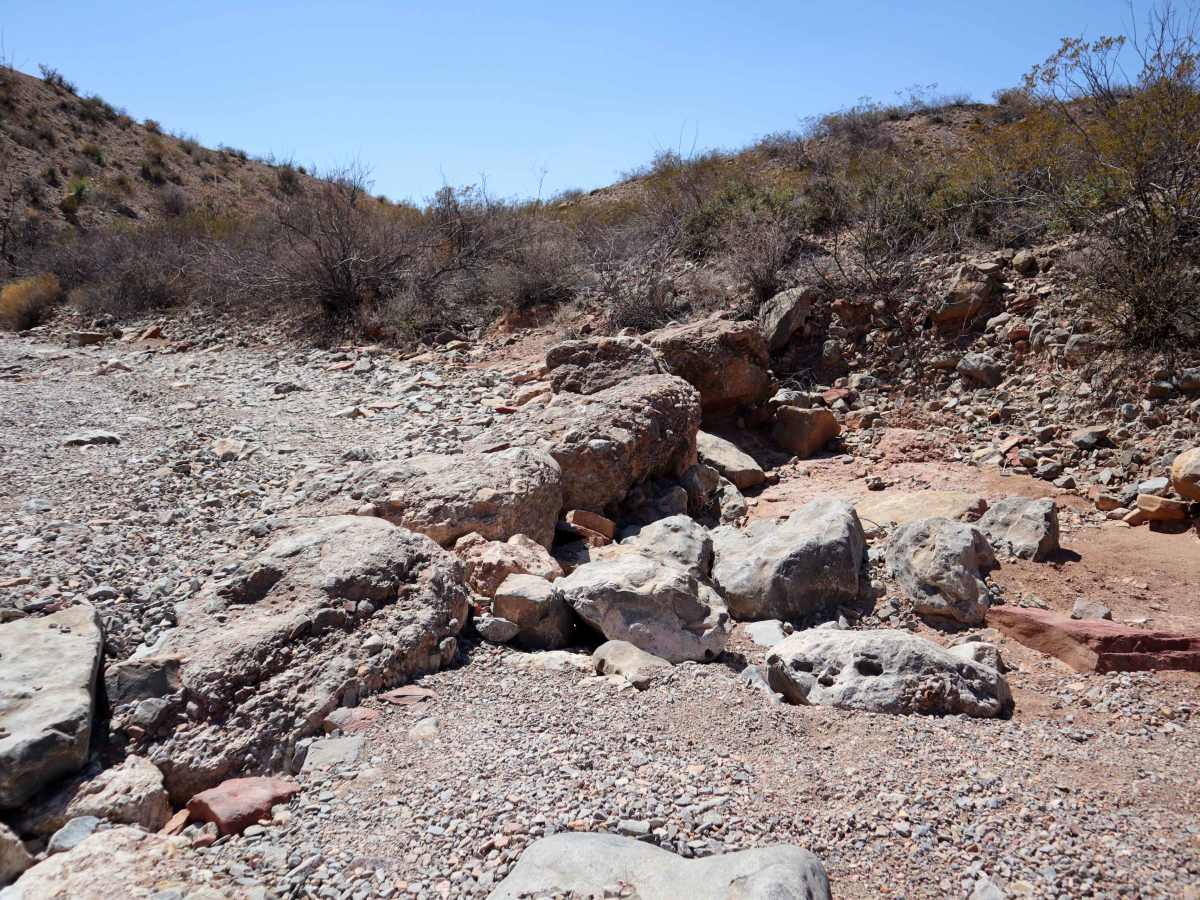
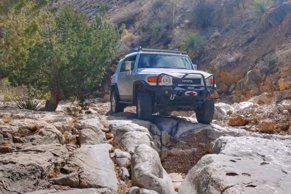
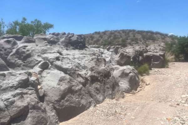
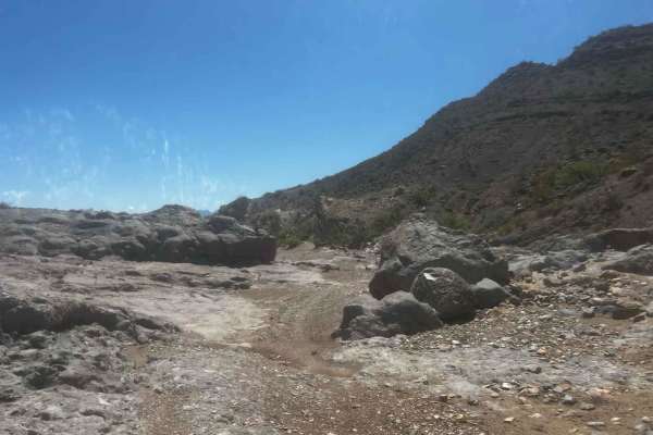
This trail is located within the Prehistoric Trackways National Monument/Robledo Mountains OHV Trail system. Opening up and giving one spectacular view of the Organ Mountains to the East and Las Cruces, NM. Free range cows will be found meandering around most trails as well. The trail is utilized as a loop around the various canyons and trails that are available to travelers. Most of the trails are marked with posts which inform motorists of the scaled rating of the trail. The vast majority of the trails located in the Robledo OHV system are difficult, this trail rated as a 4 out of 10 can still be considered difficult by some. Traversing in and out of arroyos and up steep mountain sides, tires are extremely important as many of the rocks are very sharp. Parts of this trail require navigating over rocks and ledges of almost two-feet tall. Some of the ledges are at the top of very steep hills with loose rocks as well. Larger full size trucks and SUVs will have difficult times avoiding body damage as the trail is very tight in sections, pinstriping for all vehicles is inevitable. There are no services in the OHV systems, bring all the supplies to be self sufficient out here. Cell phone service is good in most of the area, besides some of the canyons.

Photos of Robledo Chili Canyons Loop

Difficulty

This trail is a good 50/50 mix. 50 percent of the trail is done in 2WD/4 High. While the other 50 percent will require 4WD High/Low Range. Very steep, loose rocks, and shelved hills exist with no bypasses. A small rock garden with large washed out areas and tight widths. Larger vehicles will need to tread with caution and a spotter.

Technical Rating

4

Status Reports

Add Status Report
Ken Quick
Apr 16, 2026
Open
Although there are about 17 motorized trails here, we traveled the Robledo Loop counterclockwise from the staging area, only short-cutting a small portion using the Acacia Ridge trail. The blue highlighed trail displayed includes this shortcut, as the Robledo Loop at about 8 o'clock to 7 o'clock actually dips down and comes back up to where that zig-zag appears on the map. The highlighted route took 3 hours to complete going counterclockwise.
MrSheep110
Feb 11, 2026
Open
Rough, lots of trail deterioration. Local authorities should come out to do trail maintenence.
Greg Sorensen
Dec 22, 2025
Open
This trail level is a four, it’s a very high four!! In a stock 4Runner TRD I got a lot of use out of my nerf bars and skid plates. Especially when dropping into the canyon there are some very rocks to maneuver around. Great trail, don’t get me wrong. But don’t think you’re going to survive this trail because you’re Hyundai has AWD 😃
Mike Childs
Mar 16, 2025
Open
ANDRES REYES
Dec 29, 2024
Open
This was a fun trail, great views. You will do serious off roading in this trail. There are small boulder rocks at the start but you can by pass them easily. Rocky terrain. There are some tight spots and tight turns. You will benefit from a spotter to avoid body damage.
Jesus O
Sep 16, 2024
Open
Three very large boulders have been placed on the trail. One making it difficult to go over the first steps, and two on the bypass routes. Seems intentional to keep vehicles out or to cause damage to vehicles attempting to enter trail system.
jeffrey Vaughn
Jul 05, 2024
Open
a construction worker knocked a bunch of massive rocks on to the trail with a bulldozer.
Benjamin Jensen
Jul 04, 2023
Open
Clay Roberts
Apr 30, 2023
Open
Jay P.
Apr 04, 2023
Open

Robledo Chili Canyons Loop Trail can be accessed by the following ride types:

  • 60 Inch
  • High Clearance

Robledo Chili Canyons Loop Map

The onX Offroad Difference

onX Offroad combines trail photos, descriptions, difficulty ratings, width restrictions, seasonality, and more in a user-friendly interface. Available on all devices, with offline access and full compatibility with CarPlay and Android Auto. Discover what you're missing today!

Open Trail Map