South Route to Marble Head

Total Miles6.9
Technical Rating
7Difficult
Best TimeSpring, Summer, Fall
Trail TypeHigh-Clearance 4x4 Trail
Accessible By
Open Trail Map

Trail Overview

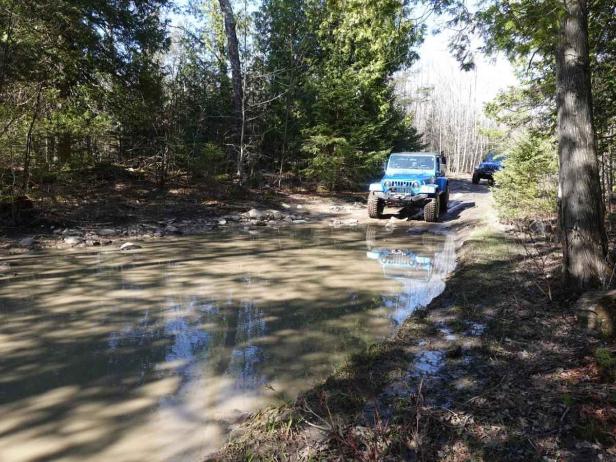
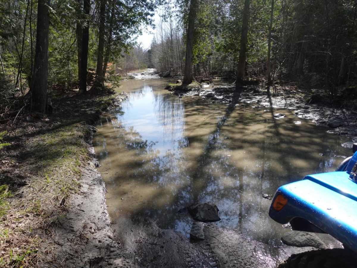
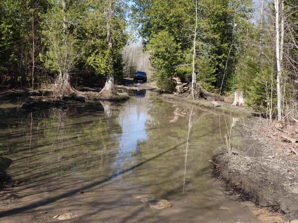
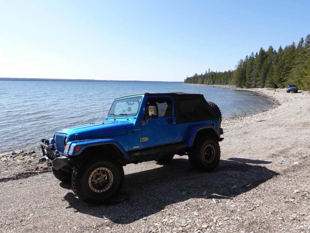
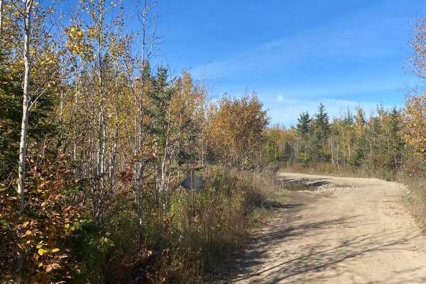
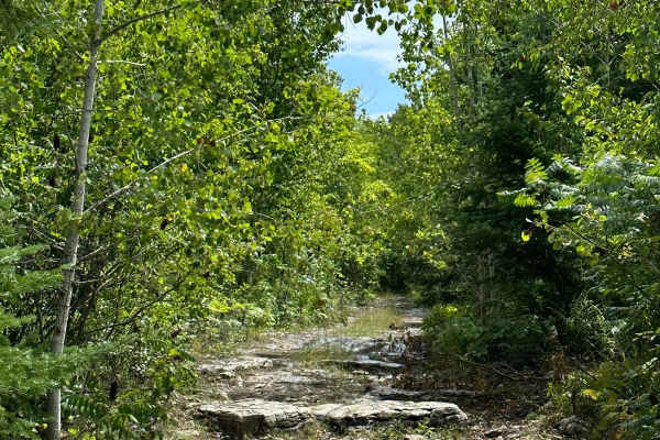
The South Route to Marble Head is a challenging, bucket-list adventure on Michigan's Drummond Island designed for experienced offroaders seeking a mix of technical rock crawling, deep water crossings, and muddy obstacles. Spanning roughly 6.9 miles, this four-wheel-drive trail rewards those who tackle its rugged terrain with breathtaking, elevated views of Lake Huron from the famous Marble Head overlook, which stands at an elevation of 725 feet. Drivers should prepare for a technical rating of 7, starting with a series of mild climbs, smaller mud puddles, and water crossings along the first half of the journey. High-clearance vehicles with large tires are highly recommended, as the trail's terrain quickly transitions into demanding sections that require careful tire placement and low-range gearing. As the route traces near the scenic shoreline of the bay before heading back into the dense woods, the difficulty intensifies significantly upon approaching the notorious tank traps. These massive, water-filled mud holes are known to swallow tires and can easily claim engines, making a winch and recovery gear absolute necessities for anyone attempting this section. Staying on the designated trail is critical here to protect the sensitive coastal environment, and drivers must resist the temptation to detour into the bay. Completing this loop earns offroaders a coveted Jeep Badge of Honor, making it a highly sought-after achievement for properly equipped Jeeps, built four-wheel-drive rigs, and capable SxSs.

Photos of South Route to Marble Head

Difficulty

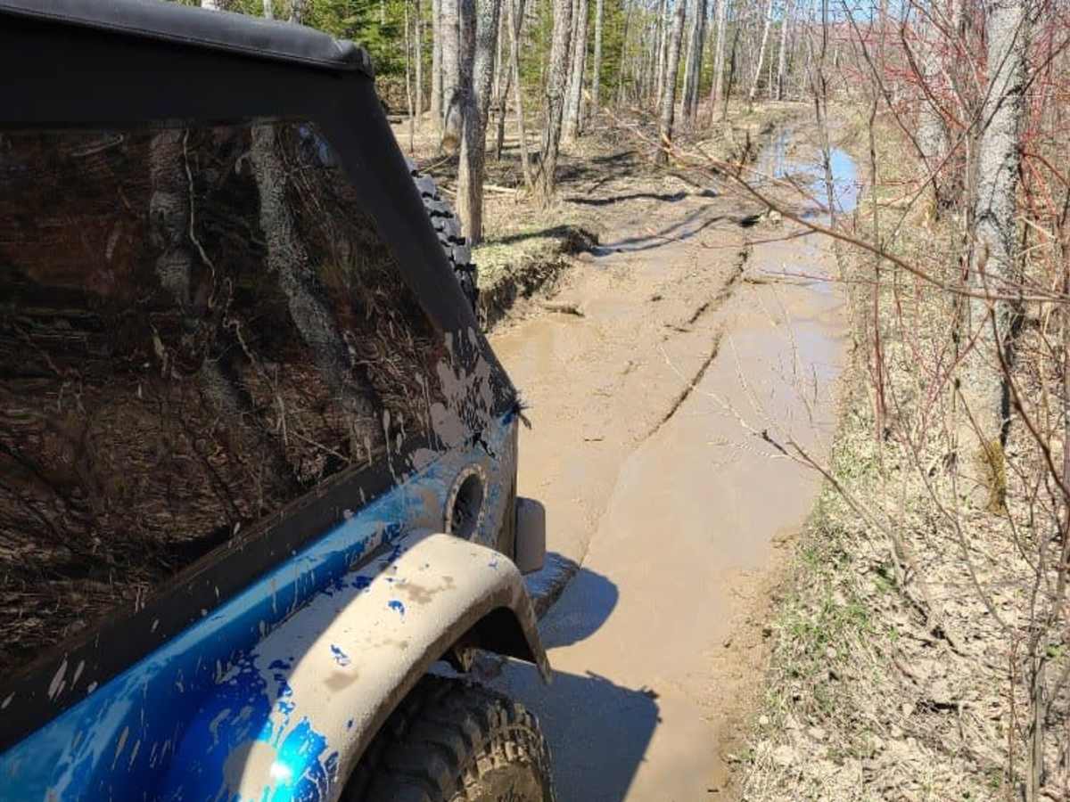
The water can be deep and has claimed more than one engine. The tank traps "mud holes" may require winching.

Technical Rating

7

Status Reports

Add Status Report
Jordan Brun
Jul 31, 2026
2025 Ford Bronco
Open
Trail was not easy. We saw groups of ATVs with 9” clearance. We were glad we had 11” clearance. Cleared everything but didn’t attempt any tank traps. A very high clearance Jeep did one and struggled but made it through. Lots of mud flying everywhere.
Michael Stone
Jul 14, 2026
2019 Polaris RZR XP
Open
DustyMuddy/WetRough/DeterioratedWashboard
Had a mix of bit of everything in the trails most of the water looks worse then it actually is, all rock bottom depth of 1.5 feet at the deepest. Tank traps are by passable so don’t fret about that being the only way through! Great ride.
Jeff and Laura Bomer
May 01, 2026
2018 Jeep Wrangler
Open
The trail was wet and muddy but Marblehead was perfect.
Tisha Richmond
Jun 22, 2025
Open
Muddy/Wet
Great trail! Was open, easy to access. Difficulties were moderate, and there are trails around the Tank Traps. Mud whole right after rain were deep in places but over all not bad. Very rocky.
Becca Spalding
Apr 26, 2025
2015 Jeep Wrangler
Open
Muddy/Wet
If you want to avoid the tank traps, take the section of trail that goes north of it. The trail marked on here takes you to the south tank traps trail which has no bypass. You’ll see where the trail splits right near Shale Beach. Overall, this trail is rocky, wet, and rough but the views are rewarding! It is worth the drive every time!
Joe Carron
Oct 04, 2024
2020 Jeep Gladiator
Open
Normal
Sky Gant
Sep 13, 2024
2020 Jeep Gladiator
Open
NormalDustyRough/Deteriorated
Tank Traps are very dry after the first two traps. The first of traps is passable, the second might stop you. The rest and bone dry and extremely deep. The stairs are still a blast even after construction, and hard to beat the view.
Joe Reagan
Aug 20, 2024
Open
Normal
Tank traps were super rutted but mostly dry. If it wouldn’t have a been dry, with the bypass, I would not have been able to make it with my mere 2” lift and 30s. The trip, one way, was about 2 hours with a stop at Shale Beach.
Tyler Shepler
Aug 17, 2024
2023 Polaris RZR Turbo R 4
Open
NormalMuddy/Wet
Alex Miller
Jul 06, 2024
2023 Ford Bronco
Open
Muddy/Wet
Started with the North Route to Marblehead and decided to come back this way. Between Shale Beach and Plywood Camp is easily accessible with a stock 4wd. Some water looks deep but they are hard bottoms. The trail south of Plywood Camp has some really deep water holes currently. There are some bypasses but very tight for a full size 4x4. Made it through with a stock Sasquatch Bronco with some technical driving. Some holes looked too deep with soft bottoms. Wouldn't recommend alone or without a winch in current conditions.
Robert Trudeau
Apr 20, 2024
2008 Jeep Wrangler
Open
Muddy/Wet
Trail was a lake, several locations were over jk fenders on 37” tires!
Erik Stein
Oct 07, 2023
Open
NormalMuddy/WetRough/Deteriorated
Jeff and Laura Bomer
Aug 10, 2023
Open
NormalMuddy/WetRough/Deteriorated
Joey Vanator
Jul 24, 2023
Open
Muddy/WetDustyRough/Deteriorated
Justin Schwarting
Jul 18, 2023
Open
NormalDustyMuddy/Wet

South Route to Marble Head Trail can be accessed by the following ride types:

  • Single Track
  • 50 Inch
  • 60 Inch
  • High Clearance

Access Description

Vehicles operating on Drummond Island's state-managed trails must display a valid Michigan DNR ORV License and ORV Trail Permit. Drivers must strictly adhere to designated routes and stay out of the bay and shoreline areas to protect the local ecosystem and prevent trail closures. Due to deep water hazards and the technical difficulty of the tank traps, a winch and recovery equipment are highly recommended.

South Route to Marble Head Map

The onX Offroad Difference

onX Offroad combines trail photos, descriptions, difficulty ratings, width restrictions, seasonality, and more in a user-friendly interface. Available on all devices, with offline access and full compatibility with CarPlay and Android Auto. Discover what you're missing today!

Open Trail Map