Martin Vejar
Dec 14, 2025
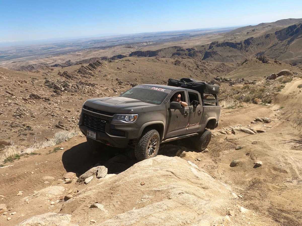
2021 Ford F-Series
Open
Muddy/WetRough/Deteriorated
Trail to the lookout point (cell towers) was unobstructed. There was a sign for washed out terrain on the back side as you finish out the trail. After putting eyes on it we decided to turn back, although we probably could have made it down just fine (we would have needed help coming back up if we had to turn around past that). I was running a stock 2021 F-150 extended cab 4x4 on 30” tires. Other than that I highly recommend! Beautiful view.
Ricky RM Garage YT
Dec 06, 2025
1993 Toyota Land Cruiser
Open
Muddy/Wet
Overall trail conditions pretty good. Some muddy areas but mostly dry. A couple sections where the dirt was soft/waterlogged but solid enough to drive over without issues.
Wade Ginn
Nov 04, 2025
2008 Jeep Wrangler
Open
Normal
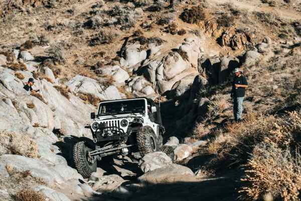
Alex Ewing
Jun 28, 2025
2019 Toyota Tacoma
Open
DustyRough/Deteriorated
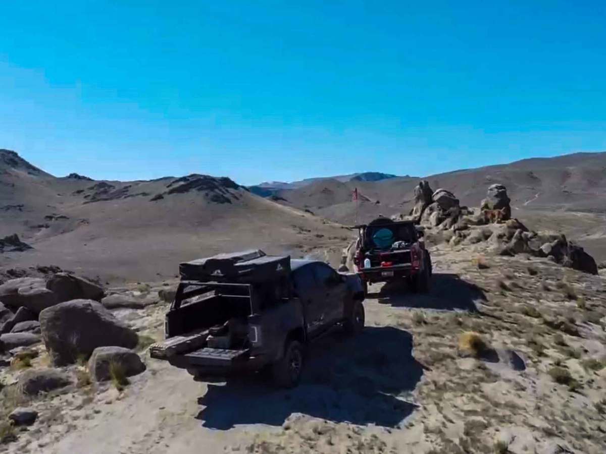
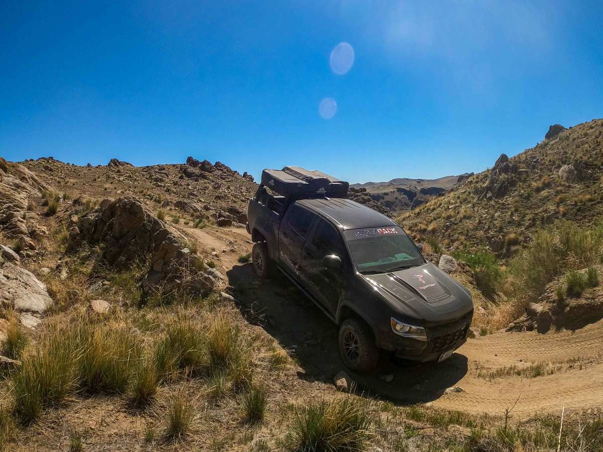
Awesome trail that meanders through some unique terrain. Incase people are wondering if you take “Wilson Road” it’s a graded road from the trail system staging area and goes up the hill. If you look closely at the map and take “Pigeon Road” that’s where I rated this loop a 5. My buddy and I started Pigeon Road from the bottom. Once we got to the top we made a right and took Wilson road back down, which I think worked great since we hit most of the difficult parts going up hill. My Taco has a 1 inch lift, skinny 32s and a rear locker. My truck handled the trail proudly but there are a few spots having rock sliders would have made me feel more comfortable. I probably wouldn’t take the trail if you’re new to wheeling or unfamiliar with your rig, but its doable. There is another post with a 3rg Gen 4Runner climbing rocks and moguls at the end of the trail, yes that obstacle is about as bad as it looks. It really was no problem but I definitely wouldn’t want to get crossed up there.
Matthew Bargeron
Jun 04, 2025
Open
NormalDustyRough/DeterioratedWashboard
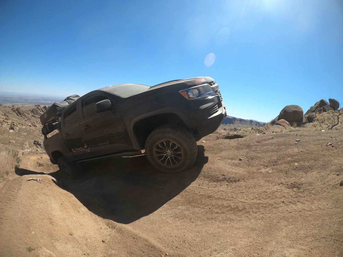
The first half of the trail a is flat wide washboard road. when you hit the turnoff onto the other part of this trail is when it gets technical. The trail turns into a tighter rutted road. Once you get to the top there is a side road on the left that will take you up to the tower. If you continue on straight you come to a sign that says the trial gets harder. This is when the rock obstacles come in and steep grades with large off camber ruts and switch backs. I wouldn’t suggest a stock 4x4 unless you’re okay with some body damage. I also would come early in the day. If you try it at night it would definitely be more difficult to see.
J Michael
May 15, 2025
1991 Suzuki Sidekick
Open
Rough/Deteriorated
We went up the north side down the south side of the trail. Exposed rocks were pretty dug out, several 18”+ drops. Had to choose lines carefully in the sidekick but made it down without issues. We probably wouldn’t have made it up the other direction without at minimum a rear locker. I’d say 5 is a pretty true rating compared to other similar trails.
Evan Yip
Mar 15, 2025
Open
NormalDustyRough/Deteriorated
Perfect soil conditions, no snow or mud, slightly tacky surface crust. Hit a couple bonus lines this round which are fun but require at least one locker. Take a second vehicle, use a spotter, and watch your tire placement, that is key on this trail. Bad tire placement could land you on your lid very easily. Extremely windy at summit, 30mph+ constant wind velocity.
Tyler franssen
Jan 18, 2025
Open
NormalRough/Deteriorated
super fun trail, some very steep, rocky, deeply rutted climbs, a few very off camber sections where a spotter would be nice, really pay attention or you could end up on your side. 35" tires or larger and dual lockers strongly recommend. ran the trail clockwise, went left before the cattle yard.
Owen Bartholomew
Jan 01, 2025
Open
Muddy/WetSnow/Ice
Little snowy and muddy
Erric oman
Nov 10, 2024
Open
Normal
The obstacles are pretty washed out, but other than that the trail's pretty nice right now
Evan Yip
Oct 26, 2024
Open
Rough/Deteriorated
Awesome technical trail, ran it clockwise from trailhead (Left out of main staging area) so I hit the front difficult side going uphill first, then down the easier back side.
Extremely washed out and eroded, multiple rock gardens with Very steep climbs with boulder walking and deep dugouts, high off-camber maneuvers that can easily land you a flopped rig. Ran it with 15psi, in 35” tires, switching between 4hi and lo, mostly rear locker, two major sections requiring 4lo and double locked. Walk the sections ahead of time or use a spotter, do not go alone, bring spare parts and tires. Super fun afternoon. 🤙
Jason Sevy
Oct 01, 2024
Open
Rough/Deteriorated
Be careful choosing this trail. Went down it after dark and was plenty challenging. I would not do it again in the dark or light.
Richie Morris
Aug 30, 2024
1999 Jeep Cherokee
Open
Steve Glover
Jun 26, 2024
Open
Normal
My first ride with a new Honda Pioneer and by myself, so very conservative on the trail. It was a very enjoyable ride and started at the Wilson Creek Trailhead and went counter-clockwise. However, I turned around prior to the climb to Wilson Peak because of a posted sign which recommended NO motorized vehicles due to washed out trail. I probably could have easily made it to the summit, but since I was by myself, with no spare tire, I turned around.