The Magruder Corridor

Total Miles121.6
Technical Rating
2Easy
Best TimeSummer
Trail TypeFull-Width Road
Accessible By
Open Trail Map

Trail Overview

The Magruder Corridor, also known as the Magruder Road Corridor, is a remote backcountry route that connects Idaho and Montana between the Selway-Bitterroot Wilderness and the Frank Church-River of No Return Wilderness. This historic trail is one of the classic overland drives in the Northern Rockies, offering quiet forest roads, mountain lookouts, dispersed camping, and a true middle-of-nowhere experience. 
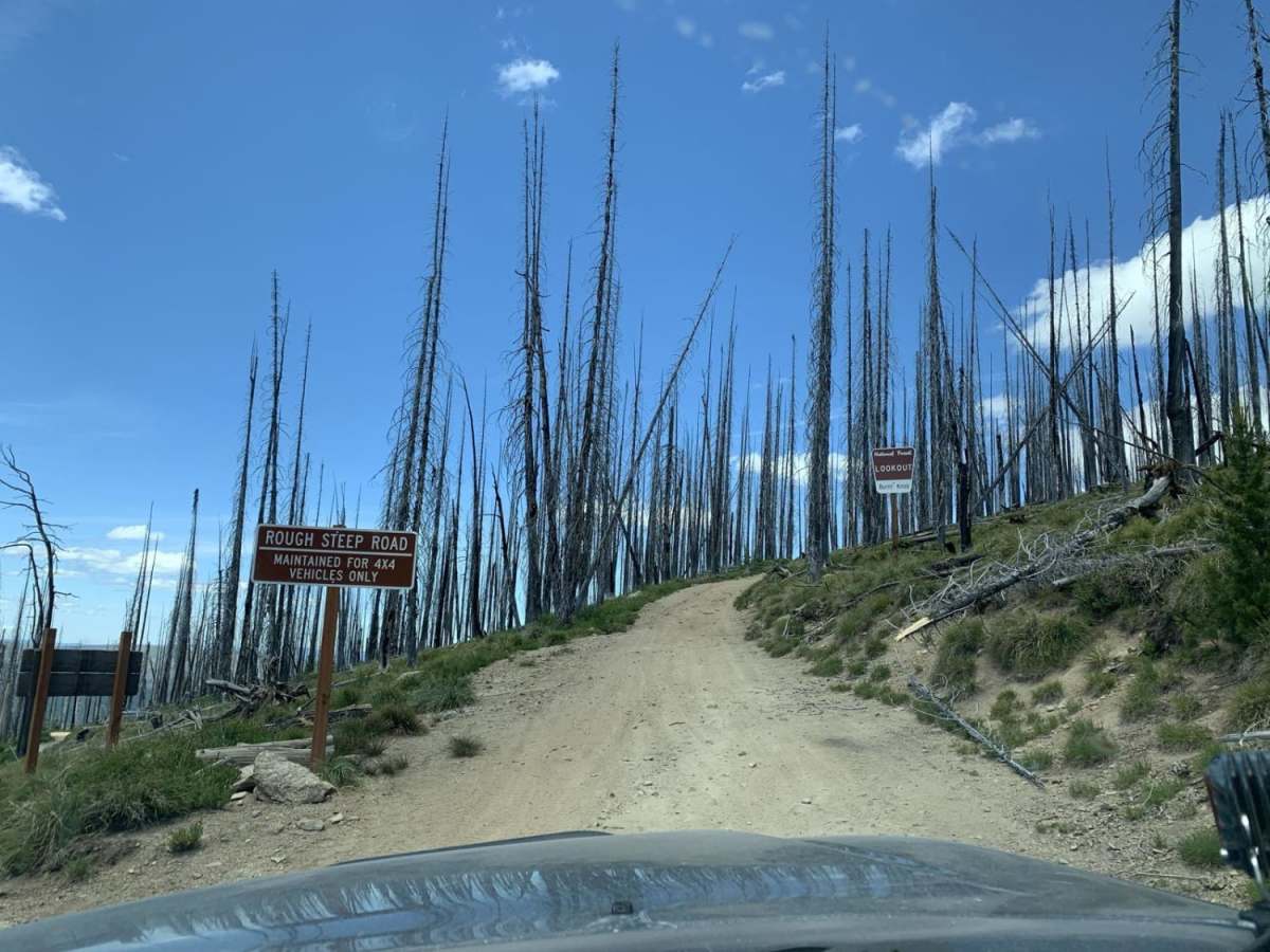
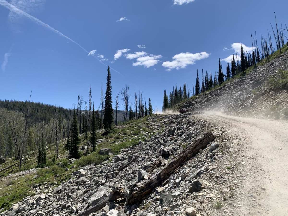
Most of the Magruder Corridor trail follows a graded forest road, with some paved sections near the eastern and western ends. It is not overly technical in dry conditions, but the remoteness is what makes this route serious. Expect long distances between services, little to no cell coverage, and changing mountain weather. Snow, downed trees, washouts, wildfire activity, and seasonal closures can all affect access, so check current road conditions before heading out and be prepared to travel self-sufficiently. 
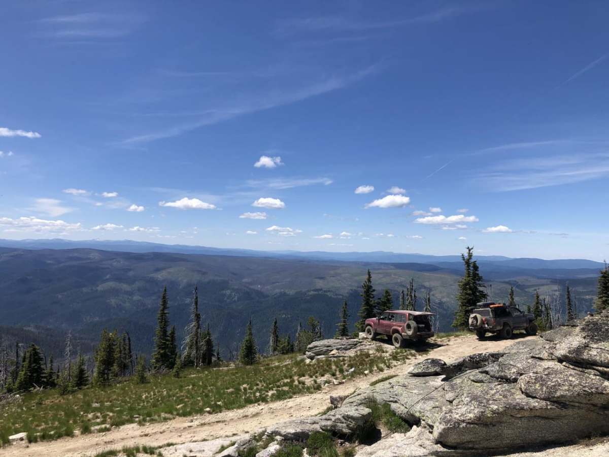
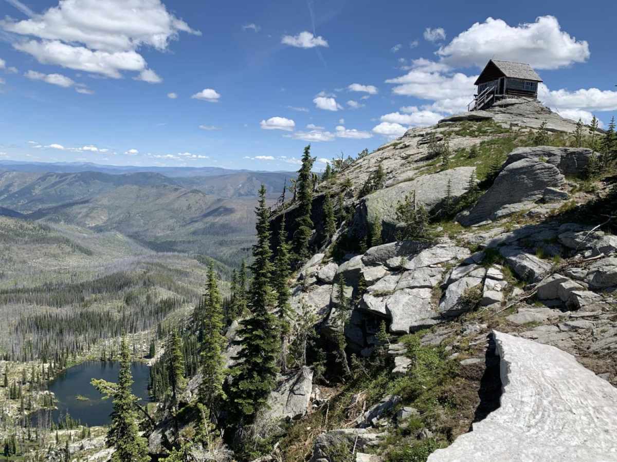
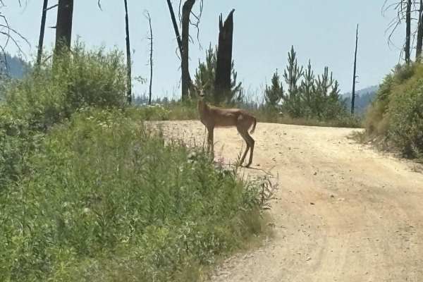
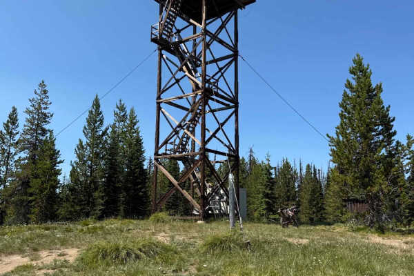
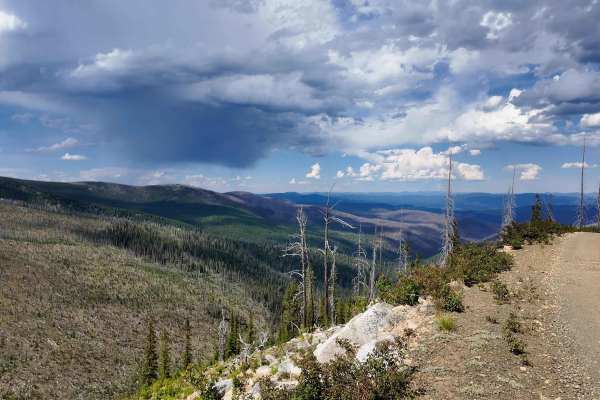
The biggest highlights along the Magruder Corridor are the scenic overlooks and side trips. Many lookout points can be reached by high-clearance 4x4 with a confident driver, while others are better explored on foot. These stops offer wide-open views across Idaho and Montana ridgelines, deep forested valleys, and some of the most remote wilderness country in the Lower 48. Camping is plentiful along the route, with a mix of established campsites and small tucked-away pullouts. Potable water may be available at the main unmanned ranger station roughly one-third of the way from the Montana side, but travelers should bring their own water and not rely on a single source. Pit toilets are available in some areas, and all trash must be packed out. The Magruder Corridor is also part of the Idaho Backcountry Discovery Route, making it a favorite for overlanders, adventure motorcyclists, and 4x4 travelers looking for a classic backcountry crossing. Fishing is available in the area with the proper license and current regulations. Stay on established routes, respect wilderness boundaries, and leave the corridor better than you found it.

Photos of The Magruder Corridor

Difficulty

The main route through is very easy, but the offshoots are difficult and require a skilled driver to complete.

History

The historic, 101-mile, single-lane, mostly-unimproved Magruder Corridor Road winds through a vast undeveloped area, offering solitude and pristine beauty as well as expansive mountain views. The corridor was created in 1980 leaving a unique road that enables a traveler to drive between two wildernesses: the 1.2 million-acre Selway-Bitterroot Wilderness to the north, and the 2.3-million-acre Frank Church-River of No Return Wilderness to the South. The road itself has changed little since its construction by the Civilian Conservation Corps (CCC) in the 1930s.

Technical Rating

2

Status Reports

Add Status Report
Jack Hegarty
Jun 20, 2026
Open
Drive west from Nez Perce Pass: the road is in good shape, all downed trees were already sawed out. We were stopped by impassable snow drifts between Observation point and Salmon Mtn. Should be a couple weeks at least until fully melted out
Paul Walchenbach
Jun 20, 2026
Open
Road impassable, downed trees and 4-5’ of snow on road, approximately 1.5 miles west of Observation Point Campground. It will take a week or two of warm weather to melt out. Some downed trees will require full-sized chain saws and a winch to remove.
Connor Penna
Jun 14, 2026
Open
Started from Red River Hoy Springs/Soda Creek. A lot of trees cleared from about mile 16 to mile 40 ish right at Burnt Knob Lookout trailhead. Made it 800’ shy of the summit due to snow here. Bring a saw.
Daniel Smadar
May 28, 2026
Open
Several downed trees just short of Observation Point Campground (coming from MT)
Tyler Langton
Apr 04, 2026
Open
Tyler Langton
Mar 22, 2026
Open
No snow at the seasonal closure sign.
Brian Scott
Oct 29, 2025
Open
This trail might be done for the season unless some sun comes. Cleared 3 trees from the trail. We made it to just before the summit from Elk City. About 200 yards away, big tree across the trail along with deep snow turned us around. We were solo, so being a little cautious. Bring a friend, a winch and a chain saw and you could probably do it.
Kaleb O'Connor
Aug 22, 2025
Open
great ride road is as expected. very doable never got into 4wd and only saw traction control light co.e o
Mathew Helms
Aug 15, 2025
Open
Trail was pretty busy and rocky. We drove a GMC 2500 and needed a chiropractor and a truck detail person for the interior cab dust as well as remove the Montana pinstriping. Great veiws and a really nice lunch. The road was heavily traveled as we passed no less than 30 vehicles. From Kim Creek Saddle Trailhead, the road is more suited for ATV/SxS/motorcycle but high clearance vehicles will make it. Will try again with a SxS or ATV.
Frank C
Jul 23, 2025
Open
Left from Elk City. Ride was excellent. Trails are in great shape. Road to Burnt Knob Lookout needs serious work.
Jim Szabo
Jun 30, 2025
Open
Dan Thompson
Aug 08, 2024
Open
A group of us rode from Falles Flats campground to Elk City (97 miles) on July 22, overnighted in Elk City, and returned the following day. Spectacular scenery. Awesome to realize that the Nez Perce did this trip (and more) on foot every year for hundreds of years!!
Justin Otherig
Jul 19, 2024
Open
David Coffey
Jul 17, 2024
Open
Trent Helms
Sep 25, 2023
Open

The Magruder Corridor Trail can be accessed by the following ride types:

  • Single Track
  • 50 Inch
  • 60 Inch
  • High Clearance
  • Full Width

Access Description

The Magruder Corridor connects the Elk City, Idaho area with the Darby, Montana area, traveling through remote national forest land between two designated wilderness areas. Access is typically seasonal and can be affected by snow, wildfire closures, road damage, or downed trees. There is little to no cell service along the route, and services are limited near both ends, so download maps, check current conditions, carry extra fuel and water, and be prepared for backcountry travel.

The Magruder Corridor Map

The onX Offroad Difference

onX Offroad combines trail photos, descriptions, difficulty ratings, width restrictions, seasonality, and more in a user-friendly interface. Available on all devices, with offline access and full compatibility with CarPlay and Android Auto. Discover what you're missing today!

Open Trail Map